- Australia ▾
- Topographic
▾
- Australia AUSTopo 250k (2025)
- Australia 50k Geoscience maps
- Australia 100k Geoscience maps
- Australia 250k Geoscience maps
- Australia 1:1m Geoscience maps
- New Zealand 50k maps
- New Zealand 250k maps
- New South Wales 25k maps
- New South Wales 50k maps
- New South Wales 100k maps
- Queensland 10k maps
- Queensland 25k maps
- Queensland 50k maps
- Queensland 100k maps
- Western Australia 25k maps
- Western Australia 50k maps
- Western Australia 100k maps
- Compasses
- Software
- GPS Systems
- International ▾
- Wall Maps
▾
- World
- Australia & New Zealand
- Countries, Continents & Regions
- Historical
- Vintage National Geographic
- Australian Capital Territory
- New South Wales
- Northern Territory
- Queensland
- South Australia
- Tasmania
- Victoria
- Western Australia
- Celestial
- Children's
- Mining & Resources
- Wine Maps
- Healthcare
- Postcode Maps
- Electoral Maps
- Nautical ▾
- Flags
▾
- Australian Flag Sets & Banners
- Flag Bunting
- Handwavers
- Australian National Flags
- Aboriginal Flags
- Torres Strait Islander Flags
- International Flags
- Flagpoles & Accessories
- Australian Capital Territory Flags
- New South Wales Flags
- Northern Territory Flags
- Queensland Flags
- South Australia Flags
- Tasmania Flags
- Victoria Flags
- Western Australia Flags
- Gifts ▾
- Globes ▾
Dear valued customer. Please note that our checkout is not supported by old browsers. Please use a recent browser to access all checkout capabilities


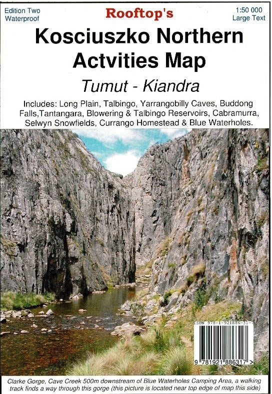
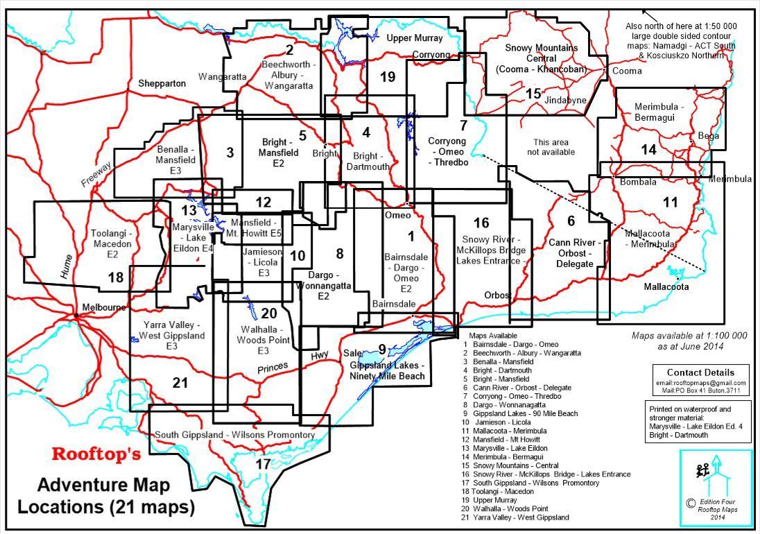
Kosciuszko Northern Activities Map Rooftop
$14.95 $15.95
Afterpay is only available for orders between $50.00 and $1000.00 More info
Explore the high country of northern Kosciuszko National Park with confidence and clarity.
The Kosciuszko Northern Activities Map by Rooftop Maps is a highly detailed, adventure-ready topographic map covering the stunning alpine and subalpine landscapes of northern Kosciuszko National Park. With a scale of 1:50,000, it offers exceptional accuracy for bushwalking, 4WD touring, camping, and backcountry exploration.
Extensively field-checked between 2008 and 2010, this map provides reliable and practical information across one of the most scenic and historically rich regions of the Snowy Mountains.
🗺️ Coverage Area
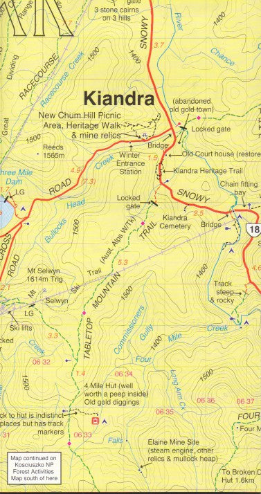
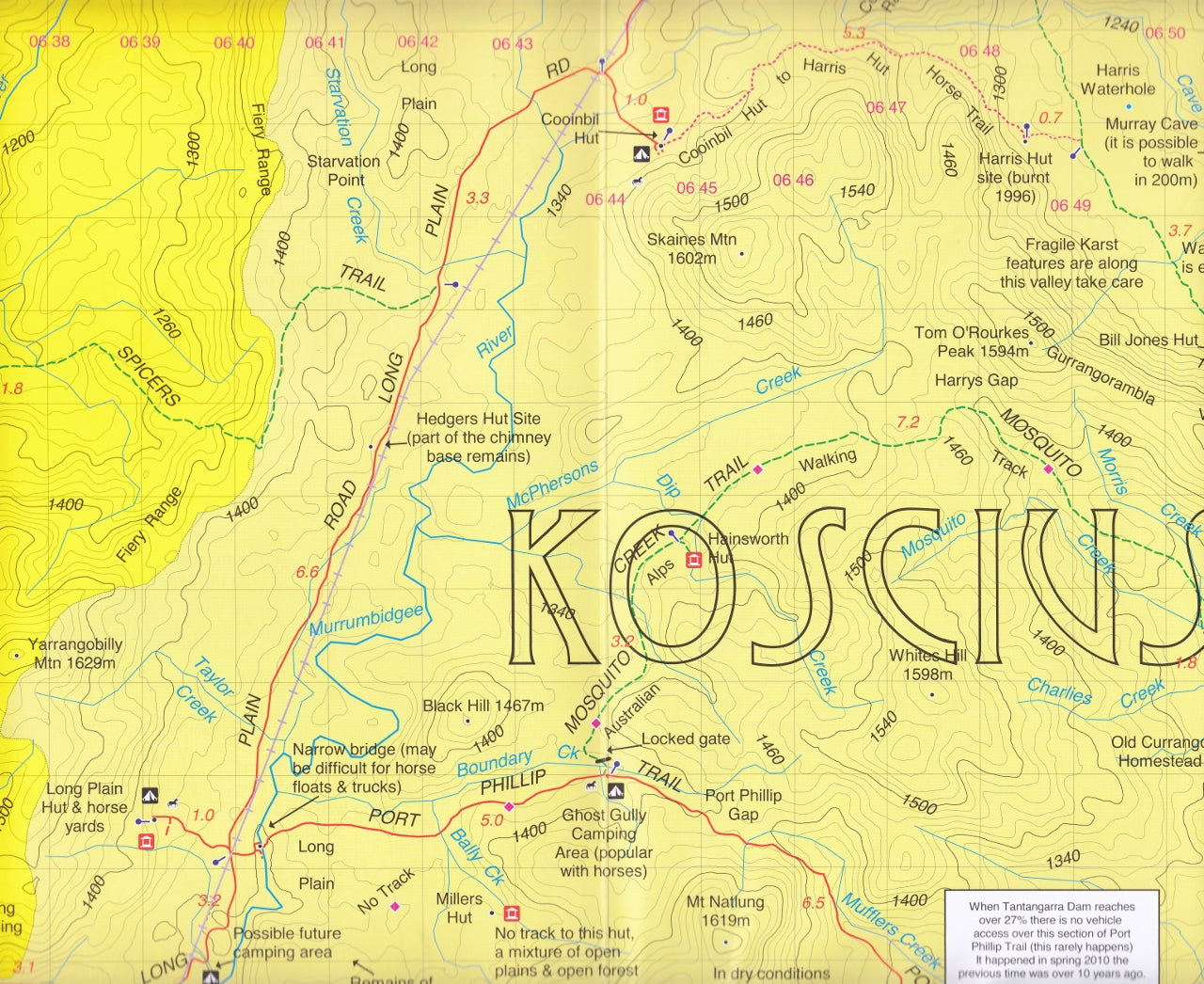
This map covers the vast and varied terrain from Kiandra to Tumut, including key alpine destinations and outdoor activity hubs:
-
Talbingo & Blowering Reservoirs
-
Tantangara Reservoir
-
Long Plain & Currango Homestead
-
Blue Waterholes & Yarrangobilly Caves
-
Buddong Falls & Selwyn Snowfields
-
Cabramurra & surrounding huts and heritage sites
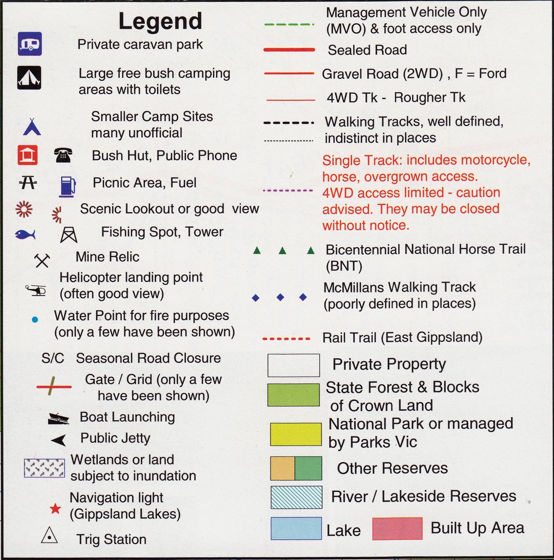
🧭 Map Features
-
✅ Topographic contours for precise terrain understanding
-
✅ Roads and 4WD tracks with conditions clearly marked
-
✅ Walking tracks including alpine trails and riverside routes
-
✅ Watercourses, rivers, and reservoirs
-
✅ Bush huts, campgrounds, and historic homesteads
-
✅ Fully field-verified mapping, ensuring accuracy in even remote areas
This map is ideal for planning multi-day bushwalks, day hikes, fishing trips, mountain biking, or 4WD journeys in the Snowy Mountains' less-travelled northern reaches.
🧴 Optional Laminated Finish
We offer a professional laminated version of this map, enhancing its durability and usability:
-
✅ Write on/wipe off surface for use with whiteboard markers
-
✅ Apply and remove map dots without damaging the surface
-
✅ Fully encapsulated in 80-micron gloss laminate for protection against moisture, dust, and tears
-
✅ Perfect for use in the field, on dashboards, or in planning areas
Note: This laminated version is produced by flattening a folded map, so minor fold lines may still be visible.
📐 Specifications
| Feature | Detail |
|---|---|
| Map Title | Kosciuszko Northern Activities Map |
| Publisher | Rooftop Maps |
| Scale | 1:50,000 |
| Dimensions | 750 mm × 1050 mm (unfolded) |
| Coverage Area | Kiandra to Tumut & surrounding alpine regions |
| Material | High-quality paper or laminated option |
| Verified | Field-checked from 2008–2010 |
🏕️ Ideal For:
-
Bushwalkers and hikers
-
4WD adventurers and campers
-
Alpine explorers and anglers
-
National parks visitors and outdoor educators
-
Travellers seeking off-the-beaten-track destinations in Kosciuszko National Park
🛒 Ordering & Delivery
-
✅ In stock and ready to ship
-
📦 Ships rolled in a protective mailing tube (flat version)
-
🚚 Fast Australia-wide and international shipping options available
-
🎁 Suitable for outdoor gear shops, park visitor centres, and bushwalking clubs
Navigate Australia’s alpine north with precision and peace of mind.
The Kosciuszko Northern Activities Map by Rooftop Maps is a rugged, reliable, and richly detailed tool—perfect for those who prefer paper maps they can trust when phone signals fade.
Frequently Asked Questions
Where can I buy the Kosciuszko Northern Activities Map Rooftop?
The Kosciuszko Northern Activities Map Rooftop is available to buy online from Mapworld, Australia's largest map and geographic product retailer, with fast shipping Australia-wide.
Is the Kosciuszko Northern Activities Map Rooftop in stock at Mapworld?
Mapworld maintains extensive stock across its map range and aims for fast dispatch. Orders placed before 2pm AEST on business days are typically dispatched the same day, with standard and express Australia-wide delivery options available.
What is Mapworld's returns policy?
Mapworld accepts returns on undamaged items in original condition. Contact Mapworld within 90 days of purchase to arrange a return or exchange.
Does Mapworld ship the Kosciuszko Northern Activities Map Rooftop across Australia?
Yes, Mapworld ships Australia-wide. Standard shipping is a flat $7 rate, with free standard shipping on orders over $75. Express options are available at checkout. Most orders placed before 2pm AEST on weekdays are dispatched same day.
Related Items


© 2026 Mapworld. Website designed by Genie Media
X