- Australia ▾
- Topographic
▾
- Australia AUSTopo 250k (2025)
- Australia 50k Geoscience maps
- Australia 100k Geoscience maps
- Australia 250k Geoscience maps
- Australia 1:1m Geoscience maps
- New Zealand 50k maps
- New Zealand 250k maps
- New South Wales 25k maps
- New South Wales 50k maps
- New South Wales 100k maps
- Queensland 10k maps
- Queensland 25k maps
- Queensland 50k maps
- Queensland 100k maps
- Compasses
- Software
- GPS Systems
- Orienteering
- International ▾
- Wall Maps
▾
- World
- Australia & New Zealand
- Countries, Continents & Regions
- Historical
- Vintage National Geographic
- Australian Capital Territory
- New South Wales
- Northern Territory
- Queensland
- South Australia
- Tasmania
- Victoria
- Western Australia
- Celestial
- Children's
- Mining & Resources
- Wine Maps
- Healthcare
- Postcode Maps
- Electoral Maps
- Nautical ▾
- Flags
▾
- Australian Flag Sets & Banners
- Flag Bunting
- Handwavers
- Australian National Flags
- Aboriginal Flags
- Torres Strait Islander Flags
- International Flags
- Flagpoles & Accessories
- Australian Capital Territory Flags
- New South Wales Flags
- Northern Territory Flags
- Queensland Flags
- South Australia Flags
- Tasmania Flags
- Victoria Flags
- Western Australia Flags
- Gifts ▾
- Globes ▾
Dear valued customer. Please note that our checkout is not supported by old browsers. Please use a recent browser to access all checkout capabilities


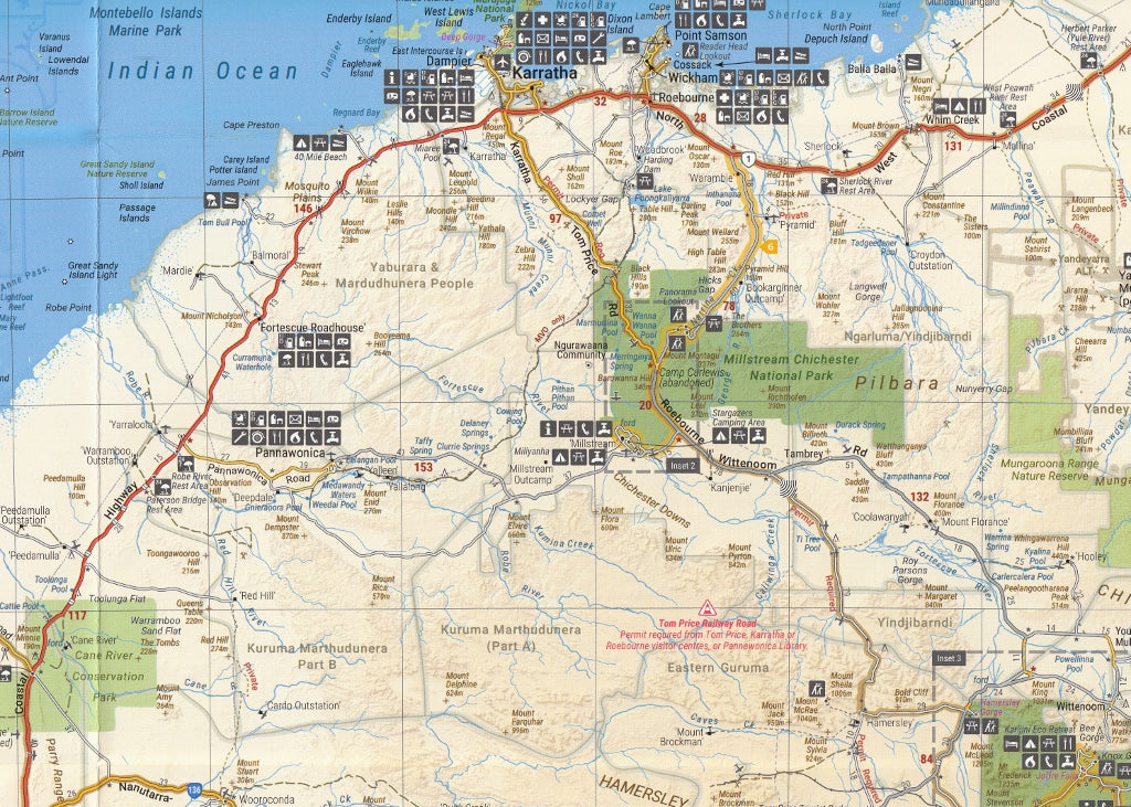
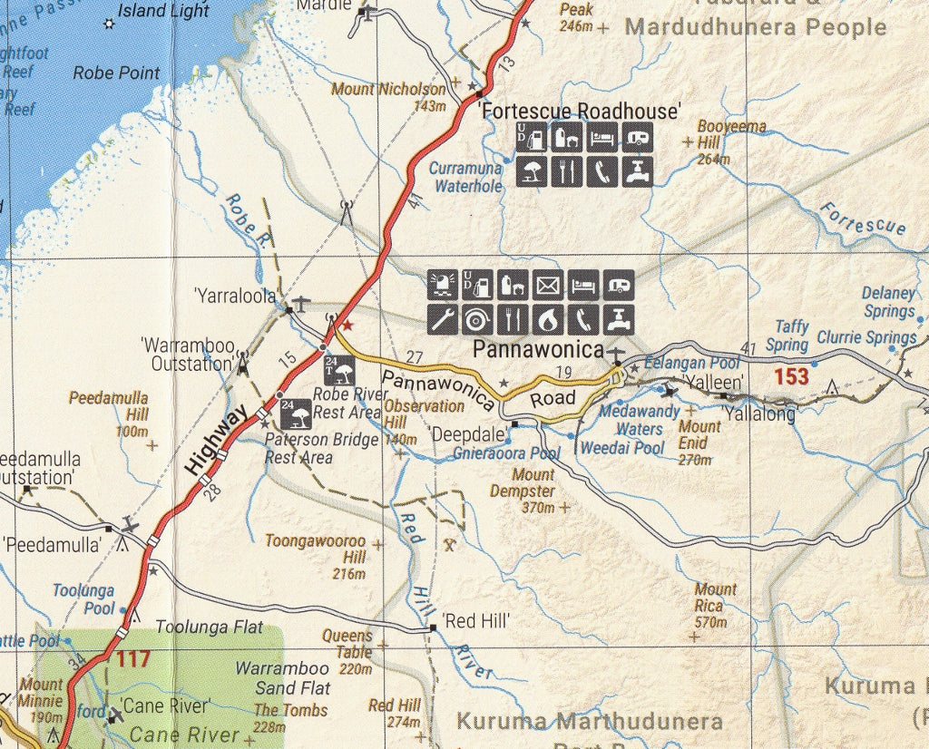
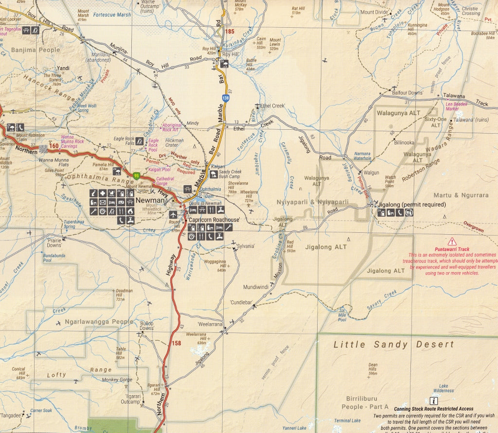
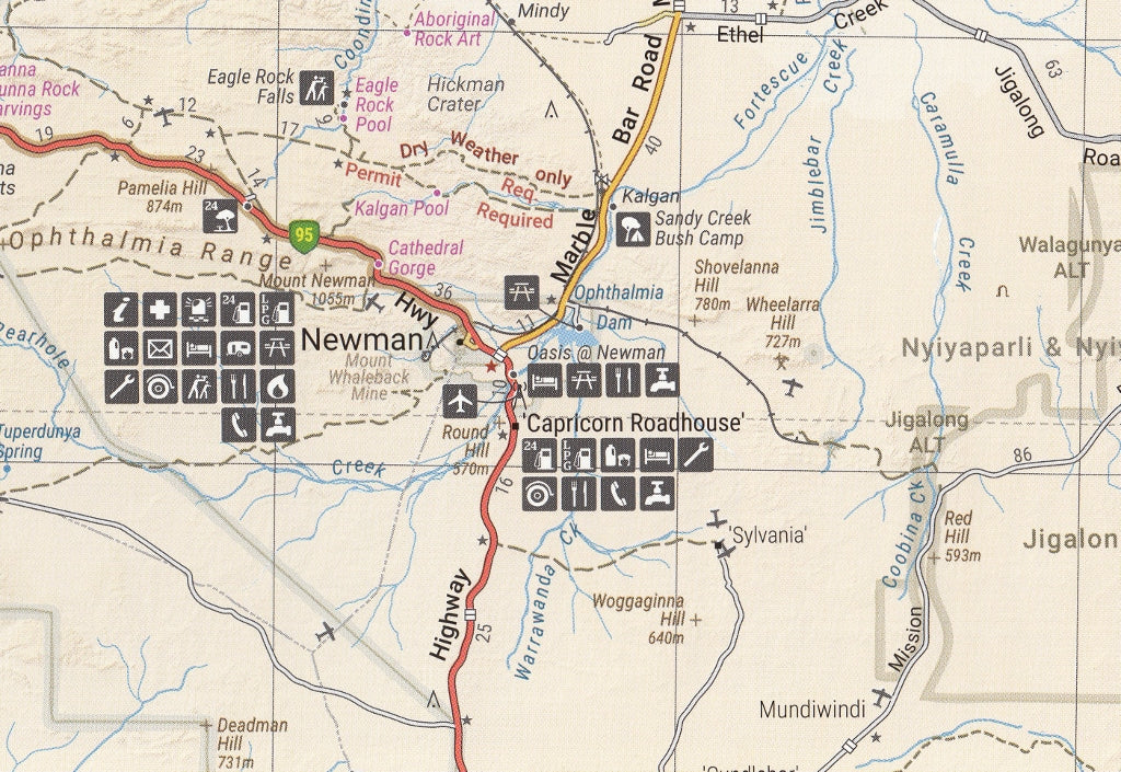
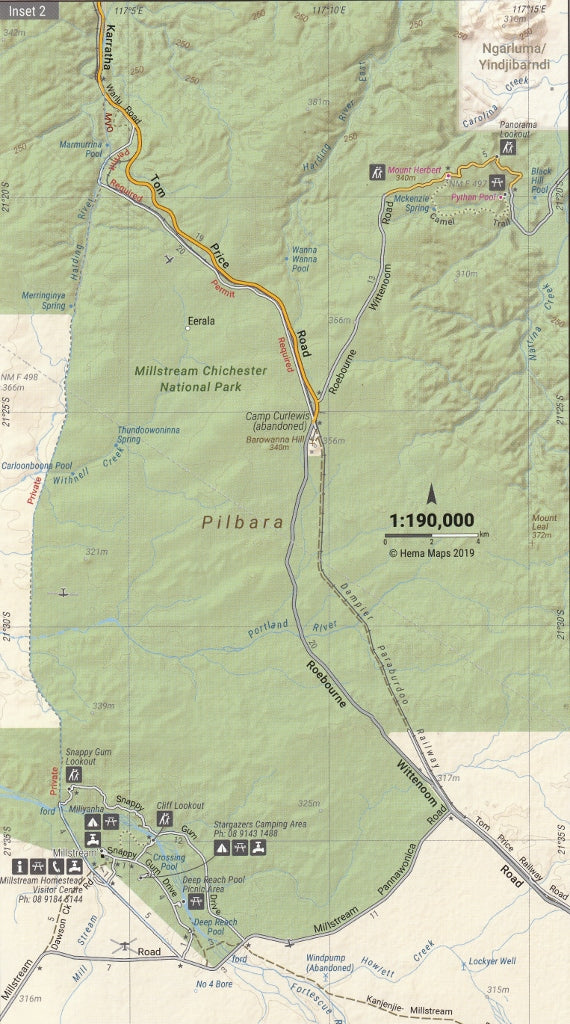
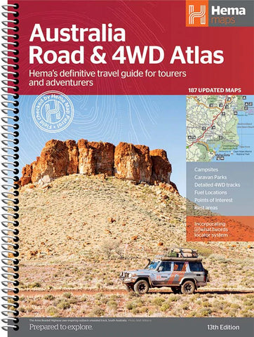
Pilbara & Coral Coast Hema Map 9th Edition
$14.95 $15.95
Afterpay is only available for orders between $50.00 and $1000.00 More info
Your essential companion for exploring Western Australia’s outback heart and spectacular coastline — from red desert gorges to turquoise waters.
The Pilbara & Coral Coast Map – 9th Edition by Hema Maps is a comprehensive, durable, and richly detailed touring map designed specifically for 4WD adventurers, campers, caravanners, and travellers heading into one of the most extraordinary regions of Western Australia. Covering everything from the ochre cliffs of Karijini National Park to the pristine waters of Ningaloo Reef and Shark Bay, this map is the ultimate guide to navigating the north-west.
Renowned for its rugged beauty, vast open spaces, and stunning contrasts, the Pilbara and Coral Coast offer unforgettable experiences — and this map helps ensure you’re prepared, informed, and inspired for every step of your journey.
🗺️ Coverage & Highlights
This map provides full regional coverage from the interior desert country of the Pilbara to the vibrant marine reserves of the Coral Coast:
-
Karijini National Park – with detailed inset and camping info
-
Millstream Chichester National Park
-
Shark Bay and François Peron National Park
-
Ningaloo Coast and Exmouth Gulf
-
Cape Range National Park
-
Marble Bar, Port Hedland, Onslow, Tom Price, Karratha, Exmouth, Coral Bay, and Carnarvon
-
Western Australia’s iconic 4WD tracks and remote access roads
-
Outback service stops, stations, and supply points
Inset maps provide zoomed-in detail for the most visited locations, helping you orient yourself even in the most remote corners of the region.
🛣️ Features & Detail
-
Scale: 1:1,200,000 – offering a perfect balance between detail and coverage
-
Road types clearly distinguished – from highways to unsealed and remote tracks
-
GPS-surveyed tracks, field-checked by Hema’s mapping patrol team
-
4WD suitability indicators, fuel availability, rest areas, and permit zones
-
Camping grounds, caravan parks, and bush camping areas marked throughout
-
Points of interest including natural attractions, historical sites, and Aboriginal cultural areas
-
Touring information with helpful tips, local knowledge, and contact points
Also includes:
-
Distances between key towns
-
Ferry and barge services
-
Emergency and visitor centre locations
-
Roadhouse, water point, and fuel station symbols
-
Warning areas for towing restrictions and 4WD-only access
🖨️ Quality & Durability
This map is printed on high-grade waterproof and tear-resistant synthetic paper, ensuring:
-
Long life, even in extreme outback or coastal conditions
-
Resistance to tearing, dirt, rain, and handling damage
-
Usable with dry-erase markers for route planning
-
Folds easily and fits into glove boxes, packs, or seat pockets
Whether you're navigating red dust roads or setting up camp near the sea, this map is built for the real world.
📐 Map Specifications
-
Edition: 9th Edition
-
Publication Date: April 2019
-
Scale: 1:1,200,000
-
Unfolded Size: 700 mm (W) × 1000 mm (H)
-
Folded Size: 140 mm × 250 mm × 2 mm
-
Weight: Approx. 60g
-
Material: Waterproof and tearproof synthetic paper
-
Publisher: Hema Maps
-
Printed in: Australia
🎯 Ideal For:
-
4WD travellers tackling off-grid tracks and remote bush drives
-
Campers and caravanners planning extended stays or station stops
-
Eco-tourists exploring Ningaloo Reef, Coral Bay, or heritage-listed Shark Bay
-
Adventurers navigating between desert gorges and world-class diving locations
-
Teachers and students studying WA’s arid and coastal ecosystems
-
Tour operators and visitor centres needing a reliable visual reference for guests
✅ Why Choose the Hema Pilbara & Coral Coast Map?
-
Trusted by 4WD tourers and remote travellers
-
Field-tested by Hema Map Patrol, ensuring accuracy
-
Designed for real use in real conditions
-
Combines cartographic precision with touring advice
-
Proudly Australian made and designed
-
An affordable, reliable, and informative resource for your journey
From the deep canyons of Karijini to the fringing reefs of Exmouth, this map unlocks one of Australia’s greatest adventure corridors.
Whether you’re venturing off the bitumen or tracing the coast, the Pilbara & Coral Coast Hema Map – 9th Edition will guide, inform, and enhance your experience every step of the way.
Outback tested. Coast approved. Adventure ready.
This map is also available as a laminated map encapsulated in high-quality plastic.
Frequently Asked Questions
What does the Pilbara & Coral Coast Hema Map 9th Edition cover?
The Pilbara & Coral Coast Hema Map 9th Edition covers 4WD tracks, camping areas, and travel routes for the region described in the product title. Most 4WD and camping guides in Mapworld's range include GPS coordinates, distance information, difficulty ratings, and notes on fuel stops and emergency contact points.
Is the Pilbara & Coral Coast Hema Map 9th Edition up to date?
Yes, this is the current edition. Mapworld stocks current editions from publishers including Hema Maps, Westprint, and others.
Is this product suitable for remote area travel?
Yes, 4WD maps and guides are designed for remote area navigation and trip planning. They include track conditions, fuel availability, camping spots, and safety information.
Does Mapworld ship the Pilbara & Coral Coast Hema Map 9th Edition across Australia?
Yes, Mapworld ships Australia-wide. Standard shipping is a flat $7 rate, with free standard shipping on orders over $75. Express options are available at checkout. Most orders placed before 2pm AEST on weekdays are dispatched same day.
Related Items


© 2026 Mapworld. Website designed by Genie Media
X