- Australia ▾
- Topographic
▾
- Australia AUSTopo 250k (2025)
- Australia 50k Geoscience maps
- Australia 100k Geoscience maps
- Australia 250k Geoscience maps
- Australia 1:1m Geoscience maps
- New Zealand 50k maps
- New Zealand 250k maps
- New South Wales 25k maps
- New South Wales 50k maps
- New South Wales 100k maps
- Queensland 10k maps
- Queensland 25k maps
- Queensland 50k maps
- Queensland 100k maps
- Compasses
- Software
- GPS Systems
- Orienteering
- International ▾
- Wall Maps
▾
- World
- Australia & New Zealand
- Countries, Continents & Regions
- Historical
- Vintage National Geographic
- Australian Capital Territory
- New South Wales
- Northern Territory
- Queensland
- South Australia
- Tasmania
- Victoria
- Western Australia
- Celestial
- Children's
- Mining & Resources
- Wine Maps
- Healthcare
- Postcode Maps
- Electoral Maps
- Nautical ▾
- Flags
▾
- Australian Flag Sets & Banners
- Flag Bunting
- Handwavers
- Australian National Flags
- Aboriginal Flags
- Torres Strait Islander Flags
- International Flags
- Flagpoles & Accessories
- Australian Capital Territory Flags
- New South Wales Flags
- Northern Territory Flags
- Queensland Flags
- South Australia Flags
- Tasmania Flags
- Victoria Flags
- Western Australia Flags
- Gifts ▾
- Globes ▾
Dear valued customer. Please note that our checkout is not supported by old browsers. Please use a recent browser to access all checkout capabilities


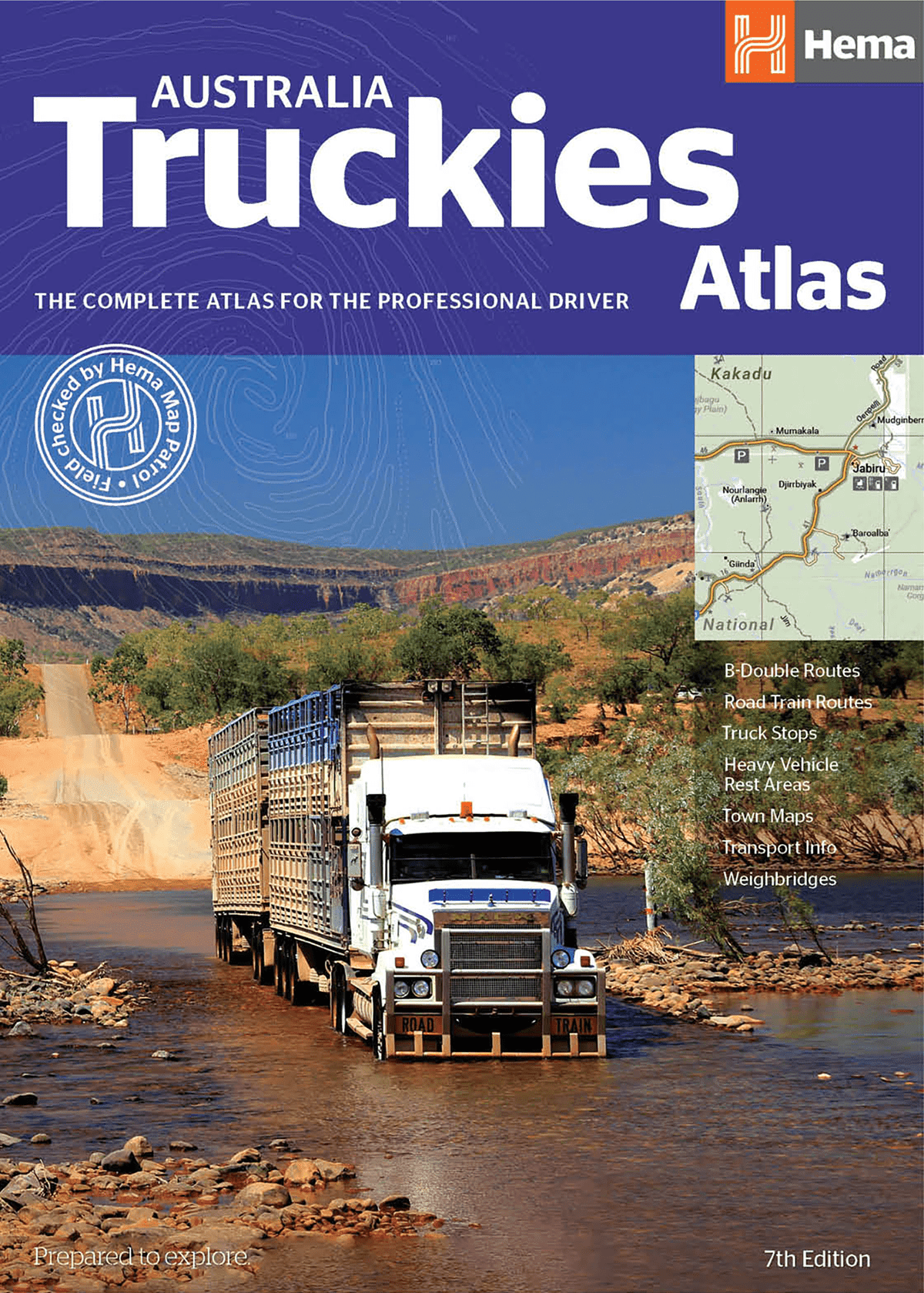
Australia Truckies Atlas Hema New 7th Edition
Sold Out
The Ultimate Atlas for Australia's Professional Drivers and Freight Operators
The Australia Truckies Atlas (7th Edition) by Hema Maps is the gold standard for truck drivers navigating Australia’s complex road network. Developed in consultation with the trucking industry, this atlas combines nationwide mapping coverage with critical transport-specific content, making it an indispensable tool for B-double drivers, road train operators, fleet managers, and independent hauliers alike.
Completely updated, this new edition includes the latest information on truck routes, infrastructure, and regulations, helping you stay compliant, efficient, and well-informed on every journey—whether you’re crossing the outback, traversing city bypasses, or delivering to remote regional towns.
🛣️ Specialised Features for Heavy Vehicle Operators
-
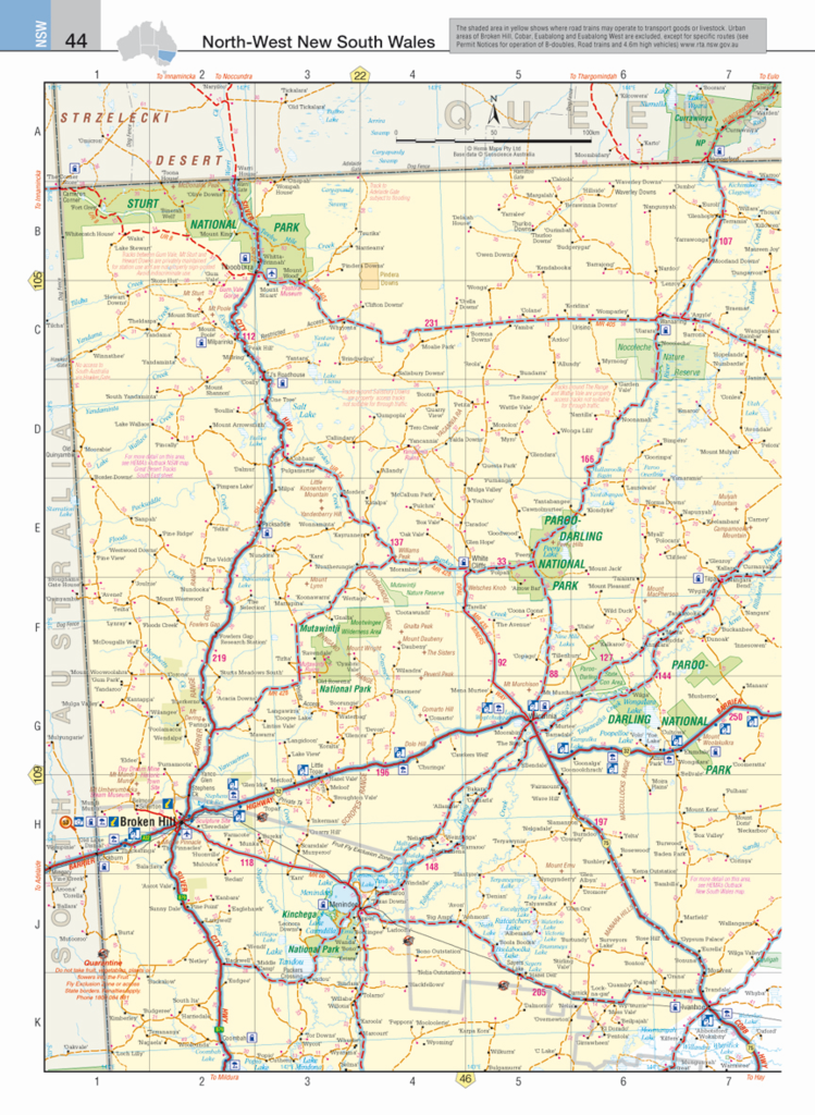
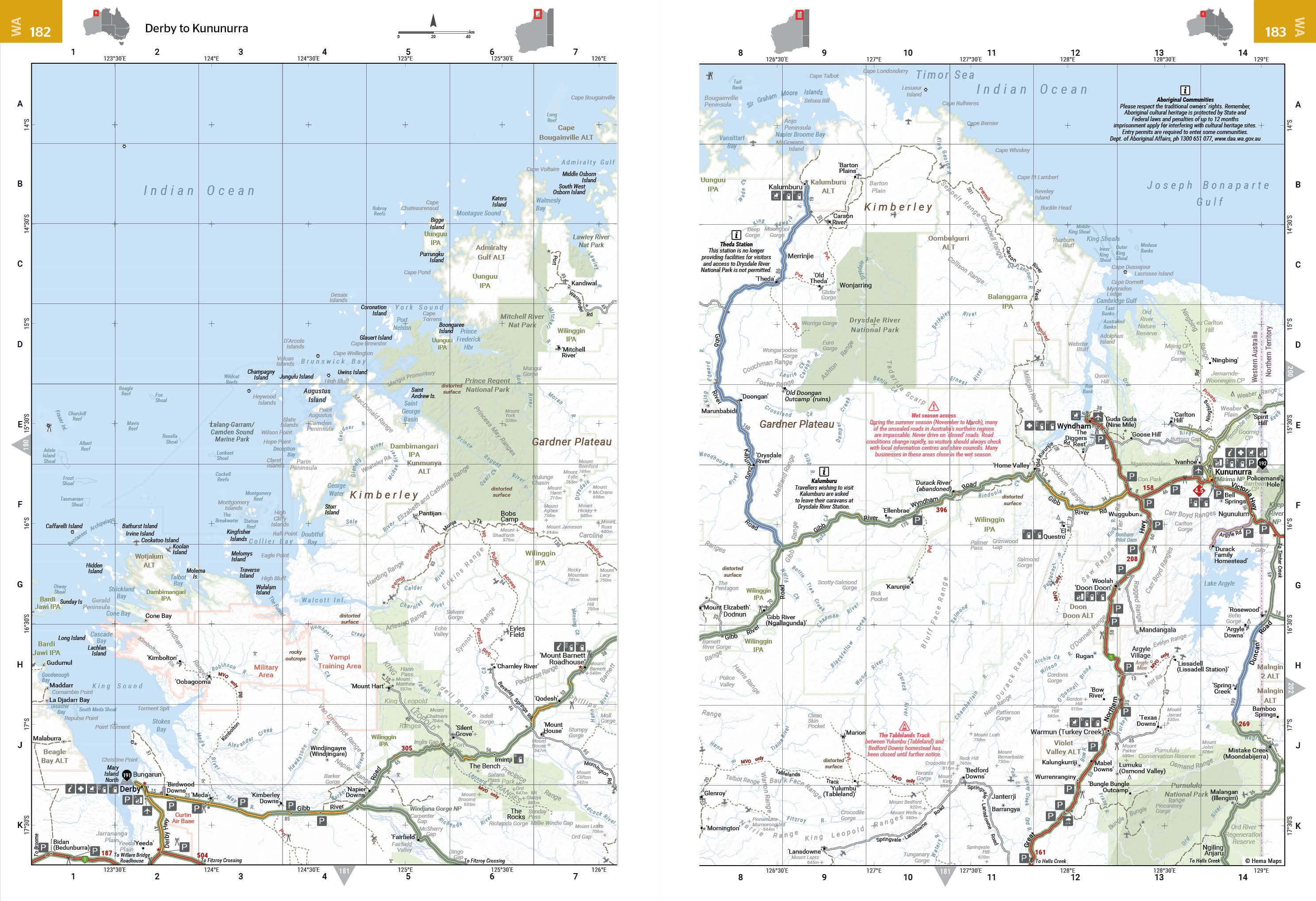
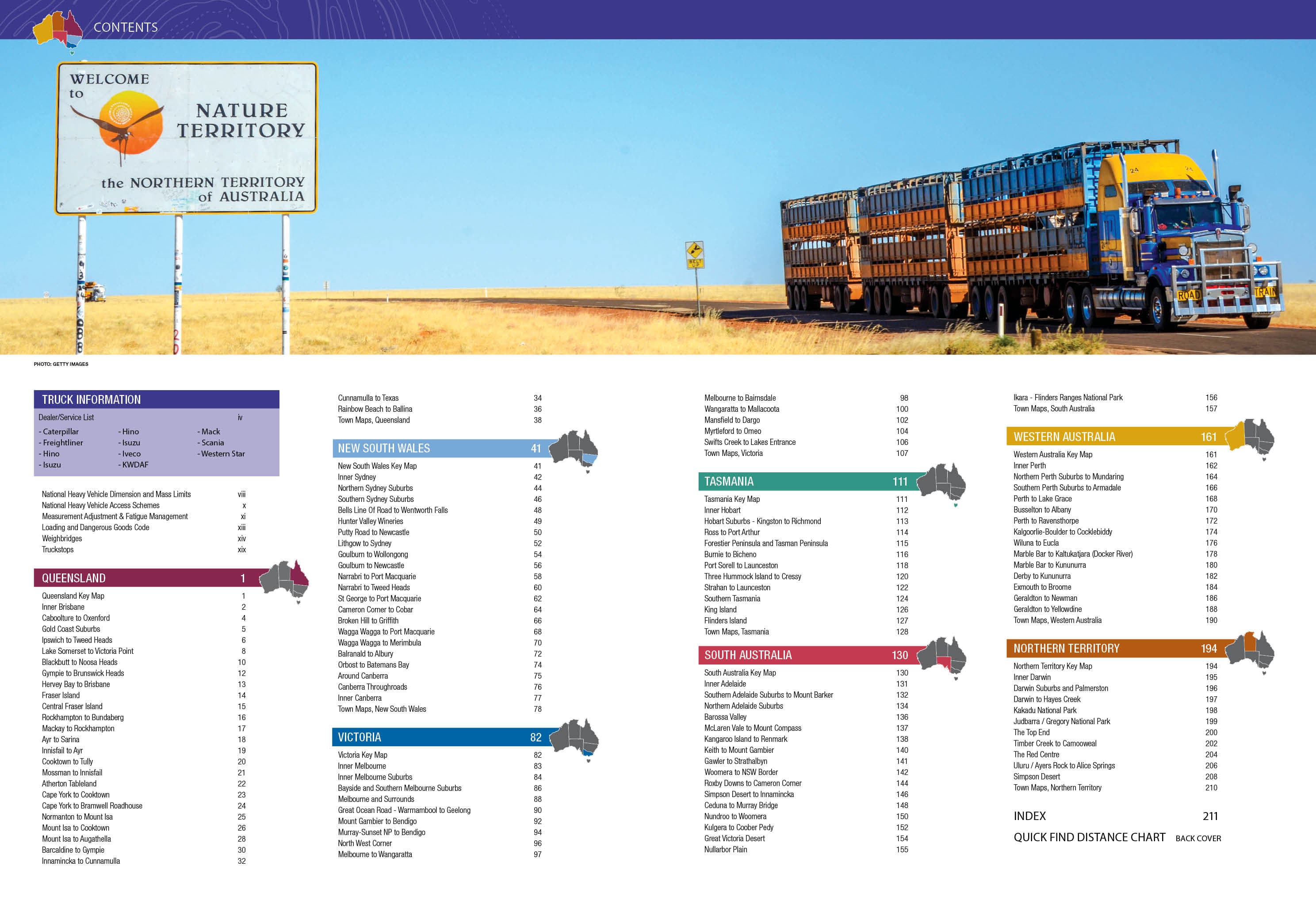
Comprehensive National Mapping
Full-colour maps of every state and territory in Australia, designed with clarity and functionality for large-format use in the cab. -
B-Double & Road Train Route Classifications
Colour-coded routes indicate where these vehicle types are permitted, including access limitations and route connectivity. -
Truck Stops, Rest Areas & Refuelling Points
Easily identify designated heavy vehicle rest stops, truck-friendly roadhouses, and key refuelling hubs along major and minor routes. -
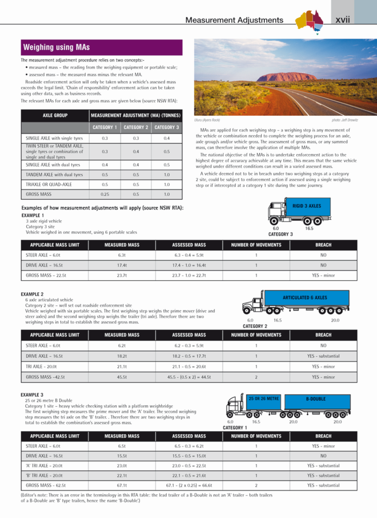
Weighbridges & Low Clearance Bridge Warnings
Includes a detailed directory of weighbridges with corresponding map references, plus alerts for low bridges that may restrict access for taller vehicles. -
112 Town & Suburban Maps with Truck-Friendly Routing
Enhanced mapping of urban and regional centres shows access routes, bypasses, truck stops, and services — vital for efficient last-mile delivery.
📋 Supporting Tools for Compliance & Planning
-
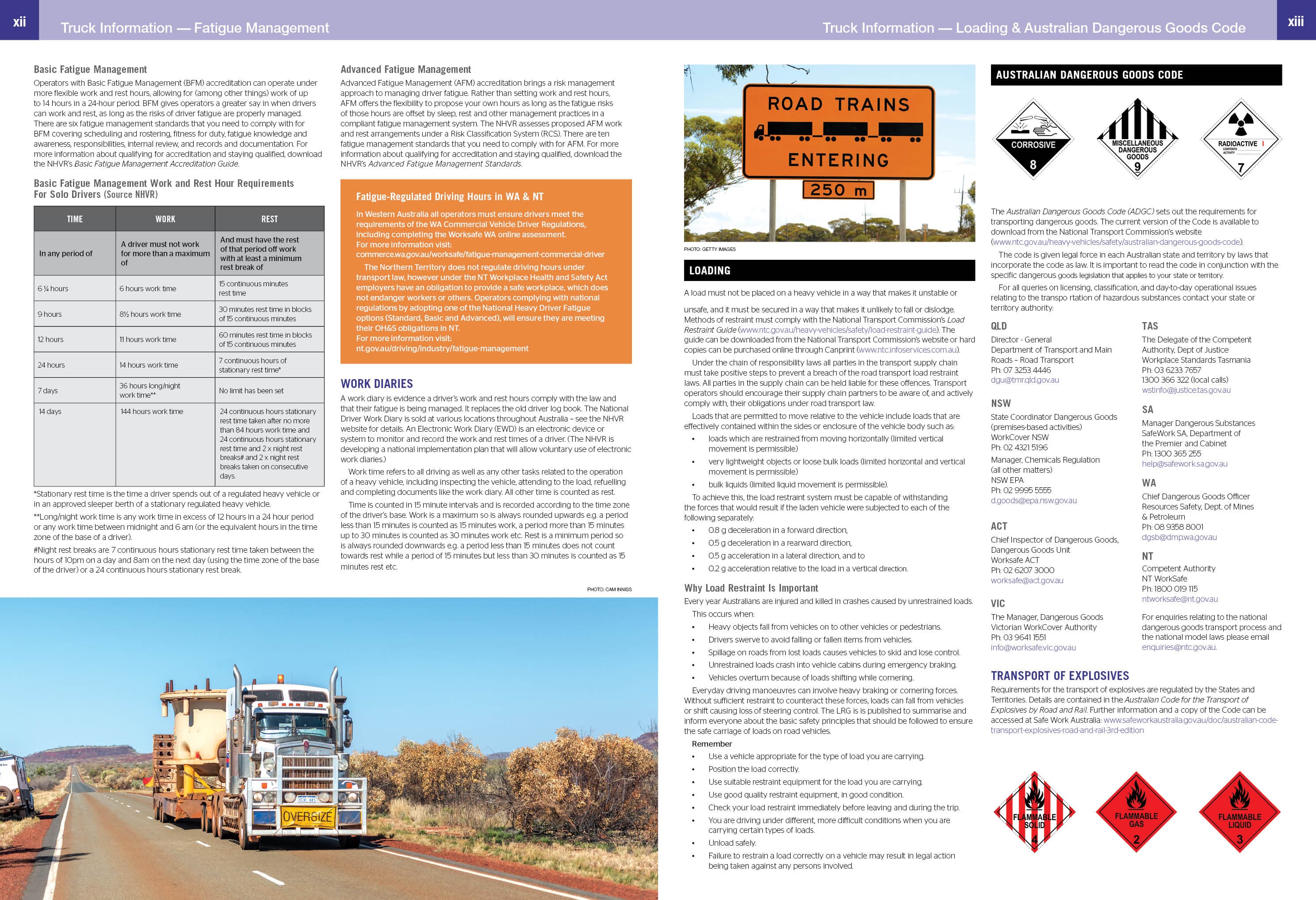
Heavy Vehicle Dimensions & Mass Limit Guidelines
State-specific reference charts make it easy to comply with legal size and weight restrictions across borders. -
Permit and Regulation Summaries
Up-to-date information about permit requirements, fatigue management zones, and operating restrictions. -
Dealer & Service Centre Listings
A national directory of truck dealerships and service centres to support vehicle maintenance on long hauls. -
Distance Charts & Route Planning Grids
Quick-reference tools help calculate fuel stops and travel times between key transport hubs.
🧭 What's New in the 7th Edition?
-
Updated cartography and route data based on recent infrastructure developments
-
Expanded suburban coverage in major capitals (including new truck bypasses and urban restrictions)
-
Revised directory listings for truck stops, weighbridges, and service facilities
-
Enhanced readability and improved layout with intuitive symbol keys
📐 Product Specifications
| Feature | Details |
|---|---|
| Edition | 7th (Latest Edition) |
| Format | Spiral Bound – Lay-flat for ease of use in truck cabins |
| Page Count | 272 pages |
| Open Size | 265 mm (W) x 345 mm (H) |
| Weight | 1.32 kg |
| Publisher | Hema Maps |
| ISBN | 9781925625962 |
🛒 Who Should Buy This Atlas?
-
Long-haul truck drivers and logistics professionals needing up-to-date infrastructure data.
-
Fleet managers looking for a reliable navigation tool for route planning and compliance.
-
Owner-operators and caravaners using large rigs or towing over-size loads across Australia.
-
New drivers preparing to navigate national routes safely and legally.
✅ Why Choose the Hema Truckies Atlas?
-
Specifically built for heavy vehicle navigation
-
Contains detailed, transport-relevant information not found in general road atlases
-
Spiral-bound for durability and practical in-cab use
-
A trusted companion from Australia’s premier mapping publisher
Whether you’re hauling across the Pilbara, weaving through Melbourne’s industrial west, or cruising along the Hume Highway, the Australia Truckies Atlas (7th Edition) is the tool you can rely on to keep you on track, compliant, and in control of your journey.
🛠️ Pair it with the Hema Where to Camp Guide or Easy Read Road Atlas for comprehensive planning support.
Drive smart. Drive with Hema.
Frequently Asked Questions
What does the Australia Truckies Atlas Hema New 7th Edition cover?
This atlas covers the geographic region indicated in the product title, including roads, towns, distances, and key travel information. Mapworld stocks atlases for Australian states and territories, 4WD regions, and international destinations.
Is this the latest edition?
Yes, this is the 7th Edition. Mapworld stocks the most current editions available from publishers.
Is this atlas or guide spiral bound?
Spiral binding is indicated in the product title where applicable. Spiral-bound atlases and guides lay flat when open, making them ideal for use in vehicles or on a table without needing to hold pages open.
Is the Australia Truckies Atlas Hema New 7th Edition in stock at Mapworld?
Mapworld maintains extensive stock across its map range and aims for fast dispatch. Orders placed before 2pm AEST on business days are typically dispatched the same day, with standard and express Australia-wide delivery options available.
Does Mapworld ship the Australia Truckies Atlas Hema New 7th Edition across Australia?
Yes, Mapworld ships Australia-wide. Standard shipping is a flat $7 rate, with free standard shipping on orders over $75. Express options are available at checkout. Most orders placed before 2pm AEST on weekdays are dispatched same day.
Related Items


© 2026 Mapworld. Website designed by Genie Media
X