- Australia ▾
- Topographic
▾
- Australia AUSTopo 250k (2024)
- Australia 50k Geoscience maps
- Australia 100k Geoscience maps
- Australia 250k Geoscience maps
- Australia 1.1m Geoscience maps
- New Zealand 50k maps
- New Zealand 250k maps
- New South Wales 25k maps
- New South Wales 50k maps
- New South Wales 100k maps
- Queensland 10k maps
- Queensland 25k maps
- Queensland 50k maps
- Queensland 100k maps
- Compasses
- Software
- GPS Systems
- Orienteering
- International ▾
- Wall Maps
▾
- World
- Australia & New Zealand
- Countries, Continents & Regions
- Historical
- Vintage National Geographic
- Australian Capital Territory
- New South Wales
- Northern Territory
- Queensland
- South Australia
- Tasmania
- Victoria
- Western Australia
- Celestial
- Children's
- Mining & Resources
- Wine Maps
- Healthcare
- Postcode Maps
- Electoral Maps
- Nautical ▾
- Flags
▾
- Australian Flag Sets & Banners
- Flag Bunting
- Handwavers
- Australian National Flags
- Aboriginal Flags
- Torres Strait Islander Flags
- International Flags
- Flagpoles & Accessories
- Australian Capital Territory Flags
- New South Wales Flags
- Northern Territory Flags
- Queensland Flags
- South Australia Flags
- Tasmania Flags
- Victoria Flags
- Western Australia Flags
- Gifts ▾
- Globes ▾
Dear valued customer. Please note that our checkout is not supported by old browsers. Please use a recent browser to access all checkout capabilities
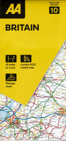
Britain Collins Handy Road Atlas 2026
Sold Out
Afterpay is only available for orders between $50.00 and $1000.00 More info
A compact, comprehensive, and fully updated road atlas — perfect for gloveboxes, backpacks, and the front seat of every journey
The Collins Handy Road Atlas Britain & Ireland 2026 is the ideal travel companion for those who want reliable, up-to-date mapping in a convenient, portable format. Covering the whole of England, Scotland, Wales, and the entire island of Ireland, this spiral-bound atlas has been carefully designed for everyday use, weekend getaways, and longer road trips across the UK and Ireland.
Whether you're navigating motorways through the Midlands, plotting scenic drives in the Highlands, or exploring Ireland’s coastal roads, this atlas offers clear cartography, smart layout, and up-to-date travel information, all in a handy A5 size.
🗺️ Key Features:
-
Full coverage of Great Britain (England, Scotland, Wales) and Ireland (both Northern Ireland and the Republic of Ireland)
-
All major roads, motorways, A and B roads clearly shown and colour-coded
-
Over 30 categories of points of interest, including castles, gardens, historic sites, theme parks, airports, sports venues, and more
-
Park & Ride locations, updated rail stations, and tram extensions in Blackpool and Edinburgh
-
Urban area maps for high-traffic zones such as Greater London, Manchester, Merseyside, and the West Midlands, allowing easier navigation in and out of cities
-
A helpful distance calculator chart to assist with estimating journey times between major destinations
-
Fully revised for 2026, with the latest road updates, infrastructure developments, and geographic adjustments
📏 Scale & Size:
-
Britain Main Maps: 1:625,000 (approx. 1 inch = 10 miles)
-
Ireland Maps: 1:1,000,000 (approx. 1 inch = 15.8 miles)
-
Urban Area Maps: 1:285,000 (approx. 1 inch = 4.5 miles)
-
Book Dimensions: 154 mm x 210 mm (A5 size)
-
Total Pages: 80
-
Format: Spiral-bound, making it easy to lay flat for use on the road or at home
🚗 Ideal For:
-
Everyday drivers who want a glovebox-ready road map for Britain and Ireland
-
Holidaymakers and tourers looking to plan their own routes with full visibility of roads and attractions
-
Back-up for digital maps and GPS, especially in remote or low-signal areas
-
Students, educators, and geography enthusiasts who appreciate the tactile, detailed experience of a printed atlas
-
Professional drivers, delivery routes, and logistics personnel needing a lightweight, reliable reference
Whether you’re heading for the Scottish Isles, exploring the rugged coastlines of Donegal, crossing through Snowdonia, or simply avoiding traffic jams with the nearest bypass, the Collins Handy Road Atlas 2026 gives you the confidence to get there—and enjoy the journey along the way.
Small in size, big on detail — the road atlas that fits wherever life takes you.


