A practical, detailed, and versatile wall map of Queensland and Greater Brisbane — perfect for real estate, business logistics, education, or general reference.
Covering both the entire state of Queensland and the metropolitan sprawl of Brisbane, this double-sided laminated map by UBD Gregory’s combines cartographic accuracy with everyday functionality. It’s an essential visual tool for those living in, working across, or learning about the Sunshine State — from regional travellers and business professionals to students, educators, and homebuyers.
Whether you're planning a statewide delivery route, teaching the geography of Queensland, navigating the suburbs of Brisbane, or simply want a durable and attractive map for your wall, this product offers two maps in one — and delivers them both with UBD’s trademark clarity and precision.
🗺️ Side A – Queensland State Map
Scale: 1:2,600,000
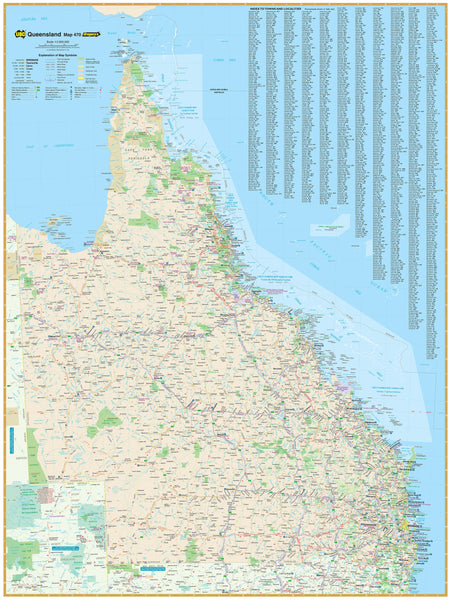
This side presents a comprehensive map of Queensland, one of the most geographically diverse and expansive states in Australia. Stretching from the tropical north and Cape York Peninsula down to the southern border with New South Wales, this map provides a bird’s-eye view of the entire state.
It shows:
-
Major highways, regional roads, and key connections across inland and coastal routes
-
All towns and cities, from outback hubs like Mount Isa and Longreach to coastal centres like Cairns, Townsville, and Rockhampton
-
Clearly marked national highways, dual carriageways, and important junctions
-
Natural features such as rivers, mountain ranges, national parks, and state borders
-
A complete town index for quick reference and route planning
Perfect for:
-
Logistics and delivery operators planning state-wide movements
-
Educational institutions needing an overview of Queensland’s geography
-
Grey nomads and caravanners preparing long-distance travel routes
-
Government and council offices requiring accurate wall references
🏙️ Side B – Metropolitan Brisbane Map
Scale: 1:100,000
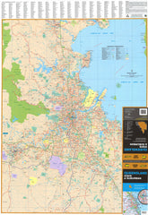
The reverse side zooms in to show Greater Brisbane and its surrounding suburbs, providing a detailed suburban map of Queensland’s capital and largest city.
Coverage includes:
-
From Caboolture in the north to Coomera in the south, with major corridors such as the Bruce Highway, Gateway Motorway, and Pacific Motorway
-
Suburban areas, including Brisbane CBD, Logan, Redland Bay, Ipswich outskirts, and Moreton Bay suburbs
-
Clearly marked arterial roads, industrial estates, parks, and national reserves
-
Suburbs are labelled with their postcode boundaries, and all are cross-referenced in a detailed suburb index
Ideal for:
-
Homebuyers, renters, and property professionals understanding suburb locations
-
Businesses operating in the metro area or delivering across postcode zones
-
New residents and students learning the layout of their new city
-
Real estate offices and consultancies using maps in client meetings
🖨️ Premium Lamination & Writeable Surface
This map is fully encapsulated in high-quality gloss laminate, offering:
-
Tear resistance for durability in high-use environments
-
A wipeable surface, allowing you to use whiteboard markers to note down:
-
Routes
-
Properties
-
Customer locations
-
Meeting areas
-
-
Compatible with Map Dots or stickers to track travel, sales territories, or points of interest
It’s ideal for office use, collaborative planning, or even home decoration with an educational edge.
🪵 Hanging Options
Available in two laminated formats:
-
Flat laminated map – $99.00
-
Supplied flat and ready to frame, pin, or hang
-
Professional presentation for offices, council chambers, boardrooms, or classrooms
-
-
Laminated folded map – $49.95
-
A previously folded map, now laminated — durable, but may show some minor crease lines
-
Perfect for more casual use or as a backup reference
-
You can also choose wooden hang rails for easy wall display:
-
Top and bottom wooden rails, lacquered in a natural finish
-
Hanging cord included for quick mounting
-
Please allow 10 working days for hang-railed map delivery, as they are custom-fitted by our framer
📐 Map Details
-
Publisher: UBD Gregory’s
-
Edition: 2023
-
Format: Double-sided, fully laminated
-
Scales:
-
Queensland State Map: 1:2,600,000
-
Greater Brisbane Suburbs: 1:100,000
-
-
Size: 690 mm wide × 1000 mm high
-
Orientation: Portrait
-
Printed and laminated in: Australia
🎯 Ideal For:
-
Property professionals and real estate offices
-
Delivery, freight, and courier companies planning local and state-wide coverage
-
Schools and universities teaching geography or urban development
-
Families moving to Brisbane or across the state
-
Business planners and franchise operators visualising service areas
-
Local councils, tourism offices, and public service organisations needing reliable display maps
From the far reaches of the Gulf of Carpentaria to the southern growth corridors of Greater Brisbane — this map has Queensland covered.
Designed with care, printed with clarity, and built to last, the Queensland State & Suburban Wall Map by UBD Gregory’s is a must-have for anyone engaging with the Sunshine State.
A clear perspective. A professional finish. A map made to be used.


