- Australia ▾
- Topographic
▾
- Australia 50k Geoscience maps
- Australia 100k Geoscience maps
- Australia 250k Geoscience maps
- Australia 1.1m Geoscience maps
- New Zealand 50k maps
- New Zealand 250k maps
- New South Wales 25k maps
- New South Wales 50k maps
- New South Wales 100k maps
- Queensland 10k maps
- Queensland 25k maps
- Queensland 50k maps
- Queensland 100k maps
- Compasses
- Software
- GPS Systems
- Orienteering
- International ▾
- Wall Maps
▾
- World
- Australia & New Zealand
- Countries, Continents & Regions
- Historical
- Vintage National Geographic
- Australian Capital Territory
- New South Wales
- Northern Territory
- Queensland
- South Australia
- Tasmania
- Victoria
- Western Australia
- Celestial
- Children's
- Mining & Resources
- Wine Maps
- Healthcare
- Postcode Maps
- Electoral Maps
- Nautical ▾
- Flags
▾
- Australian Flag Sets & Banners
- Flag Bunting
- Handwavers
- Australian National Flags
- Aboriginal Flags
- Torres Strait Islander Flags
- International Flags
- Flagpoles & Accessories
- Australian Capital Territory Flags
- New South Wales Flags
- Northern Territory Flags
- Queensland Flags
- South Australia Flags
- Tasmania Flags
- Victoria Flags
- Western Australia Flags
- Gifts ▾
- Globes ▾
Dear valued customer. Please note that our checkout is not supported by old browsers. Please use a recent browser to access all checkout capabilities


Europe Railways Kummerley & Frey
$24.95
Afterpay is only available for orders between $50.00 and $1000.00 More info
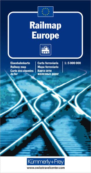
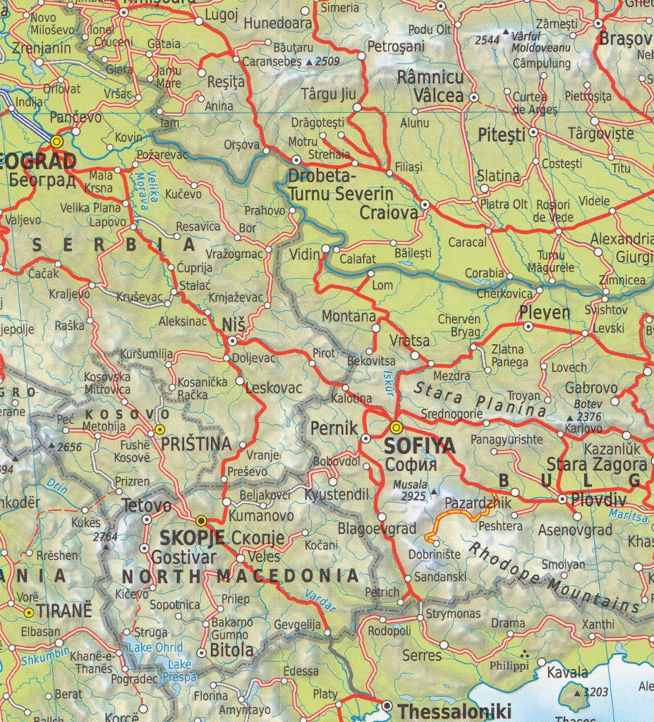
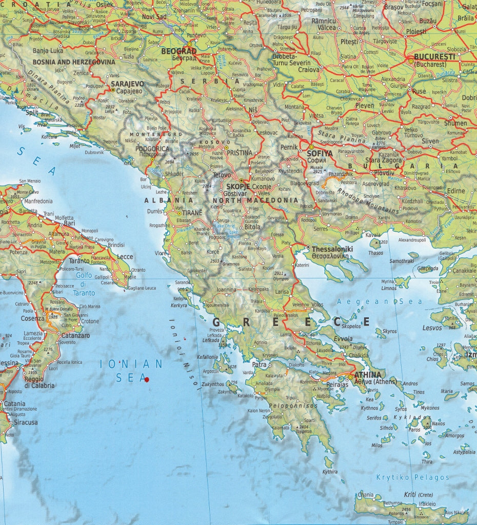
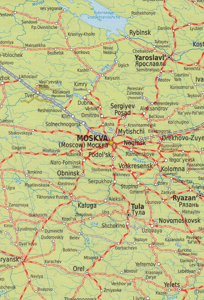
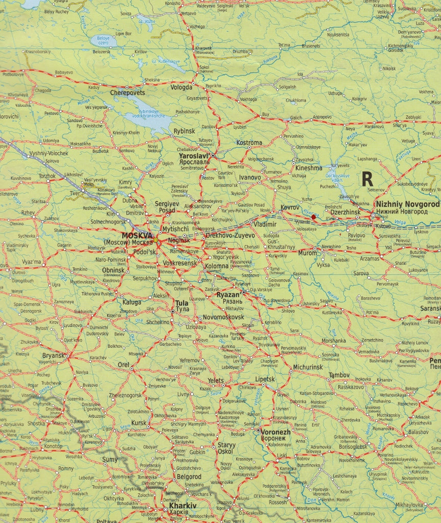
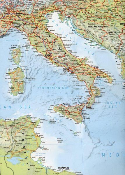
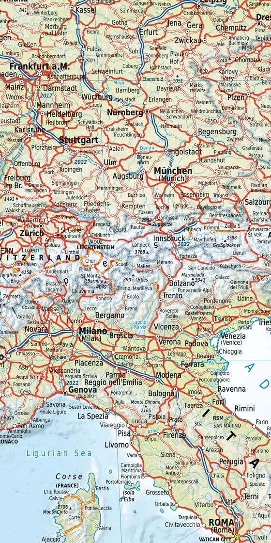
Railmap Europe
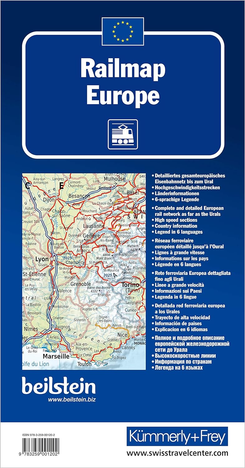
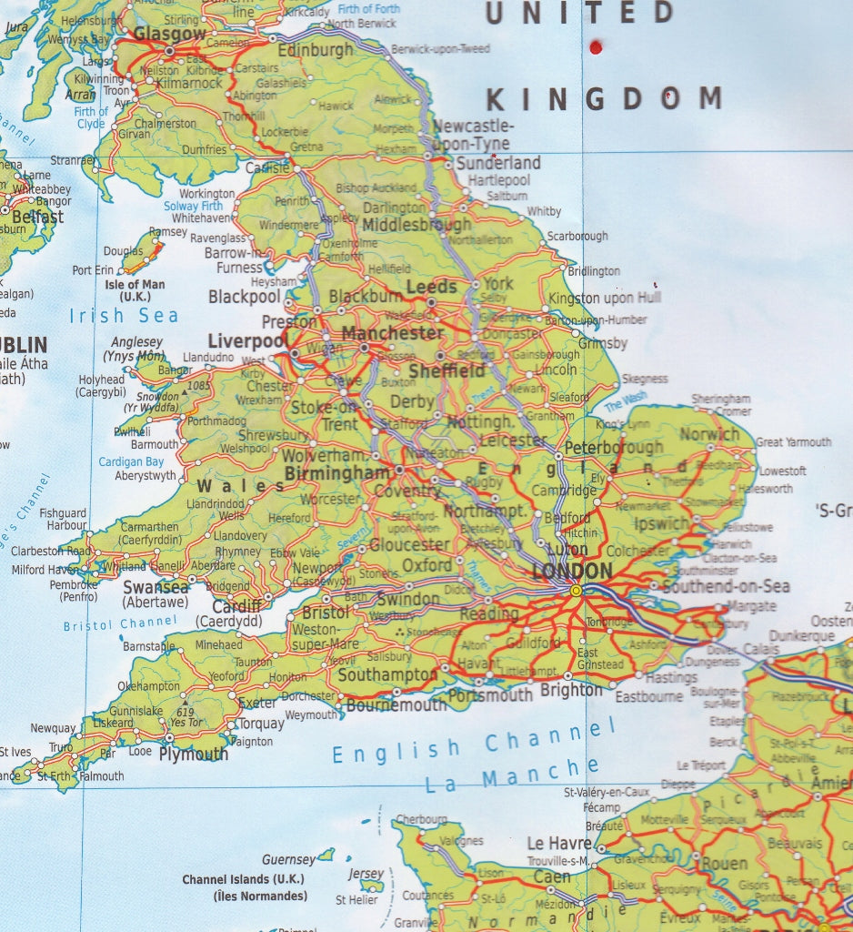
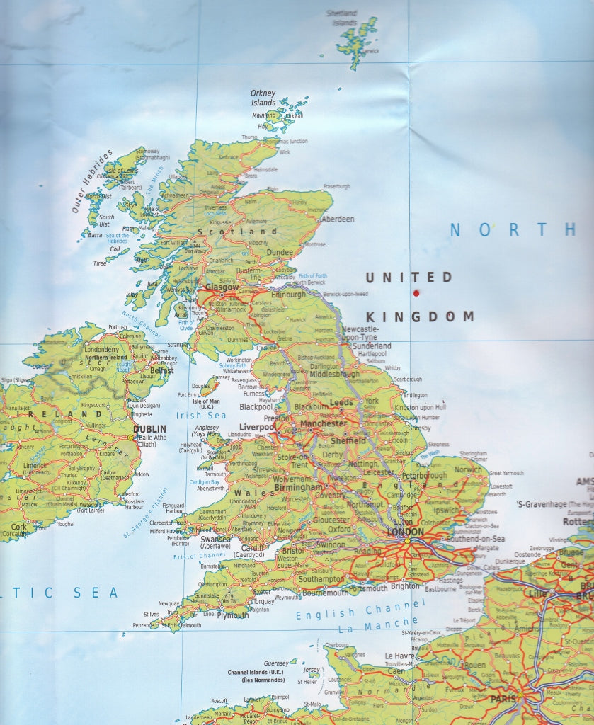
Kümmerly & Frey’s Railmap Europe is an excellent single-sided physical map of Europe with political boundaries, showing the railway network graded into 18 different types of lines.
The map covers the British Isles and Western Europe, east to Kazakhstan, Turkmenistan and most of Iraq and Iran, and along the coast of North Africa. Rail lines are shown in all of these areas.
Country and geographical names are in English. Cities are named in local languages with, where appropriate, English versions. In countries using other alphabets, larger cities are additionally given in Cyrillic, Greek, Arabic etc.
The railway network distinguishes 18 different types of lines, from new high speed lines or upgraded high speed lines to narrow gauge electrified or non-electrified. Railway ferry lines, passenger or freight, are also marked.
The map legend is in English, German, French, Italian, Spanish and Russian. It also includes a panel with flags and details of area, population and the length of rail network for all European countries.
Related Items


© 2024 Mapworld. Website designed by Genie Media
X