- Australia ▾
- Topographic
▾
- Australia AUSTopo 250k (2024)
- Australia 50k Geoscience maps
- Australia 100k Geoscience maps
- Australia 250k Geoscience maps
- Australia 1.1m Geoscience maps
- New Zealand 50k maps
- New Zealand 250k maps
- New South Wales 25k maps
- New South Wales 50k maps
- New South Wales 100k maps
- Queensland 10k maps
- Queensland 25k maps
- Queensland 50k maps
- Queensland 100k maps
- Compasses
- Software
- GPS Systems
- Orienteering
- International ▾
- Wall Maps
▾
- World
- Australia & New Zealand
- Countries, Continents & Regions
- Historical
- Vintage National Geographic
- Australian Capital Territory
- New South Wales
- Northern Territory
- Queensland
- South Australia
- Tasmania
- Victoria
- Western Australia
- Celestial
- Children's
- Mining & Resources
- Wine Maps
- Healthcare
- Postcode Maps
- Electoral Maps
- Nautical ▾
- Flags
▾
- Australian Flag Sets & Banners
- Flag Bunting
- Handwavers
- Australian National Flags
- Aboriginal Flags
- Torres Strait Islander Flags
- International Flags
- Flagpoles & Accessories
- Australian Capital Territory Flags
- New South Wales Flags
- Northern Territory Flags
- Queensland Flags
- South Australia Flags
- Tasmania Flags
- Victoria Flags
- Western Australia Flags
- Gifts ▾
- Globes ▾
Dear valued customer. Please note that our checkout is not supported by old browsers. Please use a recent browser to access all checkout capabilities
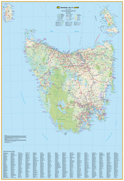
Tasmania UBD 770 Map 690 x 1000mm Canvas Wall Map
$199.00
or make 4 interest-free payments of
$49.75 AUD
fortnightly with
![]() More info
More info
Includes King & Flinders Islands | Travel + Business Planning | Canvas with Optional Timber Rails
Size: 690 mm (W) x 1000 mm (H) | Scale: 1:625,000
Bring the rich, natural beauty of Tasmania into your home or office with this detailed and elegant Tasmania State Canvas Wall Map by UBD Gregory's. This beautifully rendered map provides a comprehensive view of Tasmania—including King and Flinders Islands—making it the ideal reference for travel, planning, education, or simply appreciating the Apple Isle’s geography.
This version is printed on 395gsm HP Professional Matte Canvas using archival-grade pigment inks, resulting in a product that is both visually striking and made to last for years to come.
🌟 Map Features
| ✅ Feature | 📍 Description |
|---|---|
| 🛣️ Comprehensive Road Network | Includes dual carriageways, highways, main and minor roads, route numbers, and distances between towns |
| 🏙️ Town & Locality Index | Fully indexed with clear indications of town size and relative position |
| 🗺️ Regional Coverage | Covers mainland Tasmania, King Island, and Flinders Island in full detail |
| 🌿 Natural & Protected Areas | Shows national parks, reserves, world heritage areas, and visitor information centres |
| 🧭 Perfect for Planning | Suitable for both travel mapping and business use, thanks to its accuracy and clarity |
| 🖼️ Stunning Canvas Format | Printed on 395gsm HP Matte Canvas for texture, durability, and high-resolution clarity |
| 🪵 Optional Timber Hang Rails | Can be fitted with wooden hang battens (top and bottom) with a hanging cord, making it easy to display and stylish to match any space |
💼 Who Is It For?
-
Travellers and caravanners exploring Tasmania by road
-
Business planners, logistics managers, and service providers operating across the island
-
Educators, students, and geography enthusiasts
-
Homeowners and interior designers looking to bring a touch of the Apple Isle into a room
-
Tasmanian expats seeking a sentimental or informative piece to remember home
🧷 Hanging Options
This canvas map can be ordered with natural timber hanging battens attached at the top and bottom, with a cord for simple wall hanging. Just place a hook in the wall and hang—it’s that easy.
🪵 Timber hang rails are optional. Please select the “Canvas with Rails” finish from the dropdown menu above when ordering.
📐 Product Specifications
| Specification | Details |
|---|---|
| Publisher | UBD Gregory’s |
| Material | 395gsm HP Professional Matte Canvas |
| Print Type | Pigment-based archival inks |
| Finish | Optional wooden battens + hanging cord |
| Map Scale | 1:625,000 |
| Map Coverage | Entire state of Tasmania, including King & Flinders Islands |
| Size | 690 mm (W) x 1000 mm (H) |
| Made In | Australia |
| Dispatch Time | Please allow up to 10 working days for hang-railed canvas maps, as rails are attached by our specialist framer. |
Functional, beautiful, and durable—this canvas wall map of Tasmania is the perfect way to combine practical cartographic detail with timeless design.


