- Australia ▾
- Topographic
▾
- Australia AUSTopo 250k (2024)
- Australia 50k Geoscience maps
- Australia 100k Geoscience maps
- Australia 250k Geoscience maps
- Australia 1.1m Geoscience maps
- New Zealand 50k maps
- New Zealand 250k maps
- New South Wales 25k maps
- New South Wales 50k maps
- New South Wales 100k maps
- Queensland 10k maps
- Queensland 25k maps
- Queensland 50k maps
- Queensland 100k maps
- Compasses
- Software
- GPS Systems
- Orienteering
- International ▾
- Wall Maps
▾
- World
- Australia & New Zealand
- Countries, Continents & Regions
- Historical
- Vintage National Geographic
- Australian Capital Territory
- New South Wales
- Northern Territory
- Queensland
- South Australia
- Tasmania
- Victoria
- Western Australia
- Celestial
- Children's
- Mining & Resources
- Wine Maps
- Healthcare
- Postcode Maps
- Electoral Maps
- Nautical ▾
- Flags
▾
- Australian Flag Sets & Banners
- Flag Bunting
- Handwavers
- Australian National Flags
- Aboriginal Flags
- Torres Strait Islander Flags
- International Flags
- Flagpoles & Accessories
- Australian Capital Territory Flags
- New South Wales Flags
- Northern Territory Flags
- Queensland Flags
- South Australia Flags
- Tasmania Flags
- Victoria Flags
- Western Australia Flags
- Gifts ▾
- Globes ▾
Dear valued customer. Please note that our checkout is not supported by old browsers. Please use a recent browser to access all checkout capabilities
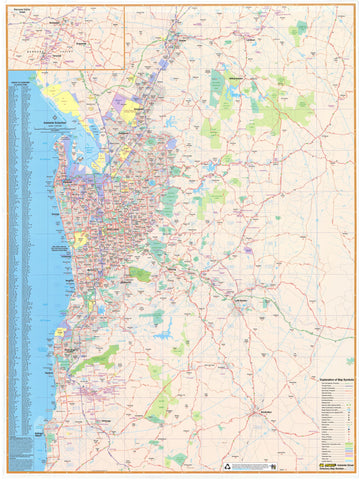
South Australia Hema 1000 x 1430mm Supermap Paper Wall Map
$129.95
or make 4 interest-free payments of
$32.49 AUD
fortnightly with
![]() More info
More info
Extra-Large Wall Map | Paper Format | 1000 × 1430 mm
A Comprehensive State Map for Planning, Travel & Display
This Supermap of South Australia by Hema Maps is one of the most detailed and readable state wall maps available. Covering the entire state, it includes all major cities and towns, national parks, highways, and secondary roads—making it an essential reference for businesses, government offices, planners, educators, and avid travellers.
Whether you're planning logistics, mapping out your next road trip, or creating a professional wall display, this map offers the clarity, scale, and precision you need.
🧭 Key Features
-
🏙️ Cities, Towns & Localities – Clearly marked for fast identification
-
🛣️ Major & Minor Roads – Including highways, main routes, and regional connectors
-
🌲 Parks & Reserves – State and national parks shown in full context
-
🗺️ Hema Cartographic Accuracy – Trusted Australian mapmaker known for field-verified detail
-
🖼️ Ideal for Wall Display – A striking and practical addition to offices, schools, or planning rooms
🖨️ Map Specifications
| Property | Detail |
|---|---|
| Scale | 1:1,190,000 |
| Map Size | 1000 mm (W) × 1430 mm (H) |
| Material | FSC-certified 170 gsm matte-coated paper |
| Printing | Pigment-based, fade-resistant inks (HP) |
| Finish | Unlaminated – suitable for glass framing |
| Made In | Australia |
🏢 Who Is This Map For?
-
🏫 Educators & Schools – Enhance classrooms with detailed regional mapping
-
🏢 Business & Government – Perfect for logistics, infrastructure, or regional strategy
-
🚗 Travellers & 4WD Explorers – Plan your next adventure with confidence
-
🎓 Students & Researchers – A valuable resource for studying geography and development
-
🎁 Map Lovers & Collectors – A timeless gift or display piece


