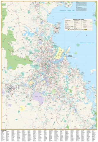
Queensland — Hema State Map
Laminated (True Encapsulation) • Timber Hang Rails • 700 × 1000 mm • Scale 1:2,500,000
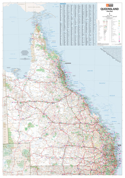
The Queensland Hema State Map is a clear, comprehensive wall reference for the entire state—showing towns, cities, and all major & secondary roads with Hema’s hallmark readability. Built for daily use and display, it’s ideal for travel planning, business logistics, classrooms, foyers, and project rooms.
📍 Coverage (Statewide at a Glance)
-
Entire state of Queensland, from the Torres Strait/Cape York in the north to the Gold Coast in the south, and west to the Northern Territory border
-
Key regions include the Gulf Country, Outback/Channel Country, Central Highlands, Whitsundays & Mackay, Wide Bay–Burnett, Darling Downs, and South East Queensland (Brisbane–Ipswich–Sunshine & Gold Coasts)
-
Major intercity corridors and inland routes clearly visible for long-range planning
🗺️ What’s Shown (At a Glance)
-
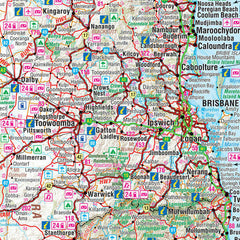
Settlements: Towns and cities statewide, cleanly labelled
-
Road network: Major highways & secondary roads (easy to distinguish)
-
Quick orientation: Uncluttered cartography for long-distance viewing on walls
🗝️ Why This Map Works
-
Business-ready: Plan service territories, delivery routes, and travel times across the state
-
Travel-friendly: Visualise multi-day road trips and regional connections at a glance
-
High legibility: Hema’s clear design remains readable from meeting-room distance
-
Display-ready: Arrives laminated with timber hang rails—no framing required
🎨 Materials & Finish
💧 Lamination (True Encapsulation)
-
Encased in 2 × 80-micron gloss films, fully edge-sealed for maximum durability
-
Waterproof • Tear-resistant • Wipe-clean
-
Use whiteboard markers and Mark-It-Dots; notes wipe off cleanly without ghosting
🪵 Timber Hang Rails (Ready to Hang)
-
Natural timber rails (lacquered) fitted top & bottom
-
Strong top hanging cord — hang from a single wall hook for a neat, professional presentation
⚠️ Lead time: Hang rails are custom-fitted by our framer — please allow up to 10 working days for delivery.
📐 Size & Scale
-
Print size: 700 mm (W) × 1000 mm (H)
-
Scale: 1:2,500,000
-
Orientation: Portrait
🧽 Care & Use
-
Write with non-permanent whiteboard markers; wipe with a soft, dry cloth
-
For labels, use Mark-It-Dots to avoid residue
-
Avoid ammonia/alcohol cleaners; a damp microfiber cloth handles stubborn marks
📊 Specifications
| Attribute | Details |
|---|---|
| Title | Queensland — Hema State Map |
| Scale | 1:2,500,000 |
| Coverage | Entire state of Queensland |
| Features | Towns & cities; major & secondary roads |
| Format | Laminated + Timber Hang Rails |
| Laminate | 2 × 80-micron gloss (true encapsulation) |
| Hang Rails | Natural timber, lacquered; top hanging cord |
| Origin | Printed in Australia |
🎯 Ideal Uses
-
Businesses & logistics: Territory mapping, routing, service-area planning
-
Tourism & travel: Trip planning boards in visitor centres and offices
-
Education: Durable teaching map for classrooms and libraries
-
Public spaces: Reception and meeting rooms needing a clear state overview
🛒 Order your Queensland — Hema State Map (Laminated with Hang Rails) today — durable, wipe-clean, and ready to hang for daily use.


