- Australia ▾
- Topographic
▾
- Australia AUSTopo 250k (2024)
- Australia 50k Geoscience maps
- Australia 100k Geoscience maps
- Australia 250k Geoscience maps
- Australia 1.1m Geoscience maps
- New Zealand 50k maps
- New Zealand 250k maps
- New South Wales 25k maps
- New South Wales 50k maps
- New South Wales 100k maps
- Queensland 10k maps
- Queensland 25k maps
- Queensland 50k maps
- Queensland 100k maps
- Compasses
- Software
- GPS Systems
- Orienteering
- International ▾
- Wall Maps
▾
- World
- Australia & New Zealand
- Countries, Continents & Regions
- Historical
- Vintage National Geographic
- Australian Capital Territory
- New South Wales
- Northern Territory
- Queensland
- South Australia
- Tasmania
- Victoria
- Western Australia
- Celestial
- Children's
- Mining & Resources
- Wine Maps
- Healthcare
- Postcode Maps
- Electoral Maps
- Nautical ▾
- Flags
▾
- Australian Flag Sets & Banners
- Flag Bunting
- Handwavers
- Australian National Flags
- Aboriginal Flags
- Torres Strait Islander Flags
- International Flags
- Flagpoles & Accessories
- Australian Capital Territory Flags
- New South Wales Flags
- Northern Territory Flags
- Queensland Flags
- South Australia Flags
- Tasmania Flags
- Victoria Flags
- Western Australia Flags
- Gifts ▾
- Globes ▾
Dear valued customer. Please note that our checkout is not supported by old browsers. Please use a recent browser to access all checkout capabilities
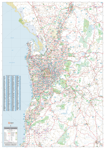
Adelaide & Region Hema 700 x 1000mm Laminated Wall Map
$99.00
or make 4 interest-free payments of
$24.75 AUD
fortnightly with
![]() More info
More info
Durable, detailed, and made for planning – your essential wall map for Greater Adelaide.
Scale: 1:80,000 | Size: 1000 mm (H) x 700 mm (W) | Laminated & Writable
Overview
Covering everything from Gawler Belt in the north to Willunga in the south, and extending east to Charleston, this Greater Adelaide Laminated Wall Map by Hema is a reliable and highly legible reference tool for both professional and personal use.
With a large-format layout and crystal-clear cartography, this map displays primary and secondary roads, metro routes, state and national route numbers, and even future freeway plans—making it ideal for logistics, deliveries, local planning, or simply understanding Adelaide’s regional geography in greater detail.
If you're managing a business, mapping service areas, or just want a practical visual reference in your home office or classroom, this wall map is designed for functionality, durability, and daily use.
🧭 Key Features
| Feature | Description |
|---|---|
| 🛣️ Road Networks | Clearly marked primary and secondary roads, metro routes, route numbers, and freeways (existing and planned) |
| 🏘️ Postcodes & Suburbs | Postcode boundaries and a suburb index for easy location lookup |
| 📌 Planning-Ready | Ideal for business owners, fleet managers, and urban planners needing a practical, up-to-date visual aid |
| ✍️ Writable Surface | Laminated surface allows for use with whiteboard markers or removable Mark-It-Dots |
| 🌿 High-Quality Materials | Printed on 120 gsm FSC-certified matte-coated paper with fade-resistant pigment inks |
| 🛡️ Heavy-Duty Laminate | Fully encapsulated between two sheets of 80-micron gloss laminate for superior durability and tear-resistance |
📐 Specifications
| Detail | Value |
|---|---|
| Title | Adelaide & Region Wall Map |
| Publisher | Hema Maps |
| Scale | 1:80,000 |
| Map Size | 1000 mm (H) x 700 mm (W) |
| Material | 120 gsm FSC matte-coated paper + 80-micron gloss laminate |
| Printing | Archival-grade pigment inks |
| Finish Options | Flat laminated (no creases) or laminated from a folded map (with minor fold lines) |
| Made In | Australia |
🛠️ Finish Options
| Option | Description | Price |
|---|---|---|
| Flat Laminated | Rolled and laminated from the original flat map – best finish, no folds | $99.00 |
| Laminated from Folded Map | Flattened and laminated version of a pre-folded map – economical but may show slight crease lines | $49.95 |
✅ Why Choose This Map?
-
Perfect for Planning – Businesses, delivery drivers, and logistics coordinators will find this an invaluable visual tool for mapping coverage areas or planning routes.
-
Writable & Reusable – Mark your locations, erase when done, and start fresh—no wear and tear.
-
Visually Clear – Large scale (1:80,000) means even street-level details are easy to read from a distance.
-
Locally Made – Designed, printed, and laminated in Australia to high production standards.
📦 Order today and make your workspace smarter, neater, and more informed with a map you’ll refer to again and again.
🛒 Click on the dropdown “Finish” to select your preferred lamination option.


