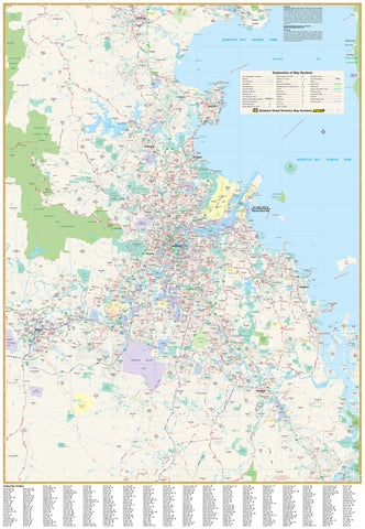
Brisbane & Region — Hema Supermap
Laminated (True Encapsulation) • Timber Hang Rails • 1000 × 1430 mm
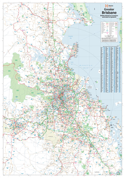
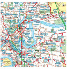
The Greater Brisbane Supermap by Hema delivers wall-filling clarity from Bribie Island (north) to Jimboomba (south) and west to Ipswich. At a detailed 1:70,000 scale, it shows major and secondary roads, Metroad routes, national & state route numbers, and present and planned freeways—plus postcodes and a suburb index for fast lookups. Perfect for planning, logistics, teaching, or a standout office display.
📍 Map Coverage
-
North–South: Bribie Island → Jimboomba
-
West–East: Ipswich → Brisbane’s bayside corridor
-
Highlights key growth areas, corridors, and connections across the metro region.
🗺️ What’s Shown (At a Glance)
-
Road network: Major & secondary roads, Metroads
-
Route numbering: State & national designations
-
Freeways: Current alignments + planned corridors (where available)
-
Postcodes & suburb index: Business-ready for territory and service planning
🗝️ Key Benefits
-
Large-format visibility: Supermap size for boardrooms and shared spaces
-
Business-ready: Postcodes + index streamline delivery, sales, and service zones
-
High legibility: Hema’s clean cartography reads clearly from a distance
-
Display-ready: Supplied laminated with hang rails—no framing required
🎨 Materials & Finish
💧 Lamination (True Encapsulation)
-
Encased in 2 × 80-micron gloss films, fully edge-sealed
-
Waterproof, tear-resistant, wipe-clean surface
-
Use whiteboard markers and Mark-It-Dots—erase cleanly without damage
🪵 Timber Hang Rails
-
Natural timber rails (lacquered) fitted top & bottom
-
Strong top hanging cord for simple, tidy wall mounting (single hook friendly)
-
Warm, professional presentation suited to offices, classrooms, and home study spaces
⚠️ Hang rails are custom-fitted—please allow up to 10 working days for delivery.
📐 Size & Scale
-
Print size: 1000 mm (W) × 1430 mm (H)
-
Scale: 1:70,000
-
Orientation: Portrait
-
Format: Supermap (large-format display)
🧽 Care & Use
-
Write with non-permanent whiteboard markers; wipe with a soft, dry cloth
-
For labels, use Mark-It-Dots to avoid residue
-
Avoid ammonia/alcohol cleaners; a damp microfiber cloth handles stubborn marks
📊 Specifications
| Attribute | Details |
|---|---|
| Title | Brisbane & Region Hema Supermap |
| Scale | 1:70,000 |
| Coverage | Bribie Island (N) to Jimboomba (S); west to Ipswich |
| Features | Major & secondary roads, Metroads, state/national routes, current & planned freeways, postcodes, suburb index |
| Format | Laminated + Timber Hang Rails |
| Laminate | 2 × 80-micron gloss (true encapsulation) |
| Hang Rails | Natural timber, lacquered; top hanging cord |
| Origin | Printed in Australia |
🎯 Ideal Uses
-
Businesses & offices: Territory planning, postcode reference, wall-ready display
-
Logistics & service teams: Route planning across metro Brisbane
-
Schools & libraries: Durable, easy-to-read teaching and display map
-
Households: A practical Brisbane reference that looks great on the wall
🛒 Order your Brisbane & Region — Hema Supermap (Laminated with Hang Rails) today—durable, wipe-clean, and ready to hang for daily use.


