- Australia ▾
- Topographic
▾
- Australia AUSTopo 250k (2024)
- Australia 50k Geoscience maps
- Australia 100k Geoscience maps
- Australia 250k Geoscience maps
- Australia 1.1m Geoscience maps
- New Zealand 50k maps
- New Zealand 250k maps
- New South Wales 25k maps
- New South Wales 50k maps
- New South Wales 100k maps
- Queensland 10k maps
- Queensland 25k maps
- Queensland 50k maps
- Queensland 100k maps
- Compasses
- Software
- GPS Systems
- Orienteering
- International ▾
- Wall Maps
▾
- World
- Australia & New Zealand
- Countries, Continents & Regions
- Historical
- Vintage National Geographic
- Australian Capital Territory
- New South Wales
- Northern Territory
- Queensland
- South Australia
- Tasmania
- Victoria
- Western Australia
- Celestial
- Children's
- Mining & Resources
- Wine Maps
- Healthcare
- Postcode Maps
- Electoral Maps
- Nautical ▾
- Flags
▾
- Australian Flag Sets & Banners
- Flag Bunting
- Handwavers
- Australian National Flags
- Aboriginal Flags
- Torres Strait Islander Flags
- International Flags
- Flagpoles & Accessories
- Australian Capital Territory Flags
- New South Wales Flags
- Northern Territory Flags
- Queensland Flags
- South Australia Flags
- Tasmania Flags
- Victoria Flags
- Western Australia Flags
- Gifts ▾
- Globes ▾
Dear valued customer. Please note that our checkout is not supported by old browsers. Please use a recent browser to access all checkout capabilities
Australia 149 Gregory's Large 920 x 675mm Wall Map
$59.95
or make 4 interest-free payments of
$14.99 AUD
fortnightly with
![]() More info
More info
Precision Mapping, Premium Lamination & Timeless Australian Reference
The Australia 149 Gregory’s Large Wall Map is more than a simple wall chart — it’s a comprehensive, up-to-date geographic reference designed for clarity, usability, and long-term durability. Whether mounted in a school classroom, corporate boardroom, logistics office, or home study, this map offers a perfect balance of visual appeal and practical functionality.
🌏 A Complete Portrait of the Nation
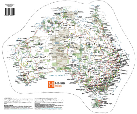
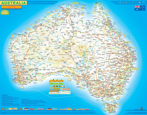
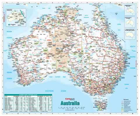
Produced by Gregory’s, one of Australia’s most trusted cartographic publishers, this wall map captures the country in meticulous detail. Every major and minor feature has been carefully plotted to give you an accurate, big-picture view without sacrificing readability.
🗺 Geographic & Cultural Features:
-
Cities, Towns & Remote Communities – From capital cities to isolated Outback homesteads.
-
Road Networks – Clearly differentiated between dual carriageways, through routes, major and minor roads, sealed and unsealed tracks, and key Outback routes.
-
Rail Infrastructure – Showing passenger and freight lines for reference and planning.
-
Protected Areas – National parks, reserves, and state parks prominently marked.
-
Aboriginal Land Boundaries – Recognising Australia’s Indigenous heritage and land rights.
-
Tourist & Natural Highlights – Unique among Australian reference maps, this edition marks notable attractions and natural wonders in distinctive blue text — including iconic coastal viewpoints, geological formations, and historic sites.
-
Full Indexing System – A complete alphabetical index allows instant location searches, making it as functional as it is attractive.
💎 Premium Lamination – True 80-Micron Encapsulation
This map is printed on heavy archival-quality paper before being sealed between two layers of 80-micron gloss laminate in a true encapsulation process.
Why this matters:
-
Durability for Daily Use – Resists tearing, creasing, and edge fraying.
-
Moisture & Stain Protection – Suitable for humid environments and high-traffic areas.
-
Dry-Erase Compatible – Mark routes, highlight territories, or plot travel itineraries with whiteboard markers and wipe clean with ease.
-
Colour Preservation – The laminate acts as a UV filter, helping to prevent fading over time.
🪵 Optional Display Upgrade – Timber Hang Rails
For an elegant, ready-to-hang presentation, you can have your map professionally mounted with lacquered natural timber hang rails at the top and bottom, complete with a strong hanging cord. This option makes the map equally suited for professional offices, educational institutions, and stylish home decor.
Note: Please allow up to 10 working days for delivery of hang-railed editions, as each is custom-mounted by our framer.
📐 Specifications
| Feature | Detail |
|---|---|
| Publisher | Gregory’s |
| Map Type | Australia Reference |
| Publication Year | Latest edition |
| Scale | 1:5,800,000 |
| Size | 920 mm (W) × 675 mm (H) |
| Finish | Laminated – 80-micron gloss, true encapsulation |
| Index | Fully indexed for towns, features & attractions |
| Optional Display | Timber hang rails |
| Made in | Australia |
🎯 Perfect For
📚 Education – Interactive geography lessons and classroom wall displays.
🏢 Business & Logistics – Planning routes, managing territories, and visualising coverage areas.
🏡 Home Reference – A practical yet attractive addition to a study or family room.
✈️ Travel Enthusiasts – Plot journeys, track Outback adventures, and dream up your next expedition.
🎁 Gift Buyers – A thoughtful and functional gift for travellers, teachers, or map lovers.
From the rugged Kimberley to the sparkling shores of the Great Barrier Reef, this map delivers an accurate, colour-rich representation of Australia’s geography, infrastructure, and points of interest — all in a format designed to withstand years of use.


