- Australia ▾
- Topographic
▾
- Australia AUSTopo 250k (2024)
- Australia 50k Geoscience maps
- Australia 100k Geoscience maps
- Australia 250k Geoscience maps
- Australia 1.1m Geoscience maps
- New Zealand 50k maps
- New Zealand 250k maps
- New South Wales 25k maps
- New South Wales 50k maps
- New South Wales 100k maps
- Queensland 10k maps
- Queensland 25k maps
- Queensland 50k maps
- Queensland 100k maps
- Compasses
- Software
- GPS Systems
- Orienteering
- International ▾
- Wall Maps
▾
- World
- Australia & New Zealand
- Countries, Continents & Regions
- Historical
- Vintage National Geographic
- Australian Capital Territory
- New South Wales
- Northern Territory
- Queensland
- South Australia
- Tasmania
- Victoria
- Western Australia
- Celestial
- Children's
- Mining & Resources
- Wine Maps
- Healthcare
- Postcode Maps
- Electoral Maps
- Nautical ▾
- Flags
▾
- Australian Flag Sets & Banners
- Flag Bunting
- Handwavers
- Australian National Flags
- Aboriginal Flags
- Torres Strait Islander Flags
- International Flags
- Flagpoles & Accessories
- Australian Capital Territory Flags
- New South Wales Flags
- Northern Territory Flags
- Queensland Flags
- South Australia Flags
- Tasmania Flags
- Victoria Flags
- Western Australia Flags
- Gifts ▾
- Globes ▾
Dear valued customer. Please note that our checkout is not supported by old browsers. Please use a recent browser to access all checkout capabilities
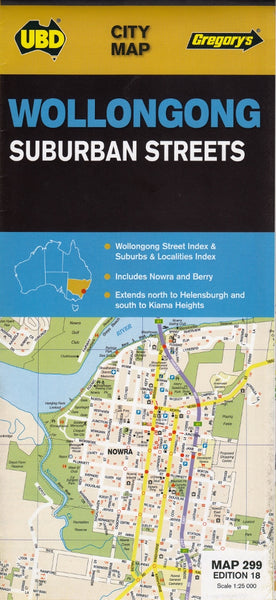
Wollongong Nowra & Berry UBD Map 299
$13.95
Afterpay is only available for orders between $50.00 and $1000.00 More info
Scale: 1:25,000 | Suburban Street Map | Folded or Laminated Option Available
Navigate the South Coast with Precision and Clarity
Whether you're a local business owner, a house hunter, a delivery driver, or simply someone who wants to get to know the Illawarra region better, the UBD Gregory’s Wollongong, Nowra & Berry Suburban Streets Map is an invaluable tool for exploring the area with ease and confidence.
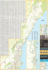
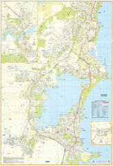
This highly detailed street-level map provides a clear view of Wollongong and surrounding suburbs, stretching north to Helensburgh and south to Kiama, and includes additional detailed town maps of Nowra and Berry — two of the South Coast’s most popular and picturesque communities.
Created by UBD Gregory's, a trusted name in Australian cartography, this map is ideal for anyone needing reliable navigation across the region — from homeowners and tradies to planners, educators, and tourists.
Coverage Area
-
Wollongong Metropolitan Region – from Helensburgh and Stanwell Tops in the north, through Thirroul, Fairy Meadow, and Port Kembla, down to Kiama in the south
-
Berry – heritage-rich town on the edge of the Shoalhaven
-
Nowra – key regional centre with river access, shopping, and community hubs
Map Features
-
🏘️ Full Suburb and Street Index – Quickly locate any address, street, or suburb with the user-friendly reference system
-
🏫 Community Landmarks – Schools, shopping centres, parks, playgrounds, police stations, libraries, and more clearly marked
-
🛣️ Detailed Road Network – All local roads, major arterials, cul-de-sacs, and public transport corridors shown with precision
-
🚸 Local Facilities – Hospitals, sports fields, aged care centres, places of worship, and other key civic features
-
🌿 Greenspace & Parks – Clearly defined recreational areas, bushland, walking trails, and coastline features
-
🧭 Orientation-Friendly Design – Designed for maximum clarity when navigating on foot, by car, or for urban planning purposes
Laminated Version Available
Want a version that stands up to heavy use? We offer this map fully laminated using high-quality 80-micron gloss laminate, creating a durable “write & wipe” surface ideal for:
-
Real estate agents marking listings
-
Local councils or planners charting boundaries
-
Business owners plotting delivery zones
-
Families or schools planning local outings
You can draw on it with a whiteboard marker or apply Map Dots to highlight key locations — and simply wipe clean when done.
🛠️ Please note: For laminated maps, we carefully flatten the folded version and encapsulate it. This means some light fold lines may still be visible, but the result is a strong, reusable and highly functional map for ongoing use.
📏 Product Details
| Feature | Details |
|---|---|
| Title | Wollongong, Nowra & Berry UBD Suburban Streets Map 299 |
| Coverage | Wollongong to Kiama, Helensburgh to Nowra & Berry |
| Map Type | Folded street map or laminated wall map |
| Scale | 1:25,000 |
| Map Size | Approx. 700mm x 1000mm (laminated version) |
| Publisher | UBD Gregory’s |
| Finish Options | Paper (folded), Laminated (flat, encapsulated) |
🧳 Who Is This Map For?
-
🏡 House Hunters & Local Residents – Explore suburbs, compare locations, or plan your next move
-
🛠️ Tradies, Couriers & Mobile Services – Identify service zones, travel times and key addresses
-
📦 Local Businesses & Planners – Ideal for delivery management, advertising zones, or service areas
-
🧭 Geography Enthusiasts & Students – Learn local geography or map out regional connections
🛒 Ready to Explore the Illawarra Region?
The UBD 299 Wollongong, Nowra & Berry Map is more than just a navigation aid — it’s a tool for discovery, planning, and connecting with your community. Order your copy today and bring the Illawarra into focus.


