- Australia ▾
- Topographic
▾
- Australia AUSTopo 250k (2024)
- Australia 50k Geoscience maps
- Australia 100k Geoscience maps
- Australia 250k Geoscience maps
- Australia 1.1m Geoscience maps
- New Zealand 50k maps
- New Zealand 250k maps
- New South Wales 25k maps
- New South Wales 50k maps
- New South Wales 100k maps
- Queensland 10k maps
- Queensland 25k maps
- Queensland 50k maps
- Queensland 100k maps
- Compasses
- Software
- GPS Systems
- Orienteering
- International ▾
- Wall Maps
▾
- World
- Australia & New Zealand
- Countries, Continents & Regions
- Historical
- Vintage National Geographic
- Australian Capital Territory
- New South Wales
- Northern Territory
- Queensland
- South Australia
- Tasmania
- Victoria
- Western Australia
- Celestial
- Children's
- Mining & Resources
- Wine Maps
- Healthcare
- Postcode Maps
- Electoral Maps
- Nautical ▾
- Flags
▾
- Australian Flag Sets & Banners
- Flag Bunting
- Handwavers
- Australian National Flags
- Aboriginal Flags
- Torres Strait Islander Flags
- International Flags
- Flagpoles & Accessories
- Australian Capital Territory Flags
- New South Wales Flags
- Northern Territory Flags
- Queensland Flags
- South Australia Flags
- Tasmania Flags
- Victoria Flags
- Western Australia Flags
- Gifts ▾
- Globes ▾
Dear valued customer. Please note that our checkout is not supported by old browsers. Please use a recent browser to access all checkout capabilities


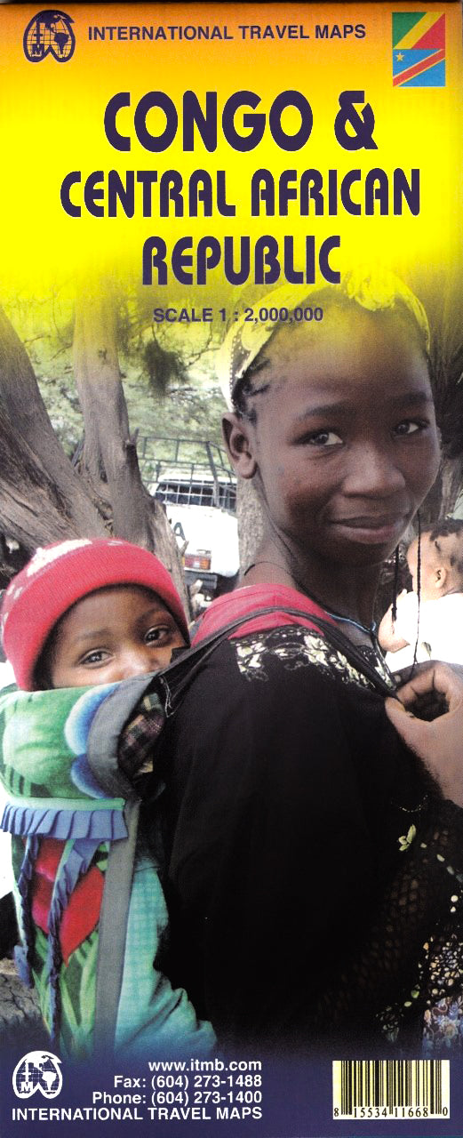
Congo, Democratic Republic of Congo & Central African Republic ITMB Map
$24.95
Afterpay is only available for orders between $50.00 and $1000.00 More info
Folded or Laminated Map | Scale 1:2,000,000 | Size: 680 x 990 mm
A richly detailed and ambitious map of Central Africa’s vast Congo River Basin — cartography on a continental scale.
🌍 Mapping One of Earth’s Last Great Frontiers
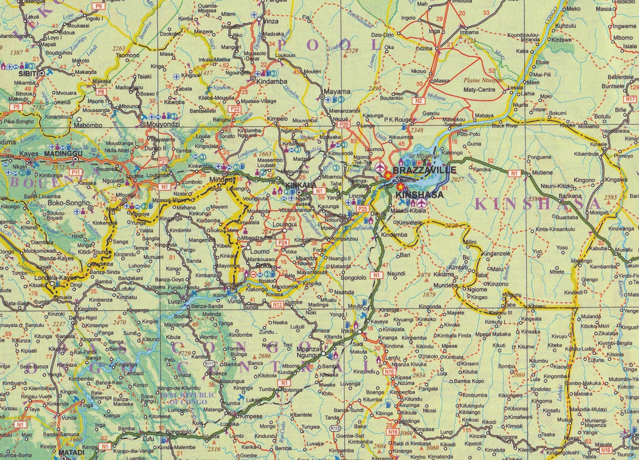
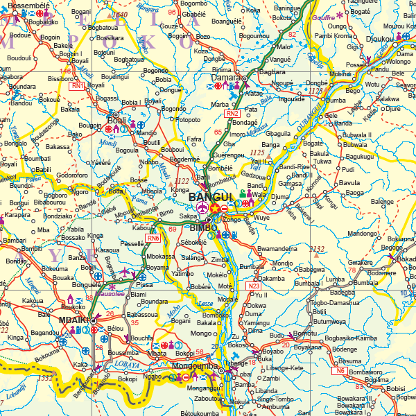
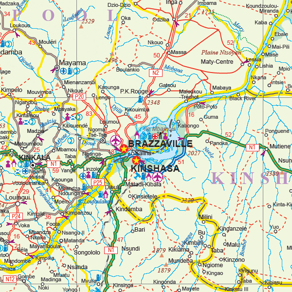
This ITMB map of the Congo, Democratic Republic of the Congo (DRC), and the Central African Republic (CAR) is an extraordinary cartographic achievement, covering a region as expansive and ecologically vital as Europe. Years in the making, this map provides a detailed overview of Central Africa’s Congo River Basin, home to the second-largest tropical rainforest on the planet.
It spans the full territory of:
-
Democratic Republic of the Congo (Congo-Kinshasa / former Zaire)
-
Republic of the Congo (Congo-Brazzaville / French Congo)
-
Central African Republic (CAR)
This is part of ITMB’s global river basin mapping series — alongside titles covering the Amazon, Mekong, Mississippi/Missouri, Nile, and Mackenzie river systems — all dedicated to the world’s largest and most complex natural landscapes.
🌟 Key Features
| 🗂️ Feature | ✅ Benefit |
|---|---|
| Covers three entire nations | Complete mapping of the DRC, Republic of the Congo, and Central African Republic |
| Focus on the Congo River Basin | Showcases the geographical heart of Africa’s great equatorial rainforest |
| Scale 1:2,000,000 | Ideal balance of regional coverage and detail |
| Topographic and hydrographic detail | Major rivers, elevation changes, and rainforest features clearly marked |
| Road network classification | Roads shown with graded quality indicators — essential for overland travellers |
| Place names, borders & towns | Key cities, borders, rivers, and regional capitals labelled |
| Part of a unique world river series | Matches ITMB’s Amazon, Nile, Mekong, and other basin-focused maps |
🚧 A Note on Infrastructure
While the region is awe-inspiring in scale and ecological significance, its transport infrastructure is limited. Roads may be unpaved, seasonal, or extremely degraded — often impassable by conventional vehicles. ITMB has worked to classify roads by condition, but due to rapid change and limited data, some routes remain marked for reference only.
Use this map as a guide, not a guarantee — and expect the unexpected.
🛡️ Laminated Option Available
Upgrade to a laminated edition for added durability and planning utility:
-
✏️ Write-on, wipe-off surface for whiteboard markers
-
📌 Apply map dots or notes without damaging the print
-
💧 Water-, tear-, and stain-resistant — ideal for fieldwork or educational use
-
🧳 Perfect for field researchers, NGOs, expedition planners, or classrooms
Note: Laminated maps are created by flattening and encapsulating the folded version in high-quality 80-micron laminate. Some light fold lines may still be visible.
📐 Product Specifications
| Specification | Description |
|---|---|
| Map Title | Congo, DRC & Central African Republic |
| Publisher | International Travel Maps (ITMB) |
| Edition | Latest edition |
| Scale | 1:2,000,000 |
| Map Size | 680 mm (W) x 990 mm (H) |
| Format | Folded paper or laminated (optional) |
| Region Covered | DRC, Republic of the Congo, CAR |
| Focus | Congo River Basin |
🎯 Perfect For:
-
🌿 Researchers and NGOs operating in Central Africa
-
🧭 Overland travellers and expedition leaders
-
📚 Educators and geography students studying rainforest ecosystems or African geopolitics
-
🗺️ Map collectors and explorers
-
🏢 Humanitarian agencies and conservation groups
A rare and essential map for one of the world’s most challenging and important regions.
Now available in folded or laminated format — ready for planning, study, or exploration.


