- Australia ▾
- Topographic
▾
- Australia AUSTopo 250k (2025)
- Australia 50k Geoscience maps
- Australia 100k Geoscience maps
- Australia 250k Geoscience maps
- Australia 1:1m Geoscience maps
- New Zealand 50k maps
- New Zealand 250k maps
- New South Wales 25k maps
- New South Wales 50k maps
- New South Wales 100k maps
- Queensland 10k maps
- Queensland 25k maps
- Queensland 50k maps
- Queensland 100k maps
- Compasses
- Software
- GPS Systems
- Orienteering
- International ▾
- Wall Maps
▾
- World
- Australia & New Zealand
- Countries, Continents & Regions
- Historical
- Vintage National Geographic
- Australian Capital Territory
- New South Wales
- Northern Territory
- Queensland
- South Australia
- Tasmania
- Victoria
- Western Australia
- Celestial
- Children's
- Mining & Resources
- Wine Maps
- Healthcare
- Postcode Maps
- Electoral Maps
- Nautical ▾
- Flags
▾
- Australian Flag Sets & Banners
- Flag Bunting
- Handwavers
- Australian National Flags
- Aboriginal Flags
- Torres Strait Islander Flags
- International Flags
- Flagpoles & Accessories
- Australian Capital Territory Flags
- New South Wales Flags
- Northern Territory Flags
- Queensland Flags
- South Australia Flags
- Tasmania Flags
- Victoria Flags
- Western Australia Flags
- Gifts ▾
- Globes ▾
Dear valued customer. Please note that our checkout is not supported by old browsers. Please use a recent browser to access all checkout capabilities


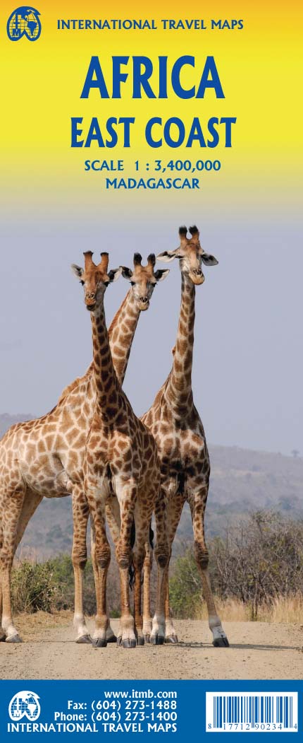
Africa East Coast ITMB Map
$24.95
Afterpay is only available for orders between $50.00 and $1000.00 More info
Navigate Africa’s Eastern Corridor from the Horn to the Cape
Scale: 1:3,400,000 | Size: 1350 mm x 1000 mm (Double-Sided)
Waterproof Paper or Optional Laminated Finish
Includes Inset Map of Madagascar
🌍 Overview
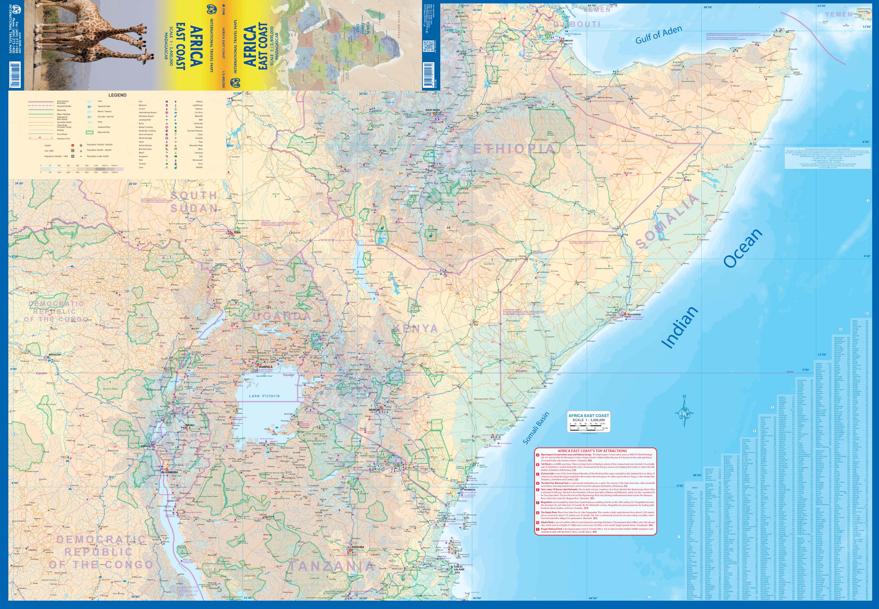
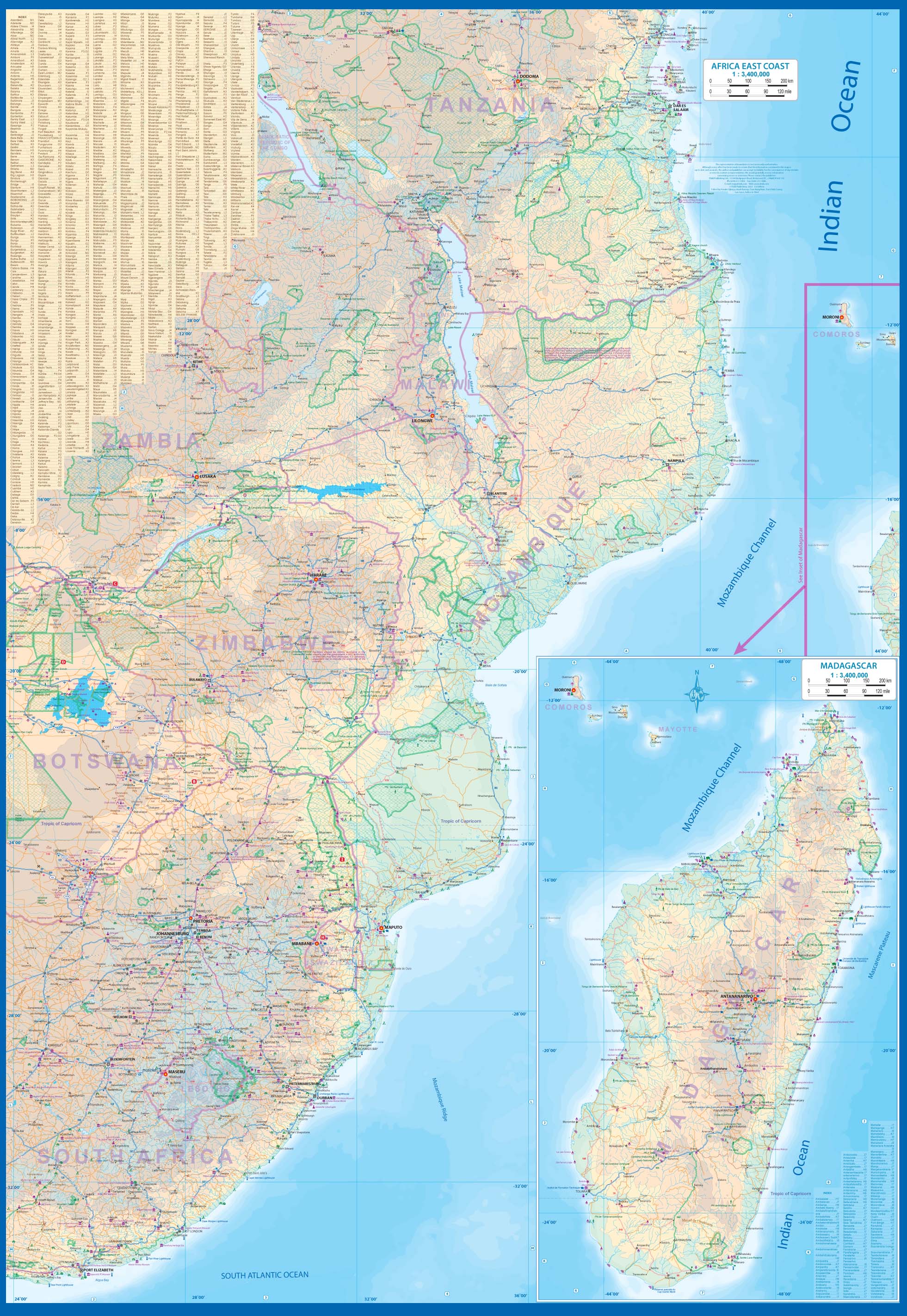
Spanning from the rugged terrain of the Horn of Africa to the southernmost reaches of the continent, the Africa East Coast Map by ITMB is an indispensable tool for travellers, planners, and geography lovers alike. Designed for practical travel use and informative display, this double-sided map covers an expansive swathe of Africa—offering reliable cartographic detail across 13 countries in full and several others in part.
Whether you're planning an overland route from Nairobi to Cape Town, mapping out safari destinations, or coordinating multi-country logistics, this map delivers the clarity, scale, and resilience needed for real-world navigation and trip planning.
🗺️ Countries Covered in Full
-
Djibouti
-
Somalia
-
Kenya
-
Uganda
-
Tanzania
-
Rwanda
-
Burundi
-
Mozambique
-
Malawi
-
Zimbabwe
-
Lesotho
-
Eswatini (formerly Swaziland)
-
Madagascar (included as an inset map)
🌐 Also Includes Portions Of
-
South Africa (northern and eastern regions)
-
Southern Ethiopia
-
Zambia
-
Democratic Republic of the Congo (southern areas)
This geographic breadth makes it ideal for overland adventures, cross-border expeditions, and anyone navigating between East and Southern Africa.
✅ Key Map Features
| Feature | Benefit |
|---|---|
| Double-Sided Format | Maximises detail across a large region while keeping it easy to handle |
| Up-to-Date Political Boundaries | Accurate country and regional borders for safe and informed travel |
| Comprehensive Road Networks | Shows all primary and secondary roads, as well as rail lines |
| Top Tourist Sites Listed | Includes major attractions like Victoria Falls, Ngorongoro, Kruger, and lesser-known gems such as Sibebe Rock and Tuli Block |
| National Parks & Game Reserves | Clearly marked for eco-tourism and safari planning |
| Major Cities & Capital Locations | All significant urban centres and capitals are labeled |
| Natural Features Highlighted | Mountains, rivers, lakes, coastlines, and forests are included for reference |
🏞️ Inset Map of Madagascar
The reverse side includes a detailed inset map of Madagascar, offering cartographic coverage of Africa’s fourth-largest island, including its national parks, key cities, road networks, and geographic features—ideal for those adding the island to an East Africa itinerary.
🛡️ Optional Laminated Finish – Built for Adventure
Upgrade to a laminated version for enhanced durability and usability:
-
Encapsulated in high-quality 80-micron gloss laminate
-
Waterproof, stain-resistant, and tear-resistant
-
Perfect for outdoor use or rugged travel environments
-
Use whiteboard markers to plan routes or annotate destinations
-
Apply and remove map dots or stickers without damaging the surface
-
Please note: Laminated maps are flattened from folded stock, and minor fold lines may be visible
📐 Product Specifications
-
Map Title: Africa East Coast Travel Map by ITMB
-
Publisher: ITMB – International Travel Maps (Canada)
-
Map Type: Double-sided
-
Size: 1350 mm (W) x 1000 mm (H)
-
Scale: 1:3,400,000
-
Inset: Madagascar
-
Material: Waterproof paper (standard) or laminated (optional)
-
Finish: Gloss laminated (optional)
-
Language: English (with international symbols)
Perfect For
-
Overland Adventurers – Planning routes from Kenya to South Africa
-
4WD & Safari Travellers – Navigating parks, reserves, and backroads
-
Backpackers & Cyclists – Identifying key stops and overland paths
-
Tour Operators & Expedition Planners – Coordinating regional logistics
-
Educators & Students – Studying geography, development, and topography
-
Map Collectors – A unique and comprehensive addition to any map collection
From Highlands to Savannah – Travel Africa with Confidence
Covering over a dozen countries, major parks, cultural landmarks, and roadways, the Africa East Coast Map by ITMB offers a rare combination of breadth and practical detail. Whether you're chasing adventure, tracing trade routes, or teaching global geography, this map is a beautifully practical tool built for the real world.
🛒 Add to your cart today and start planning the African journey of a lifetime—with the confidence of ITMB cartographic expertise guiding every step.
Frequently Asked Questions
Where can I buy the Africa East Coast ITMB Map?
The Africa East Coast ITMB Map is available to buy online from Mapworld, Australia's largest map and geographic product retailer, with fast shipping Australia-wide.
Is the Africa East Coast ITMB Map in stock at Mapworld?
Mapworld maintains extensive stock across its map range and aims for fast dispatch. Orders placed before 2pm AEST on business days are typically dispatched the same day, with standard and express Australia-wide delivery options available.
What is Mapworld's returns policy?
Mapworld accepts returns on undamaged items in original condition. Contact Mapworld within 90 days of purchase to arrange a return or exchange.
Does Mapworld ship the Africa East Coast ITMB Map across Australia?
Yes, Mapworld ships Australia-wide. Standard shipping is a flat $7 rate, with free standard shipping on orders over $75. Express options are available at checkout. Most orders placed before 2pm AEST on weekdays are dispatched same day.
Related Items


© 2026 Mapworld. Website designed by Genie Media
X