- Australia ▾
- Topographic
▾
- Australia AUSTopo 250k (2024)
- Australia 50k Geoscience maps
- Australia 100k Geoscience maps
- Australia 250k Geoscience maps
- Australia 1.1m Geoscience maps
- New Zealand 50k maps
- New Zealand 250k maps
- New South Wales 25k maps
- New South Wales 50k maps
- New South Wales 100k maps
- Queensland 10k maps
- Queensland 25k maps
- Queensland 50k maps
- Queensland 100k maps
- Compasses
- Software
- GPS Systems
- Orienteering
- International ▾
- Wall Maps
▾
- World
- Australia & New Zealand
- Countries, Continents & Regions
- Historical
- Vintage National Geographic
- Australian Capital Territory
- New South Wales
- Northern Territory
- Queensland
- South Australia
- Tasmania
- Victoria
- Western Australia
- Celestial
- Children's
- Mining & Resources
- Wine Maps
- Healthcare
- Postcode Maps
- Electoral Maps
- Nautical ▾
- Flags
▾
- Australian Flag Sets & Banners
- Flag Bunting
- Handwavers
- Australian National Flags
- Aboriginal Flags
- Torres Strait Islander Flags
- International Flags
- Flagpoles & Accessories
- Australian Capital Territory Flags
- New South Wales Flags
- Northern Territory Flags
- Queensland Flags
- South Australia Flags
- Tasmania Flags
- Victoria Flags
- Western Australia Flags
- Gifts ▾
- Globes ▾
Dear valued customer. Please note that our checkout is not supported by old browsers. Please use a recent browser to access all checkout capabilities


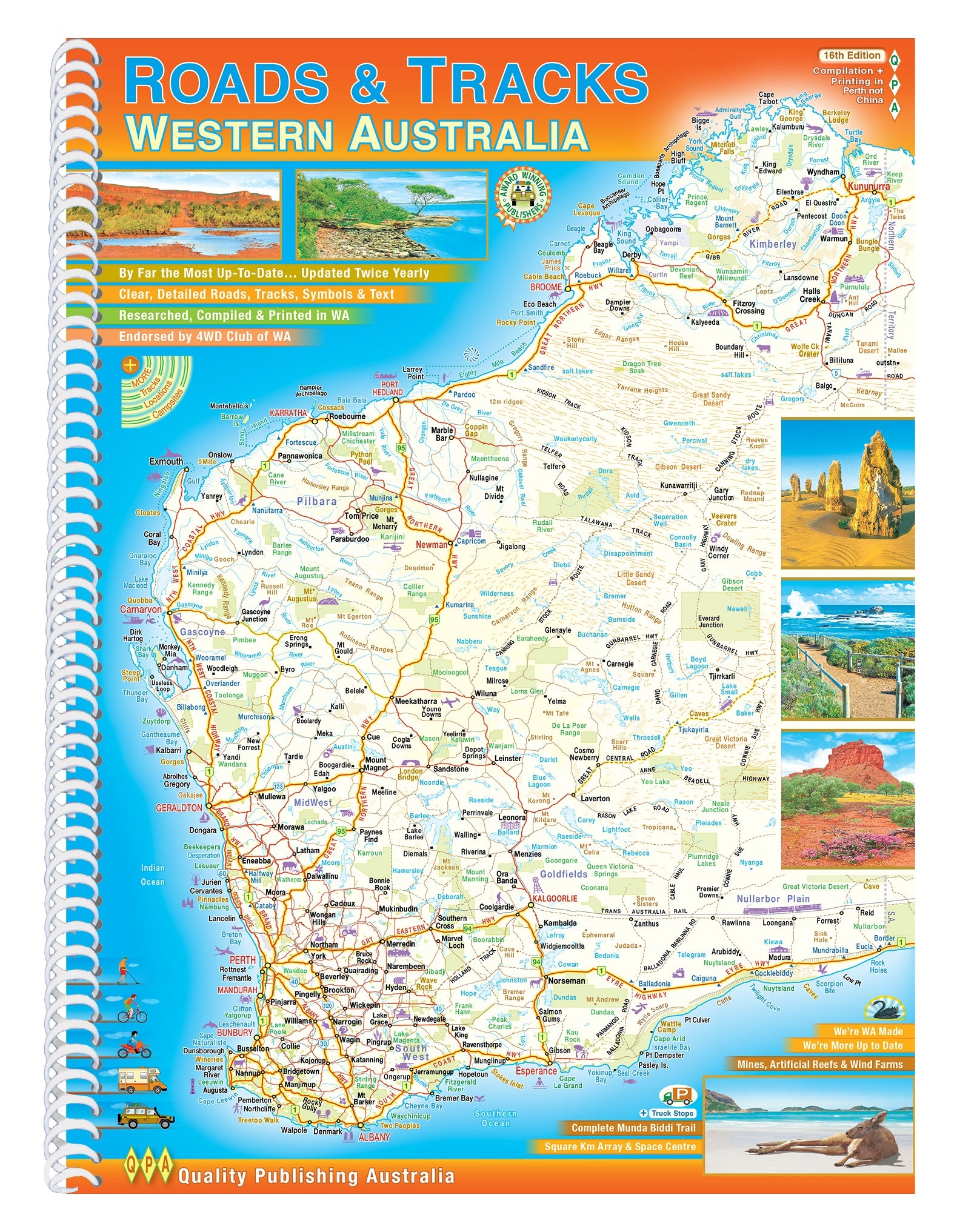
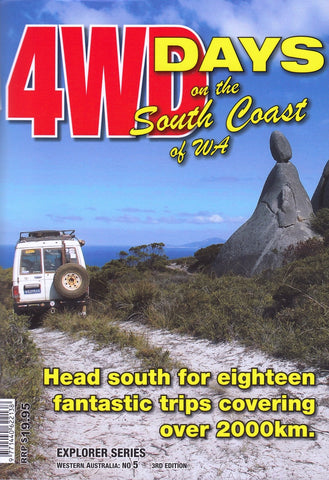
Roads & Tracks of Western Australia QPA 16th Edition
$44.95
Afterpay is only available for orders between $50.00 and $1000.00 More info
Same Day Shipping
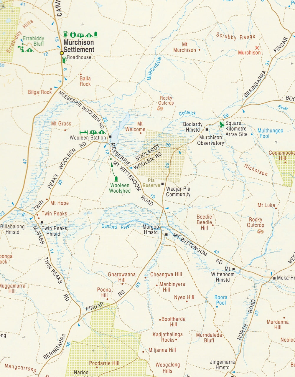
If you're planning to explore the diverse landscapes of Western Australia, the Roads & Tracks of Western Australia – 16th Edition by Quality Publishing Australia (QPA) is an indispensable resource. Published in September 2023, this spiral-bound A4 atlas offers detailed and up-to-date mapping, making it an essential companion for travellers, adventurers, and outdoor enthusiasts.
🗺️ Comprehensive Mapping Coverage
The atlas provides varying scales to suit different regions:
-
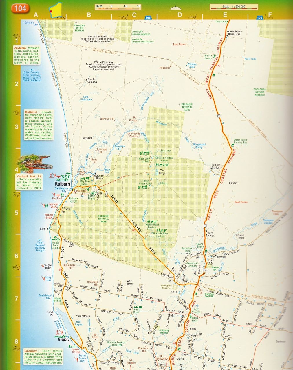
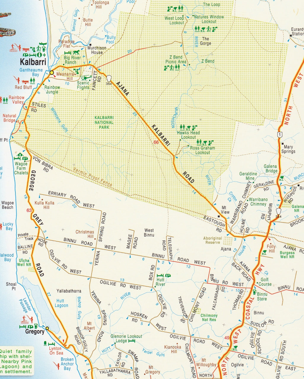
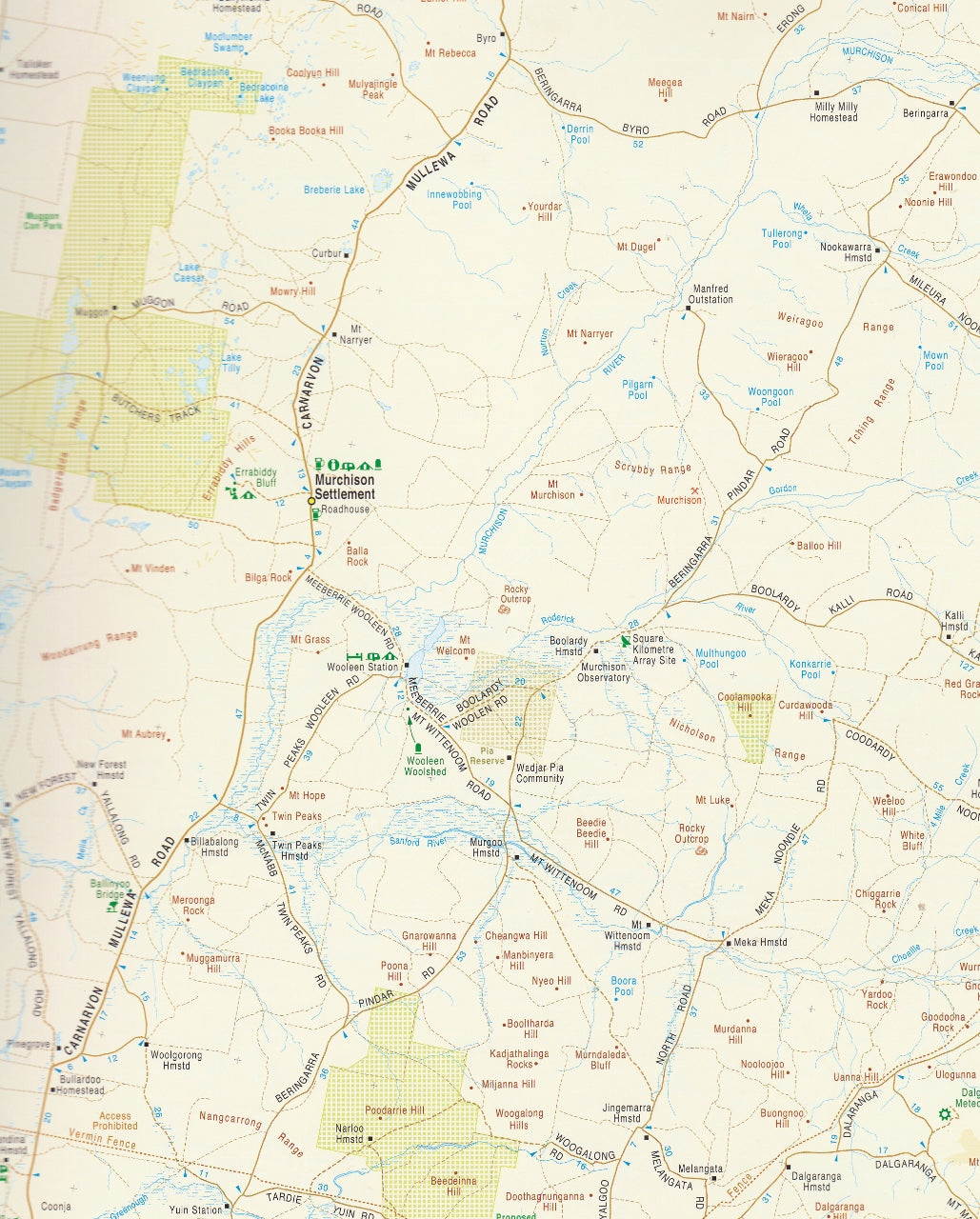
Southwest Region: Detailed at a 1:250,000 scale, covering areas such as Perth, Margaret River, and Albany.
-
Greater Southwest Area: Mapped at a 1:500,000 scale, extending beyond the immediate southwest.
-
Rest of the State: Presented at a 1:1,000,000 scale, encompassing the vast expanse of Western Australia.
This gradation ensures clarity and detail where needed, particularly in densely populated or frequently travelled areas.
🛣️ Detailed Road and Track Information
The atlas excels in its detailed representation of various routes:
-
Road Types: Includes major highways, minor roads, unsealed roads, old tracks, 4WD-only routes, and walking trails.
-
Intermediate Distances: Displays distances between key points on nearly every road, aiding in travel planning.
-
Topography: Utilises elevation tinting to depict the terrain, providing a visual understanding of the landscape.
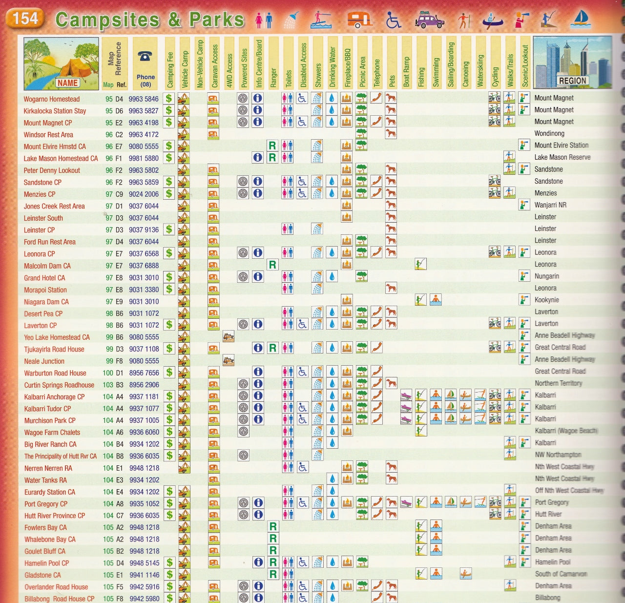
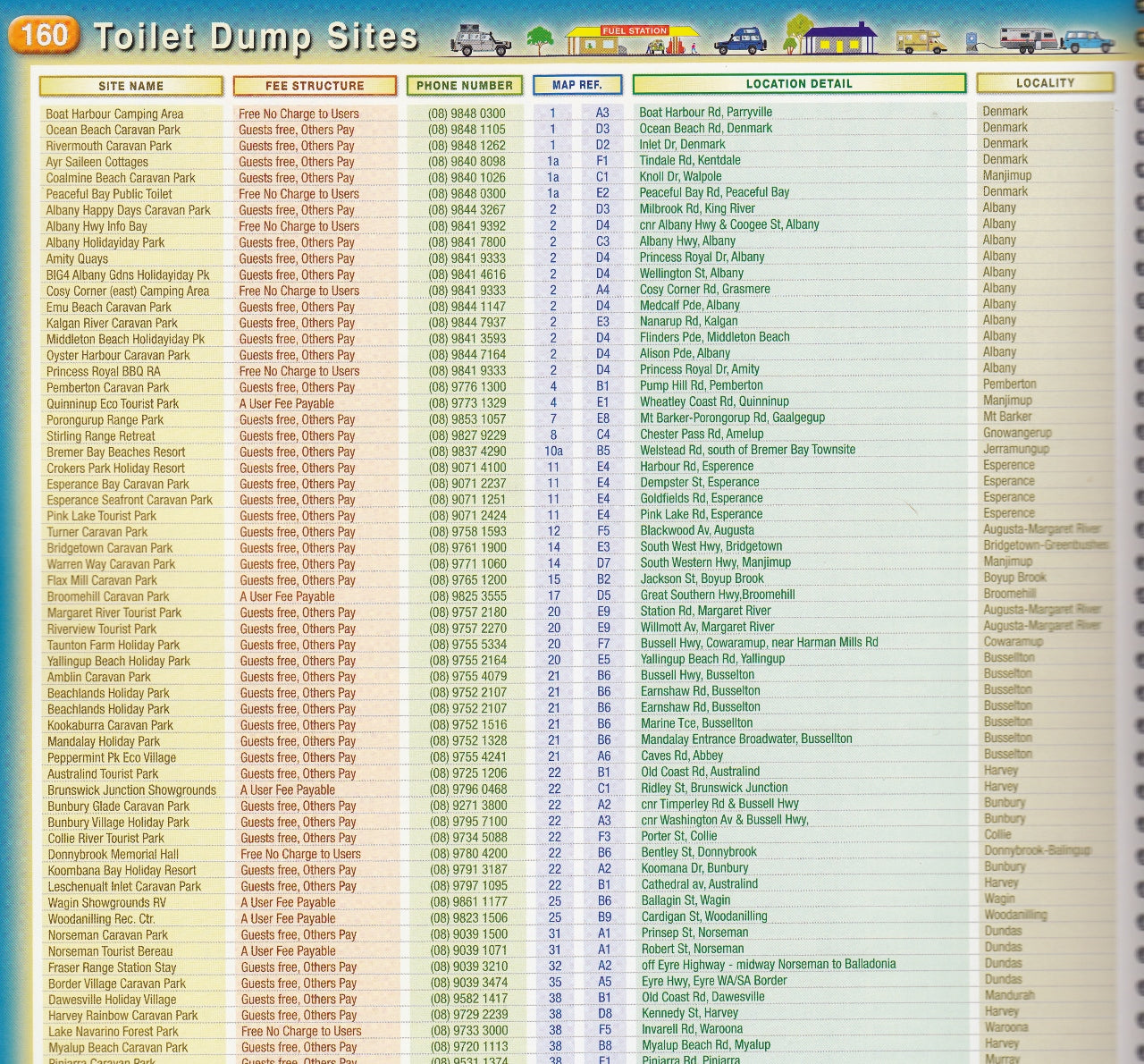
🏕️ Points of Interest and Amenities
Beyond roadways, the atlas highlights numerous features to enhance your journey:
-
Attractions: Identifies various tourist attractions and natural landmarks.
-
Facilities: Marks fuel stops, accommodation options, campsites, rest areas, and fishing spots.
-
Perth Coverage: Includes several pages dedicated to Perth at various scales for urban navigation.
-
Flora and Fauna: Features illustrations showcasing the state's diverse plant and animal life.
-
Climate Data: Provides average monthly temperature and rainfall charts for various regions.
📖 Atlas Specifications
-
Format: Spiral-bound for ease of use.
-
Dimensions: 230 x 303 x 20 mm.
-
Weight: Approximately 1.3 kg.
-
Pages: 254 pages of detailed content.
-
Publication Date: September 2023.
📚 Additional Features
-
Index: An extensive index covering roads, places, geographical features, and national parks.
-
Local Production: Researched, compiled, and printed in Western Australia, ensuring local relevance and accuracy.
-
Endorsement: Endorsed by the 4WD Club of WA, reflecting its utility for off-road enthusiasts.
The QPA 16th Edition atlas is a valuable resource for travellers seeking a reliable and detailed guide to Western Australia's roads and tracks.
If you need further assistance or information on related mapping products, feel free to ask!