- Australia ▾
- Topographic
▾
- Australia AUSTopo 250k (2024)
- Australia 50k Geoscience maps
- Australia 100k Geoscience maps
- Australia 250k Geoscience maps
- Australia 1.1m Geoscience maps
- New Zealand 50k maps
- New Zealand 250k maps
- New South Wales 25k maps
- New South Wales 50k maps
- New South Wales 100k maps
- Queensland 10k maps
- Queensland 25k maps
- Queensland 50k maps
- Queensland 100k maps
- Compasses
- Software
- GPS Systems
- Orienteering
- International ▾
- Wall Maps
▾
- World
- Australia & New Zealand
- Countries, Continents & Regions
- Historical
- Vintage National Geographic
- Australian Capital Territory
- New South Wales
- Northern Territory
- Queensland
- South Australia
- Tasmania
- Victoria
- Western Australia
- Celestial
- Children's
- Mining & Resources
- Wine Maps
- Healthcare
- Postcode Maps
- Electoral Maps
- Nautical ▾
- Flags
▾
- Australian Flag Sets & Banners
- Flag Bunting
- Handwavers
- Australian National Flags
- Aboriginal Flags
- Torres Strait Islander Flags
- International Flags
- Flagpoles & Accessories
- Australian Capital Territory Flags
- New South Wales Flags
- Northern Territory Flags
- Queensland Flags
- South Australia Flags
- Tasmania Flags
- Victoria Flags
- Western Australia Flags
- Gifts ▾
- Globes ▾
Dear valued customer. Please note that our checkout is not supported by old browsers. Please use a recent browser to access all checkout capabilities


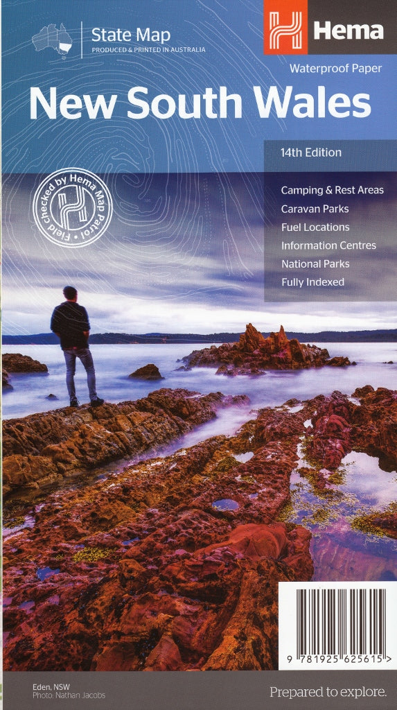

New South Wales Hema State Map
$14.95
Afterpay is only available for orders between $50.00 and $1000.00 More info
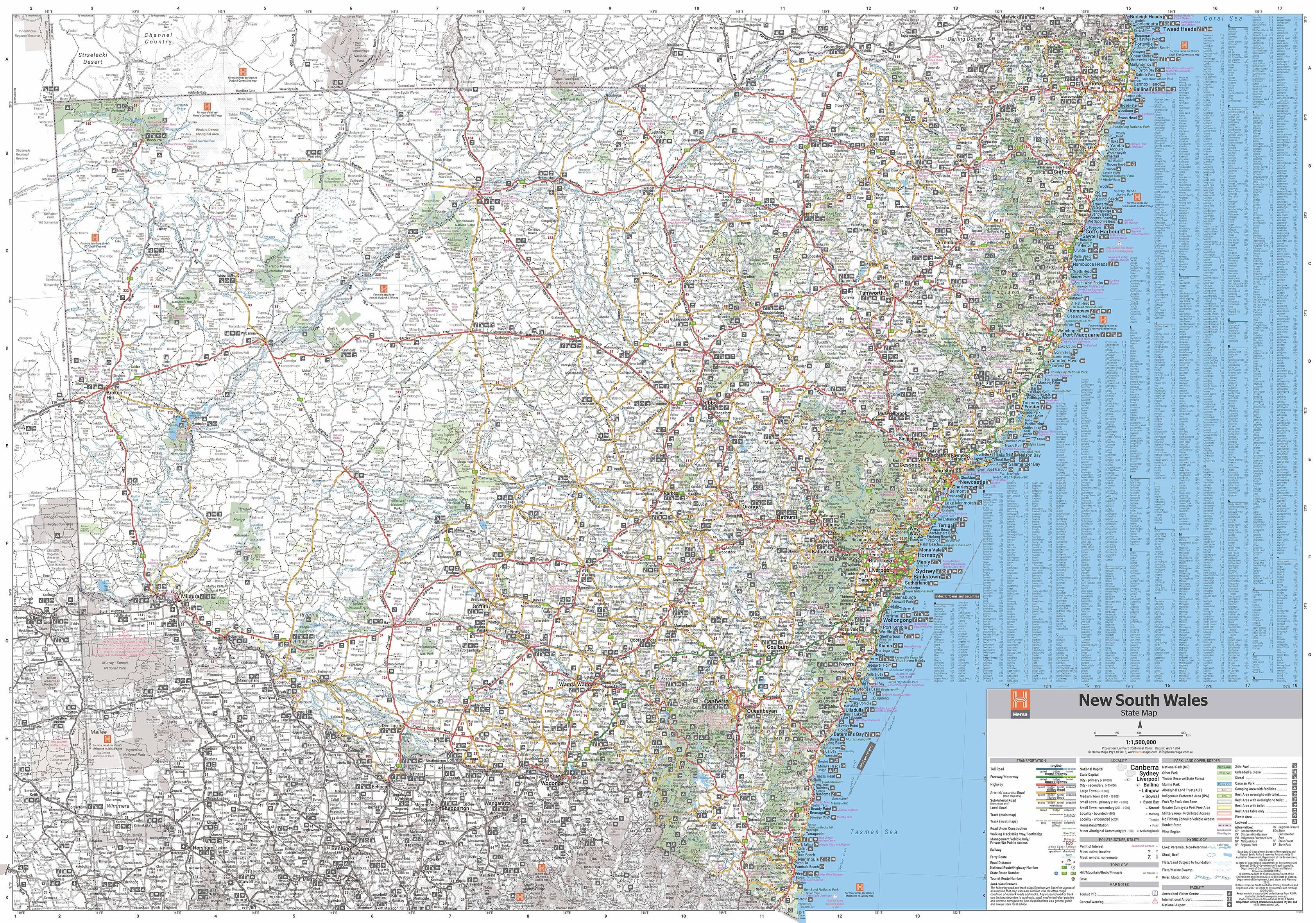
A detailed, double-sided touring map of NSW — designed for road trippers, campers, adventurers, and those looking to explore every corner of Australia's most populous state
Whether you're navigating the bustling streets of Sydney, exploring the rugged Blue Mountains, following the coastal Pacific Highway, or heading inland to the Outback edges of Broken Hill, the Hema New South Wales State Map (14th Edition) provides the clarity, coverage, and confidence you need to plan and complete your journey.
Carefully researched and produced by Hema Maps, Australia’s trusted name in navigation, this edition combines accuracy with practical travel insights, making it a must-have for locals, holidaymakers, and long-distance explorers alike.
🗺️ Map Specifications:
-
Scale: 1:1,500,000 — 1 cm = 15 km
A broad touring scale, ideal for mapping large distances while maintaining essential road and landmark detail -
Unfolded size: approx. 1000 mm x 700 mm
-
Folded size: approx. 250 mm x 140 mm x 3 mm
-
Weight: approx. 90 grams — lightweight and easy to carry
-
Edition: 14th
-
Published: December 2018
-
Printed on: High-quality, durable paper designed to withstand repeated use and travel conditions
-
Pre-Folded Laminated Map – $49.95
-
Laminated from a previously folded edition
-
Some minor crease lines may remain
-
Ideal for those seeking a durable and more affordable wall-ready map
-
🌄 Features at a Glance:
-
Double-sided layout for easy handling and maximum coverage
-
Detailed road network, including:
-
Major highways
-
Sealed and unsealed secondary roads
-
4WD tracks and outback routes
-
-
Touring information:
-
Locations of national and state parks, reserves, and forests
-
Camping areas, caravan parks, and rest stops
-
24-hour fuel stations marked for extended travel confidence
-
-
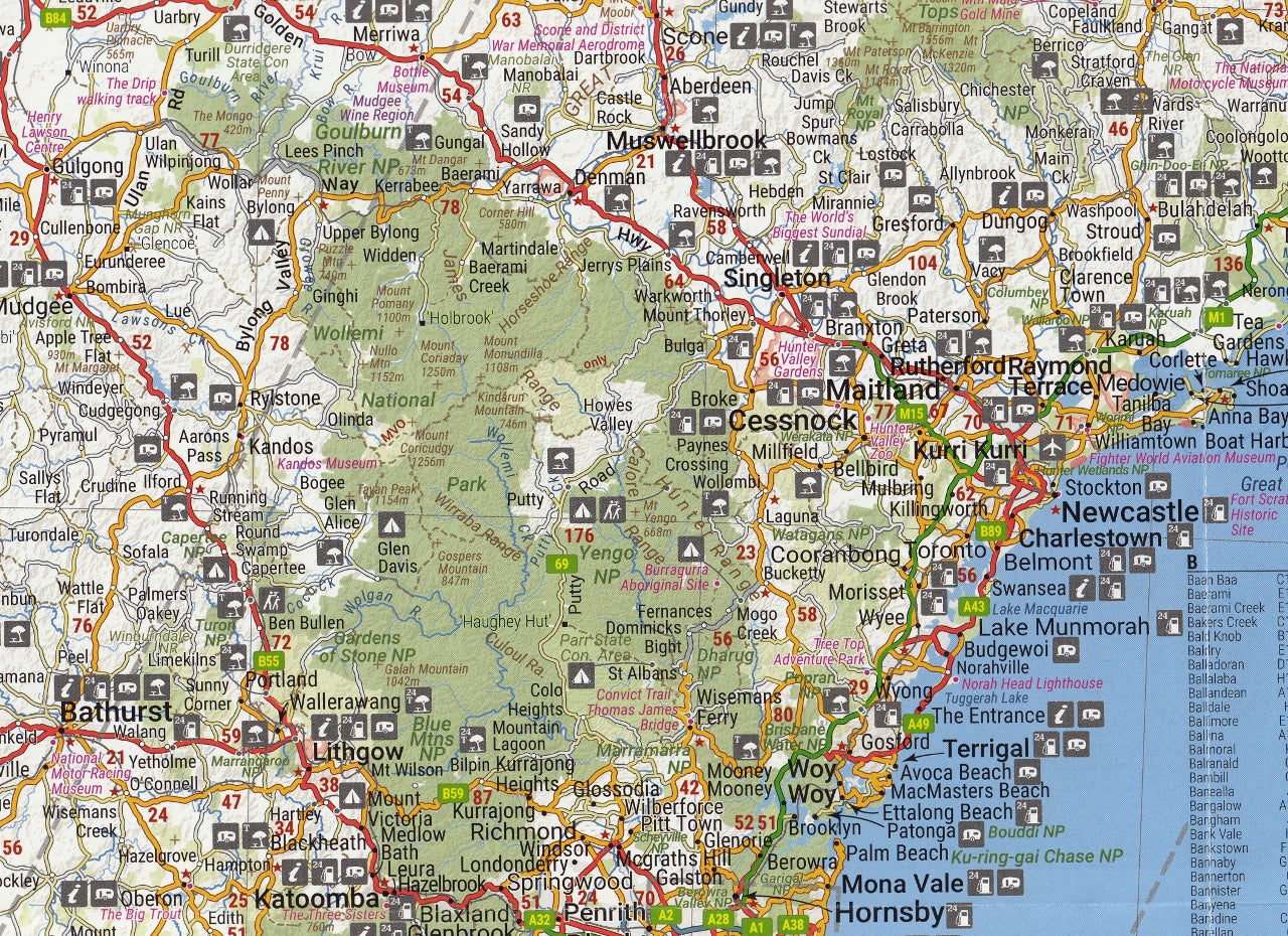
Relief shading to show topography — useful for visualising terrain and elevation changes
-
Symbols for tourist attractions, including:
-
Lookouts, heritage sites, walking tracks, caves, hot springs, lighthouses, and more
-
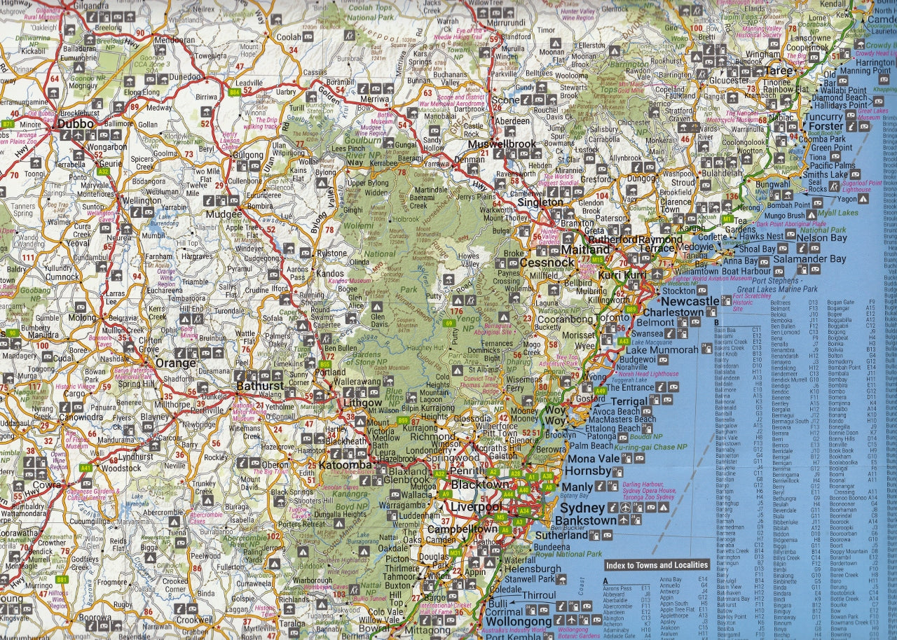
🗺️ Inset Maps Included:
-
Sydney CBD and Surrounds — helpful for navigating the city and major suburbs
-
Canberra CBD and ACT region — included due to ACT’s proximity and relevance to many NSW travellers
-
Greater Sydney Regional Map — useful for day trips, coastal routes, and Blue Mountains access
-
Blue Mountains National Park, including Katoomba and Wentworth Falls — with detailed tourist features and walking trails
🧭 Additional Information:
-
Tourist drive routes and scenic byways highlighted for memorable detours
-
Visitor Information Centres marked throughout the state
-
Index of towns and localities for quick reference
-
National park facilities table with icons indicating amenities such as toilets, picnic areas, walking tracks, and BBQs
-
Road distance matrix between major NSW destinations for trip planning
-
Clear legend and intuitive design typical of Hema’s cartographic style
🚗 Ideal For:
-
Long-distance road trippers exploring from coast to Outback
-
Families, grey nomads, and vanlife travellers looking for practical guidance and campsite suggestions
-
Bushwalkers and outdoor adventurers wanting reliable topographic cues
-
Professional drivers, logistics, and delivery operators
-
Educators, map collectors, and those seeking a detailed geographic resource
From the spectacular beaches of Byron Bay to the wide-open plains of Dubbo, the lush valleys of Hunter Wine Country to the rugged beauty of Kosciuszko National Park, this map is your gateway to experiencing New South Wales in all its diversity.
Explore further. Drive smarter. Discover more — with Hema's trusted guide to NSW.