- Australia ▾
- Topographic
▾
- Australia AUSTopo 250k (2025)
- Australia 50k Geoscience maps
- Australia 100k Geoscience maps
- Australia 250k Geoscience maps
- Australia 1:1m Geoscience maps
- New Zealand 50k maps
- New Zealand 250k maps
- New South Wales 25k maps
- New South Wales 50k maps
- New South Wales 100k maps
- Queensland 10k maps
- Queensland 25k maps
- Queensland 50k maps
- Queensland 100k maps
- Compasses
- Software
- GPS Systems
- Orienteering
- International ▾
- Wall Maps
▾
- World
- Australia & New Zealand
- Countries, Continents & Regions
- Historical
- Vintage National Geographic
- Australian Capital Territory
- New South Wales
- Northern Territory
- Queensland
- South Australia
- Tasmania
- Victoria
- Western Australia
- Celestial
- Children's
- Mining & Resources
- Wine Maps
- Healthcare
- Postcode Maps
- Electoral Maps
- Nautical ▾
- Flags
▾
- Australian Flag Sets & Banners
- Flag Bunting
- Handwavers
- Australian National Flags
- Aboriginal Flags
- Torres Strait Islander Flags
- International Flags
- Flagpoles & Accessories
- Australian Capital Territory Flags
- New South Wales Flags
- Northern Territory Flags
- Queensland Flags
- South Australia Flags
- Tasmania Flags
- Victoria Flags
- Western Australia Flags
- Gifts ▾
- Globes ▾
Dear valued customer. Please note that our checkout is not supported by old browsers. Please use a recent browser to access all checkout capabilities


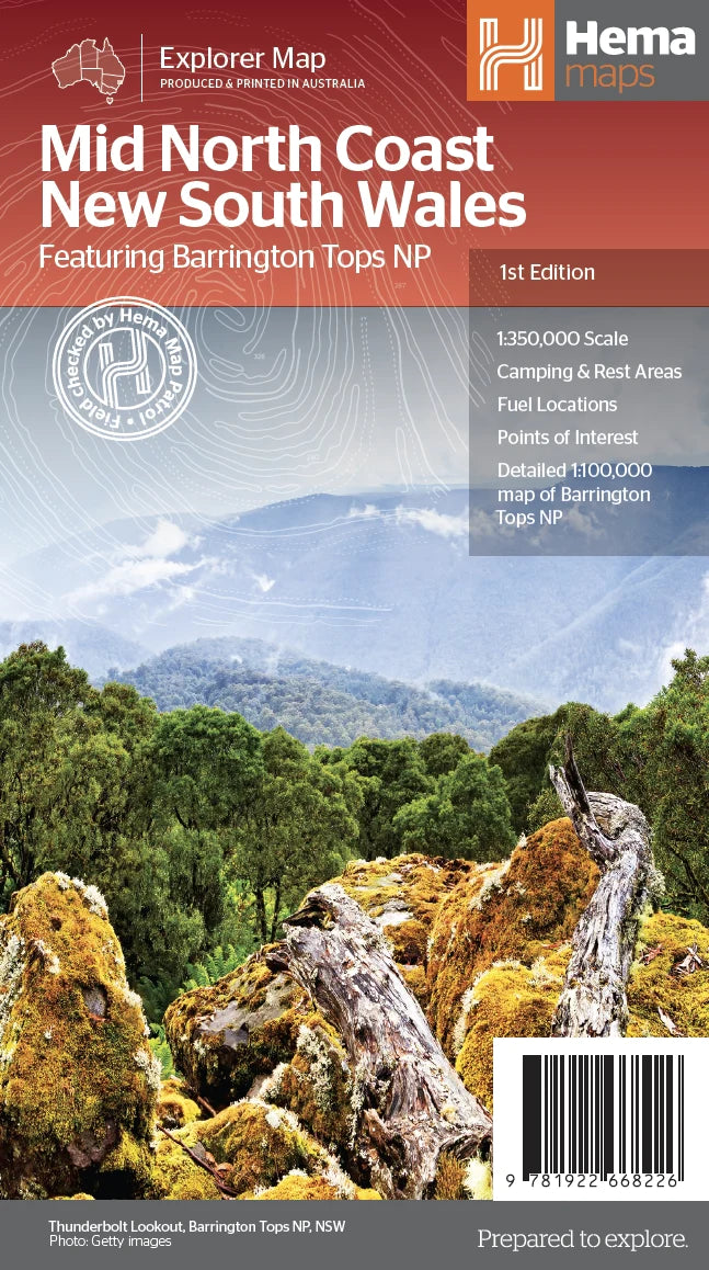
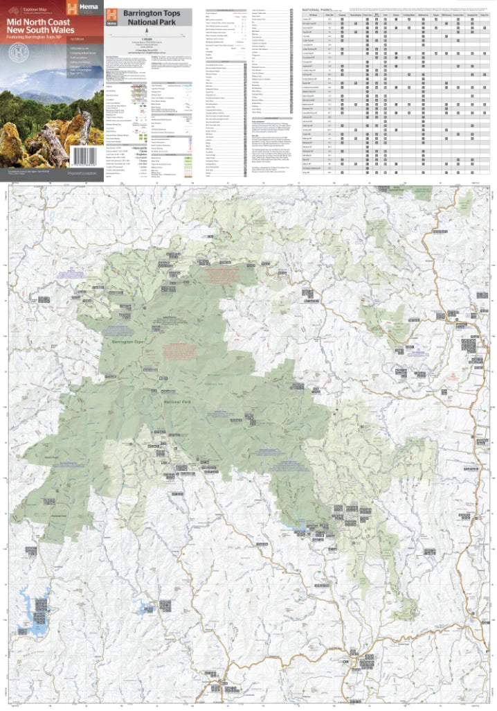
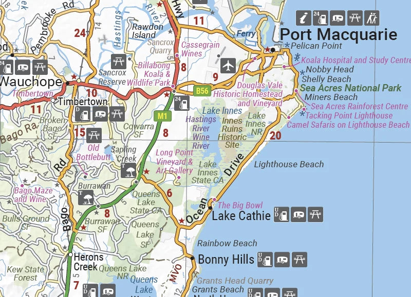
Mid North Coast New South Wales Hema Map including Barrington Tops NP
$14.95
Afterpay is only available for orders between $50.00 and $1000.00 More info
Includes Detailed Barrington Tops NP Inset
Scale: 1:350,000 (Main) & 1:100,000 (Barrington Tops NP)
Size: 700mm (W) x 1000mm (H) | Publication Date: 1 September 2022
📍 Now available laminated for durability in the field
🌿 Discover the Heart of Coastal & Inland Adventure in NSW
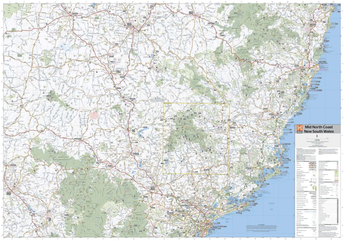
From the sparkling beaches of Port Macquarie to the elevated plateaus of Barrington Tops, the Mid North Coast of New South Wales offers a rich blend of rainforest, rivers, mountain country and charming regional towns. This comprehensive regional touring map by Hema is your key to unlocking the secrets of this spectacular corner of Australia.
Covering a broad area from northern Newcastle to Gunnedah, and east to the Pacific Ocean, this map is tailor-made for campers, 4WD explorers, caravanners, and hikers. Whether you're winding your way through the World Heritage-listed Barrington Tops, or tracing a loop through Mudgee wine country, you’ll find this map both beautifully detailed and practically essential.
🌏 Key Features
🗺️ Extensive Regional Coverage
Covers a broad swathe of the Mid North Coast including:
-
Gunnedah, Tamworth, Mudgee, Port Macquarie
-
Kempsey, Taree, Forster, Maitland, and beyond
-
Perfect for road trips that mix coastal drives with inland discovery
🌳 National Parks & Natural Wonders
-
Includes 15+ National Parks with key visitor info:
-
🏞️ Barrington Tops NP
-
🌲 Oxley Wild Rivers NP
-
🌿 Werrikimbe, Hat Head, Carrai, Cottan-Bimbang, Towarri, Nowendoc, Curracabundi, Yengo, Goulburn River, Wollemi, Mummel Gulf & more
-
-
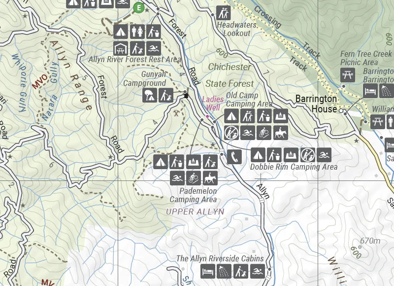
Inset map of Barrington Tops NP at 1:100,000 scale, ideal for bushwalking and remote touring
⛺ Touring & Travel Essentials
-
🏕️ Camping & Rest Areas clearly marked
-
⛽ Fuel Locations to help plan long drives through remote areas
-
📍 Points of Interest including scenic lookouts, waterfalls, historical towns, and walking tracks
-
🏡 Visitor Information Centres across the region for up-to-date local advice
📚 Bonus Content on Reverse Side
-
Detailed background on each featured region
-
Historical notes, Indigenous heritage, park profiles, and practical visitor tips
-
Local insights that turn a simple road trip into a meaningful journey
📏 Product Specifications
| Feature | Description |
|---|---|
| Publisher | Hema Maps Australia |
| Map Title | Mid North Coast NSW with Barrington Tops NP |
| Main Map Scale | 1:350,000 |
| Barrington Tops Inset | 1:100,000 |
| Size (Unfolded) | 700mm x 1000mm |
| Format | Folded or Laminated (optional) |
| Publication Date | September 2022 |
| Printed In | Australia 🇦🇺 |
👥 Who This Map Is Perfect For
-
🚐 Caravanners & Road-Trippers – Plan fuel stops and rest areas with ease
-
🏞️ Bushwalkers & Nature Lovers – Explore Barrington Tops NP in depth
-
📍 Regional Tourists – Discover hidden towns and scenic drives off the main highways
-
🧭 4WD & Touring Enthusiasts – Navigate the inland hills and river trails with accuracy
-
🗺️ Map Collectors & Local Historians – A beautiful, functional map with heritage context
🛒 Add to Cart – Navigate Your Next Coastal Adventure
Whether you're meandering through the forests of the Great Dividing Range or soaking up salt air by the Pacific coast, this Hema map gives you everything you need to plan, explore, and enjoy the Mid North Coast of NSW.
Add this map to your cart now, and don’t forget to choose the laminated option for a field-ready finish that withstands the elements.