- Australia ▾
- Topographic
▾
- Australia AUSTopo 250k (2025)
- Australia 50k Geoscience maps
- Australia 100k Geoscience maps
- Australia 250k Geoscience maps
- Australia 1:1m Geoscience maps
- New Zealand 50k maps
- New Zealand 250k maps
- New South Wales 25k maps
- New South Wales 50k maps
- New South Wales 100k maps
- Queensland 10k maps
- Queensland 25k maps
- Queensland 50k maps
- Queensland 100k maps
- Compasses
- Software
- GPS Systems
- Orienteering
- International ▾
- Wall Maps
▾
- World
- Australia & New Zealand
- Countries, Continents & Regions
- Historical
- Vintage National Geographic
- Australian Capital Territory
- New South Wales
- Northern Territory
- Queensland
- South Australia
- Tasmania
- Victoria
- Western Australia
- Celestial
- Children's
- Mining & Resources
- Wine Maps
- Healthcare
- Postcode Maps
- Electoral Maps
- Nautical ▾
- Flags
▾
- Australian Flag Sets & Banners
- Flag Bunting
- Handwavers
- Australian National Flags
- Aboriginal Flags
- Torres Strait Islander Flags
- International Flags
- Flagpoles & Accessories
- Australian Capital Territory Flags
- New South Wales Flags
- Northern Territory Flags
- Queensland Flags
- South Australia Flags
- Tasmania Flags
- Victoria Flags
- Western Australia Flags
- Gifts ▾
- Globes ▾
Dear valued customer. Please note that our checkout is not supported by old browsers. Please use a recent browser to access all checkout capabilities


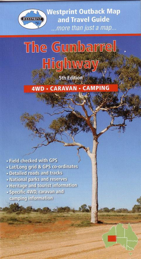
Gunbarrel Highway Map Westprint
$14.95 $15.95
Afterpay is only available for orders between $50.00 and $1000.00 More info
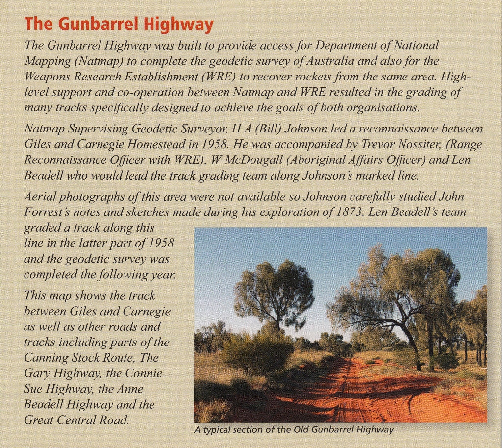
Explore Australia’s Legendary Outback Route – The Legacy of Len Beadell
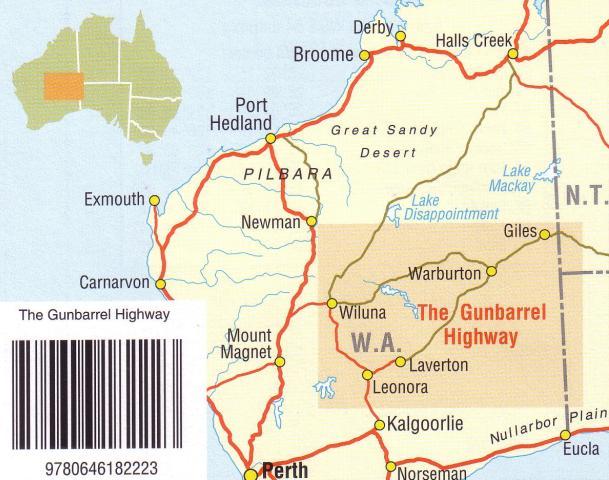
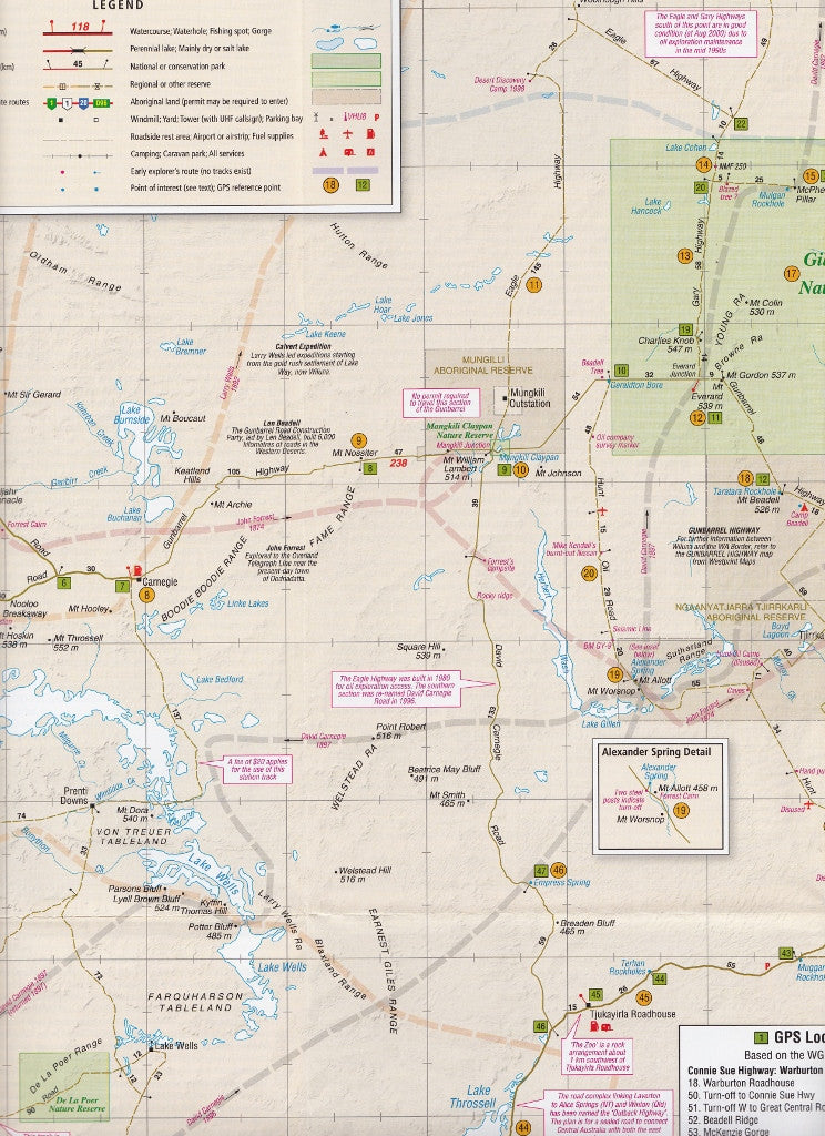
The Gunbarrel Highway Map by Westprint is your ultimate navigation and storytelling companion for traversing one of Australia's most iconic and remote four-wheel-drive routes. This highly detailed map not only showcases the full stretch of the Gunbarrel Highway but also brings to life the remarkable expeditions of Len Beadell, whose 1958 surveying efforts carved a new chapter into Australia’s exploration history.
Designed specifically for outback travellers, overlanders, and 4WD adventurers, this map goes beyond simple navigation—offering rich historical context, critical travel information, and connections to other renowned outback tracks.
🗺️ Map Coverage & Historical Context
This map details the central portion of the Gunbarrel Highway, linking with:
-
Canning Stock Route
-
Tanami Track
-
Great Central Road
-
Connecting tracks through the Gibson Desert
🔍 Historical Explorations Highlighted:
Includes routes and brief notes from 19th-century expeditions, including the tragic journey of Alfred Gibson, whose name lives on in the Gibson Desert. These layered historical insights add depth and context to your journey, connecting modern exploration with its often perilous past.
🧭 Key Features
✔️ Detailed Roads & 4WD Tracks
Clearly marked and differentiated routes, including sealed, unsealed, and remote tracks suitable for experienced off-road travellers.
✔️ Topographic Information
Accurate elevation and terrain representation across arid landscapes and desert plains.
✔️ Exploration Routes
Overlay of 19th-century exploration trails, including notes on key expeditions and survival stories.
✔️ Connection to Iconic Routes
Maps not only the Gunbarrel but also includes vital connectors like the Great Central Road, Gibson Desert routes, and entry/exit points to other major tracks.
✔️ Heritage & Points of Interest
Noteworthy landmarks, roadhouses, water points, and historical sites are indicated for both navigation and enrichment.
✔️ GPS Ready
Latitude/Longitude grid with GPS coordinates provided for syncing with your navigation devices or Hema GPS units.
✔️ Essential Outback Travel Info
Includes permit information, 4WD advice, bush camping guidance, and contact details for traveller safety and planning.
📏 Map Specifications
| Specification | Details |
|---|---|
| Scale | 1:1,750,000 |
| Dimensions | 1000 mm (W) × 700 mm (H) approx |
| Publisher | Westprint Heritage Maps |
| Format | Folded paper (laminated version optional) |
| ISBN | [Available on request] |
🛠️ Optional Lamination Available
Upgrade to a laminated version for extra durability and usability on the road:
-
🧼 Writeable with whiteboard markers
-
💧 Waterproof and tear-resistant
-
🛻 Ideal for 4WD dashboards, caravan tables, or planning spaces
-
🔄 Easily rolled and stored for long-haul trips
Laminated maps are professionally encapsulated with 80-micron gloss laminate. Fold lines may still be slightly visible underneath the lamination.
🏕️ Perfect For:
-
Adventurers tackling the Gunbarrel Highway or Great Central Road
-
4WD explorers seeking a remote desert challenge
-
Overlanders connecting between WA and the NT
-
History lovers following the footsteps of Australia’s modern and colonial explorers
-
Grey nomads and wild campers mapping out extended off-grid trips
🏞️ Summary
The Gunbarrel Highway Map by Westprint is far more than a navigational tool—it's a journey into the past and a passport to one of Australia’s great remote travel experiences. Let Len Beadell’s bold trailblazing inspire your next adventure as you trace his route through the heart of the desert.
📦 Order your copy today—available in folded paper or laminated format—and begin planning your unforgettable journey across Australia’s red heart.