- Australia ▾
- Topographic
▾
- Australia AUSTopo 250k (2025)
- Australia 50k Geoscience maps
- Australia 100k Geoscience maps
- Australia 250k Geoscience maps
- Australia 1:1m Geoscience maps
- New Zealand 50k maps
- New Zealand 250k maps
- New South Wales 25k maps
- New South Wales 50k maps
- New South Wales 100k maps
- Queensland 10k maps
- Queensland 25k maps
- Queensland 50k maps
- Queensland 100k maps
- Western Australia 25k maps
- Western Australia 50k maps
- Western Australia 100k maps
- Compasses
- Software
- GPS Systems
- International ▾
- Wall Maps
▾
- World
- Australia & New Zealand
- Countries, Continents & Regions
- Historical
- Vintage National Geographic
- Australian Capital Territory
- New South Wales
- Northern Territory
- Queensland
- South Australia
- Tasmania
- Victoria
- Western Australia
- Celestial
- Children's
- Mining & Resources
- Wine Maps
- Healthcare
- Postcode Maps
- Electoral Maps
- Nautical ▾
- Flags
▾
- Australian Flag Sets & Banners
- Flag Bunting
- Handwavers
- Australian National Flags
- Aboriginal Flags
- Torres Strait Islander Flags
- International Flags
- Flagpoles & Accessories
- Australian Capital Territory Flags
- New South Wales Flags
- Northern Territory Flags
- Queensland Flags
- South Australia Flags
- Tasmania Flags
- Victoria Flags
- Western Australia Flags
- Gifts ▾
- Globes ▾
Dear valued customer. Please note that our checkout is not supported by old browsers. Please use a recent browser to access all checkout capabilities


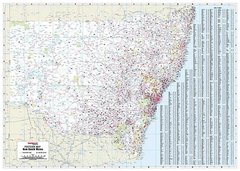
Tasmania Postcode Laminated Wall Map 788 x 935mm
$109.95
or make 4 interest-free payments of
$27.49 AUD
fortnightly with
![]() More info
More info
Tasmania Postcode Laminated Wall Map · 788 × 935 mm
Bring Tasmania’s postcode network into sharp focus with this durable, professional wall map. Designed and published by Cartodraft, the Tasmania Postcode Map shows every postcode boundary and number across the entire state, supported by a comprehensive suburb and town index. Finished in a tough write-on/wipe-off laminate, it’s the ultimate planning tool for businesses, government offices, logistics operators, and education providers working across Tasmania.
✅ Why this map is essential
-
Complete statewide coverage — the only single-sheet view showing all Tasmanian postcodes with their boundaries
-
Easy postcode referencing — includes a full suburb and town index for quick lookups and cross-checks
-
True write & wipe finish — annotate directly with whiteboard markers; erase cleanly without ghosting
-
Mark-It-Dots compatible — add, remove, or colour-code hotspots, depots, or service areas without harming the surface
-
Professional utility — ideal for sales planning, franchise management, logistics coordination, and regional service delivery
-
Wall-readable clarity — crisp cartography and high-contrast printing ensure visibility across meeting rooms and operations hubs
🪵 Premium materials & finish (built for daily use)
-
Heavy base stock — stable, smooth paper foundation ensures sharp detail and colour fidelity
-
True encapsulation lamination — sealed in 2 × 80-micron gloss film, edge-to-edge, for a waterproof, tear-resistant finish
-
Reusable write-on/wipe-off surface — designed for standard whiteboard markers; erase without residue
-
Edge-sealed protection — prevents fraying and defends against moisture in high-use spaces
-
Colour-managed workflow — every map printed with balanced tones and contrast for wall-distance readability
✨ Optional upgrade: Laminated + Timber Hang Rails — lacquered natural timber rails fitted top & bottom with a hanging cord for a smart, ready-to-hang finish.
⏱️ Please allow up to 10 working days for hang-railed maps.
🧾 What’s on the map
-
Tasmania postcode boundaries & numbers — complete statewide coverage
-
Comprehensive town & suburb index for quick postcode reference
-
Major highways, towns, and regional features (as supplied by Cartodraft) for orientation
📐 Size & display
-
788 × 935 mm (portrait) — compact enough to fit most office walls, yet large enough to display detail clearly
-
Mount with 3M picture strips or screws, or upgrade to timber hang rails for a professional wall display
📦 Practical uses
-
Sales & franchise planning — divide territories and allocate reps or dealers
-
Logistics & courier operations — plan coverage areas, delivery runs, and dispatch routes
-
Government & community services — reference tool for outreach, compliance, and regional planning
-
Education & training — valuable in schools and TAFE programs for teaching geography and administration
-
Professional wall display — functional and visually clear in reception areas, offices, and boardrooms
🧽 Care & maintenance
-
Clean gently with a soft dry or slightly damp cloth
-
Use only whiteboard markers (avoid permanent or ethanol-based pens)
-
Remove adhesive dots carefully to maintain the laminate edge seal
📊 Specifications
| Field | Detail |
|---|---|
| Title | Tasmania Postcode Laminated Wall Map |
| Publisher | Cartodraft |
| Coverage | Statewide Tasmania — postcode boundaries & numbers |
| Index | Comprehensive suburb & town index with postcodes |
| Colour-managed, high-contrast cartography | |
| Lamination | 2 × 80-micron gloss film, fully encapsulated, edge-sealed |
| Surface | Write-on/wipe-off (whiteboard-marker compatible) |
| Size & Orientation | Portrait — 788 × 935 mm |
| Optional Display | Laminated + Timber Hang Rails (natural lacquered; allow up to 10 working days) |
| Best for | Sales, logistics, franchise planning, service coverage, government & education |
🇦🇺 Our commitment
-
Made & printed in Australia — proudly supporting local production and expertise
-
Hand-finished lamination — sealed edges and smooth surfaces for years of daily use
-
Colour-managed printing — consistent quality with sharp, legible cartography
-
Carefully packed — shipped in heavy-duty tubes or flat-packed for safe arrival
-
Family-run expertise — decades of mapmaking knowledge, dedicated to delivering the best product
Plan Tasmania with confidence. Select your finish, add accessories, and bring reliable postcode clarity to your wall today.
Frequently Asked Questions
What are the dimensions of the Tasmania Postcode Laminated Wall Map 788 x 935mm?
Mapworld wall maps range from standard 700×1000mm to large-format 1000×1430mm Supermaps. The exact dimensions for this map are shown in the product title. Where multiple sizes are available, select your preferred size when adding to cart.
Is this wall map available laminated?
Many Mapworld wall maps are available in paper, laminated, or framed finishes. Check the product options when adding to cart. Laminated maps are wipe-clean and more durable.
Is this the latest edition?
Mapworld stocks the most current editions available from all publishers. Edition year is shown in the product title where applicable. Mapworld updates its catalogue as new editions are released.
Can I write on or pin this wall map?
Laminated wall maps can be written on with whiteboard markers and wiped clean. Paper maps can be pinned on a corkboard. Choose a laminated option for a writeable surface.
Does Mapworld ship the Tasmania Postcode Laminated Wall Map 788 x 935mm across Australia?
Yes, Mapworld ships Australia-wide. Standard shipping is a flat $7 rate, with free standard shipping on orders over $75. Express options are available at checkout. Most orders placed before 2pm AEST on weekdays are dispatched same day.
Related Items


© 2026 Mapworld. Website designed by Genie Media
X