- Australia ▾
- Topographic
▾
- Australia AUSTopo 250k (2025)
- Australia 50k Geoscience maps
- Australia 100k Geoscience maps
- Australia 250k Geoscience maps
- Australia 1:1m Geoscience maps
- New Zealand 50k maps
- New Zealand 250k maps
- New South Wales 25k maps
- New South Wales 50k maps
- New South Wales 100k maps
- Queensland 10k maps
- Queensland 25k maps
- Queensland 50k maps
- Queensland 100k maps
- Western Australia 25k maps
- Western Australia 50k maps
- Western Australia 100k maps
- Compasses
- Software
- GPS Systems
- International ▾
- Wall Maps
▾
- World
- Australian Wall Maps
- Countries, Continents & Regions
- Historical
- Vintage National Geographic
- Australian Capital Territory
- New South Wales
- Northern Territory
- Queensland
- South Australia
- Tasmania
- Victoria
- Western Australia
- Celestial
- Children's
- Mining & Resources
- Wine Maps
- Healthcare
- Postcode Maps
- Electoral Maps
- Nautical ▾
- Flags
▾
- Australian Flag Sets & Banners
- Flag Bunting
- Handwavers
- Australian National Flags
- Aboriginal Flags
- Torres Strait Islander Flags
- International Flags
- Flagpoles & Accessories
- Australian Capital Territory Flags
- New South Wales Flags
- Northern Territory Flags
- Queensland Flags
- South Australia Flags
- Tasmania Flags
- Victoria Flags
- Western Australia Flags
- Gifts ▾
- Globes ▾
Dear valued customer. Please note that our checkout is not supported by old browsers. Please use a recent browser to access all checkout capabilities




Seemore SH51-12 AUSTopo 1:250,000 Map
$19.95
Afterpay is only available for orders between $50.00 and $1000.00 More info
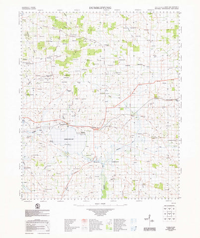
Seemore SH51-12 — AUSTopo 1:250,000 Topographic Map (2025)
Seemore Downs, ancient limestone plains and remote pastoral country—mapped with authority across Western Australia’s western Nullarbor
Covering Seemore Downs and the surrounding rangelands north of Rawlinna, this AUSTopo 1:250,000 Topographic Map provides an authoritative regional view of remote pastoral country on the western edge of the Nullarbor Plain.
The sheet brings together broad limestone plains, subtle karst depressions, station tracks, water points and extensive areas of herbland and myall woodland. It is an essential reference for pastoral operations, environmental management, geological fieldwork, emergency planning and experienced travellers working across an exceptionally isolated landscape.
At 1:250,000 scale—where 1 cm represents 2.5 km—this series offers the largest published topographic scale covering the entire Australian continent. It is particularly valuable for regional planning, rangeland management, field logistics and understanding the subtle terrain of the western Nullarbor.
Not sure which sheet you need? Use the official AUSTopo 1:250,000 Map Index to locate the correct map for your area.
🧭 Why this map stands out
-
Current 2025 mapping — prepared using modern Australian mapping standards and datums
-
Valuable pastoral coverage — Seemore Downs and the surrounding western Nullarbor rangelands shown in one coherent regional view
-
Clear remote-area context — useful for interpreting station tracks, water points, natural depressions and immense inland distances
-
Professional-quality cartography — suitable for operational planning, research, fieldwork and geographic reference
-
Dual coordinate information — supports both office-based planning and practical field navigation
-
Printed in Australia — produced at high resolution, carefully finished and individually quality-checked
🗺️ What you’ll see
-
Seemore Downs and surrounding pastoral country
-
Remote station tracks and access routes
-
Bores, wells, tanks, windmills and isolated pastoral infrastructure
-
Contours and spot elevations across weathered limestone and calcrete plains
-
Karst depressions, drainage features, herblands and myall woodland
-
Vegetation patterns, place names and administrative boundaries
-
Clearly defined grid information for positioning and large-area planning
📐 Map details at a glance
-
Scale: 1:250,000
-
Series: AUSTopo — Australian Digital Topographic Map Series
-
Coverage: Seemore
-
Sheet reference: SH51-12
-
Map currency: 2025
-
Coordinates: Geographical and MGA
-
Datum: GDA2020 and AHD
-
Projection: Universal Transverse Mercator (UTM)
-
Sheet size: 800 mm wide × 500 mm high
-
Sheet finder: View the AUSTopo 1:250,000 Map Index
💧 Field-Ready Options for Rugged Use
Choose the format that best suits your intended use—from lightweight trip planning to demanding all-weather fieldwork.
✅ Standard Paper
-
Printed on 100 gsm FSC® coated paper
-
Produces crisp, clear text and finely defined map symbols
-
Lightweight and convenient for general reference or protected field use
-
An economical choice for trip planning, research and office applications
✅ Waterproof and Tearproof Tyvek®
-
Made from genuine DuPont™ Tyvek®, an advanced synthetic material composed of pure polyethylene fibres
-
Waterproof, tear-resistant, foldable and extremely lightweight
-
Printed using HP pigment-based inks for a permanent waterproof finish
-
Suitable for backpacks, vehicles and exposed field conditions
-
Ideal for bushwalkers, emergency personnel and outdoor professionals
-
Provides exceptional durability without the weight and bulk of lamination
✅ Laminated
-
Fully encapsulated between two 80-micron gloss laminate sheets
-
Highly resistant to water, stains, smudges and tearing
-
Draw on the surface with whiteboard markers for route planning or instruction
-
Use Mark-It-Dots to identify campsites, hazards, access points or other locations without marking the map permanently
-
Wipeable and reusable
-
Ideal for offices, classrooms, operations centres and repeated field reference
🎯 Who this map is for
-
Pastoralists and station managers
-
Rangeland, environmental and land-management professionals
-
Emergency services and remote-area coordinators
-
Geologists, researchers and field survey teams
-
Infrastructure and communications planners
-
Experienced outback travellers and expedition planners
-
Historians studying pastoral development on the Nullarbor
🇦🇺 Our commitment
Every AUSTopo map supplied by Mapworld is printed and finished in Australia. Each map is colour-managed for accuracy, individually checked and carefully packed so it arrives ready for professional, educational or field use.
Plan, research and explore the Seemore region with confidence. Select your preferred finish and add this essential 2025 AUSTopo map to your field kit or reference collection today.
Related Items



© 2026 Mapworld. Website designed by Genie Media


X