- Australia ▾
- Topographic
▾
- Australia AUSTopo 250k (2025)
- Australia 50k Geoscience maps
- Australia 100k Geoscience maps
- Australia 250k Geoscience maps
- Australia 1:1m Geoscience maps
- New Zealand 50k maps
- New Zealand 250k maps
- New South Wales 25k maps
- New South Wales 50k maps
- New South Wales 100k maps
- Queensland 10k maps
- Queensland 25k maps
- Queensland 50k maps
- Queensland 100k maps
- Western Australia 25k maps
- Western Australia 50k maps
- Western Australia 100k maps
- Compasses
- Software
- GPS Systems
- International ▾
- Wall Maps
▾
- World
- Australia & New Zealand
- Countries, Continents & Regions
- Historical
- Vintage National Geographic
- Australian Capital Territory
- New South Wales
- Northern Territory
- Queensland
- South Australia
- Tasmania
- Victoria
- Western Australia
- Celestial
- Children's
- Mining & Resources
- Wine Maps
- Healthcare
- Postcode Maps
- Electoral Maps
- Nautical ▾
- Flags
▾
- Australian Flag Sets & Banners
- Flag Bunting
- Handwavers
- Australian National Flags
- Aboriginal Flags
- Torres Strait Islander Flags
- International Flags
- Flagpoles & Accessories
- Australian Capital Territory Flags
- New South Wales Flags
- Northern Territory Flags
- Queensland Flags
- South Australia Flags
- Tasmania Flags
- Victoria Flags
- Western Australia Flags
- Gifts ▾
- Globes ▾
Dear valued customer. Please note that our checkout is not supported by old browsers. Please use a recent browser to access all checkout capabilities


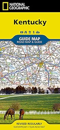

Kentucky National Geographic Folded Map
$29.95
Afterpay is only available for orders between $50.00 and $1000.00 More info
🐎 Kentucky – National Geographic State Guide Map
Waterproof • Tear-Resistant • Travel Map
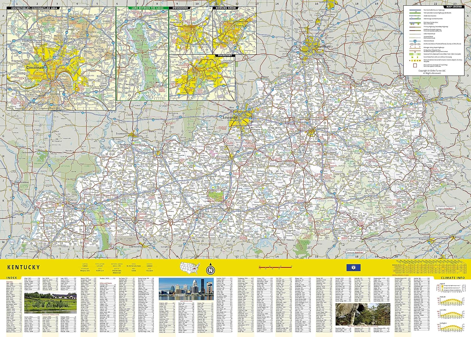
Experience The Bluegrass State with the authority and clarity only National Geographic can provide. Expertly researched and thoughtfully designed, this Kentucky State Guide Map offers comprehensive coverage of the region’s road network, natural wonders, and cultural highlights—making it an indispensable companion for every type of traveller.
🗺 Comprehensive State Coverage
From the rolling horse country of Lexington to the historic streets of Louisville and the serene beauty of Land Between the Lakes, this detailed state map helps you navigate Kentucky’s diverse landscapes with ease.
Inset Maps Include:
-
Covington, KY – Cincinnati, OH Area – Navigating the busy Ohio River gateway
-
Land Between the Lakes – Outdoor recreation and wildlife haven
-
Owensboro – Bluegrass music heritage and riverfront attractions
-
Bowling Green – Home of the National Corvette Museum
-
Frankfort – Kentucky’s historic capital
-
Louisville – Iconic Derby City landmarks
-
Lexington – Heart of Bluegrass Country
🌄 Featured Attractions & Scenic Drives
-
Mammoth Cave National Park – The world’s longest cave system with recreation details and maps
-
Kentucky Heartland Scenic Drive – Stretching from Lexington to Harrodsburg, rich in heritage and charm
-
State & National Parks – Clearly marked for outdoor adventure planning
-
Cultural & Historic Sites – From bourbon distilleries to Civil War battlefields
🚗 Road & Travel Detail
-
Highways, Toll Roads & Scenic Routes – Clearly designated for easy trip planning
-
Distances in Miles – Measured on major highways to help estimate travel times
-
Points of Interest – Including airports, public campsites, ski areas, hospitals, and visitor information centers
📊 Reference Tools
-
Park Service Sites Chart – Facilities and services listed at a glance
-
Climate Information – Seasonal temperature, rainfall, and sunshine data
-
Comprehensive Index – Quickly locate cities, towns, and notable landmarks
📐 Product Specifications
| Feature | Detail |
|---|---|
| Publisher | National Geographic Maps |
| Map Type | Folded State Guide Map |
| Material | Waterproof, tear-resistant synthetic paper |
| Scale | Statewide coverage with detailed insets |
| Format | Double-sided with city and park insets |
| Flat Size | 660 mm x 940 mm (26" x 37") |
| Folded Size | 102 mm x 229 mm (4" x 9") |
| Order Info | Order on Demand – Please allow 7–10 working days for delivery |
🎯 Perfect For
-
Road Trippers – Plan scenic drives and multi-city itineraries
-
Outdoor Enthusiasts – Explore national parks, lakes, and cave systems
-
Cultural Travellers – Discover bourbon country, bluegrass heritage, and historic towns
-
Business Travellers – Navigate Kentucky’s urban hubs and transport links
From the depths of Mammoth Cave to the thundering hooves at Churchill Downs, the Kentucky National Geographic State Guide Map delivers the accuracy, durability, and depth you need to make the most of your journey through one of America’s most storied states.
Frequently Asked Questions
What area does the Kentucky National Geographic Folded Map cover?
The Kentucky National Geographic Folded Map provides road coverage of the region named in the product title. The map covers major cities, highways, towns, and regional roads, with inset city maps for key urban centres where applicable.
Is the Kentucky National Geographic Folded Map up to date?
Yes, this is the current edition. Mapworld stocks the most current editions from all major publishers, updated to reflect new roads and infrastructure.
What size is this map when unfolded?
Folded maps from Mapworld's range are compact and portable. Most standard folded road or travel maps open to between A1 (594 × 841mm) and A0 (841 × 1189mm) when fully unfolded, and fold down to approximately A4 or smaller for easy storage in a glove box, bag, or backpack.
Is the Kentucky National Geographic Folded Map in stock at Mapworld?
Mapworld maintains extensive stock across its map range and aims for fast dispatch. Orders placed before 2pm AEST on business days are typically dispatched the same day, with standard and express Australia-wide delivery options available.
Does Mapworld ship the Kentucky National Geographic Folded Map across Australia?
Yes, Mapworld ships Australia-wide. Standard shipping is a flat $7 rate, with free standard shipping on orders over $75. Express options are available at checkout. Most orders placed before 2pm AEST on weekdays are dispatched same day.
Related Items


© 2026 Mapworld. Website designed by Genie Media
X