- Australia ▾
- Topographic
▾
- Australia AUSTopo 250k (2025)
- Australia 50k Geoscience maps
- Australia 100k Geoscience maps
- Australia 250k Geoscience maps
- Australia 1:1m Geoscience maps
- New Zealand 50k maps
- New Zealand 250k maps
- New South Wales 25k maps
- New South Wales 50k maps
- New South Wales 100k maps
- Queensland 10k maps
- Queensland 25k maps
- Queensland 50k maps
- Queensland 100k maps
- Western Australia 25k maps
- Western Australia 50k maps
- Western Australia 100k maps
- Compasses
- Software
- GPS Systems
- International ▾
- Wall Maps
▾
- World
- Australia & New Zealand
- Countries, Continents & Regions
- Historical
- Vintage National Geographic
- Australian Capital Territory
- New South Wales
- Northern Territory
- Queensland
- South Australia
- Tasmania
- Victoria
- Western Australia
- Celestial
- Children's
- Mining & Resources
- Wine Maps
- Healthcare
- Postcode Maps
- Electoral Maps
- Nautical ▾
- Flags
▾
- Australian Flag Sets & Banners
- Flag Bunting
- Handwavers
- Australian National Flags
- Aboriginal Flags
- Torres Strait Islander Flags
- International Flags
- Flagpoles & Accessories
- Australian Capital Territory Flags
- New South Wales Flags
- Northern Territory Flags
- Queensland Flags
- South Australia Flags
- Tasmania Flags
- Victoria Flags
- Western Australia Flags
- Gifts ▾
- Globes ▾
Dear valued customer. Please note that our checkout is not supported by old browsers. Please use a recent browser to access all checkout capabilities


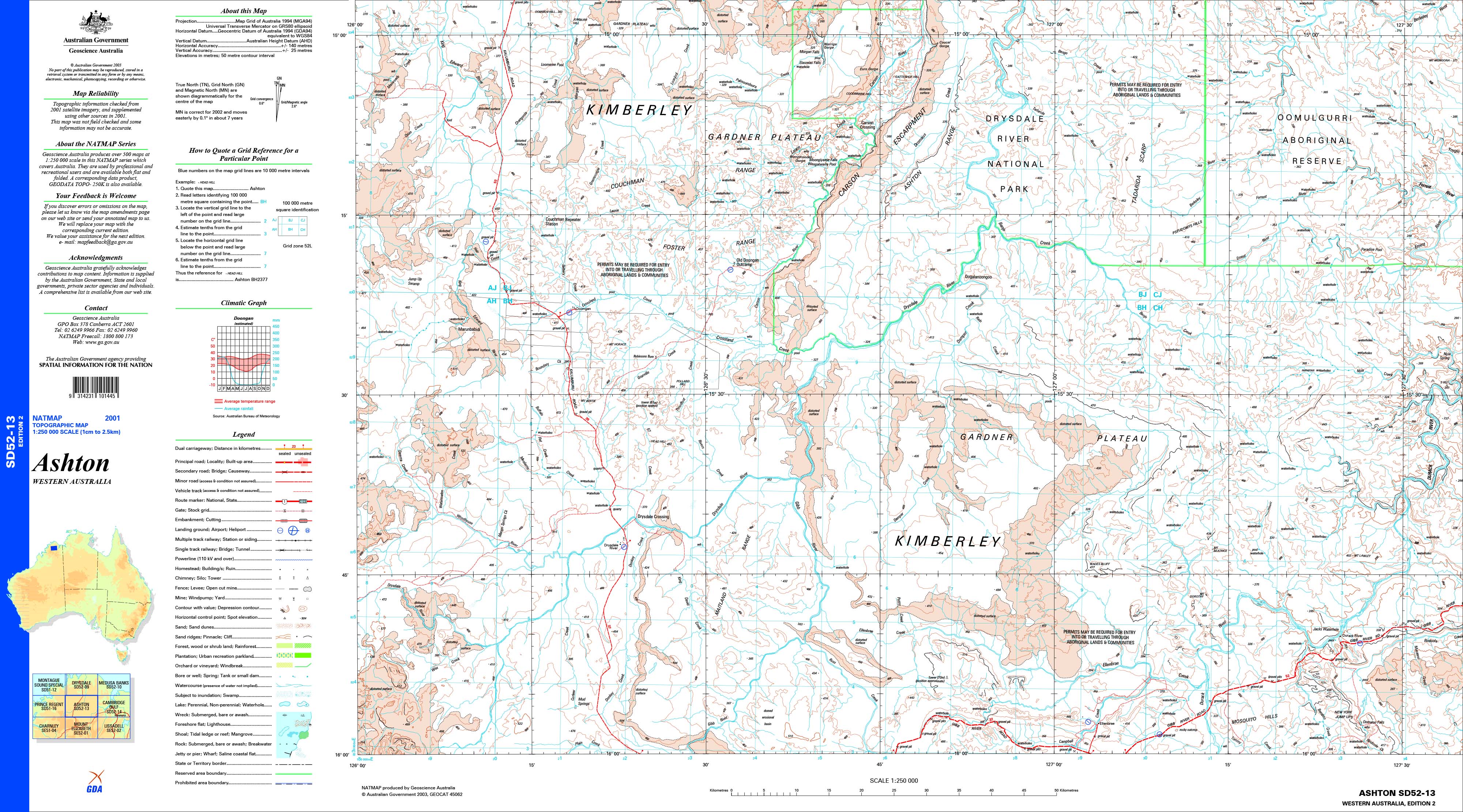
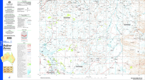
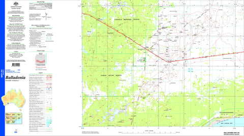
Ashton SD52-13 1:250k Topographic Map 1:250k
$19.95
Afterpay is only available for orders between $50.00 and $1000.00 More info
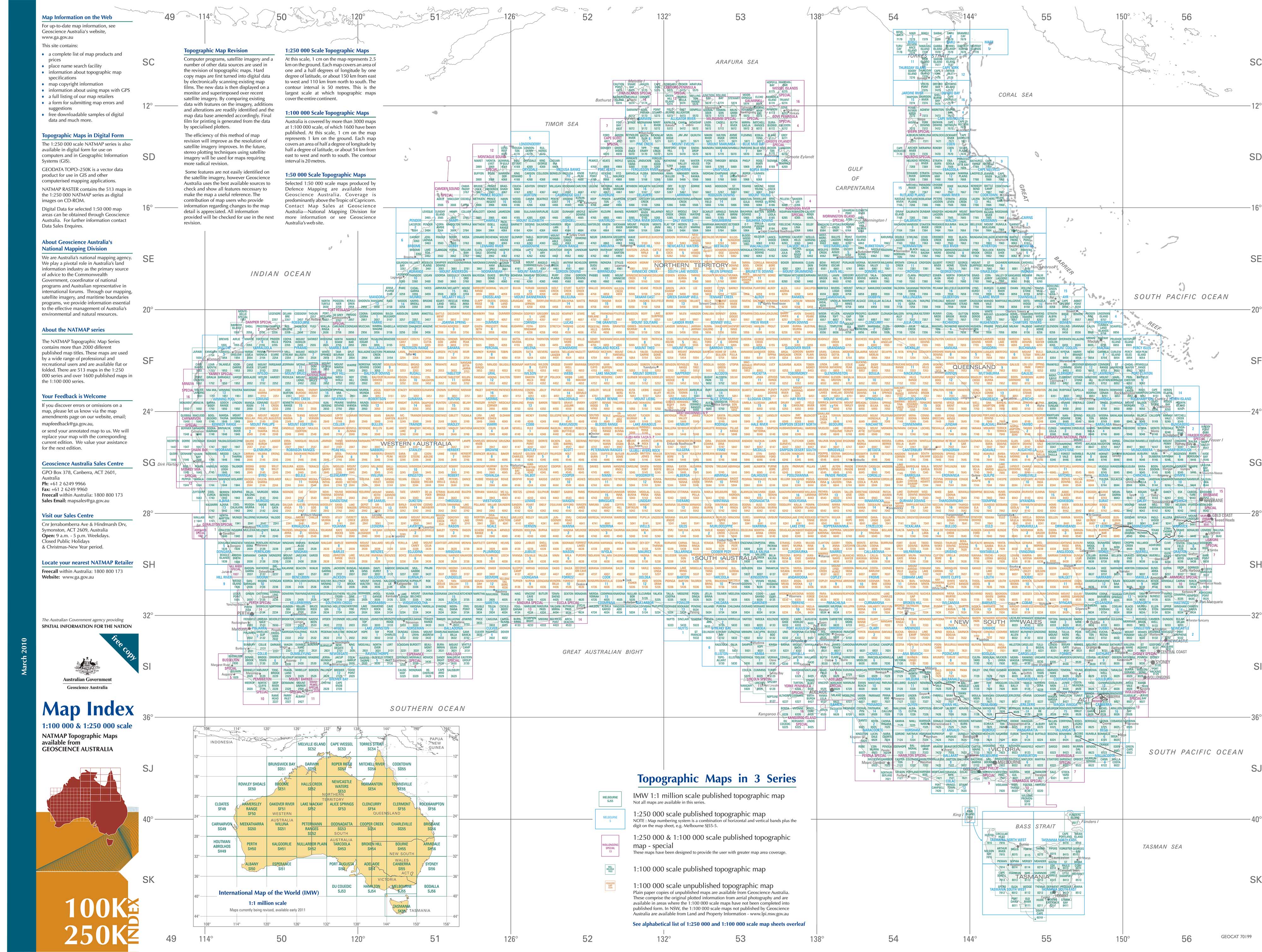
The Ashton 1:250,000 topographic map is part of the series that covers the whole of Australia at a scale of 1:250 000 (1cm on a map represents 2.5 km on the ground) and comprises 513 maps. This is the largest scale at which published topographic maps cover the entire continent. Each standard map covers an area of 1.5 degrees longitude by 1-degree latitude or about 150 kilometres from east to west and 110 kilometres from north to south.
Topographic maps show contours, spot elevations, streams, roads, buildings, place names, vegetation and administrative boundaries. They are used by emergency services, environmental resource managers, engineers and others for planning, development and recreational activities.
If you would like to use this map in the field, we can supply it on waterproof/tearproof DuPont™ Tyvek®. Tyvek® is made of pure polyethylene fibres (plastic) but has the properties of paper, which means it is foldable.
We can also laminate this map, which will allow you to draw on it in whiteboard marker or apply our map dots to locations of interest without permanently marking the map. The lamination makes the map very durable and protects against tears and stains.
To see a full index please click: Australia 100k & 250k
Scale: 1:250,000
Size: 900 mm (w) x 500 mm (w)
Frequently Asked Questions
What area does the Ashton SD52-13 1:250k Topographic Map 1:250k cover?
This topographic map covers the area named in the product title. It shows elevation contours, terrain features, waterways, roads, tracks, and key landmarks at 1:250,000 scale.
What scale is this topographic map?
This map is at 1:250,000 scale. Australian topographic maps are commonly produced at 1:25,000, 1:50,000, and 1:100,000 scales — the scale determines the level of detail and the area shown.
Is this map suitable for bushwalking and hiking?
Yes, topographic maps are the standard navigation tool for bushwalking, hiking, and off-track travel. They show contour lines, walking tracks, water sources, and terrain hazards.
Is this the most current edition available?
Mapworld stocks the most current editions available. Australian topographic maps are produced by Geoscience Australia or state mapping agencies and updated periodically.
Does Mapworld ship the Ashton SD52-13 1:250k Topographic Map 1:250k across Australia?
Yes, Mapworld ships Australia-wide. Standard shipping is a flat $7 rate, with free standard shipping on orders over $75. Express options are available at checkout. Most orders placed before 2pm AEST on weekdays are dispatched same day.
Related Items
© 2026 Mapworld. Website designed by Genie Media
X