- Australia ▾
- Topographic
▾
- Australia AUSTopo 250k (2025)
- Australia 50k Geoscience maps
- Australia 100k Geoscience maps
- Australia 250k Geoscience maps
- Australia 1:1m Geoscience maps
- New Zealand 50k maps
- New Zealand 250k maps
- New South Wales 25k maps
- New South Wales 50k maps
- New South Wales 100k maps
- Queensland 10k maps
- Queensland 25k maps
- Queensland 50k maps
- Queensland 100k maps
- Compasses
- Software
- GPS Systems
- Orienteering
- International ▾
- Wall Maps
▾
- World
- Australia & New Zealand
- Countries, Continents & Regions
- Historical
- Vintage National Geographic
- Australian Capital Territory
- New South Wales
- Northern Territory
- Queensland
- South Australia
- Tasmania
- Victoria
- Western Australia
- Celestial
- Children's
- Mining & Resources
- Wine Maps
- Healthcare
- Postcode Maps
- Electoral Maps
- Nautical ▾
- Flags
▾
- Australian Flag Sets & Banners
- Flag Bunting
- Handwavers
- Australian National Flags
- Aboriginal Flags
- Torres Strait Islander Flags
- International Flags
- Flagpoles & Accessories
- Australian Capital Territory Flags
- New South Wales Flags
- Northern Territory Flags
- Queensland Flags
- South Australia Flags
- Tasmania Flags
- Victoria Flags
- Western Australia Flags
- Gifts ▾
- Globes ▾
Dear valued customer. Please note that our checkout is not supported by old browsers. Please use a recent browser to access all checkout capabilities


Alroy E5315 AUSTopo 1:250,000 Map
$19.95
Afterpay is only available for orders between $50.00 and $1000.00 More info
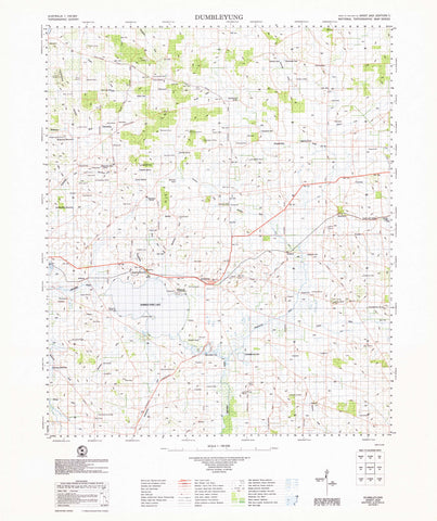
Alroy E5315 — AUSTopo 1:250,000 Topographic Map (2025)
Pastoral stations, open plains, and remote corridors—mapped for clarity across Central Australia
Covering Alroy and the surrounding Central Australian pastoral country, this AUSTopo 1:250,000 sheet delivers a clear, authoritative regional overview of vast inland landscapes where distance, access, and terrain are critical. From station leases and drainage lines to remote tracks and regional routes, it’s built for professionals and experienced travellers who need dependable big-area context.
At 1:250,000 scale (1 cm = 2.5 km), this is the largest scale at which published topographic maps cover the entire Australian continent—ideal for regional planning, land management, logistics, and serious outback navigation.
🧭 Why this map stands out
-
Updated mapping (2025) — aligned to modern Australian datums for confident decision-making
-
True regional perspective — pastoral country, plains, and access routes in one coherent view
-
Professional-grade cartography — relied on by emergency services, engineers, and land managers
-
Dual coordinate systems — seamless transition between office planning and field navigation
-
Printed in Australia — precision output, locally finished and quality-checked
🗺️ What you’ll see
-
Contours and spot elevations across low-relief plains and gentle rises
-
Creeks, drainage lines, and arid hydrology
-
Roads, station tracks, and place names
-
Vegetation patterns and administrative boundaries
-
Clear grid overlays for accurate positioning and large-area planning
📐 Map details at a glance
-
Scale: 1:250,000
-
Series: AUSTopo — Australian Digital Topographic Map Series
-
Coverage: Alroy E5315
-
Map currency: 2025
-
Coordinates: Geographical & MGA
-
Datum: GDA2020, AHD
-
Projection: Universal Transverse Mercator (UTM)
-
Sheet size: 800 mm (W) × 500 mm (H)
🎨 Field-ready print options
All finishes are printed in Australia using high-resolution colour for crisp linework and dependable legibility.
-
📄 Paper (standard)
Ideal for planning tables, briefing rooms, or framed reference. -
💧 DuPont™ Tyvek® (waterproof & tear-proof)
Foldable, lightweight, and exceptionally durable—perfect for remote fieldwork and repeated handling. -
🔒 Laminated (write-on / wipe-off)
True encapsulation protects against tears and stains. Annotate routes with whiteboard markers or apply map dots—then wipe clean and reuse.
🎯 Who it’s for
-
Emergency services & remote-area coordinators
-
Pastoral, environmental & land-use managers
-
Engineers and infrastructure teams
-
Educators and students
-
Outback travellers and expedition planners
🇦🇺 Our commitment
Every AUSTopo map we supply is printed and finished in Australia, colour-managed for accuracy, hand-checked, and packed with care—so it arrives ready for real-world use.
Plan, brief, and explore the Alroy region with confidence. Choose your finish and add this essential 2025 AUSTopo map to your kit today.
Frequently Asked Questions
What area does the Alroy E5315 AUSTopo 1:250,000 Map cover?
This topographic map covers the area named in the product title. It shows elevation contours, terrain features, waterways, roads, tracks, and key landmarks at 1:250,000 scale.
What scale is this topographic map?
This map is at 1:250,000 scale. Australian topographic maps are commonly produced at 1:25,000, 1:50,000, and 1:100,000 scales — the scale determines the level of detail and the area shown.
Is this map suitable for bushwalking and hiking?
Yes, topographic maps are the standard navigation tool for bushwalking, hiking, and off-track travel. They show contour lines, walking tracks, water sources, and terrain hazards.
Is this the most current edition available?
Mapworld stocks the most current editions available. Australian topographic maps are produced by Geoscience Australia or state mapping agencies and updated periodically.
Does Mapworld ship the Alroy E5315 AUSTopo 1:250,000 Map across Australia?
Yes, Mapworld ships Australia-wide. Standard shipping is a flat $7 rate, with free standard shipping on orders over $75. Express options are available at checkout. Most orders placed before 2pm AEST on weekdays are dispatched same day.
Related Items


© 2026 Mapworld. Website designed by Genie Media
X