- Australia ▾
- Topographic
▾
- Australia AUSTopo 250k (2025)
- Australia 50k Geoscience maps
- Australia 100k Geoscience maps
- Australia 250k Geoscience maps
- Australia 1:1m Geoscience maps
- New Zealand 50k maps
- New Zealand 250k maps
- New South Wales 25k maps
- New South Wales 50k maps
- New South Wales 100k maps
- Queensland 10k maps
- Queensland 25k maps
- Queensland 50k maps
- Queensland 100k maps
- Western Australia 25k maps
- Western Australia 50k maps
- Western Australia 100k maps
- Compasses
- Software
- GPS Systems
- International ▾
- Wall Maps
▾
- World
- Australia & New Zealand
- Countries, Continents & Regions
- Historical
- Vintage National Geographic
- Australian Capital Territory
- New South Wales
- Northern Territory
- Queensland
- South Australia
- Tasmania
- Victoria
- Western Australia
- Celestial
- Children's
- Mining & Resources
- Wine Maps
- Healthcare
- Postcode Maps
- Electoral Maps
- Nautical ▾
- Flags
▾
- Australian Flag Sets & Banners
- Flag Bunting
- Handwavers
- Australian National Flags
- Aboriginal Flags
- Torres Strait Islander Flags
- International Flags
- Flagpoles & Accessories
- Australian Capital Territory Flags
- New South Wales Flags
- Northern Territory Flags
- Queensland Flags
- South Australia Flags
- Tasmania Flags
- Victoria Flags
- Western Australia Flags
- Gifts ▾
- Globes ▾
Dear valued customer. Please note that our checkout is not supported by old browsers. Please use a recent browser to access all checkout capabilities


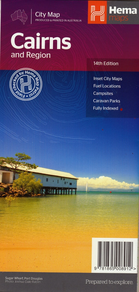
Cairns and Region Hema Map 14th Edition
$11.95
Afterpay is only available for orders between $50.00 and $1000.00 More info
City & Regional Coverage • Street-Level Detail • Camping & Tourist Info Included
Double-Sided Map | Scale: 1:22,500 | Size: 730 mm x 700 mm
Explore Far North Queensland with confidence using the 14th Edition of the Cairns & Region Map by Hema, a beautifully detailed double-sided map covering everything from the vibrant city centre to the tropical beaches, hinterland towns, and regional routes beyond.
Whether you’re road tripping along the coast, discovering waterfalls, or navigating Cairns’ growing suburbs, this map offers exceptional clarity and up-to-date street-level accuracy—all in a handy foldable format.
🌴 Double the Detail – City + Region
This thoughtfully designed, double-sided map provides comprehensive coverage of:
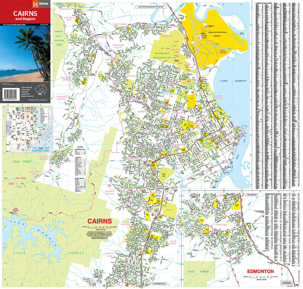
🗺️ Side One – Cairns & Edmonton
-
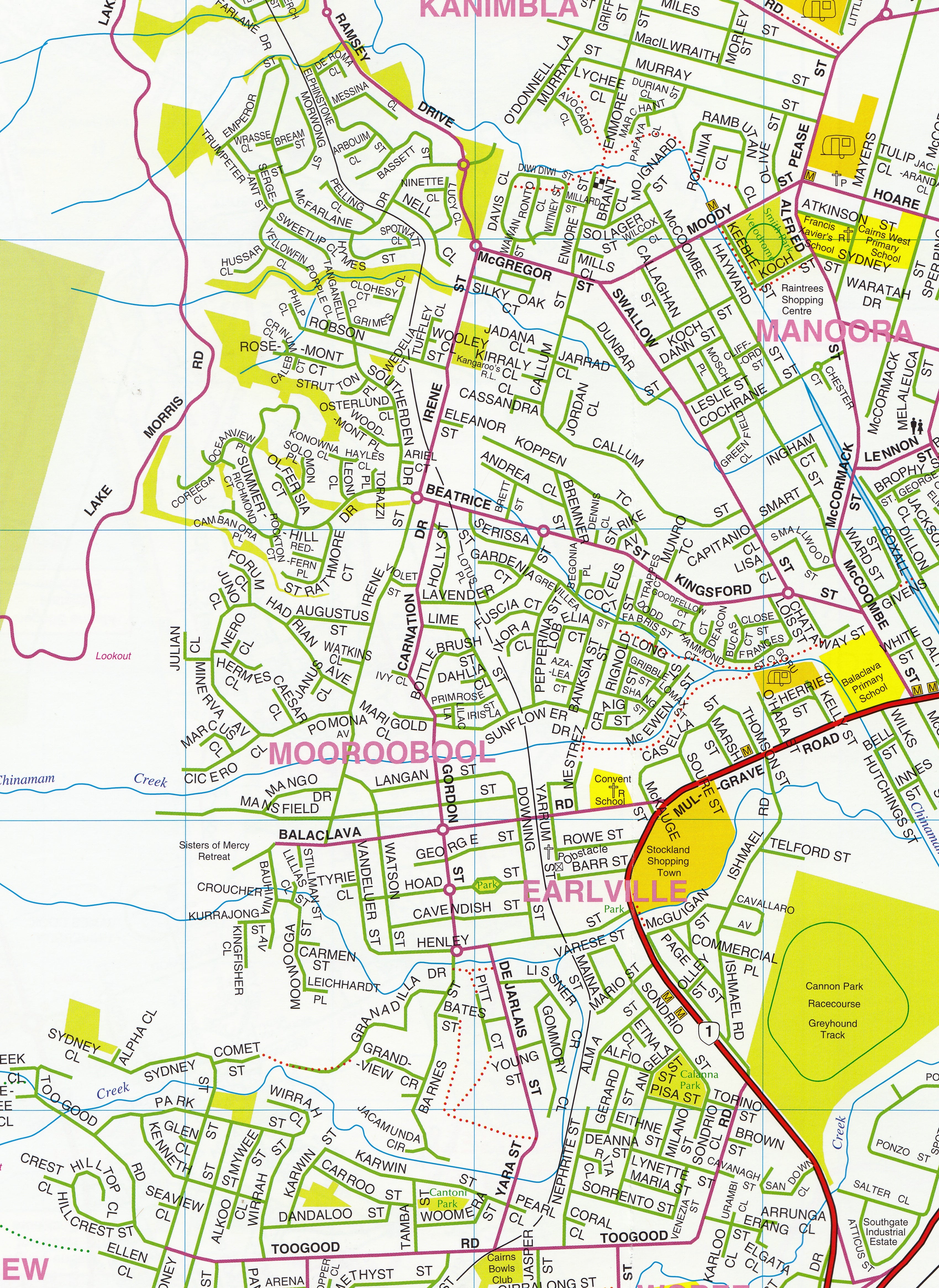
Full street-level map of Cairns & Edmonton
-
Inset map of Cairns CBD
-
Coverage extends from Palm Cove in the north through Cairns Harbour to Gordonvale in the south, and east to Cascade Glen
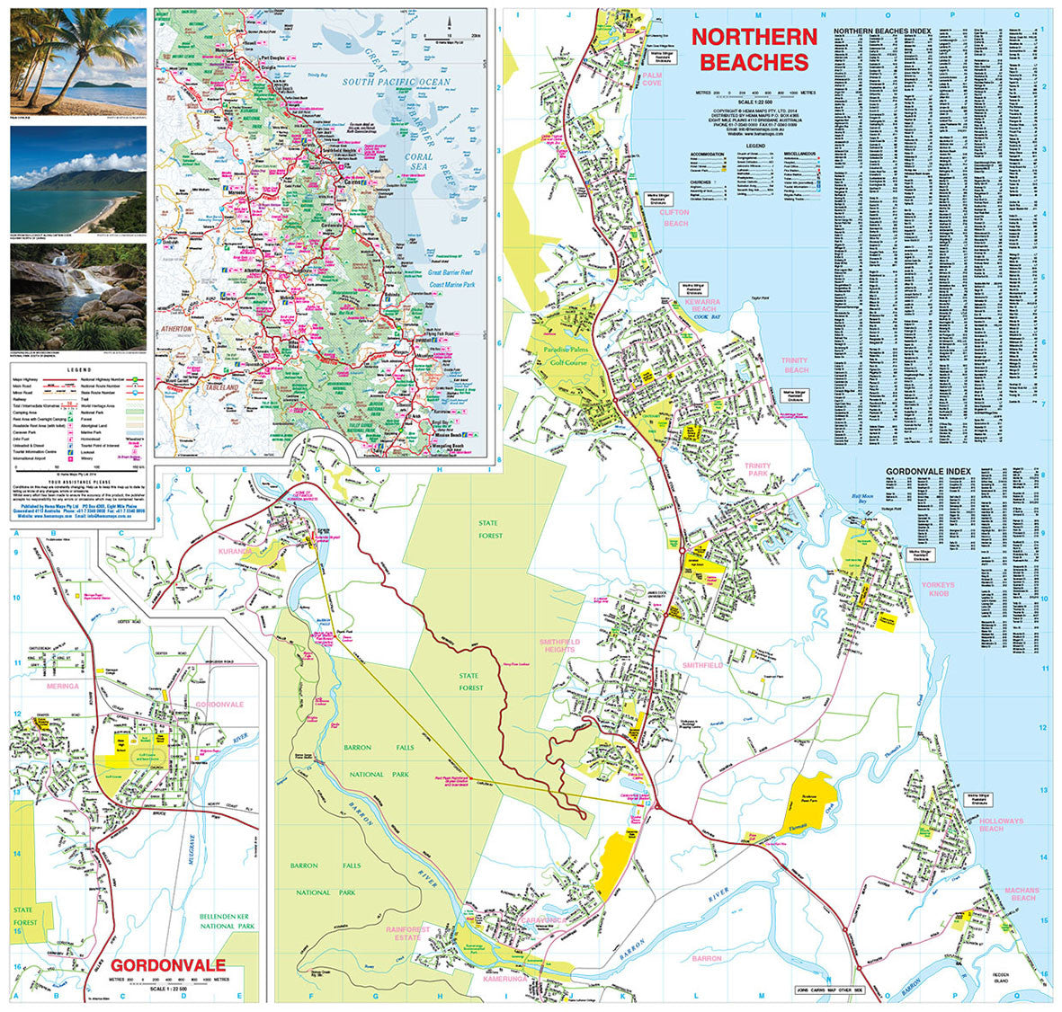
🏖️ Side Two – Northern Beaches & Region
-
Detailed street mapping of:
-
Northern Beaches
-
Gordonvale
-
-
Regional inset showing the broader area from:
-
Mossman in the north
-
Down to Wongaling Beach in the south
-
Across to Dimbulah in the west
-
This is your go-to map for understanding both the urban landscape and the wider tropical region.
📌 Key Map Features
| Feature | Description |
|---|---|
| 🚗 Major & Minor Roads | Clearly marked road hierarchy for easy navigation |
| 🚆 Railways | Railway lines included for reference |
| ⛺ Camping & Rest Areas | Includes free and overnight rest areas, campgrounds, and caravan parks |
| 🚻 Toilets at Rest Stops | Roadside rest areas with toilet facilities clearly marked |
| ⛽ 24-Hour Fuel Stops | Essential for road trippers and remote area planning |
| ℹ️ Tourist Information Centres | Visitor advice hubs marked throughout the region |
| 🔍 Street Index | Comprehensive street index for quick location lookup |
| 📸 Regional Imagery | Beautiful images of local landscapes and attractions included |
📐 Map Specifications
| Specification | Detail |
|---|---|
| Title | Cairns & Region Map (14th Edition) |
| Publisher | Hema Maps |
| Scale | 1:22,500 |
| Format | Double-sided folded map |
| Size | 730 mm (W) x 700 mm (H) (unfolded) |
| Edition | 14th Edition – Latest |
| Full colour with high cartographic clarity |
🎯 Who’s This Map For?
Perfect for locals and travellers alike, this map suits:
-
🏝️ Holidaymakers & Tourists – discover beaches, attractions, and routes
-
🚐 Caravanners & Campers – find rest stops, 24hr fuel, and campgrounds
-
🏠 Home buyers & real estate agents – understand layout of suburbs and localities
-
🧭 Day-trippers & explorers – plan scenic drives and rainforest escapes
-
🗺️ Educators & students – great for teaching local geography and urban planning
🛡️ Optional Laminated Version Available
Need something more durable?
✨ Also available laminated – professionally encapsulated in high-quality plastic, perfect for reuse with whiteboard markers, map dots, or for long-term fieldwork.
The laminated version is ideal for classrooms, tourist offices, council buildings, or travellers looking for a weather-resistant reference that lasts.
🛒 Add to Cart Now
Whether you’re setting up camp in the hinterland, exploring the Northern Beaches, or navigating city streets, the Cairns & Region Map by Hema is your all-in-one guide to Far North Queensland’s most captivating corner.
Frequently Asked Questions
Where can I buy the Cairns and Region Hema Map 14th Edition?
The Cairns and Region Hema Map 14th Edition is available to buy online from Mapworld, Australia's largest map and geographic product retailer, with fast shipping Australia-wide.
Is the Cairns and Region Hema Map 14th Edition in stock at Mapworld?
Mapworld maintains extensive stock across its map range and aims for fast dispatch. Orders placed before 2pm AEST on business days are typically dispatched the same day, with standard and express Australia-wide delivery options available.
What is Mapworld's returns policy?
Mapworld accepts returns on undamaged items in original condition. Contact Mapworld within 90 days of purchase to arrange a return or exchange.
Does Mapworld ship the Cairns and Region Hema Map 14th Edition across Australia?
Yes, Mapworld ships Australia-wide. Standard shipping is a flat $7 rate, with free standard shipping on orders over $75. Express options are available at checkout. Most orders placed before 2pm AEST on weekdays are dispatched same day.
Related Items

© 2026 Mapworld. Website designed by Genie Media
X