- Australia ▾
- Topographic
▾
- Australia AUSTopo 250k (2025)
- Australia 50k Geoscience maps
- Australia 100k Geoscience maps
- Australia 250k Geoscience maps
- Australia 1:1m Geoscience maps
- New Zealand 50k maps
- New Zealand 250k maps
- New South Wales 25k maps
- New South Wales 50k maps
- New South Wales 100k maps
- Queensland 10k maps
- Queensland 25k maps
- Queensland 50k maps
- Queensland 100k maps
- Western Australia 25k maps
- Western Australia 50k maps
- Western Australia 100k maps
- Compasses
- Software
- GPS Systems
- International ▾
- Wall Maps
▾
- World
- Australia & New Zealand
- Countries, Continents & Regions
- Historical
- Vintage National Geographic
- Australian Capital Territory
- New South Wales
- Northern Territory
- Queensland
- South Australia
- Tasmania
- Victoria
- Western Australia
- Celestial
- Children's
- Mining & Resources
- Wine Maps
- Healthcare
- Postcode Maps
- Electoral Maps
- Nautical ▾
- Flags
▾
- Australian Flag Sets & Banners
- Flag Bunting
- Handwavers
- Australian National Flags
- Aboriginal Flags
- Torres Strait Islander Flags
- International Flags
- Flagpoles & Accessories
- Australian Capital Territory Flags
- New South Wales Flags
- Northern Territory Flags
- Queensland Flags
- South Australia Flags
- Tasmania Flags
- Victoria Flags
- Western Australia Flags
- Gifts ▾
- Globes ▾
Dear valued customer. Please note that our checkout is not supported by old browsers. Please use a recent browser to access all checkout capabilities


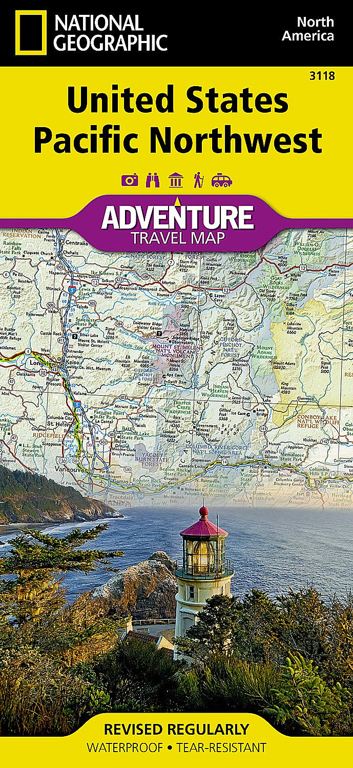
Pacific North West National Geographic Folded Map
$27.95
Afterpay is only available for orders between $50.00 and $1000.00 More info
Explore Washington • Oregon • Idaho • Northern California • Western Montana & More
Folded Map | Waterproof & Tear-Resistant | Durable Synthetic Paper
🌲 Where Rugged Peaks Meet Coastal Beauty — Discover the American Northwest
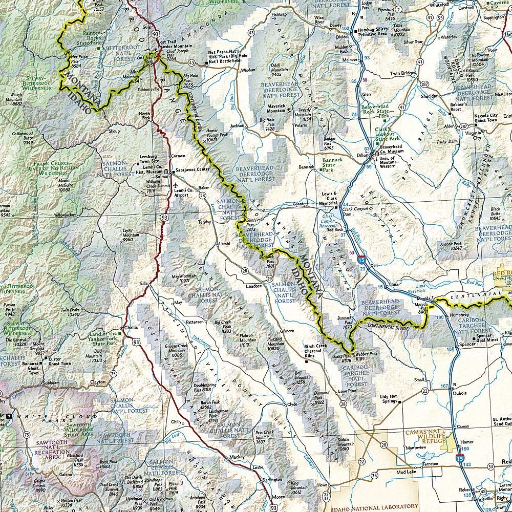
National Geographic’s Pacific Northwest Adventure Map is your essential companion to one of the most breathtaking and geographically diverse regions of North America. Whether you're navigating the dramatic coastline of Oregon, winding through the evergreen slopes of Washington’s Cascades, or venturing into the vast wilderness of Idaho and Montana, this map offers unmatched clarity, coverage, and resilience for life on the road.
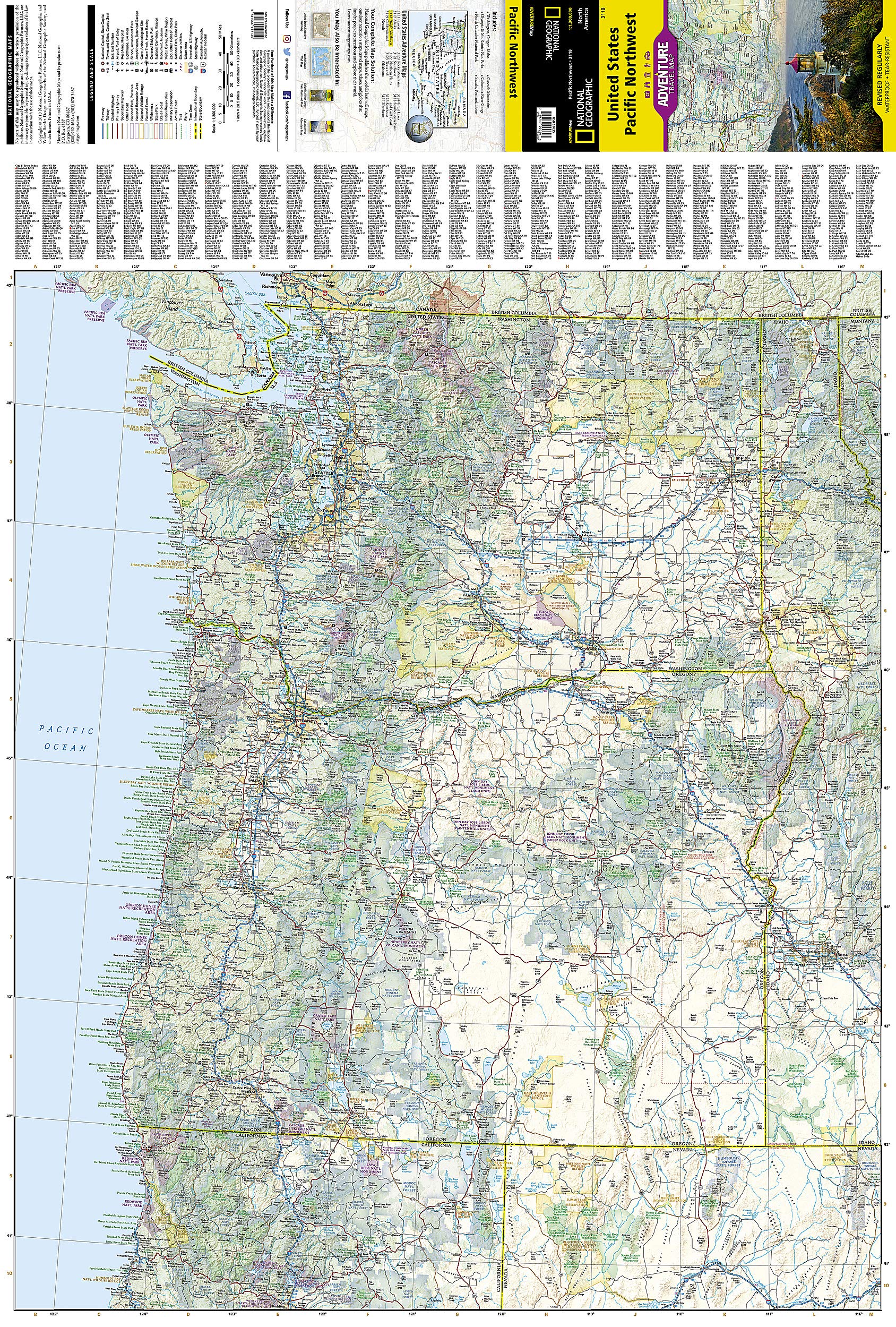
🧭 What This Map Covers
Designed for travellers, adventurers, and road-trippers alike, this map highlights:
| Region | Key Areas Covered |
|---|---|
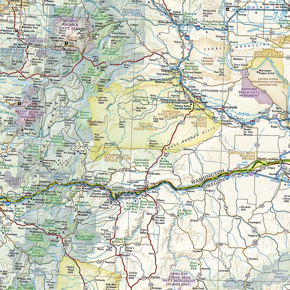
| 🏞️ Washington State | Seattle, Spokane, Puget Sound, Olympic National Park, Mt. Rainier, Columbia River Gorge |
| 🌄 Oregon | Portland, Eugene, Crater Lake National Park, Mt. Hood, Pacific Coastline |
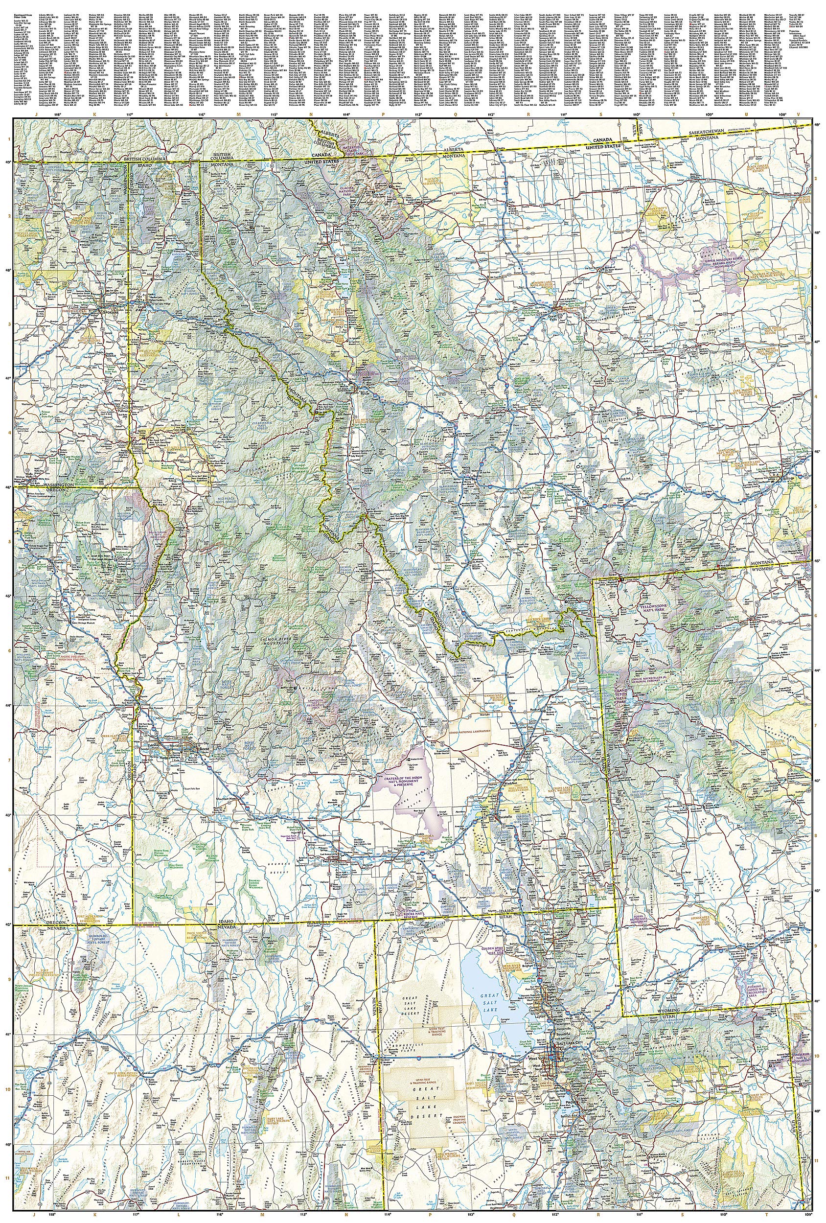
| 🏔️ Idaho | Boise, wilderness trails, lakes and mountain routes |
| 🏕️ Northern California | Shasta Cascade region, Klamath Mountains, Redwood areas |
| 🐻 Western Montana & Wyoming | Glacier National Park, Yellowstone’s western sections |
| 🏜️ Northern Nevada & Utah | Remote trails, scenic byways, Great Basin outskirts |
📌 Map Features
-
Full topographic context with shaded relief for terrain awareness
-
National Parks, Monuments, and Forests clearly marked
-
Highways, scenic routes & back roads ideal for both planned tours and spontaneous detours
-
Points of Interest including natural landmarks, historical sites, and recreational areas
-
City insets for Seattle, Portland, Boise & more
-
State & national borders, lakes, rivers, mountains, and coastlines rendered with signature National Geographic cartographic precision
-
User-friendly index for easy navigation
🧳 Built for Adventure
National Geographic Adventure Maps are crafted for travel — durable, packable, and made to withstand every environment you explore.
✅ Waterproof
✅ Tear-resistant
✅ Lightweight synthetic material
✅ Folded for convenience – slips easily into your pack, glove box, or day bag
📍 Who This Map is For
-
🚗 Road trippers driving through the scenic highways of the Pacific Northwest
-
🏕️ Campers, hikers & backpackers exploring national forests and backcountry trails
-
📷 Photographers and nature lovers chasing volcanoes, wild coasts, and ancient forests
-
🏙️ City explorers visiting Seattle, Portland, Boise, or Eugene
-
🌲 National Park enthusiasts planning visits to Olympic, Crater Lake, Mt. Rainier, Glacier, or Yellowstone
🧾 Map Specifications
| Feature | Detail |
|---|---|
| Publisher | National Geographic Maps |
| Title | Pacific Northwest Adventure Travel Map |
| Format | Folded, double-sided |
| Material | Synthetic paper (waterproof & tear-resistant) |
| Size (unfolded) | 965 mm x 660 mm |
| Size (folded) | 235 mm x 108 mm |
| Map Scale | Approx. 1:1,250,000 |
| Language | English with multilingual legend |
🌎 Plan Deeper, Explore Further
From snow-capped volcanoes to lush valleys, windswept coastlines to high desert plains, the Pacific Northwest delivers nature at its most inspiring. Whether you’re chasing waterfalls, hiking ancient forests, or simply enjoying the open road, this map is your trusted guide to the region’s wild soul and cultural charm.
🧭 Adventure starts here. With National Geographic in your pocket, the Pacific Northwest is yours to explore.
Frequently Asked Questions
What area does the Pacific North West National Geographic Folded Map cover?
The Pacific North West National Geographic Folded Map provides road coverage of the region named in the product title. The map covers major cities, highways, towns, and regional roads, with inset city maps for key urban centres where applicable.
Is the Pacific North West National Geographic Folded Map up to date?
Yes, this is the current edition. Mapworld stocks the most current editions from all major publishers, updated to reflect new roads and infrastructure.
What size is this map when unfolded?
Folded maps from Mapworld's range are compact and portable. Most standard folded road or travel maps open to between A1 (594 × 841mm) and A0 (841 × 1189mm) when fully unfolded, and fold down to approximately A4 or smaller for easy storage in a glove box, bag, or backpack.
Is the Pacific North West National Geographic Folded Map in stock at Mapworld?
Mapworld maintains extensive stock across its map range and aims for fast dispatch. Orders placed before 2pm AEST on business days are typically dispatched the same day, with standard and express Australia-wide delivery options available.
Does Mapworld ship the Pacific North West National Geographic Folded Map across Australia?
Yes, Mapworld ships Australia-wide. Standard shipping is a flat $7 rate, with free standard shipping on orders over $75. Express options are available at checkout. Most orders placed before 2pm AEST on weekdays are dispatched same day.
Related Items


© 2026 Mapworld. Website designed by Genie Media
X