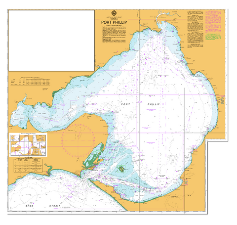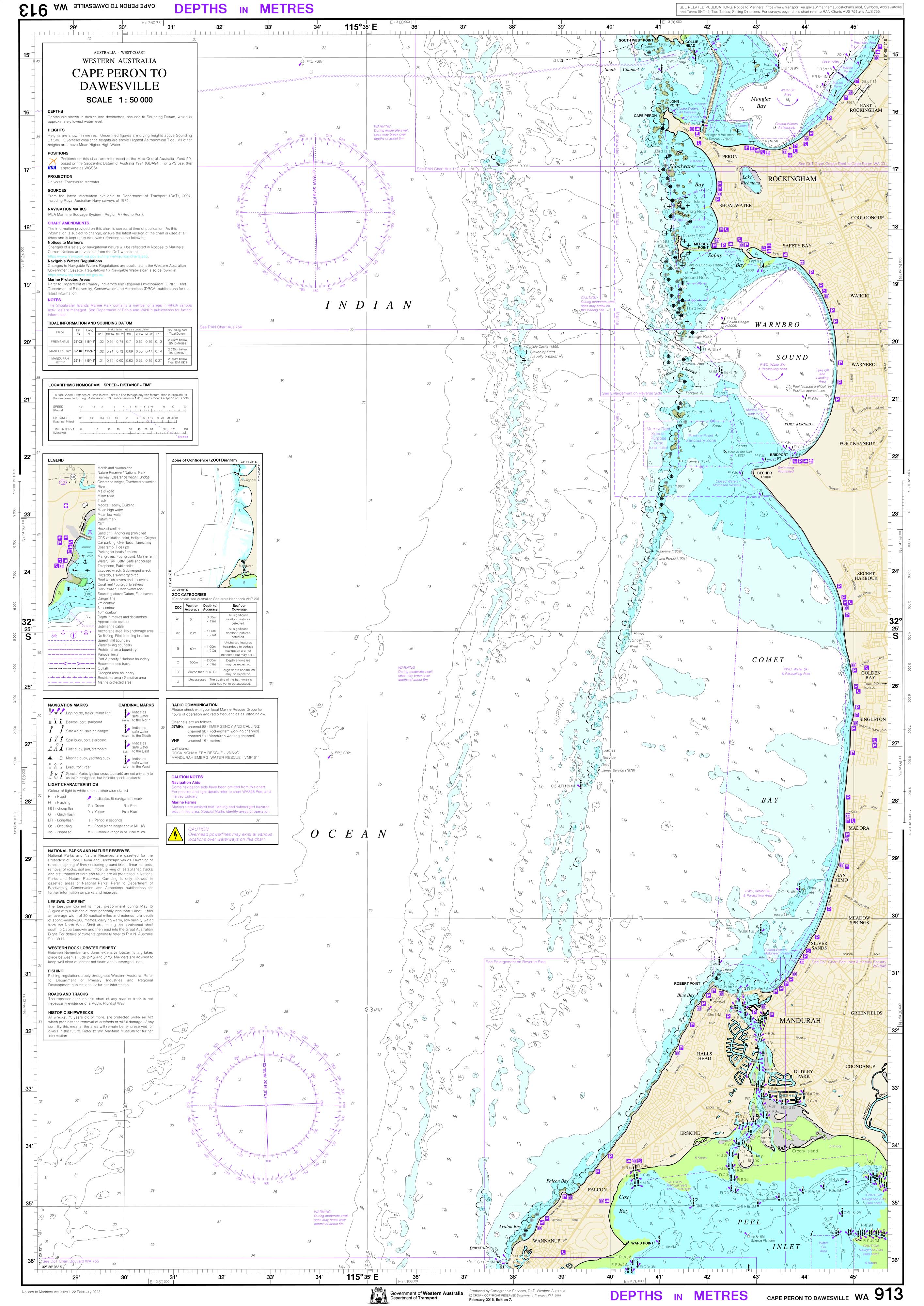
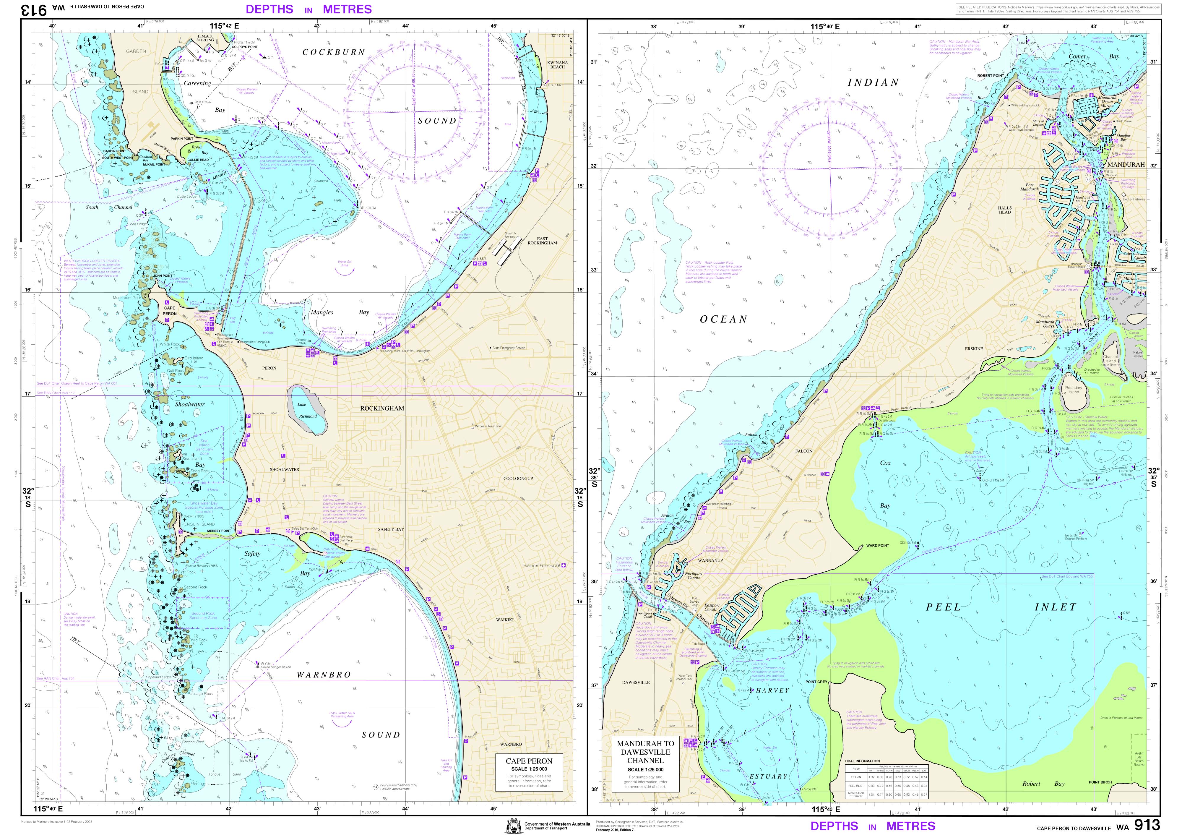
913 — Cape Peron to Dawesville
WA Department of Transport Nautical Chart
Detailed coastal and near-shore navigation for Mandurah, the Peel coastline, and adjoining waters.
🚤 Navigate the Peel Coast with Local Authority Confidence
Chart 913 — Cape Peron to Dawesville is a high-detail nautical chart published by the Western Australian Department of Transport to support safe recreational and local commercial boating along the Peel coastline.
Covering the busy coastal stretch from Cape Peron south to Dawesville, this chart brings together fine-scale inshore detail with broader coastal context—ideal for skippers transiting between exposed coast, near-shore reefs, and the approaches to Mandurah and Peel–Harvey waters.
🧭 Why Skippers Rely on This Chart
-
⚓ Authoritative WA source — Published by the Department of Transport
-
🗺️ Dual-scale coverage — 1:25,000 close detail & 1:50,000 coastal overview
-
🚦 Navigation aids clearly shown — Lights, beacons, piles & limits
-
🌊 Depth soundings & coastal features — Essential near reefs and shoals
-
🚤 Hazard awareness — Supports safe passage in mixed coastal conditions
-
🇦🇺 Printed locally in Australia — Crisp colour and professional finish
Compiled to specifications based on those of the International Hydrographic Organisation (IHO), this chart aligns with global charting standards while remaining tightly focused on local Western Australian waters.
🧠 Why This Section of Coast Needs a Dedicated Chart
The coast between Cape Peron and Dawesville combines open ocean exposure, near-shore reefs, and busy recreational traffic. This chart helps skippers:
-
Plan safe coastal transits
-
Navigate confidently near reefs and shallow patches
-
Identify navigation aids and nautical limits
-
Maintain situational awareness in high-use boating zones
-
Combine route planning with on-water decision-making
This is a working navigation tool, not a decorative map.
👥 Who This Chart Is For
-
🚤 Recreational skippers boating the Peel and Mandurah coast
-
🎣 Fishers & divers operating close to reefs and inshore grounds
-
🛥️ Local commercial operators
-
🧭 Boating clubs & training providers
-
🗂️ Marine planners and educators
-
🎁 A practical coastal gift for WA boat owners
If you boat regularly along this stretch of coast, this chart belongs on board.
🗺️ What You’ll See on the Chart
Clear, concise, and navigationally relevant information, including:
-
Accurate depth soundings
-
Coastal and seabed features
-
Navigation aids (lights, beacons, piles)
-
Marked nautical limits
-
Identified hazards and obstructions
-
Reference points for safe coastal passage planning
Mariners should keep charts current by regularly consulting relevant Notices to Mariners.
🖨️ Field-Ready Print Options
Choose the finish that suits how you use your chart:
📄 Paper (Standard)
-
Full-colour print on quality paper
-
Ideal for chart tables, planning, or protected use
💧 Waterproof DuPont™ Tyvek®
-
Tear-proof, water-resistant & foldable
-
Will not disintegrate when wet
-
Ideal for on-board coastal navigation
✍️ Laminated (Write-On / Wipe-Off)
-
True encapsulation for durability
-
Draw routes with whiteboard marker
-
Apply map dots without permanent marks
-
Resistant to tears and stains
📐 Chart Specifications
| Detail | Information |
|---|---|
| Chart Number | 913 |
| Title | Cape Peron to Dawesville |
| Publisher | WA Department of Transport |
| Scales | 1:25,000 & 1:50,000 |
| Format | Two single-sided sheets |
| Sheet Size | 590 mm × 840 mm |
| Colour | Full colour |
| Use | Recreational & local commercial boating |
| Production | Printed in Australia |
⚠️ Important Navigation Notice
These Department of Transport charts do not meet Australian or international chart carriage requirements, including SOLAS V.
For compliance-grade navigation, mariners must use official charts published by the Australian Hydrographic Service or UK Admiralty.
This chart is intended for planning, reference, and local navigation awareness, where detailed coastal knowledge is essential.
🇦🇺 Our Commitment
At Mapworld, we print charts locally in Australia using professional-grade materials and marine-friendly finishes. Every chart is carefully handled and checked—ready for real boating use in changing coastal conditions.
🧭 Ready to navigate the Peel coast with confidence?
Select your preferred finish and add Chart 913 — Cape Peron to Dawesville to your kit today.