- Australia ▾
- Topographic
▾
- Australia AUSTopo 250k (2025)
- Australia 50k Geoscience maps
- Australia 100k Geoscience maps
- Australia 250k Geoscience maps
- Australia 1:1m Geoscience maps
- New Zealand 50k maps
- New Zealand 250k maps
- New South Wales 25k maps
- New South Wales 50k maps
- New South Wales 100k maps
- Queensland 10k maps
- Queensland 25k maps
- Queensland 50k maps
- Queensland 100k maps
- Western Australia 25k maps
- Western Australia 50k maps
- Western Australia 100k maps
- Compasses
- Software
- GPS Systems
- International ▾
- Wall Maps
▾
- World
- Australia & New Zealand
- Countries, Continents & Regions
- Historical
- Vintage National Geographic
- Australian Capital Territory
- New South Wales
- Northern Territory
- Queensland
- South Australia
- Tasmania
- Victoria
- Western Australia
- Celestial
- Children's
- Mining & Resources
- Wine Maps
- Healthcare
- Postcode Maps
- Electoral Maps
- Nautical ▾
- Flags
▾
- Australian Flag Sets & Banners
- Flag Bunting
- Handwavers
- Australian National Flags
- Aboriginal Flags
- Torres Strait Islander Flags
- International Flags
- Flagpoles & Accessories
- Australian Capital Territory Flags
- New South Wales Flags
- Northern Territory Flags
- Queensland Flags
- South Australia Flags
- Tasmania Flags
- Victoria Flags
- Western Australia Flags
- Gifts ▾
- Globes ▾
Dear valued customer. Please note that our checkout is not supported by old browsers. Please use a recent browser to access all checkout capabilities


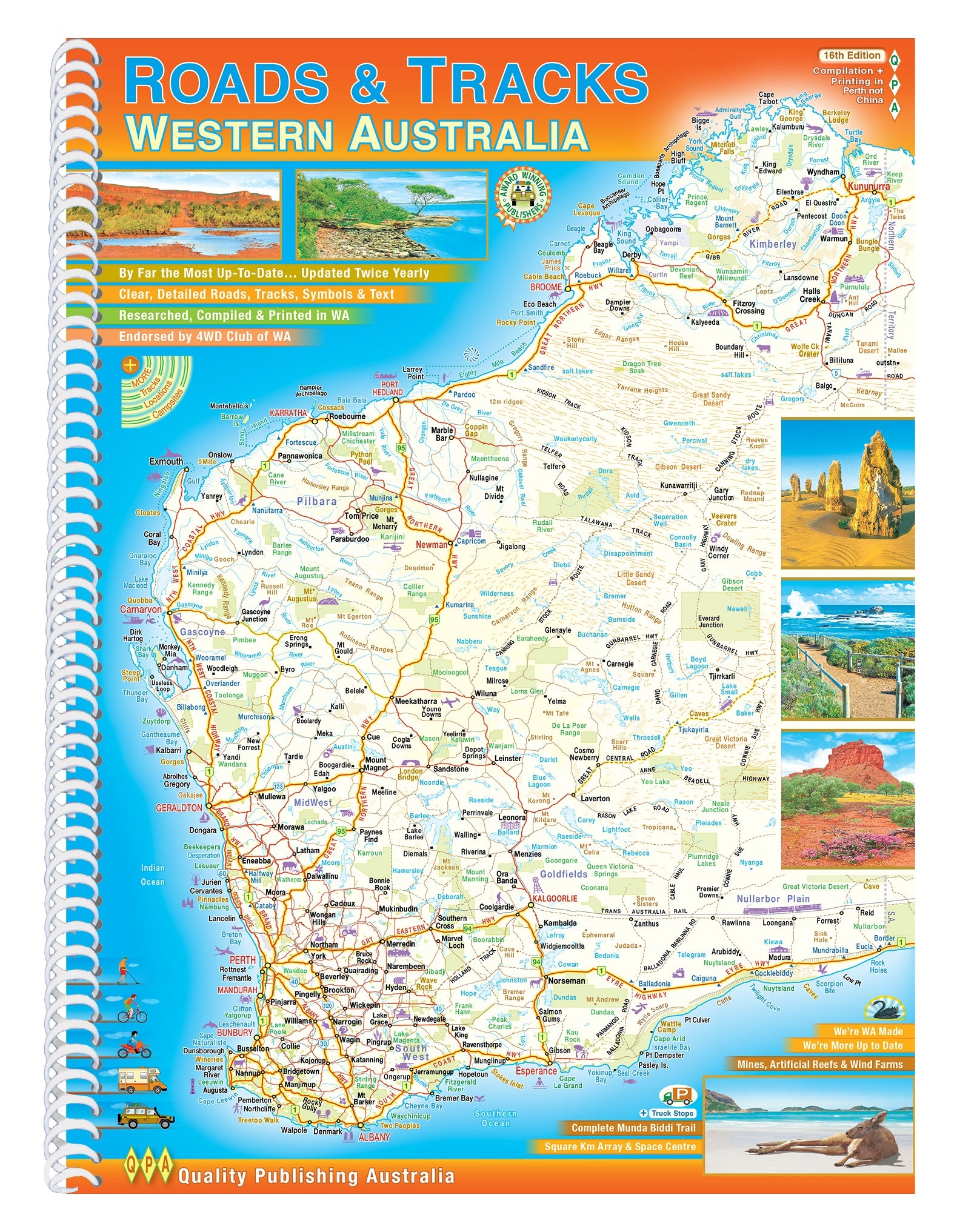
Roads & Tracks of Western Australia QPA 16th Edition
$44.95
Afterpay is only available for orders between $50.00 and $1000.00 More info
Same Day Shipping
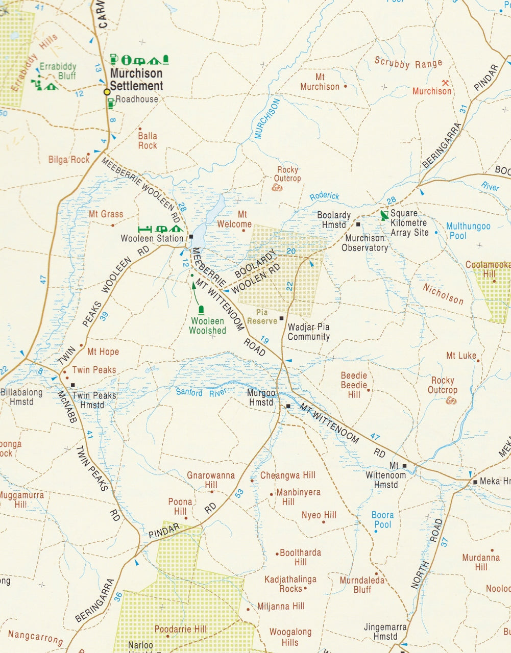
If you're planning to explore the diverse landscapes of Western Australia, the Roads & Tracks of Western Australia – 16th Edition by Quality Publishing Australia (QPA) is an indispensable resource. Published in September 2023, this spiral-bound A4 atlas offers detailed and up-to-date mapping, making it an essential companion for travellers, adventurers, and outdoor enthusiasts.
🗺️ Comprehensive Mapping Coverage
The atlas provides varying scales to suit different regions:
-
Southwest Region: Detailed at a 1:250,000 scale, covering areas such as Perth, Margaret River, and Albany.
-
Greater Southwest Area: Mapped at a 1:500,000 scale, extending beyond the immediate southwest.
-
Rest of the State: Presented at a 1:1,000,000 scale, encompassing the vast expanse of Western Australia.
This gradation ensures clarity and detail where needed, particularly in densely populated or frequently travelled areas.
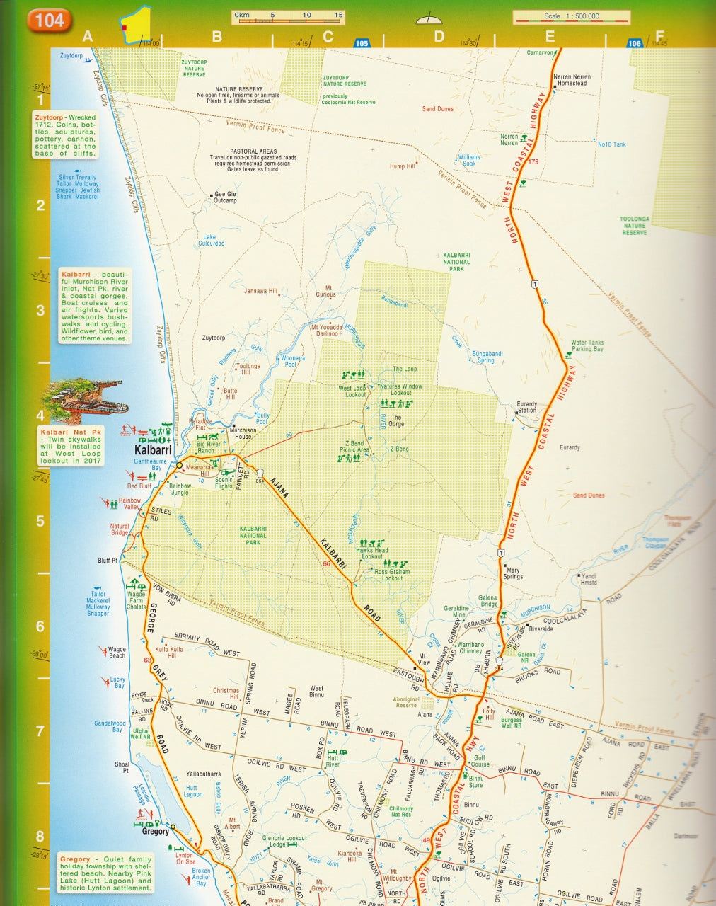
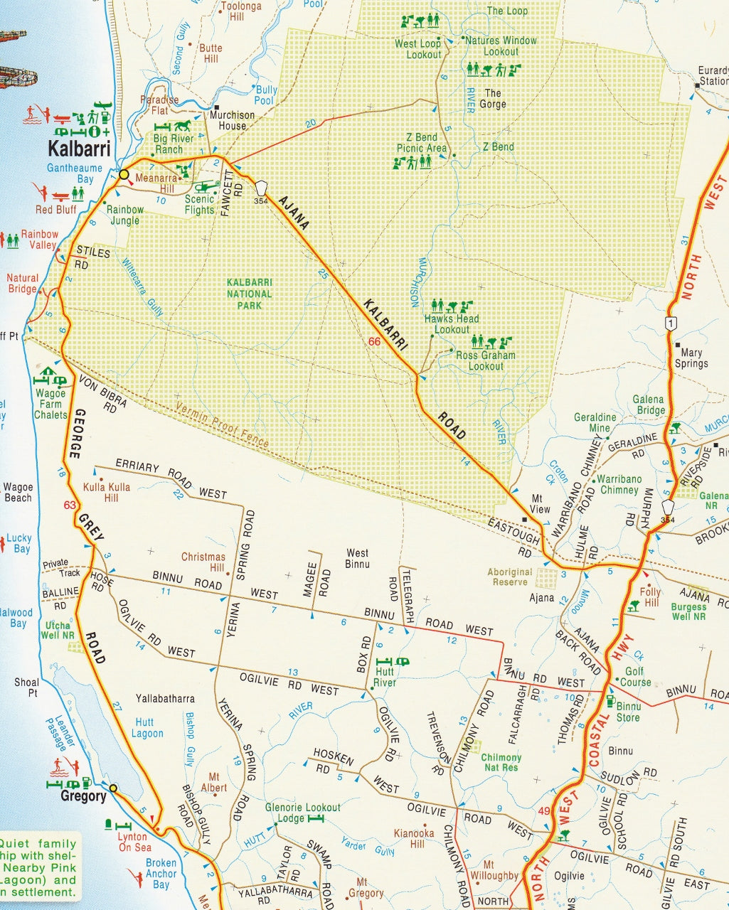
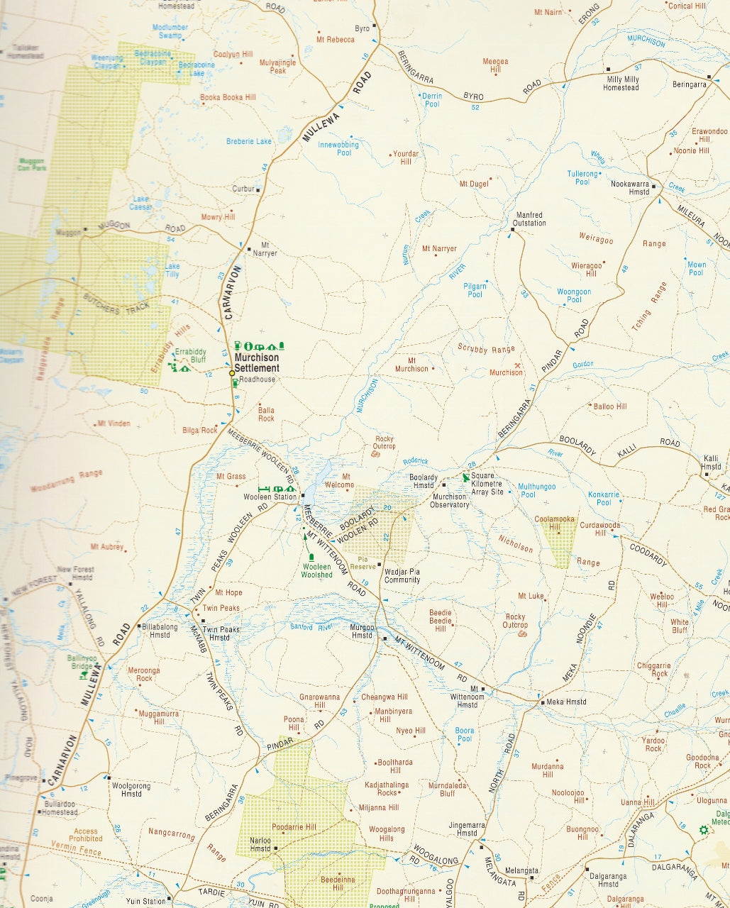
🛣️ Detailed Road and Track Information
The atlas excels in its detailed representation of various routes:
-
Road Types: Includes major highways, minor roads, unsealed roads, old tracks, 4WD-only routes, and walking trails.
-
Intermediate Distances: Displays distances between key points on nearly every road, aiding in travel planning.
-
Topography: Utilises elevation tinting to depict the terrain, providing a visual understanding of the landscape.
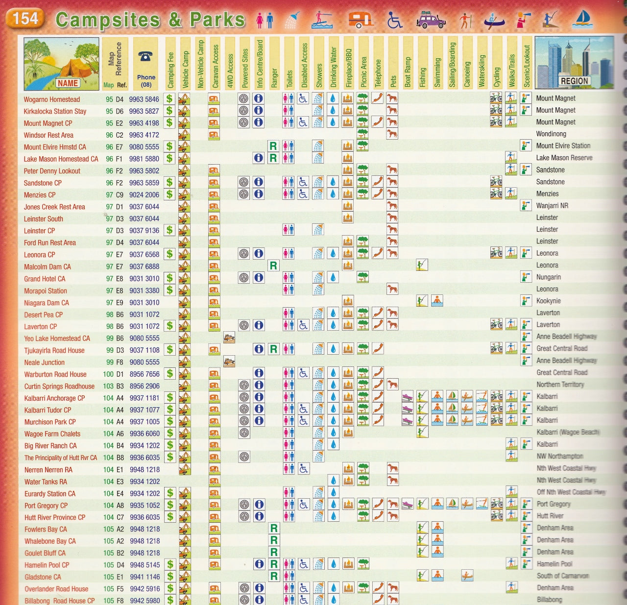
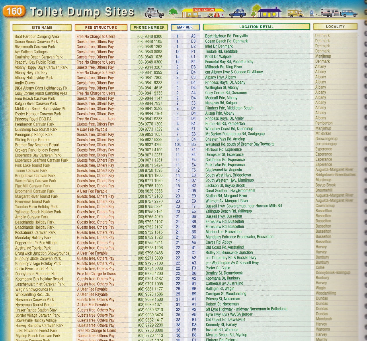
🏕️ Points of Interest and Amenities
Beyond roadways, the atlas highlights numerous features to enhance your journey:
-
Attractions: Identifies various tourist attractions and natural landmarks.
-
Facilities: Marks fuel stops, accommodation options, campsites, rest areas, and fishing spots.
-
Perth Coverage: Includes several pages dedicated to Perth at various scales for urban navigation.
-
Flora and Fauna: Features illustrations showcasing the state's diverse plant and animal life.
-
Climate Data: Provides average monthly temperature and rainfall charts for various regions.
📖 Atlas Specifications
-
Format: Spiral-bound for ease of use.
-
Dimensions: 230 x 303 x 20 mm.
-
Weight: Approximately 1.3 kg.
-
Pages: 254 pages of detailed content.
-
Publication Date: September 2023.
📚 Additional Features
-
Index: An extensive index covering roads, places, geographical features, and national parks.
-
Local Production: Researched, compiled, and printed in Western Australia, ensuring local relevance and accuracy.
-
Endorsement: Endorsed by the 4WD Club of WA, reflecting its utility for off-road enthusiasts.
The QPA 16th Edition atlas is a valuable resource for travellers seeking a reliable and detailed guide to Western Australia's roads and tracks.
If you need further assistance or information on related mapping products, feel free to ask!
Frequently Asked Questions
What does the Roads & Tracks of Western Australia QPA 16th Edition cover?
The Roads & Tracks of Western Australia QPA 16th Edition covers 4WD tracks, camping areas, and travel routes for the region described in the product title. Most 4WD and camping guides in Mapworld's range include GPS coordinates, distance information, difficulty ratings, and notes on fuel stops and emergency contact points.
Is the Roads & Tracks of Western Australia QPA 16th Edition up to date?
Yes, this is the current edition. Mapworld stocks current editions from publishers including Hema Maps, Westprint, and others.
Is this product suitable for remote area travel?
Yes, 4WD maps and guides are designed for remote area navigation and trip planning. They include track conditions, fuel availability, camping spots, and safety information.
Does Mapworld ship the Roads & Tracks of Western Australia QPA 16th Edition across Australia?
Yes, Mapworld ships Australia-wide. Standard shipping is a flat $7 rate, with free standard shipping on orders over $75. Express options are available at checkout. Most orders placed before 2pm AEST on weekdays are dispatched same day.
Related Items


© 2026 Mapworld. Website designed by Genie Media
X