- Australia ▾
- Topographic
▾
- Australia AUSTopo 250k (2025)
- Australia 50k Geoscience maps
- Australia 100k Geoscience maps
- Australia 250k Geoscience maps
- Australia 1:1m Geoscience maps
- New Zealand 50k maps
- New Zealand 250k maps
- New South Wales 25k maps
- New South Wales 50k maps
- New South Wales 100k maps
- Queensland 10k maps
- Queensland 25k maps
- Queensland 50k maps
- Queensland 100k maps
- Compasses
- Software
- GPS Systems
- Orienteering
- International ▾
- Wall Maps
▾
- World
- Australia & New Zealand
- Countries, Continents & Regions
- Historical
- Vintage National Geographic
- Australian Capital Territory
- New South Wales
- Northern Territory
- Queensland
- South Australia
- Tasmania
- Victoria
- Western Australia
- Celestial
- Children's
- Mining & Resources
- Wine Maps
- Healthcare
- Postcode Maps
- Electoral Maps
- Nautical ▾
- Flags
▾
- Australian Flag Sets & Banners
- Flag Bunting
- Handwavers
- Australian National Flags
- Aboriginal Flags
- Torres Strait Islander Flags
- International Flags
- Flagpoles & Accessories
- Australian Capital Territory Flags
- New South Wales Flags
- Northern Territory Flags
- Queensland Flags
- South Australia Flags
- Tasmania Flags
- Victoria Flags
- Western Australia Flags
- Gifts ▾
- Globes ▾
Dear valued customer. Please note that our checkout is not supported by old browsers. Please use a recent browser to access all checkout capabilities


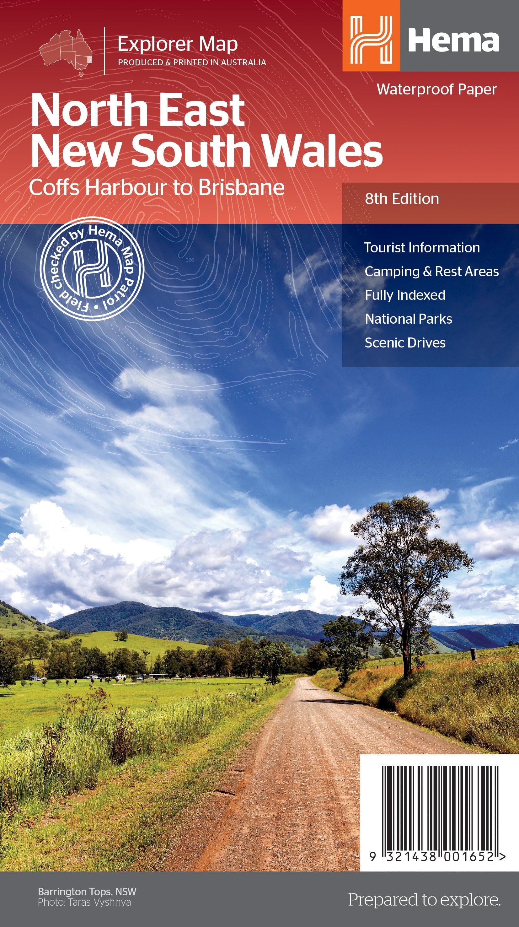
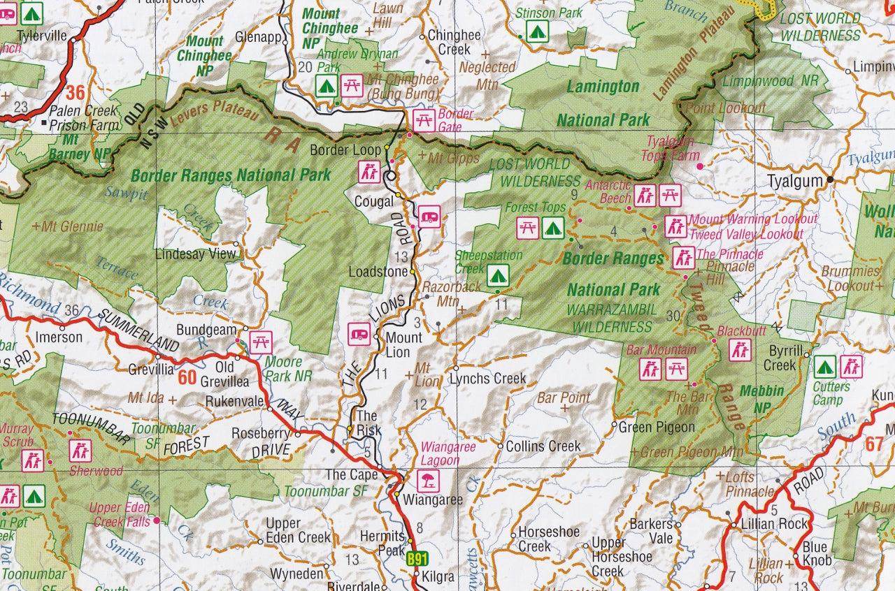
North East New South Wales Hema Map
$14.95
Afterpay is only available for orders between $50.00 and $1000.00 More info
Hema Maps | Double-Sided Touring Map | Waterproof & Tear-Resistant | For Road Trips, Camping & 4WD Exploration
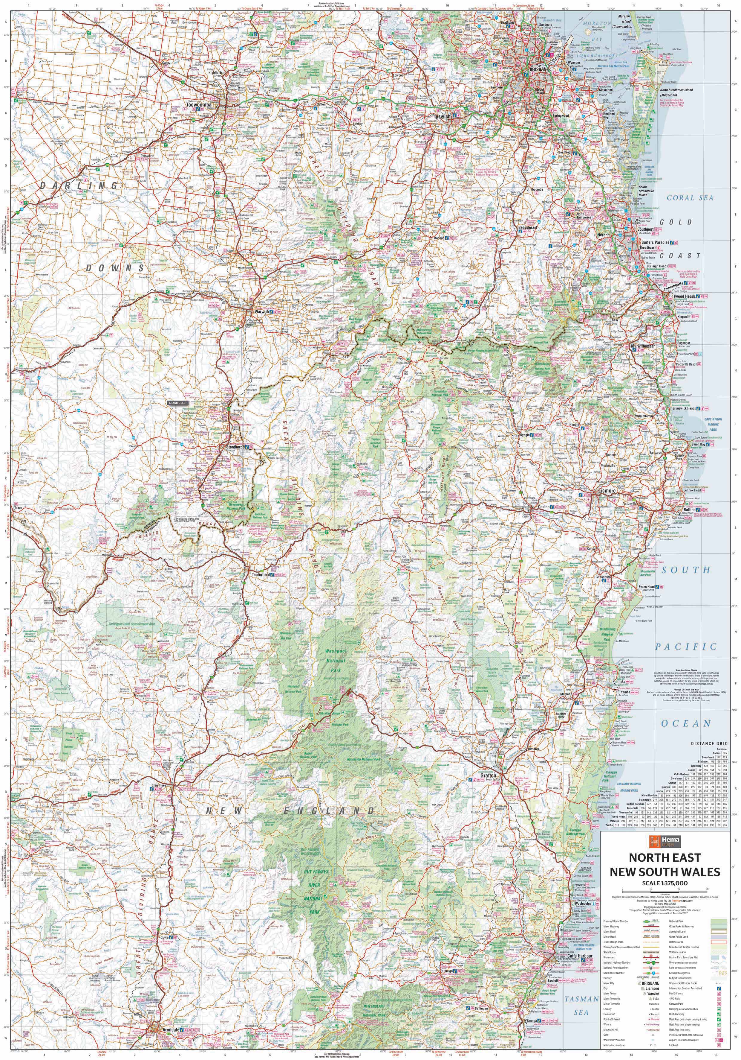
A richly detailed, field-tested touring map that reveals the beauty and diversity of coastal and inland North East New South Wales.
From golden beaches to misty mountain ranges, vibrant hinterland villages to dense national parks, North East NSW is one of Australia’s most captivating touring regions. This 8th Edition map from Hema is your essential guide to unlocking every corner of this enchanting landscape.
Designed for touring enthusiasts, 4WD travellers, campers, and families, this double-sided map balances accuracy and practicality with beautiful cartographic presentation. Whether you're tracing the winding Waterfall Way, settling into a rainforest campsite, or navigating the New England Highlands, this is the map you can trust.
🌄 Regional Coverage
Covers a wide and varied area stretching from Brisbane in the north to Coffs Harbour in the south, and inland to the New England Tablelands. Key destinations and highlights include:
-
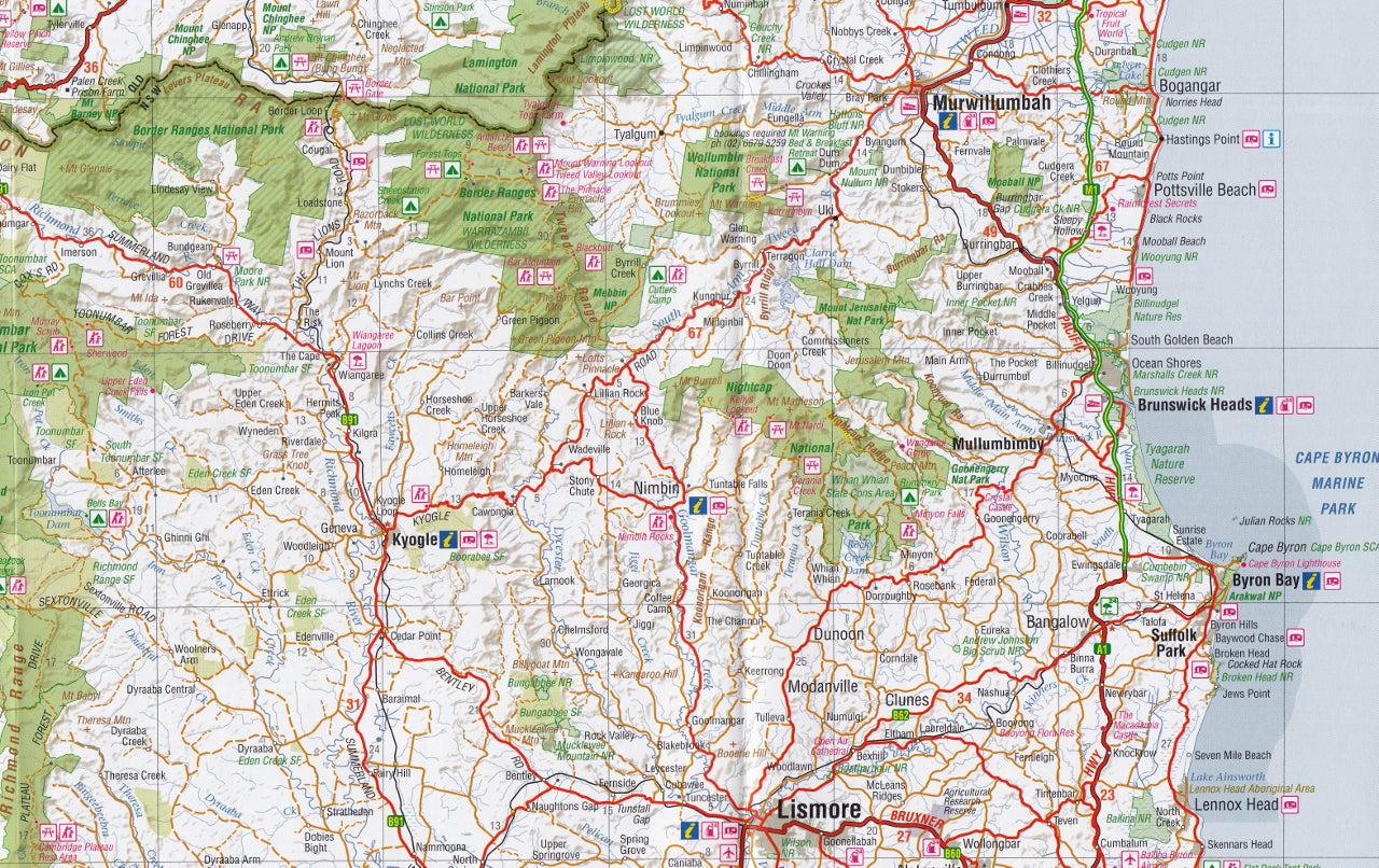
Byron Bay, Ballina, Lismore, and Casino
-
Coffs Harbour, Woolgoolga, and Grafton
-
Armidale, Tenterfield, Glen Innes, and Inverell
-
Dorrigo and the scenic Waterfall Way
-
Nimbin, Kyogle, and the Nightcap Ranges
-
Parts of Southern Queensland and the Gold Coast Hinterland
Features both major highways and smaller backroads, making it ideal for both on-road touring and off-road adventure.
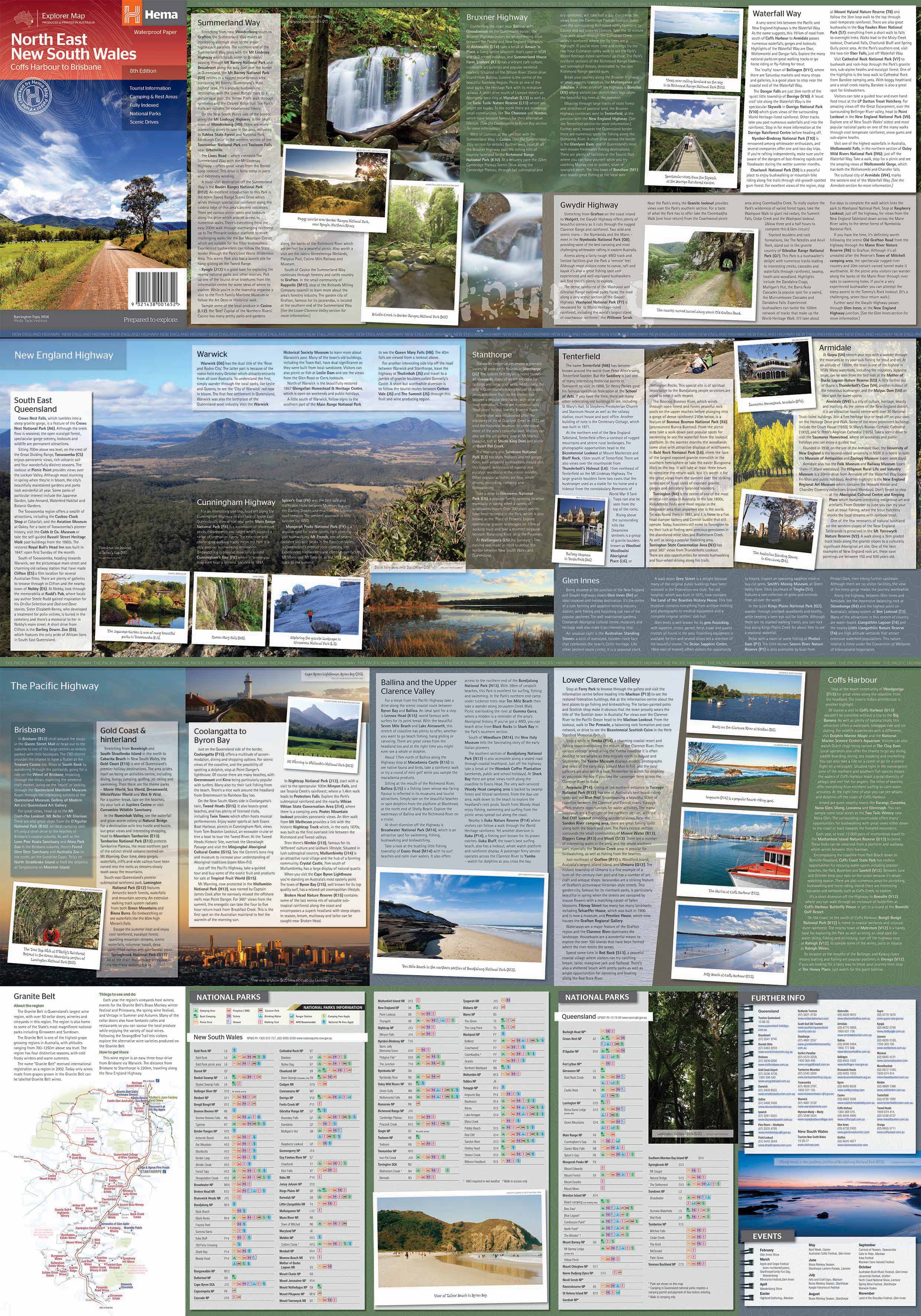
🚗 Touring Features & Routes
Includes the region’s most scenic drives and popular touring corridors, such as:
-
Pacific Highway (A1)
-
Waterfall Way – one of Australia’s most spectacular scenic routes
-
New England Highway
-
Bruxner Highway
-
Gwydir Highway
-
Summerland Way
Each route includes:
-
Road classifications and surface types
-
Distance markers and key junctions
-
Towns, lookouts, and attractions along the way
🏕️ Outdoor Recreation & Travel Information
Whether you're camping, caravanning, or hiking, this map is loaded with practical information to enhance your adventure:
-
⛺ Camping grounds, bush camps, and caravan parks
-
🚻 Visitor centres, rest areas, and roadhouses
-
🌳 National Parks & Nature Reserves, including:
-
Nightcap National Park
-
Dorrigo National Park
-
Gibraltar Range & Washpool
-
Border Ranges, Boonoo Boonoo, and Bald Rock
-
-
🛣️ 4WD-accessible forest tracks and backcountry routes
-
🌊 Clarence, Macleay, and Richmond River systems
-
🐾 Aboriginal cultural sites, historic landmarks, and natural attractions
📐 Map Specifications
| Feature | Details |
|---|---|
| Edition | 8th |
| Publication Date | December 2013 |
| Scale | 1:375,000 |
| Flat Size | 1000 mm (W) × 700 mm (H) |
| Folded Size | 140 mm × 250 mm × 3 mm |
| Material | Waterproof, tear-resistant synthetic paper |
| Weight | Approx. 90g |
| Format | Double-sided full-colour print |
| Publisher | Hema Maps |
| Printed In | Australia |
💧 Optional Lamination Upgrade
For added durability and ease of use in the field, this map is also available in a laminated format, encapsulated between two sheets of 80-micron gloss laminate. Benefits include:
-
✅ Waterproof, dust-proof, and tear-resistant
-
✍️ Writeable with whiteboard or permanent markers
-
🧳 Ideal for repeated use on trips or as a caravan/tabletop planning map
Please note: Folded maps are flattened before lamination, and slight fold lines may remain visible.
🎯 Perfect For
-
🚙 4WD explorers and touring enthusiasts
-
🏕️ Caravaners, grey nomads, and family campers
-
📸 Nature lovers and eco-photographers
-
🥾 Hikers and bushwalkers in World Heritage forests
-
🛻 Adventure travellers navigating the hinterlands
-
🗺️ Schools, councils, and visitor centres
🌟 Why Choose the Hema North East NSW Map?
-
✅ Field-tested by Hema Map Patrol – not just computer-generated
-
✅ Balances touring routes, natural features, and cultural sites
-
✅ Durable, waterproof, and long-lasting – built for real travel
-
✅ Covers one of Australia's most rewarding regions for road trips and eco-tourism
🏞️ Explore the Highlands, Rainforests & Coastline of North East NSW
This map will guide you from the misty tablelands of Armidale, across the lush hinterland valleys and heritage towns of the Great Dividing Range, and down to golden surf beaches and ancient volcanic plateaus.
Plan your route. Discover hidden gems. Travel with Hema.
Frequently Asked Questions
Where can I buy the North East New South Wales Hema Map?
The North East New South Wales Hema Map is available to buy online from Mapworld, Australia's largest map and geographic product retailer, with fast shipping Australia-wide.
Is the North East New South Wales Hema Map in stock at Mapworld?
Mapworld maintains extensive stock across its map range and aims for fast dispatch. Orders placed before 2pm AEST on business days are typically dispatched the same day, with standard and express Australia-wide delivery options available.
What is Mapworld's returns policy?
Mapworld accepts returns on undamaged items in original condition. Contact Mapworld within 90 days of purchase to arrange a return or exchange.
Does Mapworld ship the North East New South Wales Hema Map across Australia?
Yes, Mapworld ships Australia-wide. Standard shipping is a flat $7 rate, with free standard shipping on orders over $75. Express options are available at checkout. Most orders placed before 2pm AEST on weekdays are dispatched same day.
Related Items


© 2026 Mapworld. Website designed by Genie Media
X