- Australia ▾
- Topographic
▾
- Australia 50k Geoscience maps
- Australia 100k Geoscience maps
- Australia 250k Geoscience maps
- Australia 1.1m Geoscience maps
- New Zealand 50k maps
- New Zealand 250k maps
- New South Wales 25k maps
- New South Wales 50k maps
- New South Wales 100k maps
- Queensland 10k maps
- Queensland 25k maps
- Queensland 50k maps
- Queensland 100k maps
- Compasses
- Software
- GPS Systems
- Orienteering
- International ▾
- Wall Maps
▾
- World
- Australia & New Zealand
- Countries, Continents & Regions
- Historical
- Vintage National Geographic
- Australian Capital Territory
- New South Wales
- Northern Territory
- Queensland
- South Australia
- Tasmania
- Victoria
- Western Australia
- Celestial
- Children's
- Mining & Resources
- Wine Maps
- Healthcare
- Postcode Maps
- Electoral Maps
- Nautical ▾
- Flags
▾
- Australian Flag Sets & Banners
- Flag Bunting
- Handwavers
- Australian National Flags
- Aboriginal Flags
- Torres Strait Islander Flags
- International Flags
- Flagpoles & Accessories
- Australian Capital Territory Flags
- New South Wales Flags
- Northern Territory Flags
- Queensland Flags
- South Australia Flags
- Tasmania Flags
- Victoria Flags
- Western Australia Flags
- Gifts ▾
- Globes ▾
Dear valued customer. Please note that our checkout is not supported by old browsers. Please use a recent browser to access all checkout capabilities


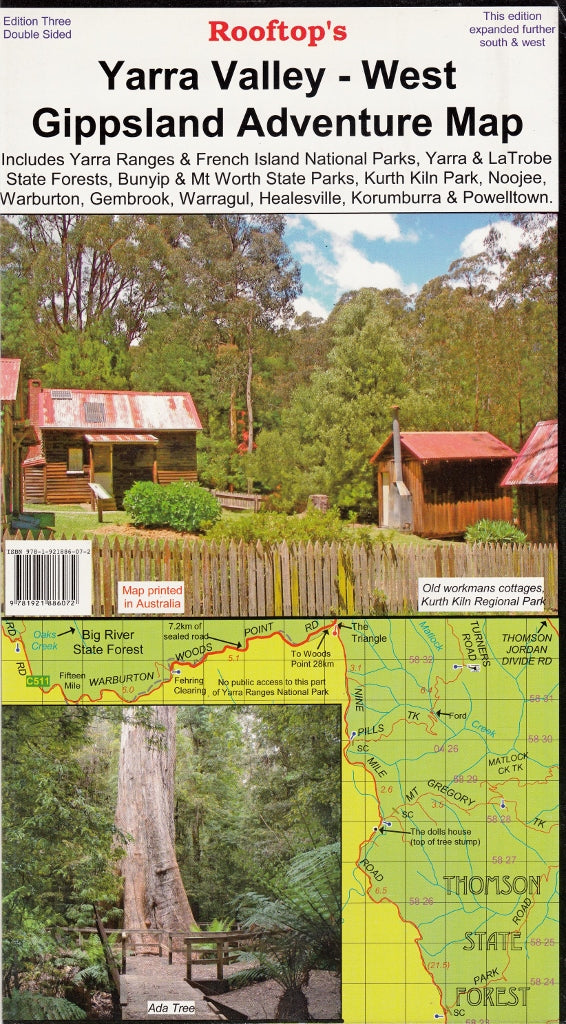
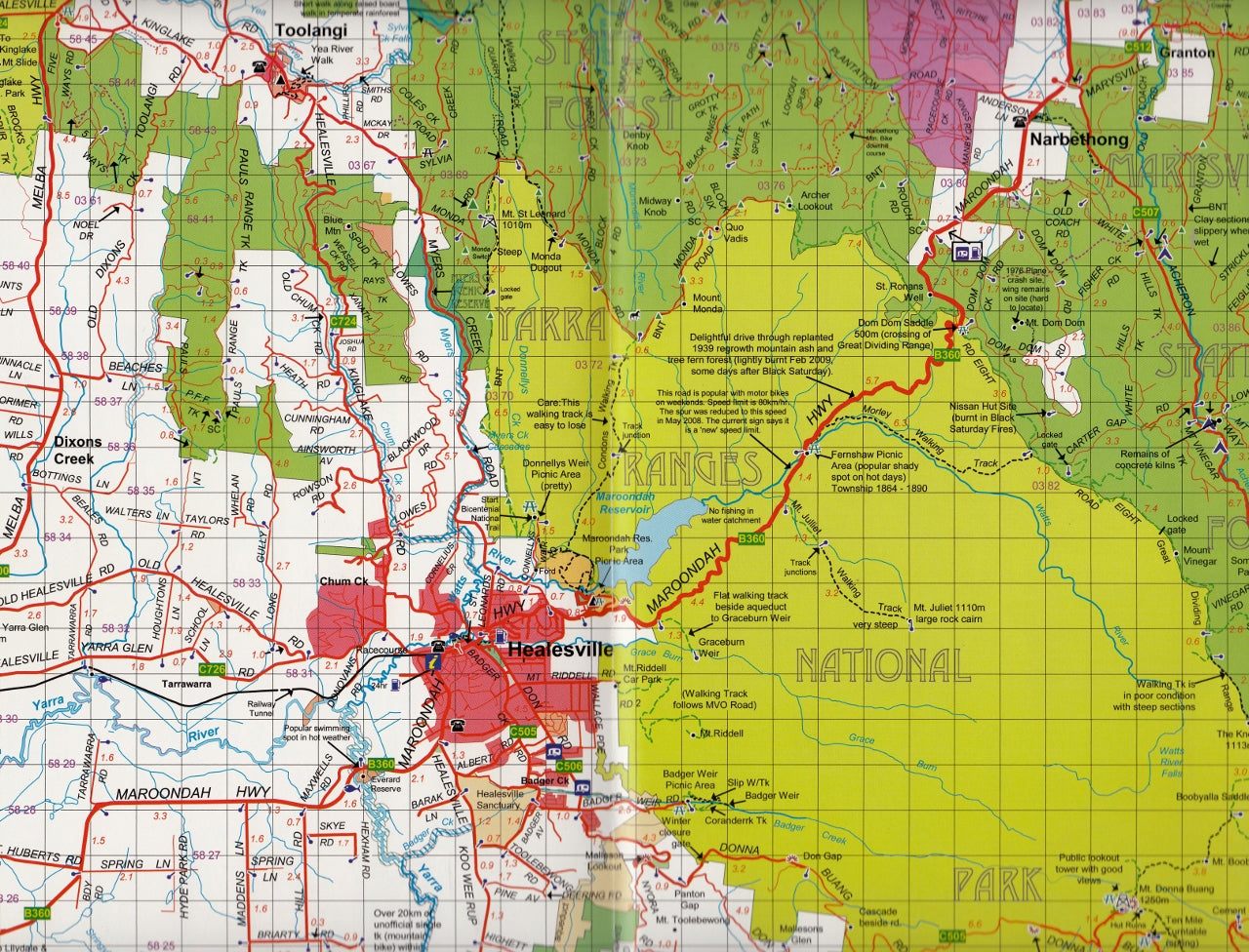
Yarra Valley - West Gippsland Adventure Map Rooftop
$11.95
Afterpay is only available for orders between $50.00 and $1000.00 More info
The Yarra Valley - West Gippsland Adventure Map by Rooftop Maps covers from Marysville, Narbethong and Cumberland Junction in the north to Mount Worth, Pakenham and Trafalgar in the south. It includes Yarra Ranges National Park, Bunyip State Park, Yarra State Forest, Gembrook, Kurth Kiln, Noojee, Neerim South, Warragul, Powelltown and Mount Worth State Park.
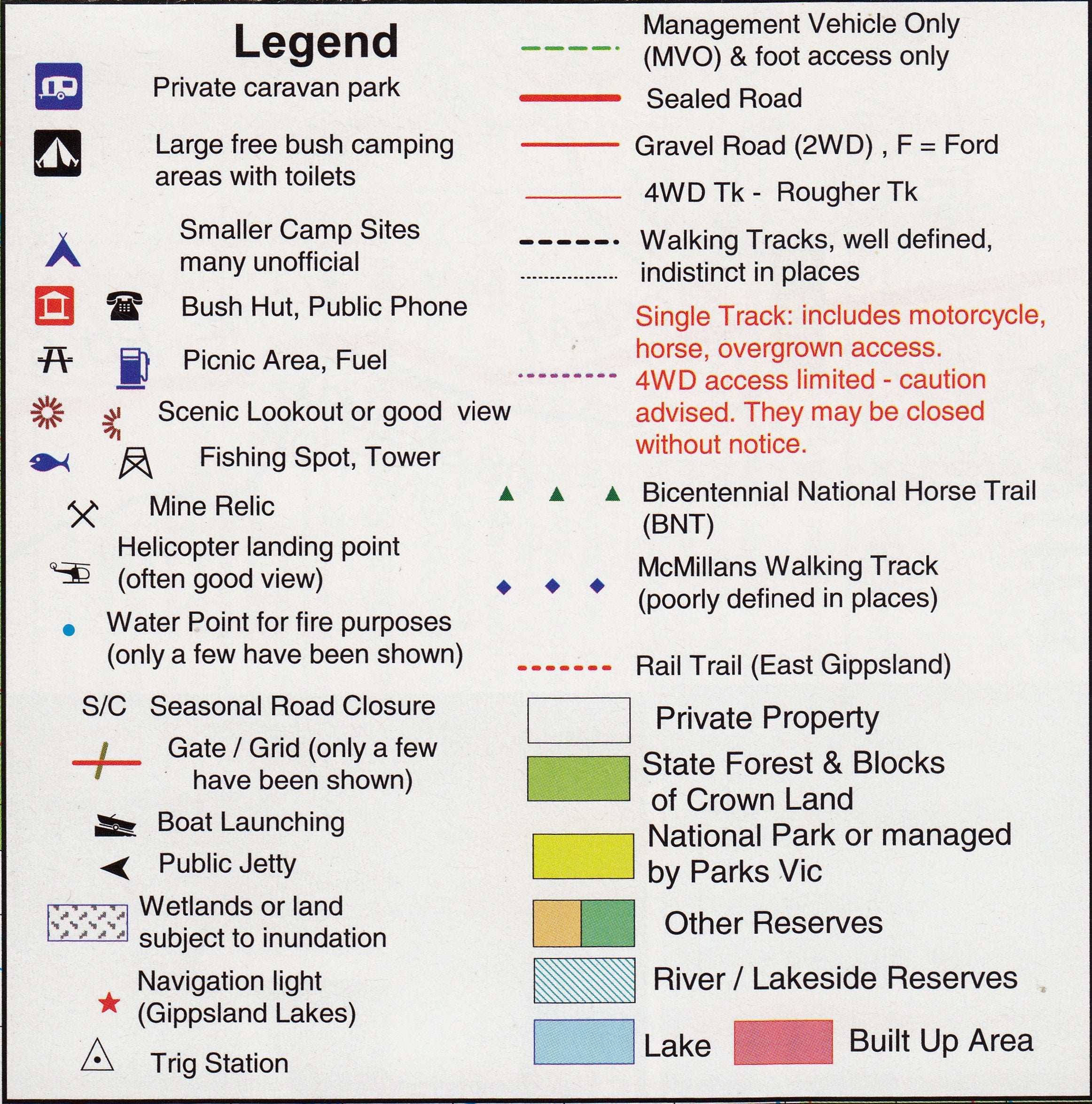
All parks, reserves and state forests are shown and all roads and tracks have been plotted using GPS mapping technology.
Scale is 1:100,000. The reverse of the map has a 1:50,000 scale enlargement titled ' Gembrook - Noojee Forest Activities Map' with contours.
We can also laminate this map, allowing you to draw on it in whiteboard marker or apply our map dots to locations of interest without permanently marking the map. The lamination also makes the map very durable and protects against tears and stains.
Customer Reviews
Based on 2 reviews
Write a review
Related Items


© 2024 Mapworld. Website designed by Genie Media
X