- Australia ▾
- Topographic
▾
- Australia 50k Geoscience maps
- Australia 100k Geoscience maps
- Australia 250k Geoscience maps
- Australia 1.1m Geoscience maps
- New Zealand 50k maps
- New Zealand 250k maps
- New South Wales 25k maps
- New South Wales 50k maps
- New South Wales 100k maps
- Queensland 10k maps
- Queensland 25k maps
- Queensland 50k maps
- Queensland 100k maps
- Compasses
- Software
- GPS Systems
- Orienteering
- International ▾
- Wall Maps
▾
- World
- Australia & New Zealand
- Countries, Continents & Regions
- Historical
- Vintage National Geographic
- Australian Capital Territory
- New South Wales
- Northern Territory
- Queensland
- South Australia
- Tasmania
- Victoria
- Western Australia
- Celestial
- Children's
- Mining & Resources
- Wine Maps
- Healthcare
- Postcode Maps
- Electoral Maps
- Nautical ▾
- Flags
▾
- Australian Flag Sets & Banners
- Flag Bunting
- Handwavers
- Australian National Flags
- Aboriginal Flags
- Torres Strait Islander Flags
- International Flags
- Flagpoles & Accessories
- Australian Capital Territory Flags
- New South Wales Flags
- Northern Territory Flags
- Queensland Flags
- South Australia Flags
- Tasmania Flags
- Victoria Flags
- Western Australia Flags
- Gifts ▾
- Globes ▾
Dear valued customer. Please note that our checkout is not supported by old browsers. Please use a recent browser to access all checkout capabilities


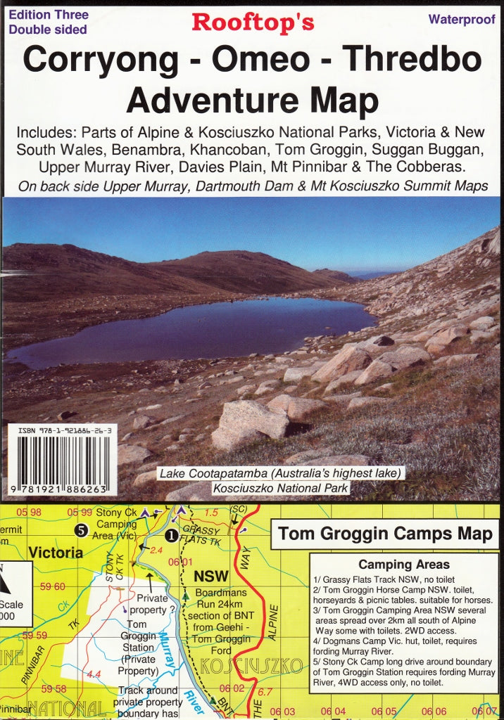
Corryong - Omeo - Thredbo Adventure Map Rooftop
$13.95
Afterpay is only available for orders between $50.00 and $1000.00 More info
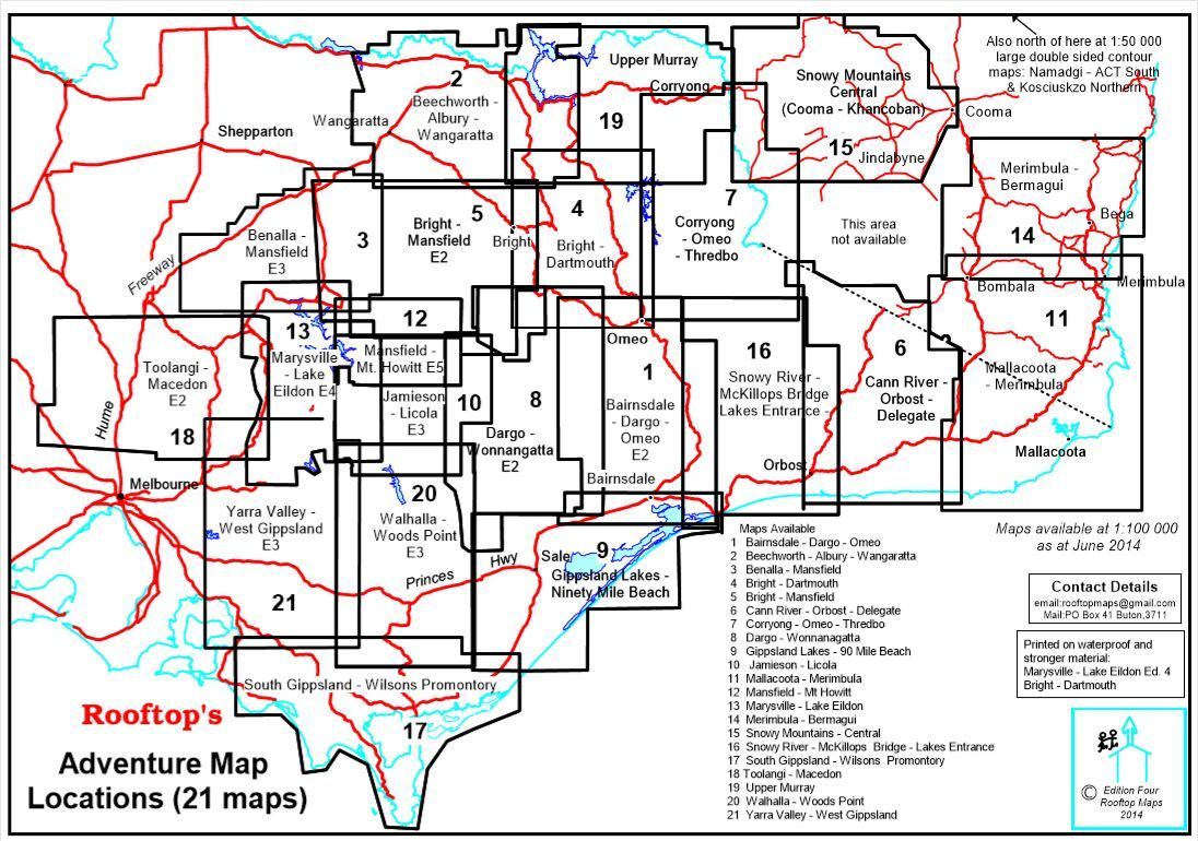
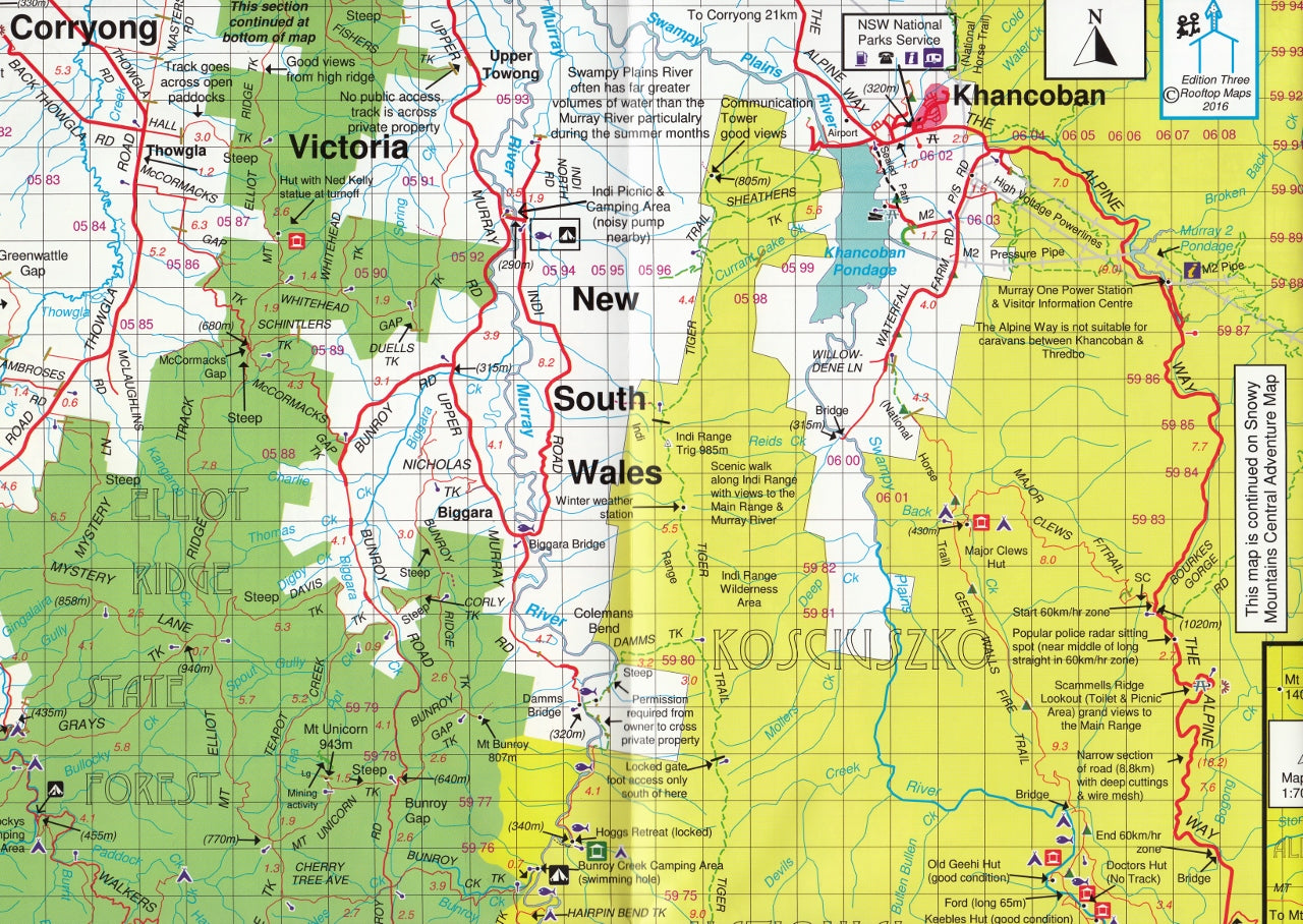
The third edition of the Corryong - Omeo - Thredbo Adventure Map by Rooftop Maps includes Corryong, Khancoban, Nariel, Gibbo, Pinninbar, Tom Groggin, Benambra, Omeo, Taylors Crossing, Glen Dart, The Cobberas, Cowombat Flat, Suggan Buggan, Wulgulmerang, Davies Plain, Upper Murray and Thredbo as well as parts of the Alpine National Park, Kosciuszko National Park and Upper Murray River.
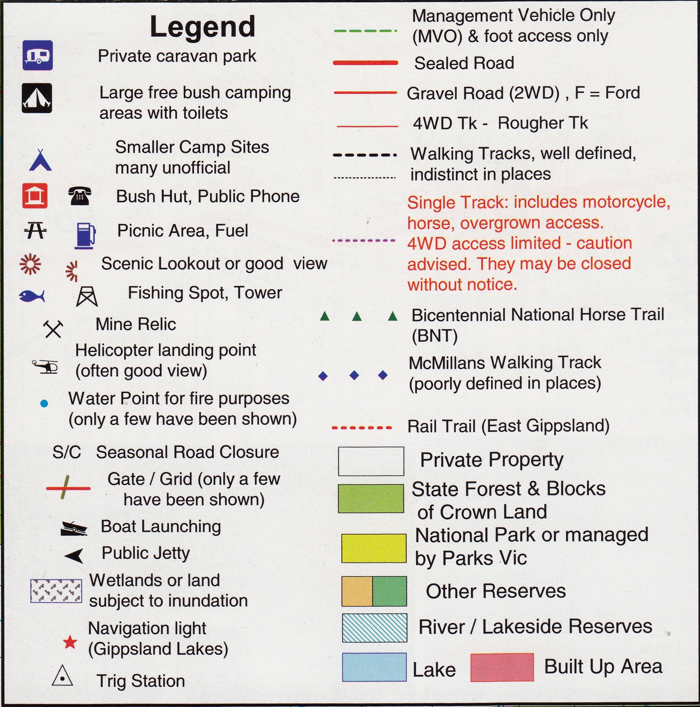
All parks, reserves and state forests are shown and all roads and tracks within the map area have been plotted using GPS mapping technology.
The reverse side features inset maps of Dartmouth Dam, Upper Murray and Mount Kosciuszko Summit Acces.
This map is printed on waterproof paper making it both water and tear resistant perfect for hikers and 4 wheel drivers.
We can also laminate this map, allowing you to draw on it in whiteboard marker or apply our map dots to locations of interest without permanently marking the map. The lamination also makes the map very durable and protects against tears and stains.
Scale: 1:100,000 / 1:50,000 enlargement
Size: 700 mm x 1000 mm
Customer Reviews
Based on 4 reviews
Write a review
Related Items


© 2024 Mapworld. Website designed by Genie Media
X