- Australia ▾
- Topographic
▾
- Australia 50k Geoscience maps
- Australia 100k Geoscience maps
- Australia 250k Geoscience maps
- Australia 1.1m Geoscience maps
- New Zealand 50k maps
- New Zealand 250k maps
- New South Wales 25k maps
- New South Wales 50k maps
- New South Wales 100k maps
- Queensland 10k maps
- Queensland 25k maps
- Queensland 50k maps
- Queensland 100k maps
- Compasses
- Software
- GPS Systems
- Orienteering
- International ▾
- Wall Maps
▾
- World
- Australia & New Zealand
- Countries, Continents & Regions
- Historical
- Vintage National Geographic
- Australian Capital Territory
- New South Wales
- Northern Territory
- Queensland
- South Australia
- Tasmania
- Victoria
- Western Australia
- Celestial
- Children's
- Mining & Resources
- Wine Maps
- Healthcare
- Postcode Maps
- Electoral Maps
- Nautical ▾
- Flags
▾
- Australian Flag Sets & Banners
- Flag Bunting
- Handwavers
- Australian National Flags
- Aboriginal Flags
- Torres Strait Islander Flags
- International Flags
- Flagpoles & Accessories
- Australian Capital Territory Flags
- New South Wales Flags
- Northern Territory Flags
- Queensland Flags
- South Australia Flags
- Tasmania Flags
- Victoria Flags
- Western Australia Flags
- Gifts ▾
- Globes ▾
Dear valued customer. Please note that our checkout is not supported by old browsers. Please use a recent browser to access all checkout capabilities


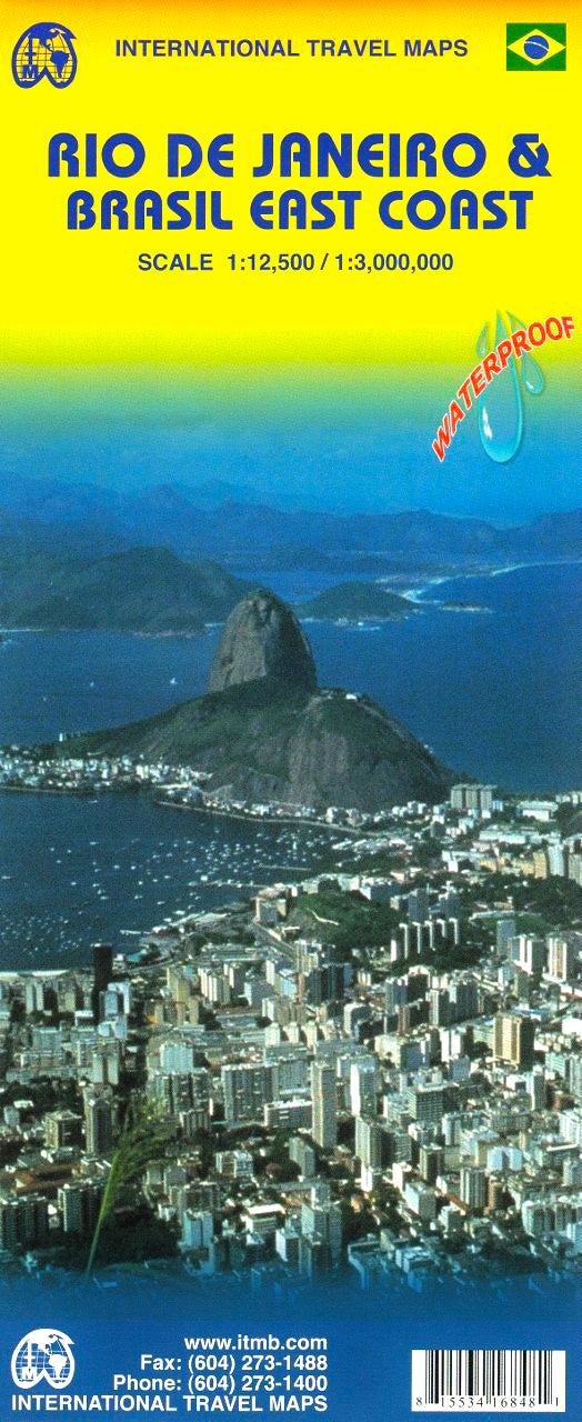
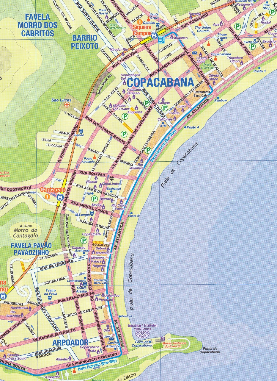
Rio de Janeiro & Brazil East Coast ITMB Map
$24.95
Afterpay is only available for orders between $50.00 and $1000.00 More info
![]()
Rio was the site of the Summer Olympic Games in 2016. As such, it is bound to become even better-known and more visited as the Games approach. The city itself, with its Sugar Loaf Mountain, its carnival atmosphere, and its marvellous beaches, is already the most visited city in South America. This new edition not only updates and adds more information about Rio, and details the Olympic sites, but includes for the first time a major improvement for visitors.
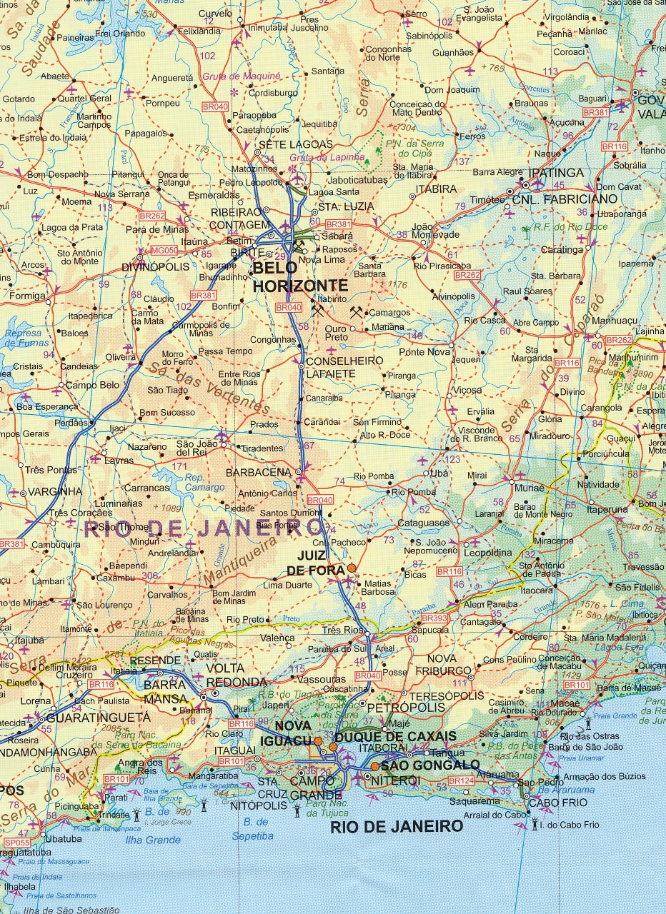
Anyone coming to Rio probably also wants to see the surrounding countryside, but not necessarily all of Brasil, so we have created a detailed map of the coastal area of Brasil, from Porto Alegre in the south to Fortaleza in the north, and extending inland to include Sao Paulo, Brasilia, and Belo Horizonte. An inset map of Sao Paulo is also included.
We can laminate this map, which will allow you to draw on it in whiteboard marker or apply map dots to locations of interest without permanently marking the map. The lamination also makes the map very durable and protects against tears and stains.
To laminate this map we have taken the folded map and flattened it out before encapsulating it in high-quality 80-micron laminate, so please be aware that there will still be slight fold lines visible.
Scale: 1:12,500 / 1:3,000,000
Size: 690 mm x 1000 mm
Related Items


© 2024 Mapworld. Website designed by Genie Media
X