- Australia ▾
- Topographic
▾
- Australia 50k Geoscience maps
- Australia 100k Geoscience maps
- Australia 250k Geoscience maps
- Australia 1.1m Geoscience maps
- New Zealand 50k maps
- New Zealand 250k maps
- New South Wales 25k maps
- New South Wales 50k maps
- New South Wales 100k maps
- Queensland 10k maps
- Queensland 25k maps
- Queensland 50k maps
- Queensland 100k maps
- Compasses
- Software
- GPS Systems
- Orienteering
- International ▾
- Wall Maps
▾
- World
- Australia & New Zealand
- Countries, Continents & Regions
- Historical
- Vintage National Geographic
- Australian Capital Territory
- New South Wales
- Northern Territory
- Queensland
- South Australia
- Tasmania
- Victoria
- Western Australia
- Celestial
- Children's
- Mining & Resources
- Wine Maps
- Healthcare
- Postcode Maps
- Electoral Maps
- Nautical ▾
- Flags
▾
- Australian Flag Sets & Banners
- Flag Bunting
- Handwavers
- Australian National Flags
- Aboriginal Flags
- Torres Strait Islander Flags
- International Flags
- Flagpoles & Accessories
- Australian Capital Territory Flags
- New South Wales Flags
- Northern Territory Flags
- Queensland Flags
- South Australia Flags
- Tasmania Flags
- Victoria Flags
- Western Australia Flags
- Gifts ▾
- Globes ▾
Dear valued customer. Please note that our checkout is not supported by old browsers. Please use a recent browser to access all checkout capabilities


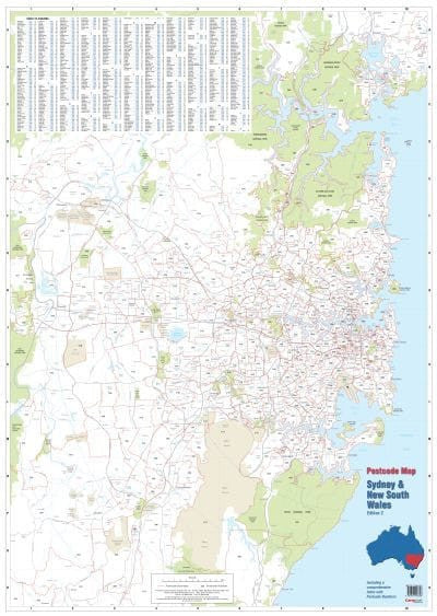
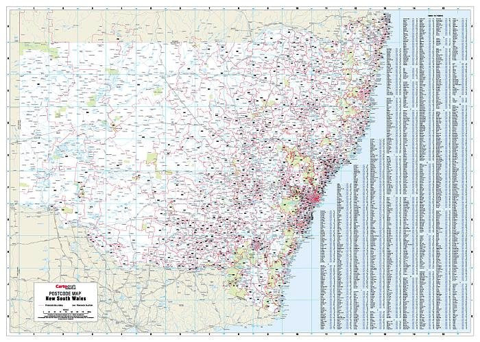

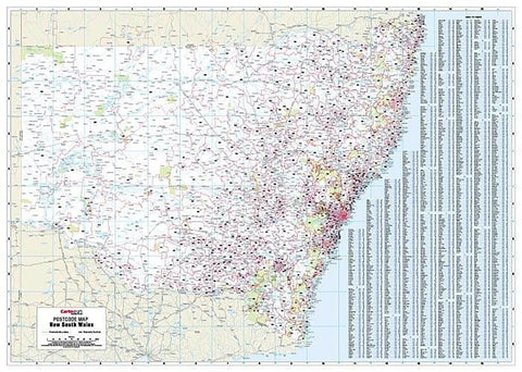
Sydney & New South Wales Postcode Laminated Wall Map 788 x 1110mm
$99.95
or make 4 interest-free payments of
$24.99 AUD
fortnightly with
![]() More info
More info
![]()
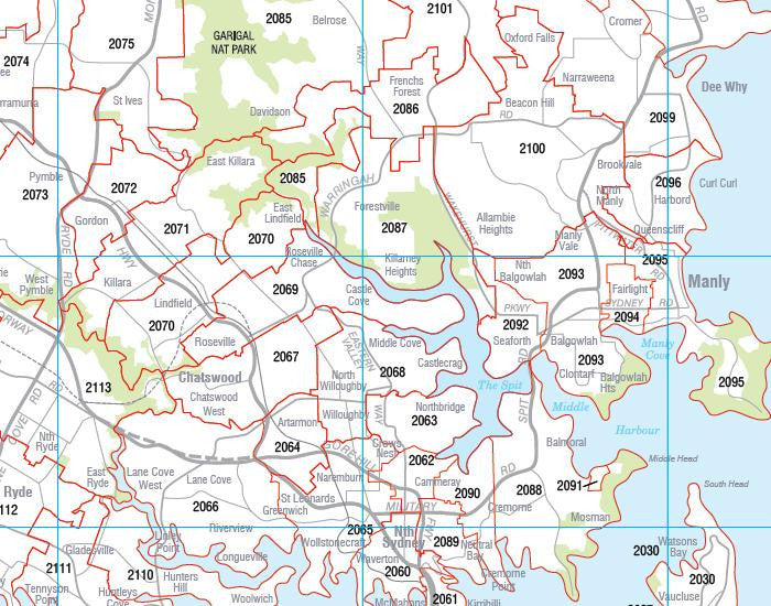
This postcode map of Sydney & New South Wales by Cartodraft is a double-sided laminated map, which clearly shows postcode boundaries and postcode numbers.
This is the only map which shows postcodes and postcode boundaries at state level.
The map is comprehensively indexed with an easy to read list of town names and their postcodes.
Featuring a durable "write and wipe" surface the lamination allows you to place Mark-It-Dots to highlight locations of interest.
This postcode map is the perfect planning tool for any business.
Size 788mm x 1110mm
Related Items


© 2024 Mapworld. Website designed by Genie Media
X