- Australia ▾
- Topographic
▾
- Australia 50k Geoscience maps
- Australia 100k Geoscience maps
- Australia 250k Geoscience maps
- Australia 1.1m Geoscience maps
- New Zealand 50k maps
- New Zealand 250k maps
- New South Wales 25k maps
- New South Wales 50k maps
- New South Wales 100k maps
- Queensland 10k maps
- Queensland 25k maps
- Queensland 50k maps
- Queensland 100k maps
- Compasses
- Software
- GPS Systems
- Orienteering
- International ▾
- Wall Maps
▾
- World
- Australia & New Zealand
- Countries, Continents & Regions
- Historical
- Vintage National Geographic
- Australian Capital Territory
- New South Wales
- Northern Territory
- Queensland
- South Australia
- Tasmania
- Victoria
- Western Australia
- Celestial
- Children's
- Mining & Resources
- Wine Maps
- Healthcare
- Postcode Maps
- Electoral Maps
- Nautical ▾
- Flags
▾
- Australian Flag Sets & Banners
- Flag Bunting
- Handwavers
- Australian National Flags
- Aboriginal Flags
- Torres Strait Islander Flags
- International Flags
- Flagpoles & Accessories
- Australian Capital Territory Flags
- New South Wales Flags
- Northern Territory Flags
- Queensland Flags
- South Australia Flags
- Tasmania Flags
- Victoria Flags
- Western Australia Flags
- Gifts ▾
- Globes ▾
Dear valued customer. Please note that our checkout is not supported by old browsers. Please use a recent browser to access all checkout capabilities


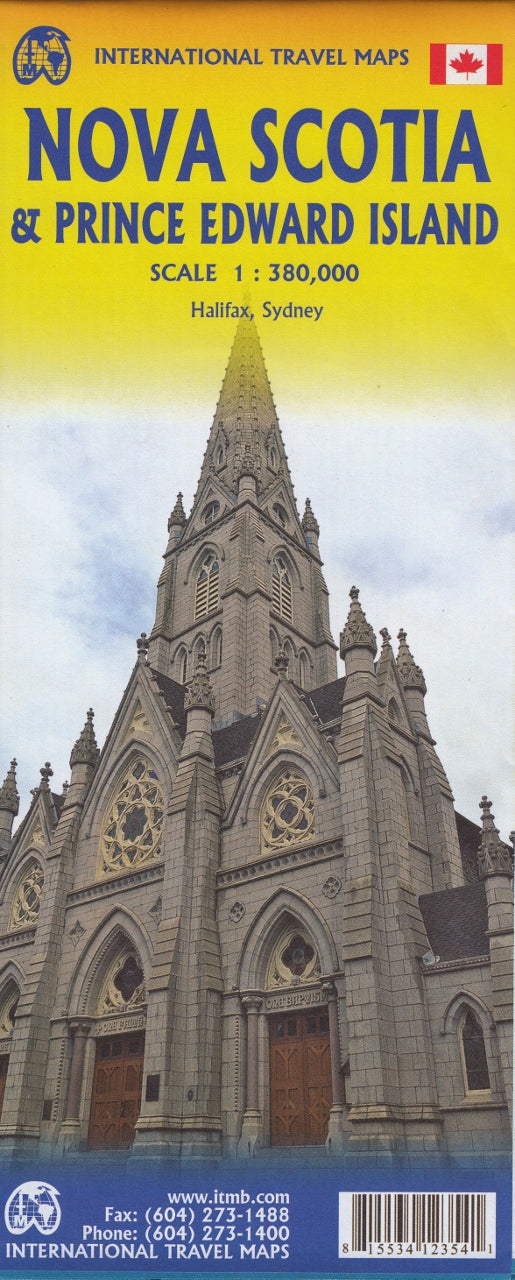
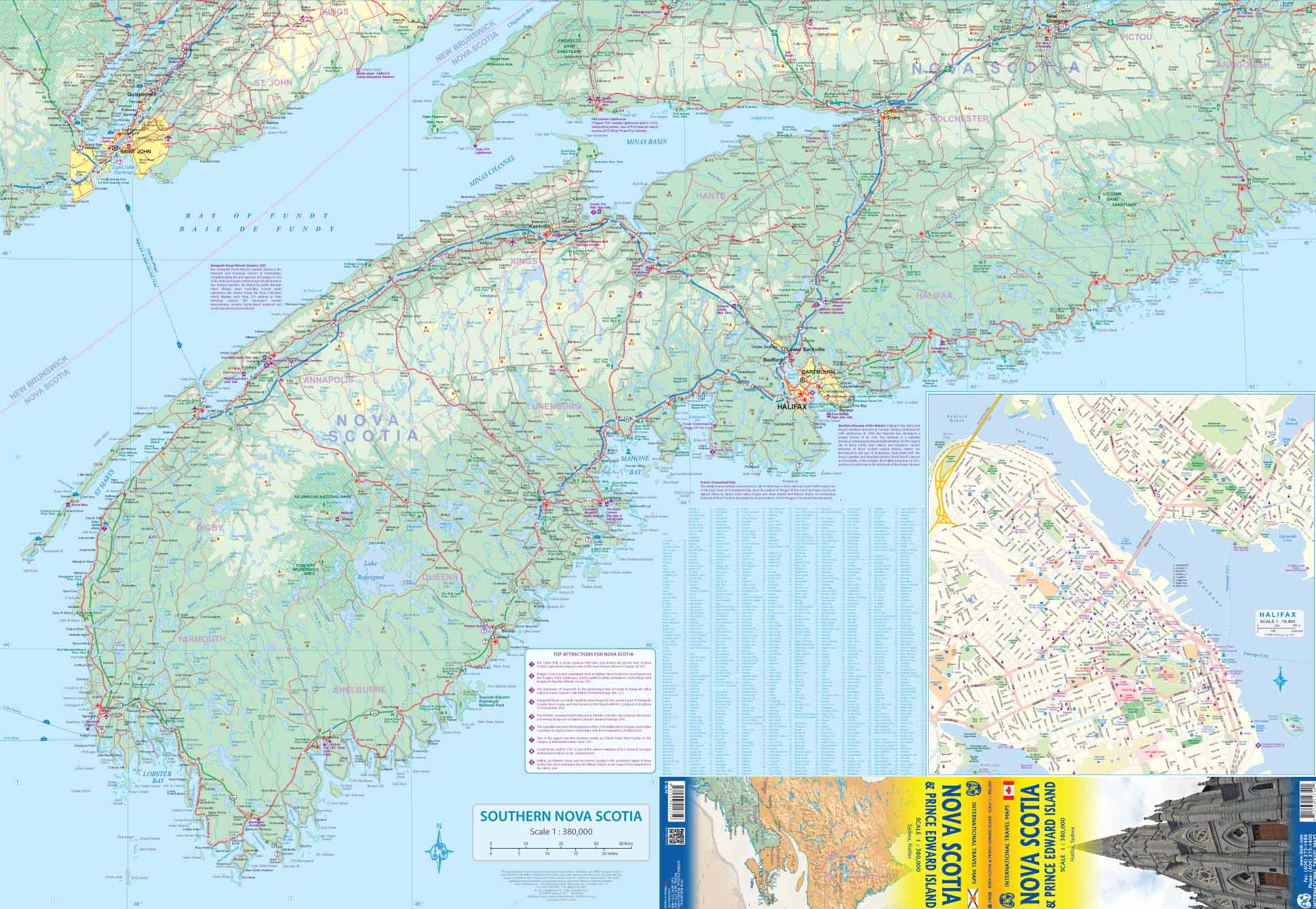
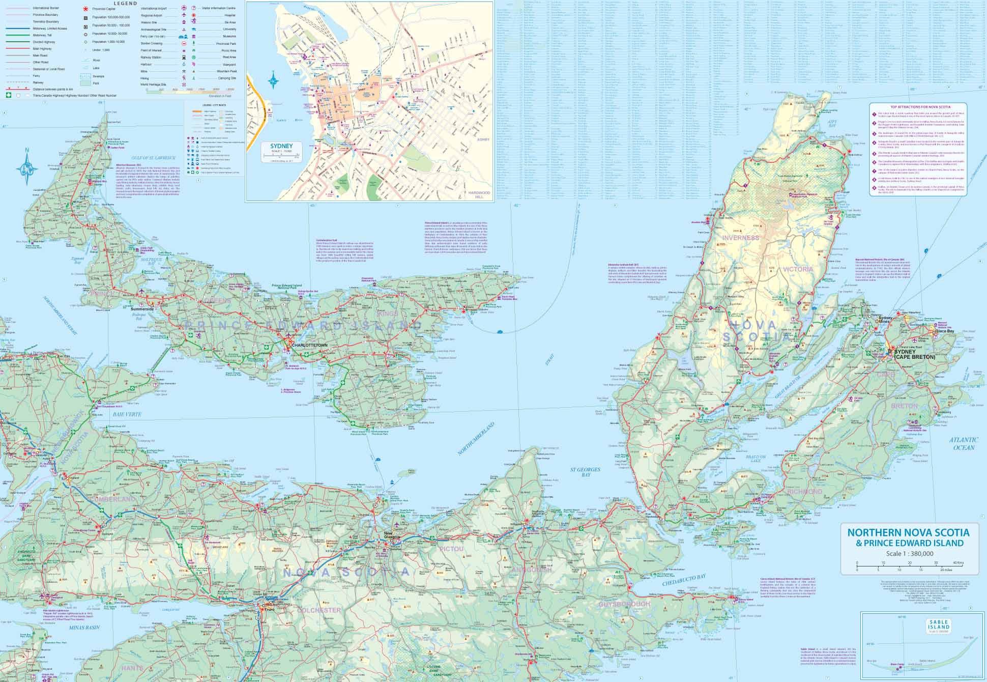
Nova Scotia & Prince Edward Island ITMB Map
$24.95
Afterpay is only available for orders between $50.00 and $1000.00 More info
![]()
Nova Scotia is one of the most historic provinces of Canada, having become British as a result of military conquest in the 1740s. Initially, the British distrusted the Acadian settlers and moved many of them to French settlements in Louisiana, which was then a huge area of land. Some of the Acadians stayed in the South, becoming known as 'Cajuns'; others eventually found their way back north. The fortress of Louisburg, on Cape Breton, was state of the art for its time, but was seized by the British anyway and used throughout the American revolutionary war as a bastion of British strength. The fortress has been restored and is now a national monument. Luneburg, and Halifax are both very interesting cities to visit, and Peggy's Cove is probably in more people's photo albums than any place in North America, outside of Niagara Falls. This is an excellent map as well to portray Canada's smallest province, Prince Edward Island, the 'home' of both Canadian confederation and of the famous Anne of Green Gables, the fictional heroine of Lucy Maud Montgomery's novels.
Scale 1:380,000
Size: 690mm x 1000mm
Customer Reviews
Based on 1 review
Write a review
Related Items


© 2024 Mapworld. Website designed by Genie Media
X