- Australia ▾
- Topographic
▾
- Australia 50k Geoscience maps
- Australia 100k Geoscience maps
- Australia 250k Geoscience maps
- Australia 1.1m Geoscience maps
- New Zealand 50k maps
- New Zealand 250k maps
- New South Wales 25k maps
- New South Wales 50k maps
- New South Wales 100k maps
- Queensland 10k maps
- Queensland 25k maps
- Queensland 50k maps
- Queensland 100k maps
- Compasses
- Software
- GPS Systems
- Orienteering
- International ▾
- Wall Maps
▾
- World
- Australia & New Zealand
- Countries, Continents & Regions
- Historical
- Vintage National Geographic
- Australian Capital Territory
- New South Wales
- Northern Territory
- Queensland
- South Australia
- Tasmania
- Victoria
- Western Australia
- Celestial
- Children's
- Mining & Resources
- Wine Maps
- Healthcare
- Postcode Maps
- Electoral Maps
- Nautical ▾
- Flags
▾
- Australian Flag Sets & Banners
- Flag Bunting
- Handwavers
- Australian National Flags
- Aboriginal Flags
- Torres Strait Islander Flags
- International Flags
- Flagpoles & Accessories
- Australian Capital Territory Flags
- New South Wales Flags
- Northern Territory Flags
- Queensland Flags
- South Australia Flags
- Tasmania Flags
- Victoria Flags
- Western Australia Flags
- Gifts ▾
- Globes ▾
Dear valued customer. Please note that our checkout is not supported by old browsers. Please use a recent browser to access all checkout capabilities


Kentucky National Geographic Folded Map
$26.95
Afterpay is only available for orders between $50.00 and $1000.00 More info
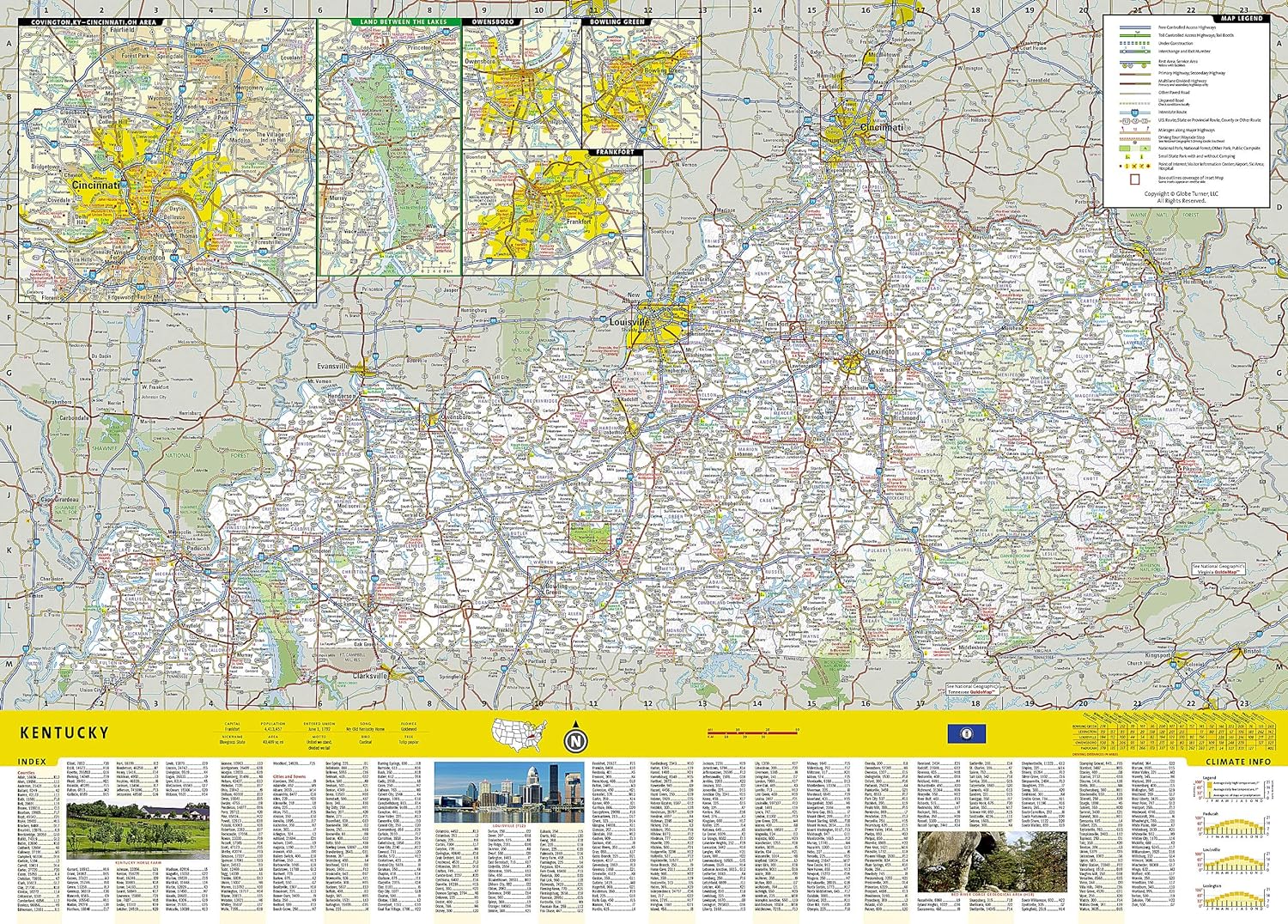
Waterproof Tear-Resistant Travel Map
Expertly researched and loaded with helpful information, National Geographic's Kentucky Guide Map is a must-have for travelers exploring "The Bluegrass State." Cities and towns are easy to find with the map's helpful index. Highways, roadways, toll roads, scenic routes, and other roads are clearly designated. Distances in miles are noted on major highways so travelers can easily plan their best route. In addition to a state map, inset maps provide detail on the Covington, KY-Cincinnati, OH Area; Land Between the Lakes; Owensboro; Bowling Green; Frankfort, Louisville and Lexington.
Additional information and maps feature the recreation activities available in Mammoth Cave National Park and the attractions along the Kentucky Heartland scenic drive which stretches from Lexington to Harrodsburg. National and state parks, public campsites, visitor information centers, airports, ski areas, hospitals, and more are noted. A handy chart of park service sites and climate information are also included.
Every State Guide Map is printed on durable synthetic paper, making them waterproof, tear-resistant and tough capable of withstanding the rigors of any kind of travel.
THIS MAP IS ORDER ON DEMAND. PLEASE ALLOW 7-10 WORKING DAYS FOR DELIVERY.
Related Items


© 2024 Mapworld. Website designed by Genie Media
X