- Australia ▾
- Topographic
▾
- Australia 50k Geoscience maps
- Australia 100k Geoscience maps
- Australia 250k Geoscience maps
- Australia 1.1m Geoscience maps
- New Zealand 50k maps
- New Zealand 250k maps
- New South Wales 25k maps
- New South Wales 50k maps
- New South Wales 100k maps
- Queensland 10k maps
- Queensland 25k maps
- Queensland 50k maps
- Queensland 100k maps
- Compasses
- Software
- GPS Systems
- Orienteering
- International ▾
- Wall Maps
▾
- World
- Australia & New Zealand
- Countries, Continents & Regions
- Historical
- Vintage National Geographic
- Australian Capital Territory
- New South Wales
- Northern Territory
- Queensland
- South Australia
- Tasmania
- Victoria
- Western Australia
- Celestial
- Children's
- Mining & Resources
- Wine Maps
- Healthcare
- Postcode Maps
- Electoral Maps
- Nautical ▾
- Flags
▾
- Australian Flag Sets & Banners
- Flag Bunting
- Handwavers
- Australian National Flags
- Aboriginal Flags
- Torres Strait Islander Flags
- International Flags
- Flagpoles & Accessories
- Australian Capital Territory Flags
- New South Wales Flags
- Northern Territory Flags
- Queensland Flags
- South Australia Flags
- Tasmania Flags
- Victoria Flags
- Western Australia Flags
- Gifts ▾
- Globes ▾
Dear valued customer. Please note that our checkout is not supported by old browsers. Please use a recent browser to access all checkout capabilities


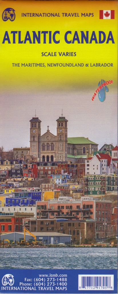
Atlantic Canada ITMB Map
$24.95
Afterpay is only available for orders between $50.00 and $1000.00 More info
![]()
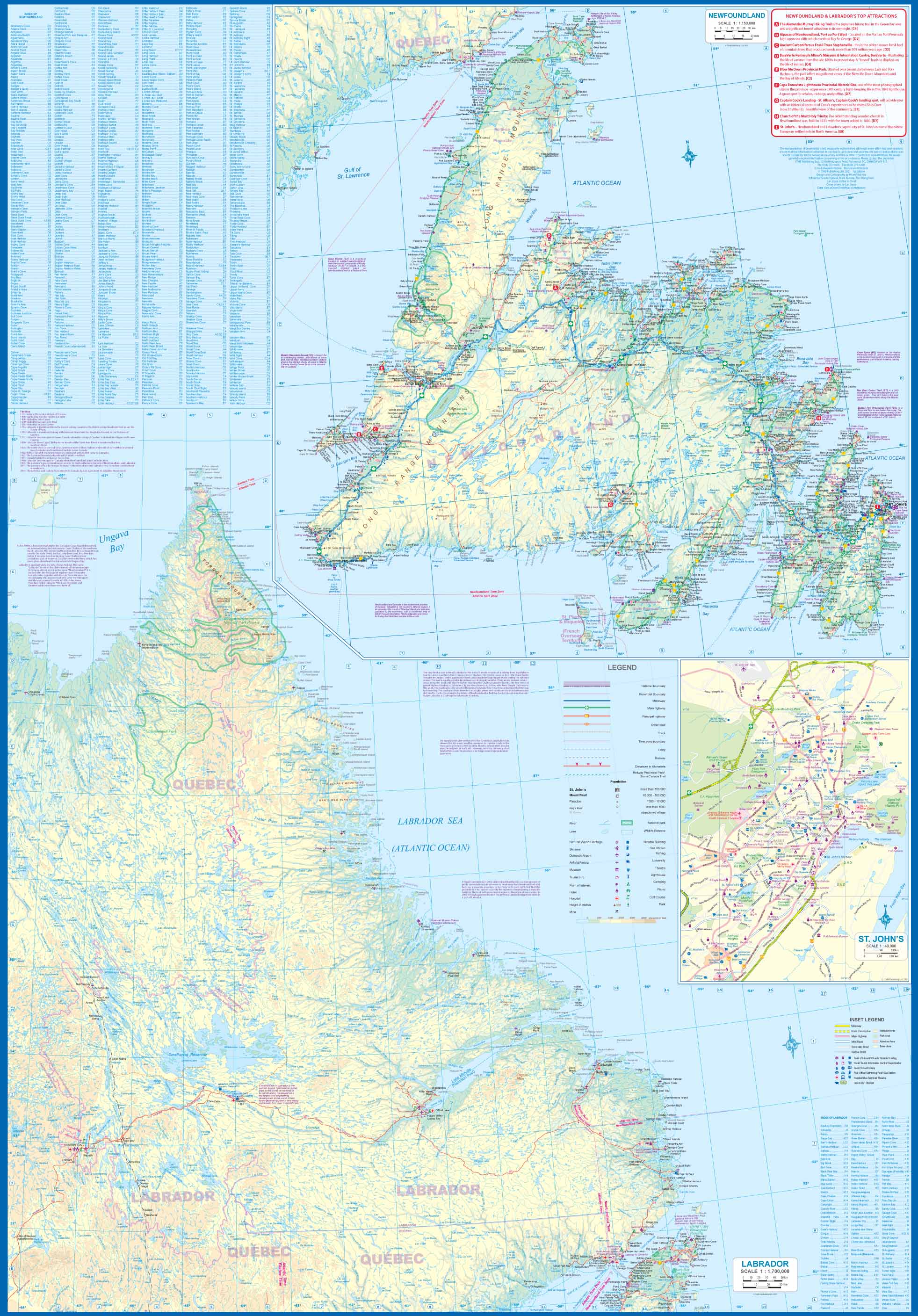
On waterproof paper The first edition was published in 2000 using artwork under licence. This edition uses original ITMB artwork. Side 1 cover Nova Scotia, New Brunswick, and Price Edward Island as well as Quebec's Magdalen Islands at a scale of 1:800,000. This side also includes the Top 10 Attractions of the three provinces. The second side is devoted to the Canadian Province of Newfoundland and Labrador, with the much smaller island portion being a half-page inset at 1:150,000 scale and the larger mainland portion being at 1:1,700,000. The northernmost tip of Quebec/Labrador belongs to Nunavut. St.Pierre et Miquelon, a French overseas possession just south of Newfoundland Island, is also included, as well as the map's only urban inset, historic St.John's, one of North America's oldest cities. The map also includes a listing of 9 Top Attractions. ITMB also publishes maps of the individual provinces, but the advantages of this regional map is that it combines together four interesting parts of Canada on to one sheet, ideal for someone making a grand circle trip. It is printed on durable, waterproof, decomposable stone paper.
Scale 1:1,300,000
Size: 690mm x 1000mm
Customer Reviews
Based on 1 review
Write a review
Related Items


© 2024 Mapworld. Website designed by Genie Media
X