- Australia ▾
- Topographic
▾
- Australia 50k Geoscience maps
- Australia 100k Geoscience maps
- Australia 250k Geoscience maps
- Australia 1.1m Geoscience maps
- New Zealand 50k maps
- New Zealand 250k maps
- New South Wales 25k maps
- New South Wales 50k maps
- New South Wales 100k maps
- Queensland 10k maps
- Queensland 25k maps
- Queensland 50k maps
- Queensland 100k maps
- Compasses
- Software
- GPS Systems
- Orienteering
- International ▾
- Wall Maps
▾
- World
- Australia & New Zealand
- Countries, Continents & Regions
- Historical
- Vintage National Geographic
- Australian Capital Territory
- New South Wales
- Northern Territory
- Queensland
- South Australia
- Tasmania
- Victoria
- Western Australia
- Celestial
- Children's
- Mining & Resources
- Wine Maps
- Healthcare
- Postcode Maps
- Electoral Maps
- Nautical ▾
- Flags
▾
- Australian Flag Sets & Banners
- Flag Bunting
- Handwavers
- Australian National Flags
- Aboriginal Flags
- Torres Strait Islander Flags
- International Flags
- Flagpoles & Accessories
- Australian Capital Territory Flags
- New South Wales Flags
- Northern Territory Flags
- Queensland Flags
- South Australia Flags
- Tasmania Flags
- Victoria Flags
- Western Australia Flags
- Gifts ▾
- Globes ▾
Dear valued customer. Please note that our checkout is not supported by old browsers. Please use a recent browser to access all checkout capabilities


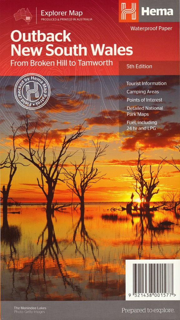
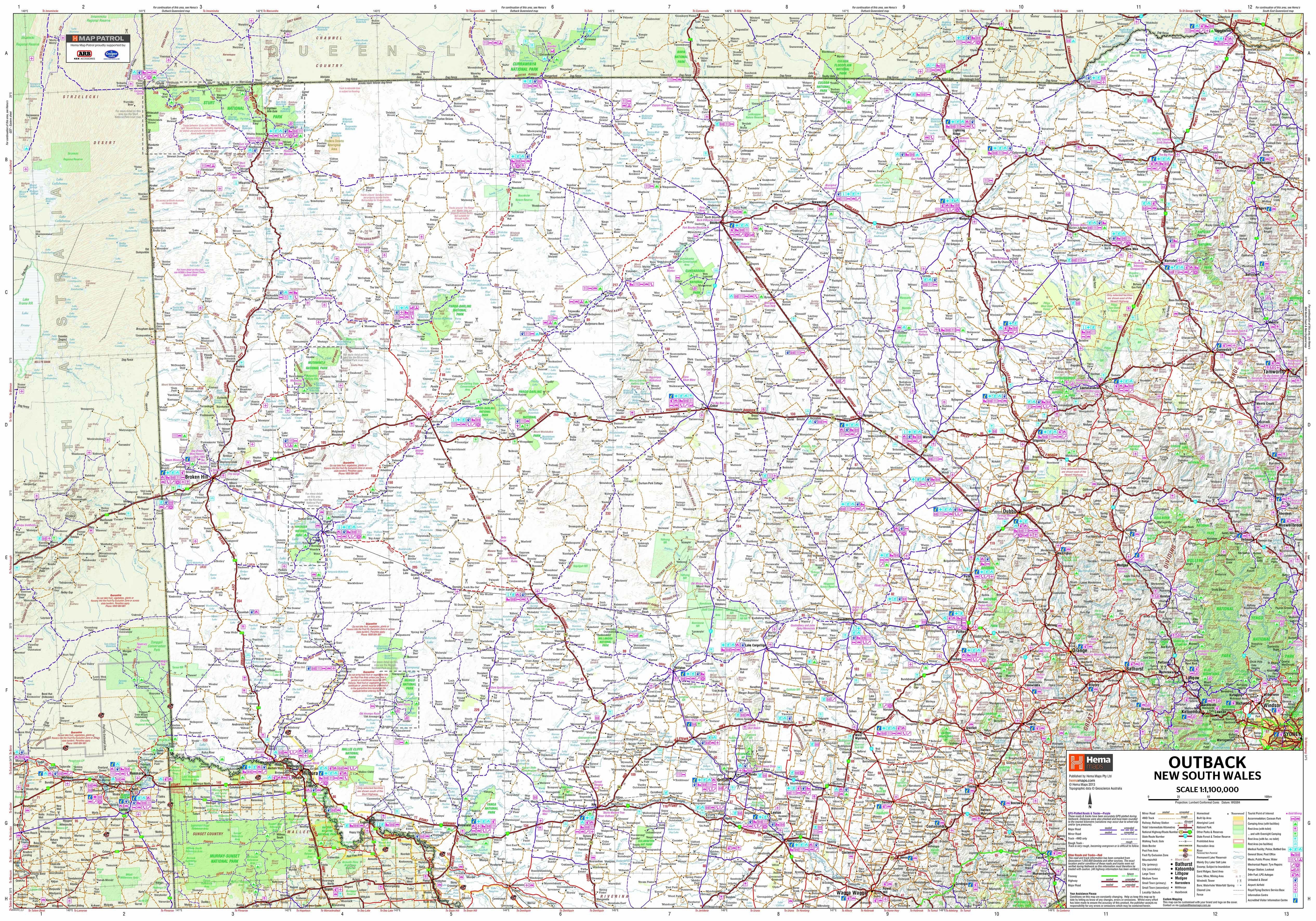
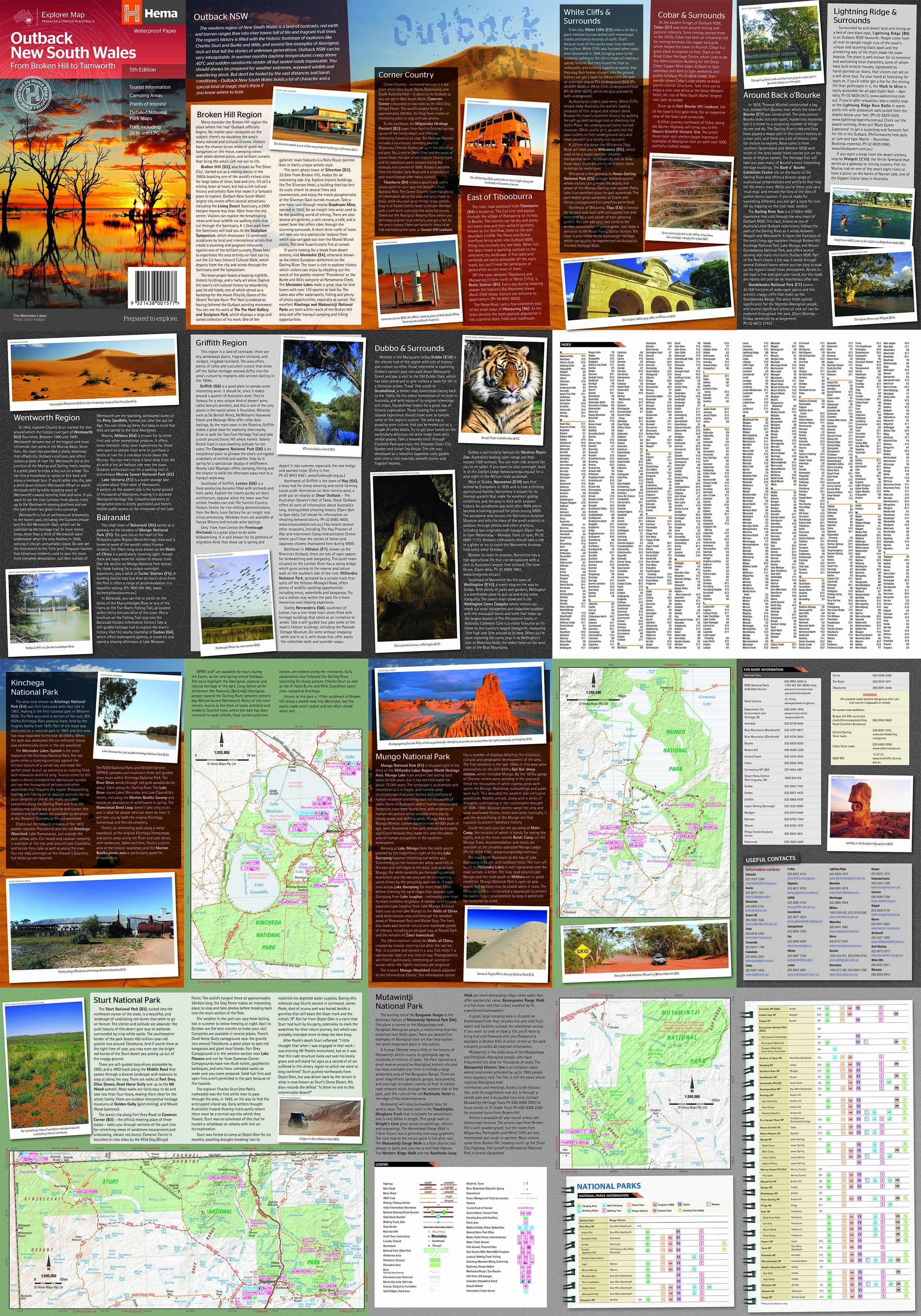
Outback New South Wales Hema Map
$13.95 $14.95
Afterpay is only available for orders between $50.00 and $1000.00 More info
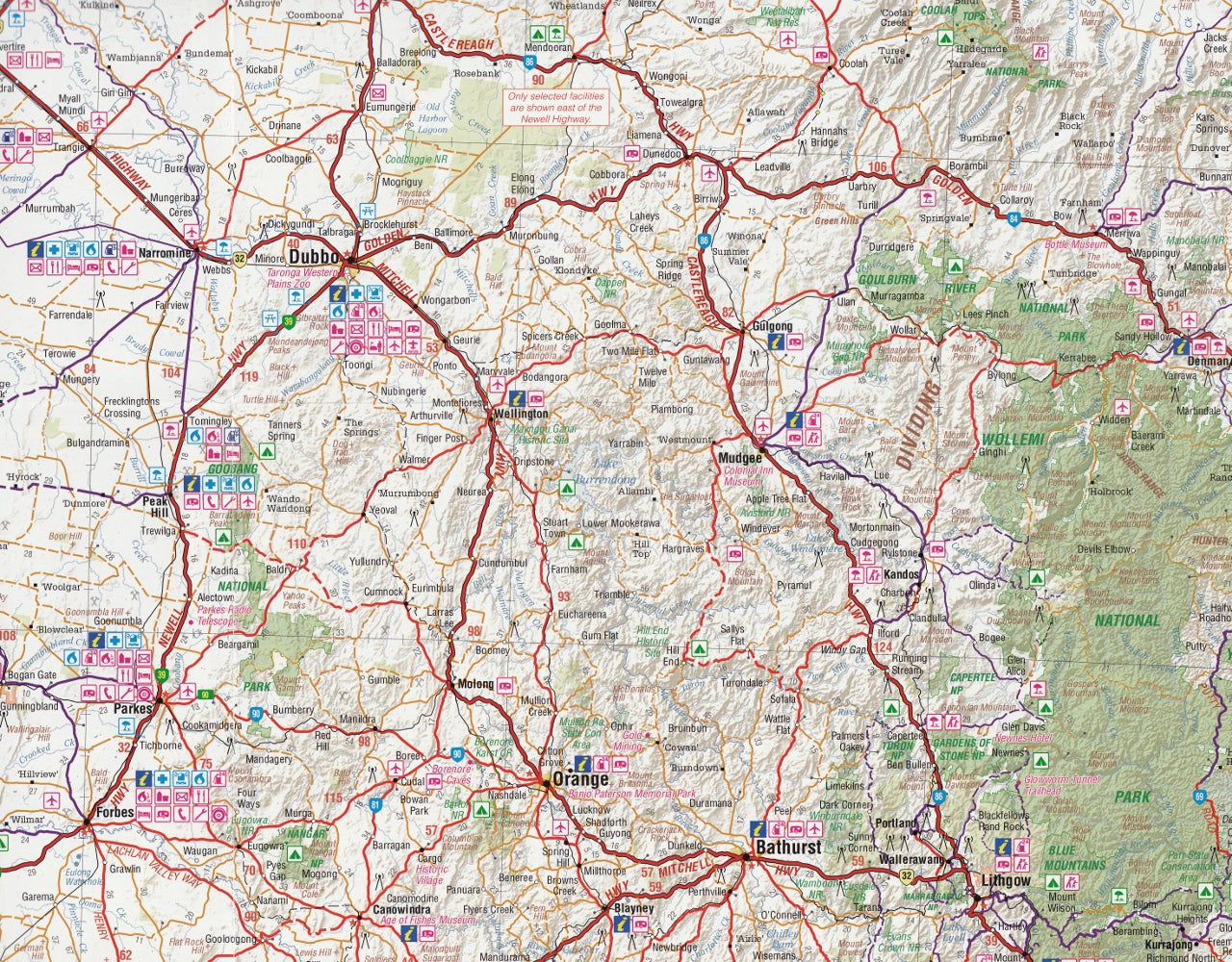
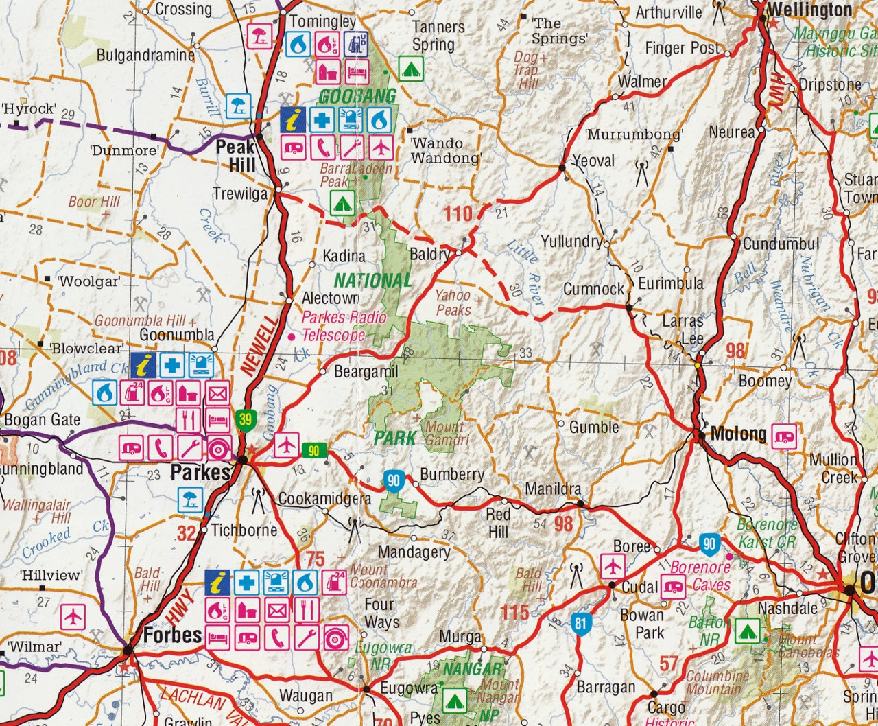
This great regional map of Outback NSW by Hema ranges from Tamworth to well past Broken Hill.
The back of the map lists extensive detail on what to see, where to go, and what to do when you get there.
This map covers an extensive region reaching from the southern towns in Queensland of St George and Cunnamulla south as far as Wagga Wagga and the junction of South Australia, Victoria and New South Wales. It's most easterly point is Dubbo and it finishes just west of Innamincka in the southern corner of the Northern Territory.
This map features:
- Tracks field-checked by the Hema Map Patrol
- National Park maps
- Tourist information
- Camping areas
- Points of interest
- Fuel, including 24-hour & LPG
This map is also available as a laminated map encapsulated in high-quality plastic.
Scale: 1:1,000,000
Size: 700 mm (w) x 1000 mm (h)
Customer Reviews
Based on 20 reviews
Write a review
Related Items


© 2024 Mapworld. Website designed by Genie Media
X