- Australia ▾
- Topographic
▾
- Australia 50k Geoscience maps
- Australia 100k Geoscience maps
- Australia 250k Geoscience maps
- Australia 1.1m Geoscience maps
- New Zealand 50k maps
- New Zealand 250k maps
- New South Wales 25k maps
- New South Wales 50k maps
- New South Wales 100k maps
- Queensland 10k maps
- Queensland 25k maps
- Queensland 50k maps
- Queensland 100k maps
- Compasses
- Software
- GPS Systems
- Orienteering
- International ▾
- Wall Maps
▾
- World
- Australia & New Zealand
- Countries, Continents & Regions
- Historical
- Vintage National Geographic
- Australian Capital Territory
- New South Wales
- Northern Territory
- Queensland
- South Australia
- Tasmania
- Victoria
- Western Australia
- Celestial
- Children's
- Mining & Resources
- Wine Maps
- Healthcare
- Postcode Maps
- Electoral Maps
- Nautical ▾
- Flags
▾
- Australian Flag Sets & Banners
- Flag Bunting
- Handwavers
- Australian National Flags
- Aboriginal Flags
- Torres Strait Islander Flags
- International Flags
- Flagpoles & Accessories
- Australian Capital Territory Flags
- New South Wales Flags
- Northern Territory Flags
- Queensland Flags
- South Australia Flags
- Tasmania Flags
- Victoria Flags
- Western Australia Flags
- Gifts ▾
- Globes ▾
Dear valued customer. Please note that our checkout is not supported by old browsers. Please use a recent browser to access all checkout capabilities


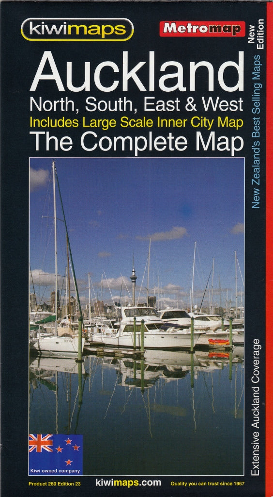
Auckland Compete New Zealand Kiwimaps Folded Map
$12.95
Afterpay is only available for orders between $50.00 and $1000.00 More info
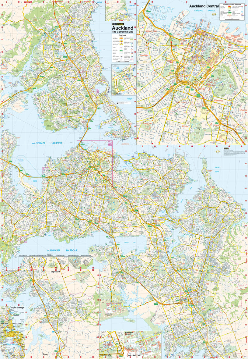
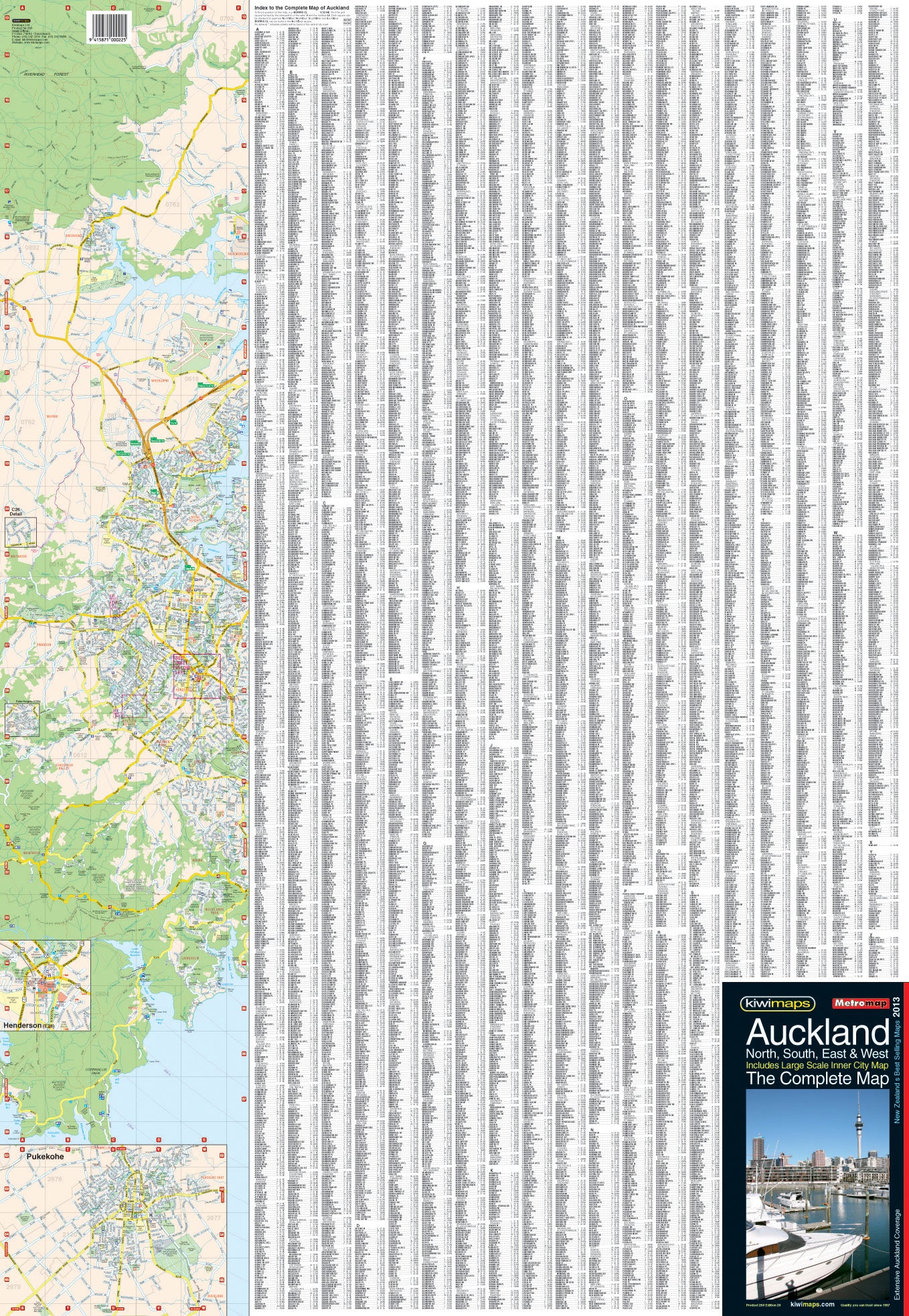
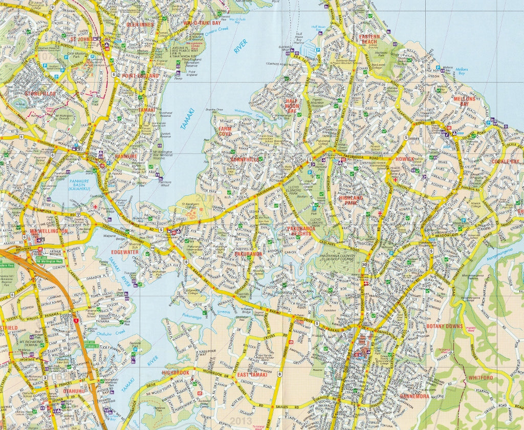
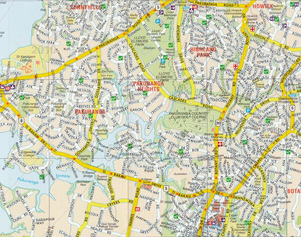
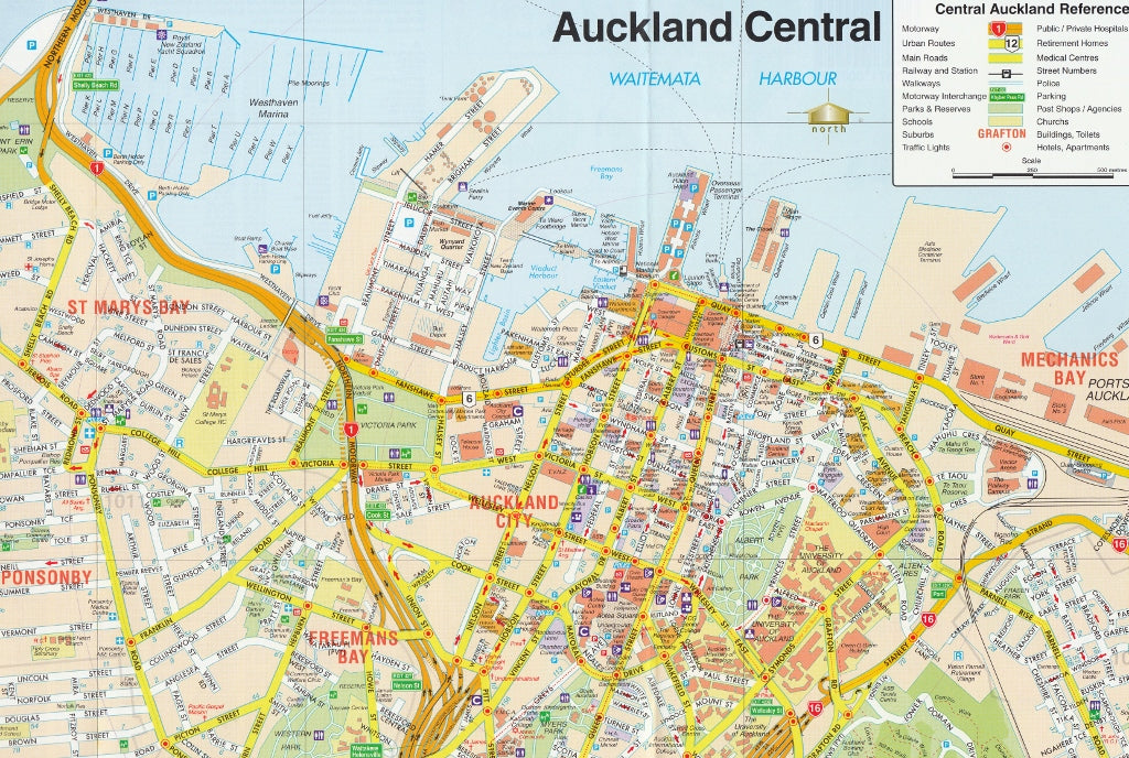
Street plan of the whole of Auckland with enlargements for the city centre, the international airport, and the centres of Takapuna, Manaku, Henderson and Pukekohe, plus a comprehensive street index. The main plan covers the whole area at 1:40,000, showing names of various suburbs and clearly indicating exits from the city onto various tourist routes. One way streets, car parks, railway lines with stations, ferry terminals, public buildings, etc. are marked. A large inset 1:12,500 shows Auckland’s town centre in greater detail. Also included are enlargements, at varying scales, for the international airport and the centres of Takapuna, Manaku, Henderson and Pukekohe, plus for various private village developments. The plans show boundaries of postal districts and postcodes. An unusual feature of the map is an unobtrusive circular radius grid showing distance from the intersection of Victoria and Queen Street.
Related Items


© 2024 Mapworld. Website designed by Genie Media
X