- Australia ▾
- Topographic
▾
- Australia 50k Geoscience maps
- Australia 100k Geoscience maps
- Australia 250k Geoscience maps
- Australia 1.1m Geoscience maps
- New Zealand 50k maps
- New Zealand 250k maps
- New South Wales 25k maps
- New South Wales 50k maps
- New South Wales 100k maps
- Queensland 10k maps
- Queensland 25k maps
- Queensland 50k maps
- Queensland 100k maps
- Compasses
- Software
- GPS Systems
- Orienteering
- International ▾
- Wall Maps
▾
- World
- Australia & New Zealand
- Countries, Continents & Regions
- Historical
- Vintage National Geographic
- Australian Capital Territory
- New South Wales
- Northern Territory
- Queensland
- South Australia
- Tasmania
- Victoria
- Western Australia
- Celestial
- Children's
- Mining & Resources
- Wine Maps
- Healthcare
- Postcode Maps
- Electoral Maps
- Nautical ▾
- Flags
▾
- Australian Flag Sets & Banners
- Flag Bunting
- Handwavers
- Australian National Flags
- Aboriginal Flags
- Torres Strait Islander Flags
- International Flags
- Flagpoles & Accessories
- Australian Capital Territory Flags
- New South Wales Flags
- Northern Territory Flags
- Queensland Flags
- South Australia Flags
- Tasmania Flags
- Victoria Flags
- Western Australia Flags
- Gifts ▾
- Globes ▾
Dear valued customer. Please note that our checkout is not supported by old browsers. Please use a recent browser to access all checkout capabilities


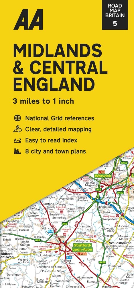
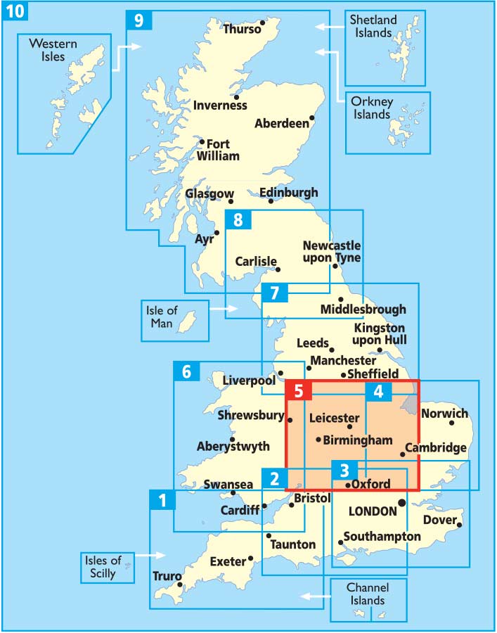
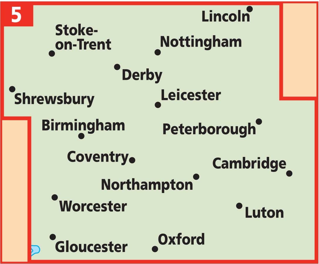
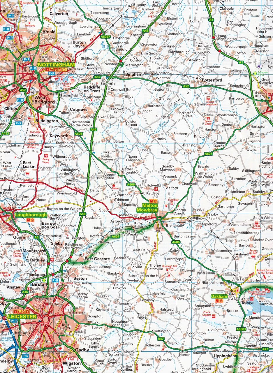
Midlands & Central England AA Road Map 5
$21.95
Afterpay is only available for orders between $50.00 and $1000.00 More info
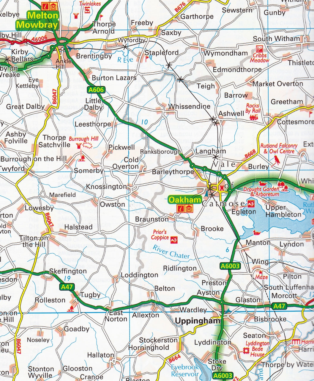
The Midlands & Central England by AA is a detailed and easy-to-read regional map. Encased in a durable, weatherproof cover, the mapping is produced at a scale of 3 miles to 1 inch (1:200,000 / 2km to 1cm).
The map shows: toll points, service areas, road numbers, motorways, dual carriageways and wide narrow local roads, National Parks and other places of interest.
Map features:
- Fully updated speed camera locations, plus speed cameras with speed limits shown
- Clear place name index
- 8 city and town plans
- Caravan & camping sites are pinpointed on the mapping
- National Parks and places of interest are also highlighted
- National Trust, English Heritage, Scottish and Welsh Heritage sites shown
Incorporates CBD plans of: Birmingham, Derby, Leicester, Cheltenham, Coventry, Milton Keynes, Nottingham & Wolverhampton.
This map covers the popular tourist area of the Cotswolds.
Format: Paper folded
Scale: 1:200,000
Size: 1200 mm x 980 mm
Customer Reviews
Based on 1 review
Write a review
Related Items


© 2024 Mapworld. Website designed by Genie Media
X