- Australia ▾
- Topographic
▾
- Australia 50k Geoscience maps
- Australia 100k Geoscience maps
- Australia 250k Geoscience maps
- Australia 1.1m Geoscience maps
- New Zealand 50k maps
- New Zealand 250k maps
- New South Wales 25k maps
- New South Wales 50k maps
- New South Wales 100k maps
- Queensland 10k maps
- Queensland 25k maps
- Queensland 50k maps
- Queensland 100k maps
- Compasses
- Software
- GPS Systems
- Orienteering
- International ▾
- Wall Maps
▾
- World
- Australia & New Zealand
- Countries, Continents & Regions
- Historical
- Vintage National Geographic
- Australian Capital Territory
- New South Wales
- Northern Territory
- Queensland
- South Australia
- Tasmania
- Victoria
- Western Australia
- Celestial
- Children's
- Mining & Resources
- Wine Maps
- Healthcare
- Postcode Maps
- Electoral Maps
- Nautical ▾
- Flags
▾
- Australian Flag Sets & Banners
- Flag Bunting
- Handwavers
- Australian National Flags
- Aboriginal Flags
- Torres Strait Islander Flags
- International Flags
- Flagpoles & Accessories
- Australian Capital Territory Flags
- New South Wales Flags
- Northern Territory Flags
- Queensland Flags
- South Australia Flags
- Tasmania Flags
- Victoria Flags
- Western Australia Flags
- Gifts ▾
- Globes ▾
Dear valued customer. Please note that our checkout is not supported by old browsers. Please use a recent browser to access all checkout capabilities


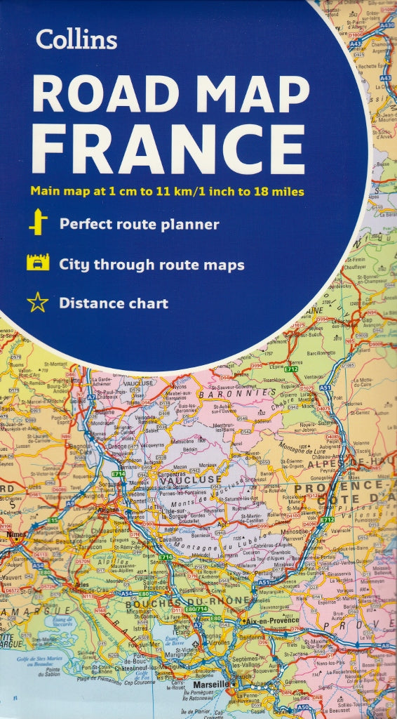

France Collins Folded Map
$21.95 $24.95
Afterpay is only available for orders between $50.00 and $1000.00 More info
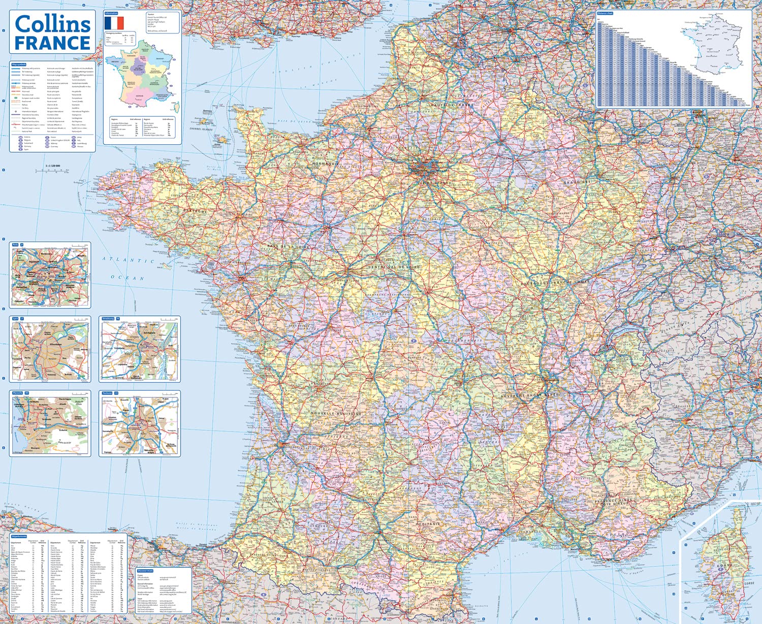
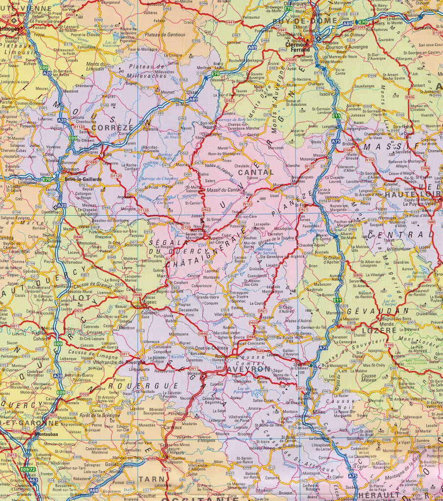
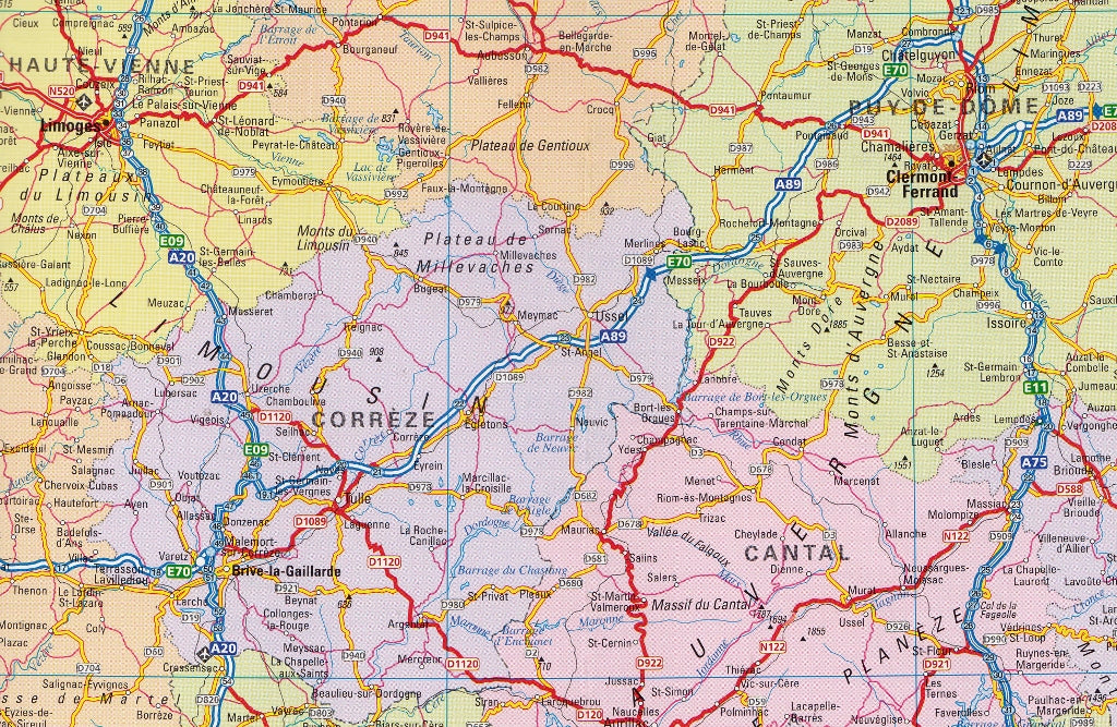
A fully revised and updated colour road map of France at 18 miles to 1 inch / 11km to 1cm.
The only map of France we have which shows individual departements by name in different colours.
All cities, towns, roads, European route numbers, motorways and toll motorways are clearly shown, making it the ideal map for planning and route-finding.
The map shows the road network in detail for easy route planning.
Main features
• Clear, detailed road network
• Through-route maps of Paris, Lyon, Marseille, Strasbourg, and Toulouse
• Distance chart giving distances in kilometres between main towns
• Key to department names and numbers, and list of regions
• Full Index to place names
• Map key in English, French and German
Size 1080mm x 980mm
SHIPS FROM AUSTRALIA, NEXT DAY SHIPPING
Customer Reviews
Based on 2 reviews
Write a review
Related Items


© 2024 Mapworld. Website designed by Genie Media
X