- Australia ▾
- Topographic
▾
- Australia 50k Geoscience maps
- Australia 100k Geoscience maps
- Australia 250k Geoscience maps
- Australia 1.1m Geoscience maps
- New Zealand 50k maps
- New Zealand 250k maps
- New South Wales 25k maps
- New South Wales 50k maps
- New South Wales 100k maps
- Queensland 10k maps
- Queensland 25k maps
- Queensland 50k maps
- Queensland 100k maps
- Compasses
- Software
- GPS Systems
- Orienteering
- International ▾
- Wall Maps
▾
- World
- Australia & New Zealand
- Countries, Continents & Regions
- Historical
- Vintage National Geographic
- Australian Capital Territory
- New South Wales
- Northern Territory
- Queensland
- South Australia
- Tasmania
- Victoria
- Western Australia
- Celestial
- Children's
- Mining & Resources
- Wine Maps
- Healthcare
- Postcode Maps
- Electoral Maps
- Nautical ▾
- Flags
▾
- Australian Flag Sets & Banners
- Flag Bunting
- Handwavers
- Australian National Flags
- Aboriginal Flags
- Torres Strait Islander Flags
- International Flags
- Flagpoles & Accessories
- Australian Capital Territory Flags
- New South Wales Flags
- Northern Territory Flags
- Queensland Flags
- South Australia Flags
- Tasmania Flags
- Victoria Flags
- Western Australia Flags
- Gifts ▾
- Globes ▾
Dear valued customer. Please note that our checkout is not supported by old browsers. Please use a recent browser to access all checkout capabilities


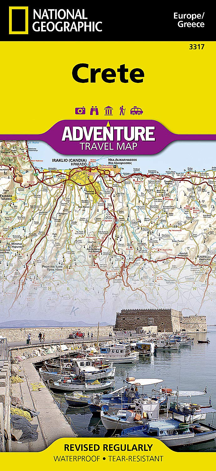
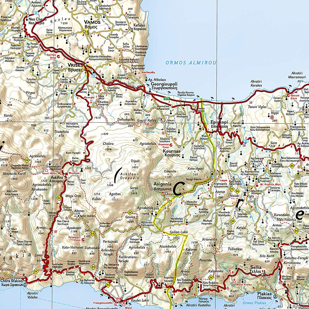
Crete National Geographic Folded Map
$26.95
Afterpay is only available for orders between $50.00 and $1000.00 More info
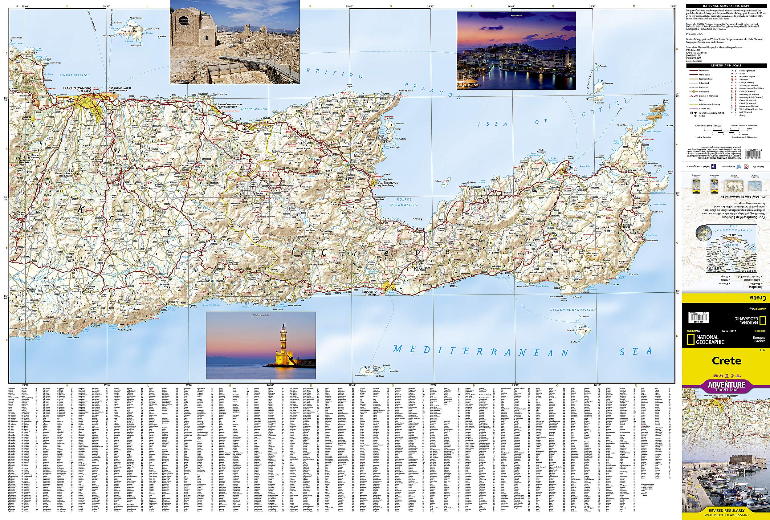
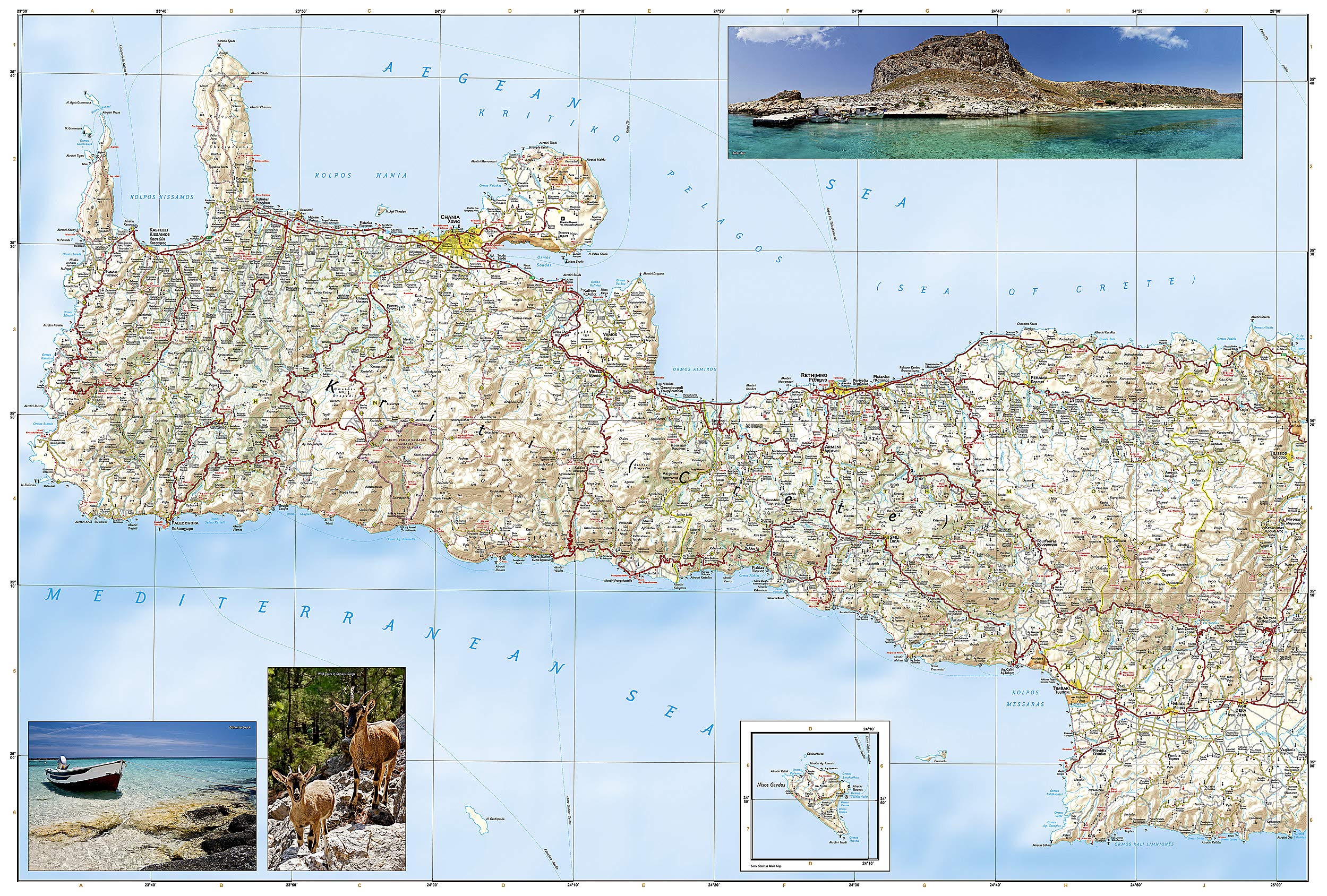
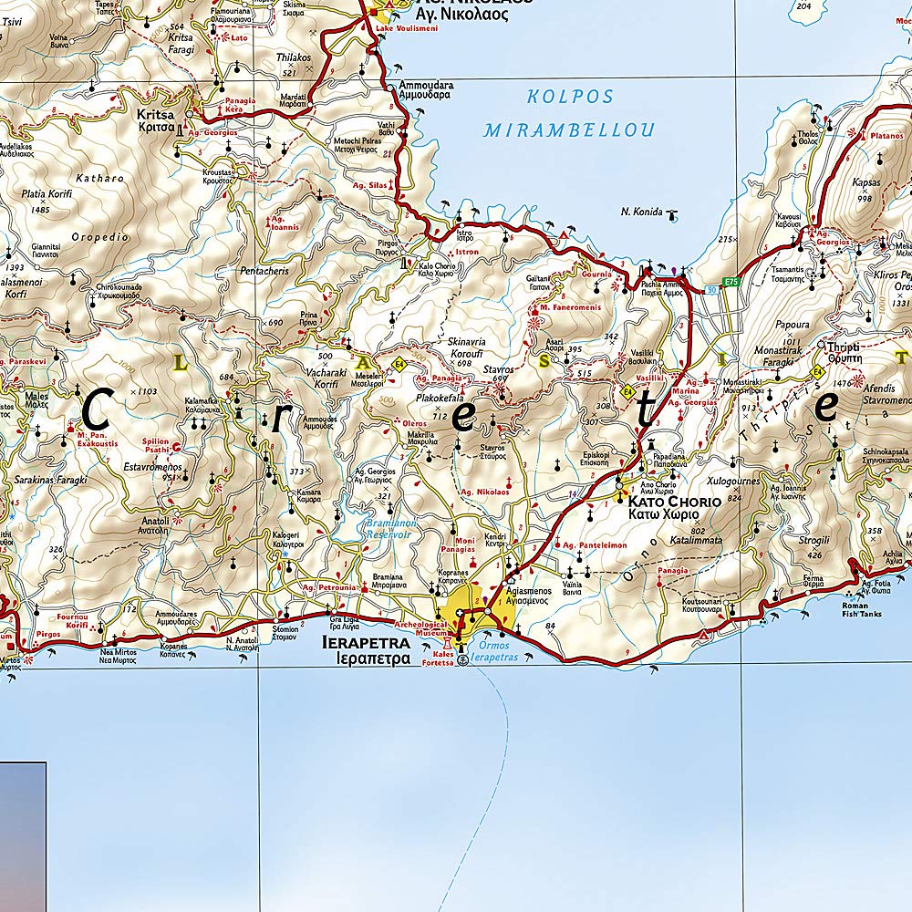
National Geographic's Crete Adventure Map is designed to meet the unique needs of adventure travelers with its durability and accurate information. This folded map provides global travelers with the perfect combination of detail and perspective, highlighting hundreds of points of interest and the diverse and unique destinations within the country. The front side of the Crete map details the eastern region of the island with the Sea of Crete to the north. The reverse side of the map shows the western region of the island with the Aegean Sea to the north and the Mediterranean Sea to the south. The map includes the locations of cities and towns with a user-friendly index, plus a clearly marked road network complete with distances and designations for major highways, main roads, and tracks and trails for those seeking to explore more remote regions. Every Adventure Map is printed on durable synthetic paper, making them waterproof, tear-resistant and tough – capable of withstanding the rigors of international travel. Each is two-sided and can be folded to a packable size of 235 x 108 mm; unfolded size is 965 x 660 mm.
Customer Reviews
Based on 13 reviews
Write a review
Related Items


© 2024 Mapworld. Website designed by Genie Media
X