- Australia ▾
- Topographic
▾
- Australia 50k Geoscience maps
- Australia 100k Geoscience maps
- Australia 250k Geoscience maps
- Australia 1.1m Geoscience maps
- New Zealand 50k maps
- New Zealand 250k maps
- New South Wales 25k maps
- New South Wales 50k maps
- New South Wales 100k maps
- Queensland 10k maps
- Queensland 25k maps
- Queensland 50k maps
- Queensland 100k maps
- Compasses
- Software
- GPS Systems
- Orienteering
- International ▾
- Wall Maps
▾
- World
- Australia & New Zealand
- Countries, Continents & Regions
- Historical
- Vintage National Geographic
- Australian Capital Territory
- New South Wales
- Northern Territory
- Queensland
- South Australia
- Tasmania
- Victoria
- Western Australia
- Celestial
- Children's
- Mining & Resources
- Wine Maps
- Healthcare
- Postcode Maps
- Electoral Maps
- Nautical ▾
- Flags
▾
- Australian Flag Sets & Banners
- Flag Bunting
- Handwavers
- Australian National Flags
- Aboriginal Flags
- Torres Strait Islander Flags
- International Flags
- Flagpoles & Accessories
- Australian Capital Territory Flags
- New South Wales Flags
- Northern Territory Flags
- Queensland Flags
- South Australia Flags
- Tasmania Flags
- Victoria Flags
- Western Australia Flags
- Gifts ▾
- Globes ▾
Dear valued customer. Please note that our checkout is not supported by old browsers. Please use a recent browser to access all checkout capabilities


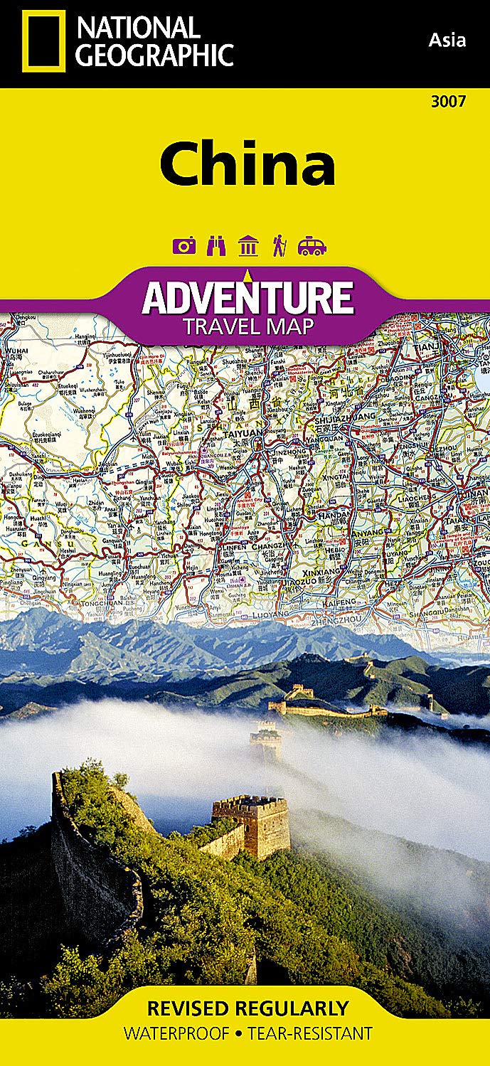
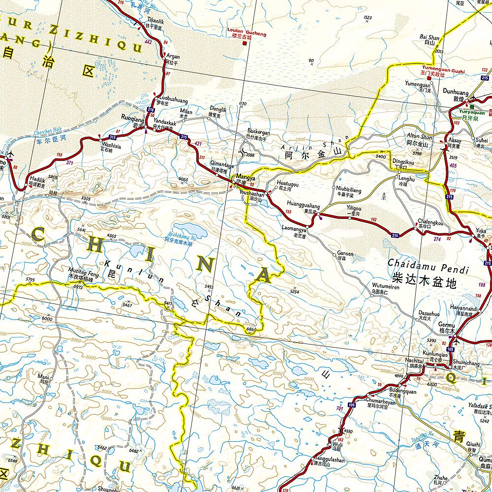
China National Geographic Folded Map
$26.95
Afterpay is only available for orders between $50.00 and $1000.00 More info
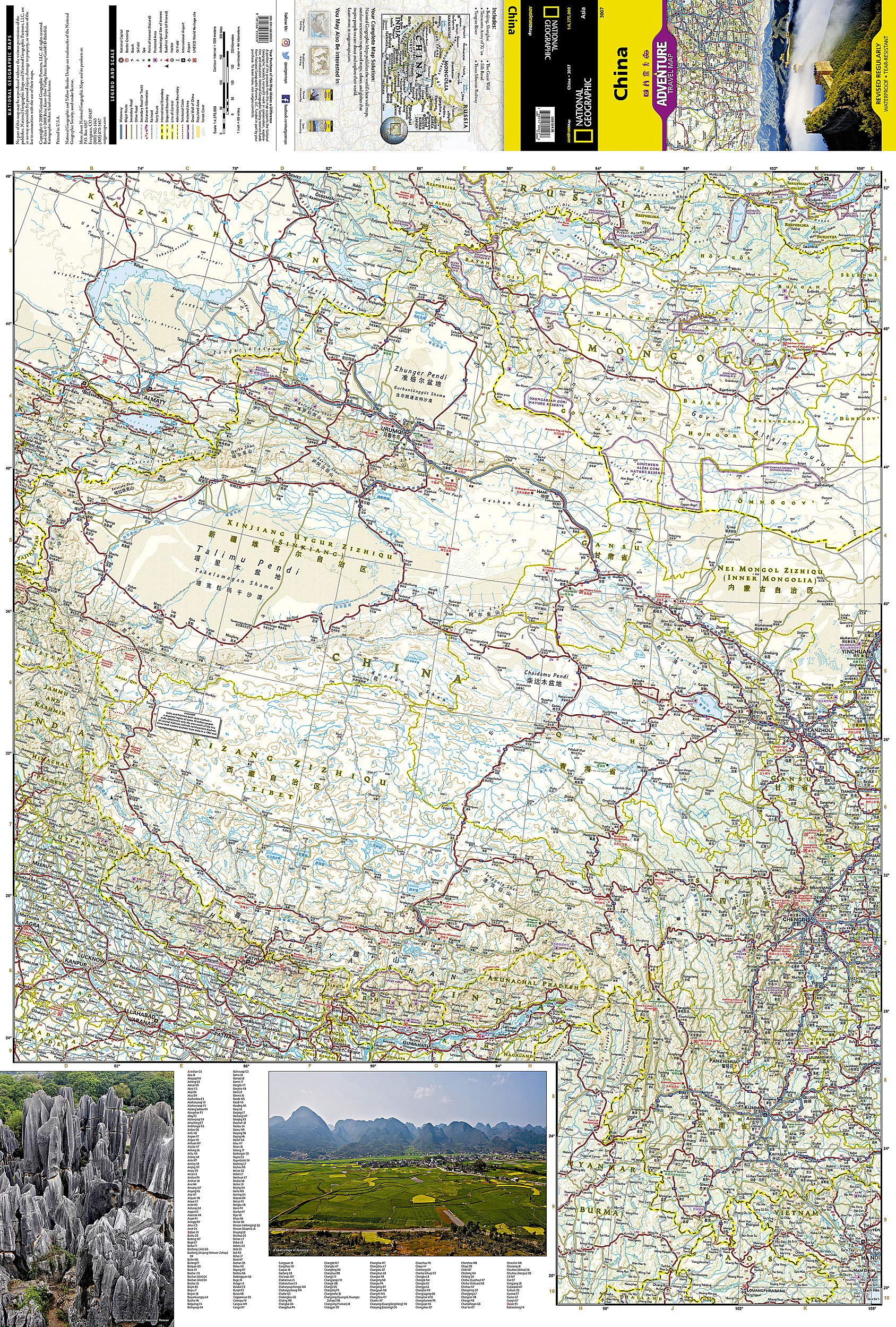
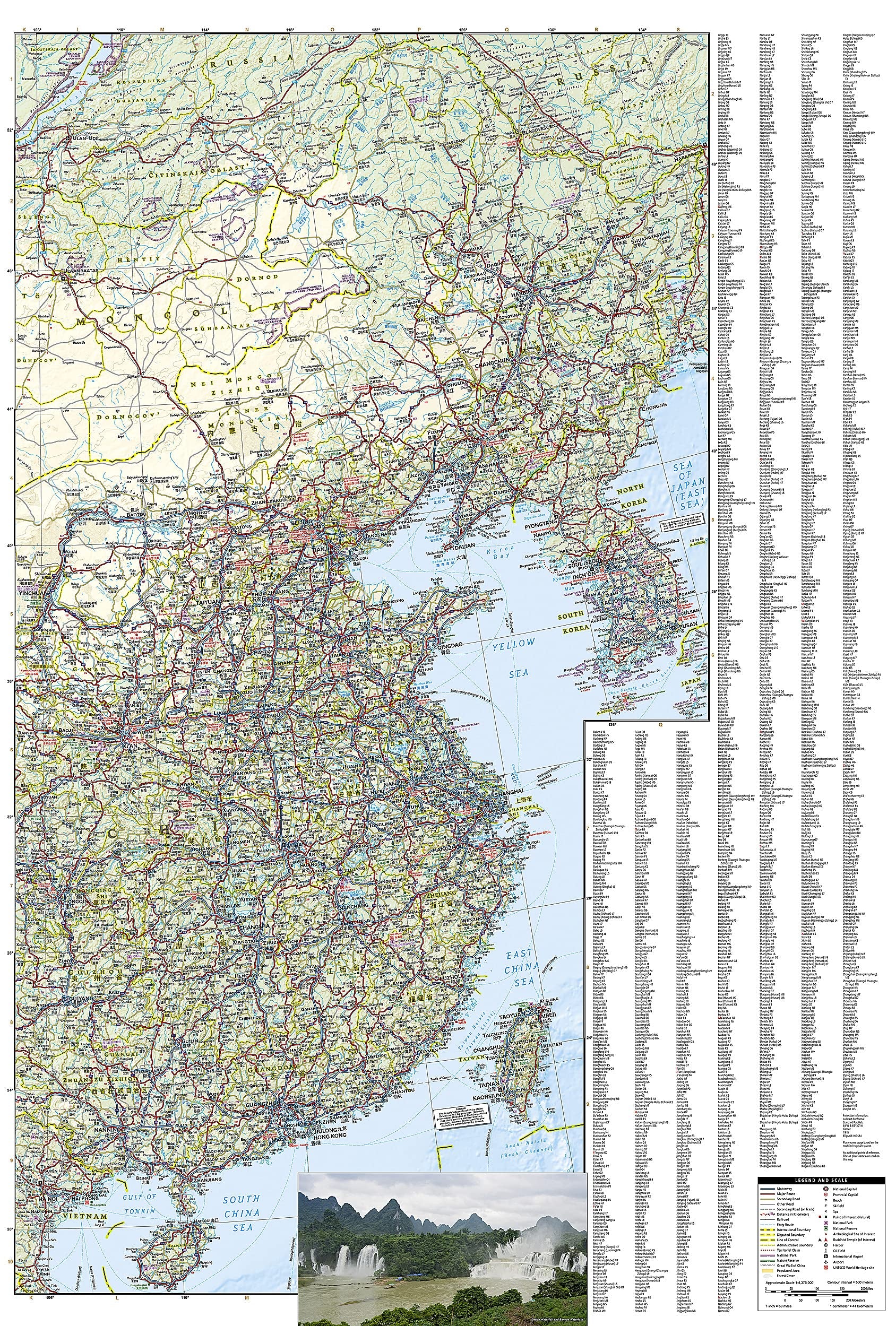
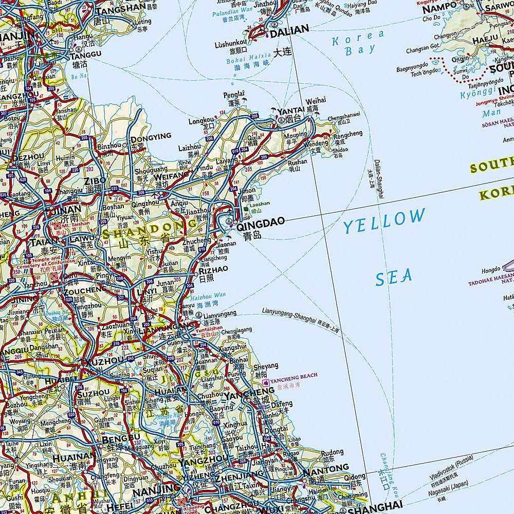
National Geographic's China Adventure Map is designed to meet the unique needs of adventure travelers with its durability and detailed, accurate information. The map includes the locations of thousands of cities and towns with a user-friendly index, plus a clearly marked road network complete with distances and designations for major highways, main roads, plus tracks and trails for those seeking to explore more remote regions. This map differs from a traditional road map because it includes hundreds of points of interest that highlight the diverse and unique recreational, ecological, cultural and historic destinations within the country. Our adventure maps are the perfect companion to a guidebook, yet far easier to pack! The China Adventure Map is printed in the United States on a durable synthetic paper, making it waterproof, tear-resistant and tough capable of withstanding the rigors of international travel. The map is two-sided and can be folded to a packable size of 235 x 108; unfolded size is 965 x 660 mm. Net proceeds from the sale of this map go to support the nonprofit mission of the National Geographic Society. The front side of the map contains the western side of the country from it's borders with India, Bhutan, Nepal, Pakistan north to Russia and Kazakhstan. The reverse contains eastern China as well as the Korean peninsula and Taiwan. <u>Key Features:</u> <li>Waterproof and tear-resistant <li>Detailed topography with clearly labeled natural features <li>Hundreds of points of interest, including the location of protected sites, parks and nature reserves, protected lands, archeological sites, wildlife parks and more <li>Thousands of place names with a detailed index <li>Important travel aids including airports, lighthouses, ferry routes and rail lines <li>Latitude/Longitude and UTM grids along with a compass rose and scale bars for accurate navigation with compass or GPS
Related Items


© 2024 Mapworld. Website designed by Genie Media
X