- Australia ▾
- Topographic
▾
- Australia 50k Geoscience maps
- Australia 100k Geoscience maps
- Australia 250k Geoscience maps
- Australia 1.1m Geoscience maps
- New Zealand 50k maps
- New Zealand 250k maps
- New South Wales 25k maps
- New South Wales 50k maps
- New South Wales 100k maps
- Queensland 10k maps
- Queensland 25k maps
- Queensland 50k maps
- Queensland 100k maps
- Compasses
- Software
- GPS Systems
- Orienteering
- International ▾
- Wall Maps
▾
- World
- Australia & New Zealand
- Countries, Continents & Regions
- Historical
- Vintage National Geographic
- Australian Capital Territory
- New South Wales
- Northern Territory
- Queensland
- South Australia
- Tasmania
- Victoria
- Western Australia
- Celestial
- Children's
- Mining & Resources
- Wine Maps
- Healthcare
- Postcode Maps
- Electoral Maps
- Nautical ▾
- Flags
▾
- Australian Flag Sets & Banners
- Flag Bunting
- Handwavers
- Australian National Flags
- Aboriginal Flags
- Torres Strait Islander Flags
- International Flags
- Flagpoles & Accessories
- Australian Capital Territory Flags
- New South Wales Flags
- Northern Territory Flags
- Queensland Flags
- South Australia Flags
- Tasmania Flags
- Victoria Flags
- Western Australia Flags
- Gifts ▾
- Globes ▾
Dear valued customer. Please note that our checkout is not supported by old browsers. Please use a recent browser to access all checkout capabilities


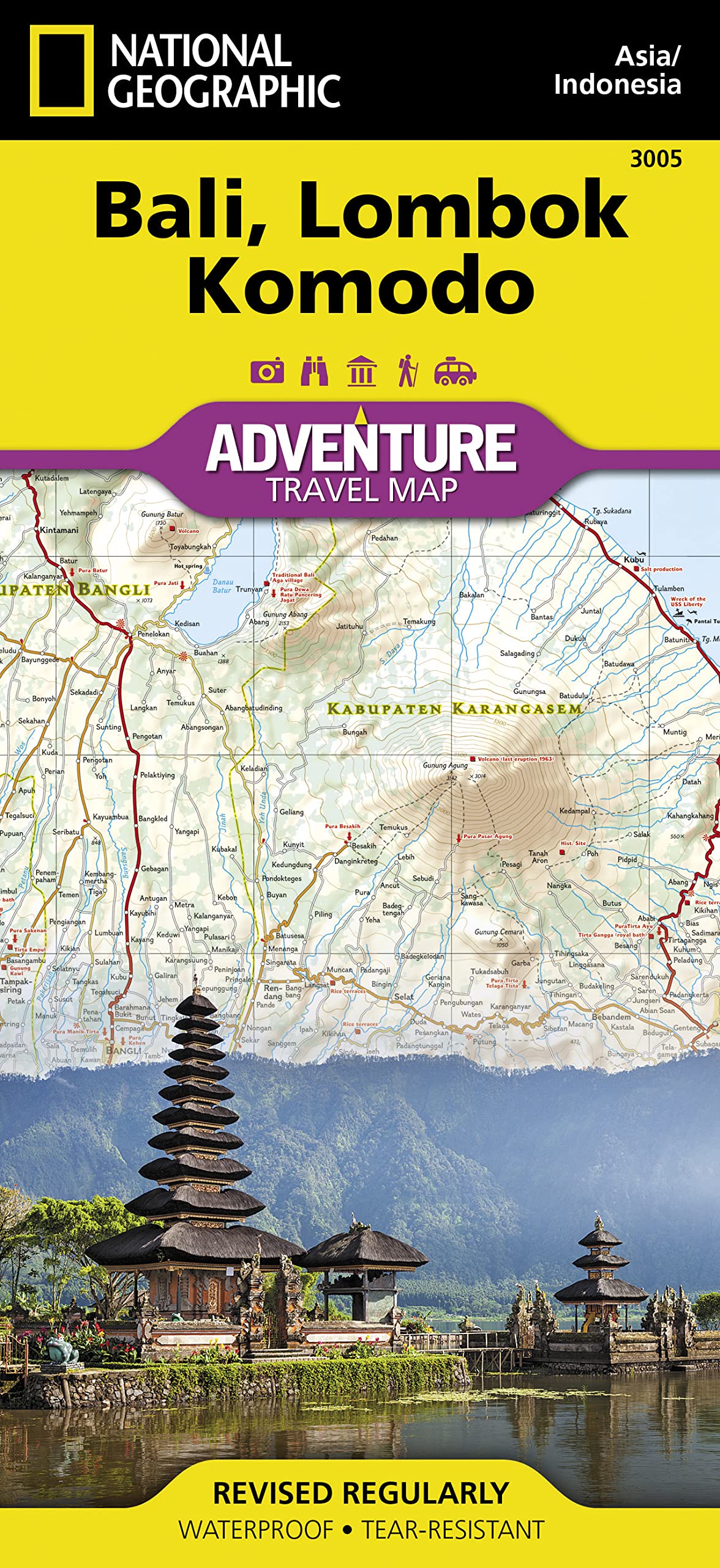
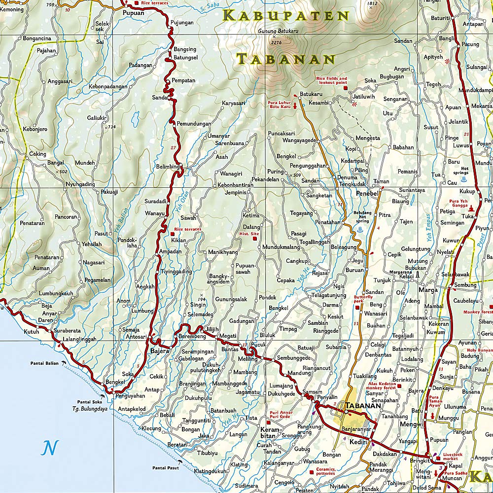
Bali Lombok Komodo National Geographic Folded Map
$26.95
Afterpay is only available for orders between $50.00 and $1000.00 More info
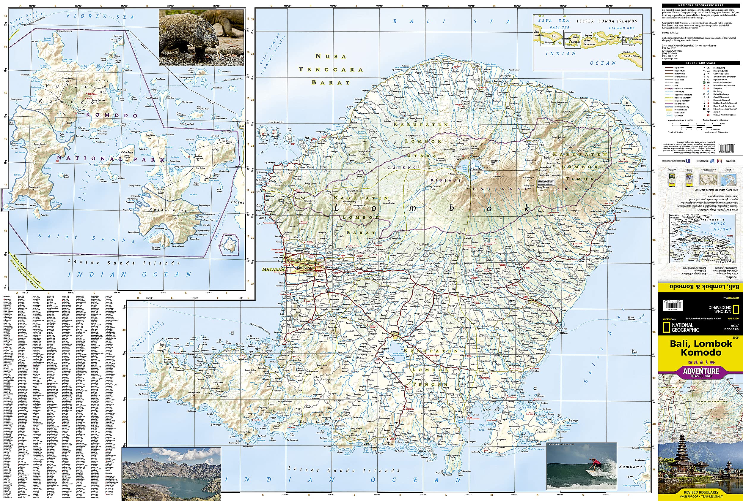
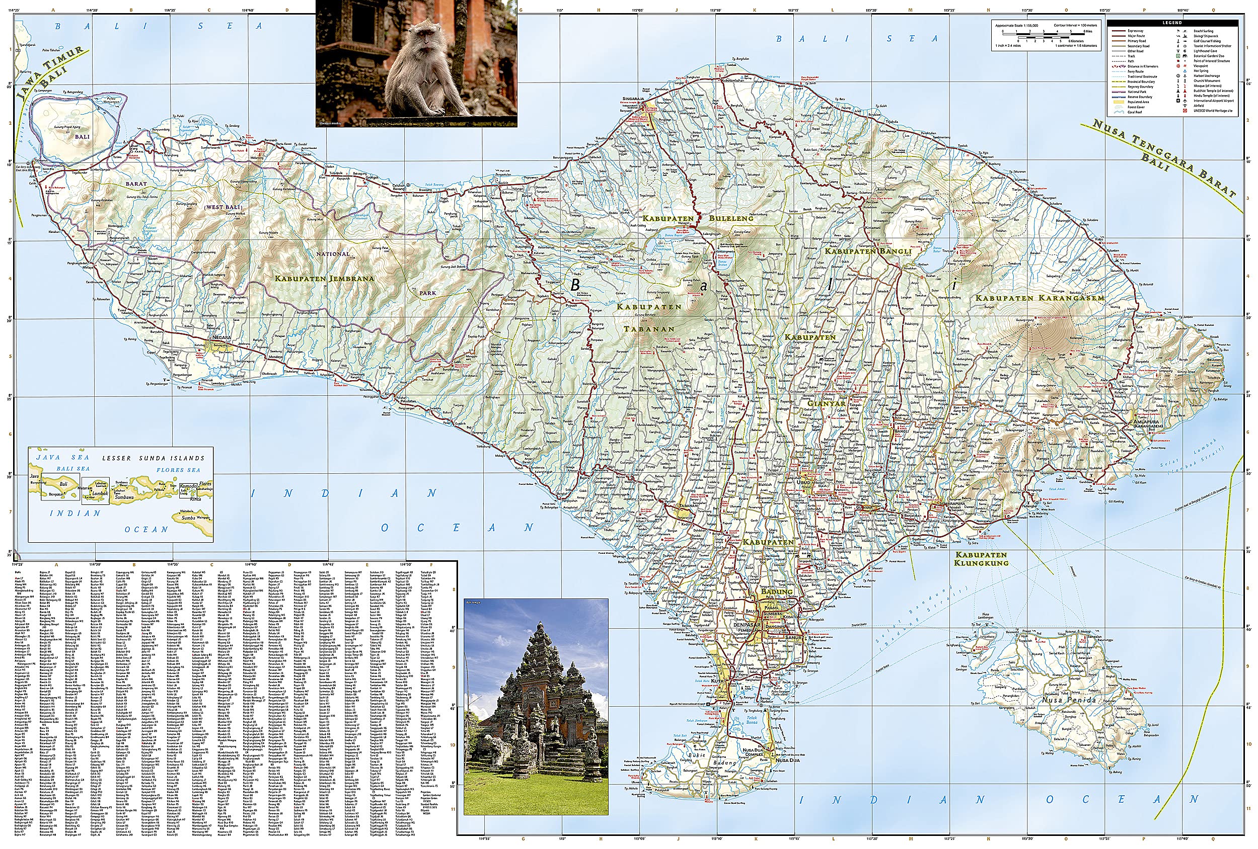
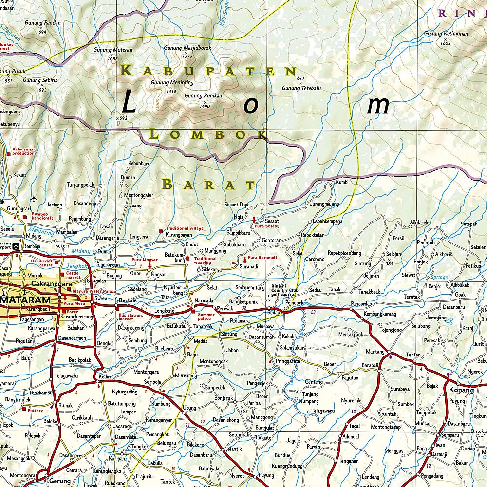
Discover the natural beauty and exciting recreational opportunities available to travelers in Indonesia with National Geographic's Adventure Map of Bali, Lombok, and Komodo. This map includes the locations of thousands of towns and villages, plus a clearly marked road network complete with distances and designations for expressways, major routes, and secondary roadways. Rough tracks and paths are included for adventurers seeking to explore more remote regions. Hundreds of points of interest are highlighted including World Heritage sites, national parks, golf courses, botanical gardens, and religious sites are noted in addition to a beaches and a variety of sites for surfing, diving, and fishing.
The front side of the print map shows the islands of Lombok and Komodo. Bali and Nusa Penida are detailed on the reverse side. A small inset of the Lesser Sunda Islands shows the location of Bali, Lombok, and Komodo in the island chain. The locations of airports, airfields, harbors, anchorages, ferry routes, and traditional boat routes take the guesswork out of travel around the islands. Tourist information centers are also marked for travelers seeking additional resources.
Every Adventure Map is printed on durable synthetic paper, making them waterproof, tear-resistant and tough — capable of withstanding the rigors of international travel.
- Map Scale = 1:155,000
- Sheet Size = 37.75" x 25.5"
- Folded Size = 4.25" x 9.25"
Related Items


© 2024 Mapworld. Website designed by Genie Media
X