- Australia ▾
- Topographic
▾
- Australia AUSTopo 250k (2025)
- Australia 50k Geoscience maps
- Australia 100k Geoscience maps
- Australia 250k Geoscience maps
- Australia 1:1m Geoscience maps
- New Zealand 50k maps
- New Zealand 250k maps
- New South Wales 25k maps
- New South Wales 50k maps
- New South Wales 100k maps
- Queensland 10k maps
- Queensland 25k maps
- Queensland 50k maps
- Queensland 100k maps
- Compasses
- Software
- GPS Systems
- Orienteering
- International ▾
- Wall Maps
▾
- World
- Australia & New Zealand
- Countries, Continents & Regions
- Historical
- Vintage National Geographic
- Australian Capital Territory
- New South Wales
- Northern Territory
- Queensland
- South Australia
- Tasmania
- Victoria
- Western Australia
- Celestial
- Children's
- Mining & Resources
- Wine Maps
- Healthcare
- Postcode Maps
- Electoral Maps
- Nautical ▾
- Flags
▾
- Australian Flag Sets & Banners
- Flag Bunting
- Handwavers
- Australian National Flags
- Aboriginal Flags
- Torres Strait Islander Flags
- International Flags
- Flagpoles & Accessories
- Australian Capital Territory Flags
- New South Wales Flags
- Northern Territory Flags
- Queensland Flags
- South Australia Flags
- Tasmania Flags
- Victoria Flags
- Western Australia Flags
- Gifts ▾
- Globes ▾
Dear valued customer. Please note that our checkout is not supported by old browsers. Please use a recent browser to access all checkout capabilities


Western Australia - Maps, Guides, Road Atlases, Digital Mapping & Street Directories
Western Australia wall maps, road atlases, folded maps, and street directories offer a practical and comprehensive way to navigate the country’s largest and most remote state. From the streets of Perth to the vast outback, the Coral Coast, Kimberley region, and goldfields, these maps provide clear, detailed coverage of both urban centres and rugged landscapes.
Our collection features wall maps perfect for planning and display, durable road atlases ideal for long-distance and off-road travel, convenient folded maps for travellers on the go, and street directories for navigating Perth and surrounding suburbs. Whether you're managing logistics, exploring WA’s remote beauty, or simply finding your way around the city, Western Australia maps are indispensable tools for travel, planning, and adventure across this vast and varied state.


About Western Australia Maps
Western Australia is Australia's largest state — 2.5 million square kilometres covering one-third of the continent. From the Mediterranean climate of the South West to the tropical Kimberley, the iron-rich Pilbara, the gold-bearing Goldfields and the vast Nullarbor and Great Victoria Desert, no single state demands more map firepower for travellers, planners, or businesses operating across its scale.
Mapworld is based in Perth, which means we use these maps ourselves. Our WA range covers every major Australian publisher — Hema, UBD-Gregory's, Carto Graphics, Quality Publishing Australia (QPA), Westprint and Cartographics — plus the Landgate WA topographic series and DPI inshore boating charts. Same-day dispatch from our Willetton warehouse on weekday orders before 2 pm AWST.
Western Australia Map Types Explained
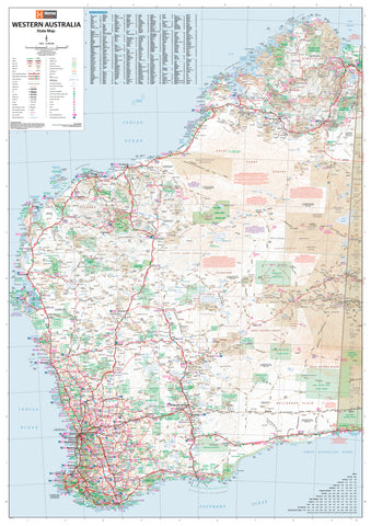
Touring & Wall Maps
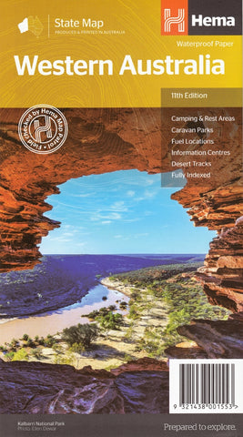
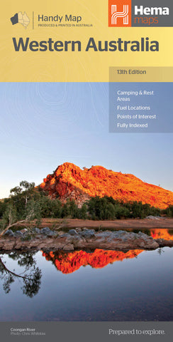
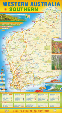
For road-tripping the south-west, navigating between Perth and the Pilbara, hanging a state-wide reference at the office, or planning a Goldfields trek. The Hema WA State Map is the standard touring reference, with laminated wall map versions in standard, Supermap and Megamap formats. Quality Publishing Australia's WA regional maps (South West, Pilbara/Kimberley, Roads & Tracks WA) are the locally-published alternatives.
4WD & Outback Maps
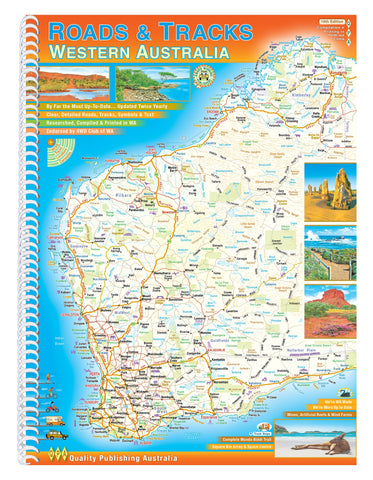
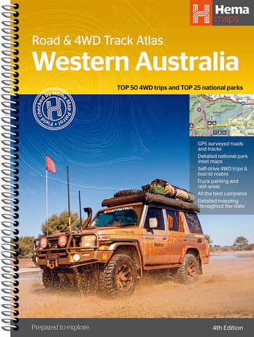
Hema produces dedicated regional 4WD maps for the Kimberley, Pilbara & Coral Coast, Gascoyne, and the Great Desert Tracks (Western Sheet covers WA). For specific outback routes, Westprint maps cover the Canning Stock Route, Gunbarrel Highway, Beadell Roads and the Anne Beadell Highway. Roads & Tracks of Western Australia by QPA (16th edition) is the comprehensive WA-specific track reference.
Topographic Maps
Landgate WA publishes topographic sheets at 1:50k, 1:100k and 1:250k scales — the standard for bushwalking, orienteering, emergency services, mining and exploration. Mapworld stocks paper and laminated formats. Geoscience Australia's 1:250k AUSTopo series provides broader topographic coverage of the whole state.
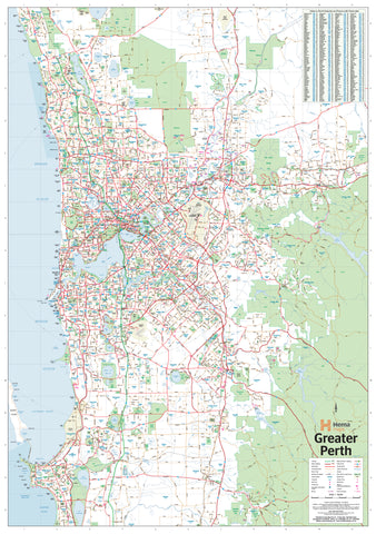
Postcode, Electoral & LGA Maps
WA postcode wall maps cover Perth metro and the full state. Electoral and Local Government Area maps are essential for real estate, political analysis, sales territory planning and government work. Mapworld carries Perth Postcode, Western Australia Postcode, WA Electoral and WA LGA wall maps in laminated formats.
Mining & Resources Maps
WA's mining sector is unique — Mapworld stocks specialist resources maps including WA Operating and Under Development Mines, Major Resources Projects, Geological Map of WA, and the North West Shelf Oil & Gas wall map. These are reference tools used by exploration companies, government departments and infrastructure planners.
Marine Charts
WA's coast is covered by AUS-numbered Australian Hydrographic Service charts plus state DPI (Department of Primary Industries) inshore boating charts. Standout sheets: AUS 117 Gage Roads & Cockburn Sound, AUS 53 Approaches to Port Hedland, AUS 57 Dampier Archipelago, 412 Rottnest Island, 898 Swan & Canning River. All charts are corrected to the latest Notices to Mariners at dispatch.
Choosing the Right WA Map by Region
| Region | Recommended map |
|---|---|
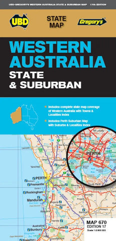
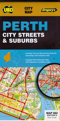
| Perth metro | UBD 662 Perth Suburban map + Perth Postcode wall map |
| South West / Margaret River / Albany | South West WA QPA + Cape to Cape Track Map Pack |
| Pilbara & Coral Coast | Hema Pilbara & Coral Coast map + Pilbara Kimberley QPA |
| Kimberley (Broome to Kununurra) | Hema Kimberley Atlas & Guide + Kimberley folded map (current 15th edition) |
| Goldfields / Nullarbor | Hema Australia Road & 4WD Atlas + Nullarbor Plain Cartographics |
| Outback expeditions (Canning, Gunbarrel) | Westprint Canning Stock Route + Gunbarrel Highway maps |
| Sales / real estate / planning | WA Postcode wall map + WA LGA wall map |
| Boating Perth metro | 898 Swan & Canning River + AUS 117 Gage Roads chart |
| Mining / exploration | WA Operating Mines wall map + Geological Map of WA |
Why Buy WA Maps from Mapworld
- Perth-based specialist — we live, drive and travel in WA. Our team uses these maps personally.
- Largest WA-specific range in Australia — over 250 WA products covering every region and use case
- Current editions only — we rotate stock with each new release
- Same-day dispatch from our Willetton warehouse on weekday orders before 2 pm AWST
- Free shipping over $75 Australia-wide, flat $7 below that
- Custom mapping service for businesses needing branded WA postcode, electoral, sales-territory or mining tenement maps
- Local pickup available at our Perth warehouse for metro customers — call 1300 795 697
Frequently Asked Questions
What's the best map for a Kimberley 4WD trip?
The Hema Kimberley Atlas & Guide is the comprehensive trip-planning resource — pair it with the current 15th edition Kimberley folded touring map for in-vehicle use. For wall-mounted planning at home, the laminated Kimberley wall map.
Do you stock the latest WA topographic sheets from Landgate?
Yes. Mapworld stocks the full Landgate Western Australia topographic series at 1:50k, 1:100k and 1:250k scales, in paper and laminated formats. Search for the sheet name or number to find your area.
Can I pick up my WA map order in Perth?
Yes — local pickup is available from our Willetton warehouse for Perth metro customers. Call 1300 795 697 to arrange. Otherwise, same-day dispatch on weekday orders before 2 pm AWST.
What's the difference between the Hema WA Map and the QPA Roads & Tracks map?
The Hema WA State Map (1:1.85m) is the standard touring reference for sealed-road and major-route travel — caravanning, road trips, broad regional planning. QPA's Roads & Tracks WA (16th edition) is more detailed at 1:1.25m with significantly more 4WD track and outback route coverage — better for off-road expeditions. Many WA travellers carry both.
Do you offer custom WA maps for businesses?
Yes. Mapworld runs a custom mapping service for businesses needing branded or modified WA maps — postcode and electoral overlays, sales-territory colouring, mining tenement and resources maps, healthcare service catchments, fleet planning maps and more.
How quickly does Mapworld ship WA orders interstate?
Orders placed before 2 pm AWST on weekdays dispatch same-day. Interstate delivery typically takes 3–7 business days via Australia Post. Express Post options available at checkout.
For real estate, sales or service-area planning across [State Name], see our laminated [State Name] postcode wall map.
© 2026 Mapworld. Website designed by Genie Media
X