- Australia ▾
- Topographic
▾
- Australia 50k Geoscience maps
- Australia 100k Geoscience maps
- Australia 250k Geoscience maps
- Australia 1.1m Geoscience maps
- New Zealand 50k maps
- New Zealand 250k maps
- New South Wales 25k maps
- New South Wales 50k maps
- New South Wales 100k maps
- Queensland 10k maps
- Queensland 25k maps
- Queensland 50k maps
- Queensland 100k maps
- Compasses
- Software
- GPS Systems
- Orienteering
- International ▾
- Wall Maps
▾
- World
- Australia & New Zealand
- Countries, Continents & Regions
- Historical
- Vintage National Geographic
- Australian Capital Territory
- New South Wales
- Northern Territory
- Queensland
- South Australia
- Tasmania
- Victoria
- Western Australia
- Celestial
- Children's
- Mining & Resources
- Wine Maps
- Healthcare
- Postcode Maps
- Electoral Maps
- Nautical ▾
- Flags
▾
- Australian Flag Sets & Banners
- Flag Bunting
- Handwavers
- Australian National Flags
- Aboriginal Flags
- Torres Strait Islander Flags
- International Flags
- Flagpoles & Accessories
- Australian Capital Territory Flags
- New South Wales Flags
- Northern Territory Flags
- Queensland Flags
- South Australia Flags
- Tasmania Flags
- Victoria Flags
- Western Australia Flags
- Gifts ▾
- Globes ▾
Dear valued customer. Please note that our checkout is not supported by old browsers. Please use a recent browser to access all checkout capabilities


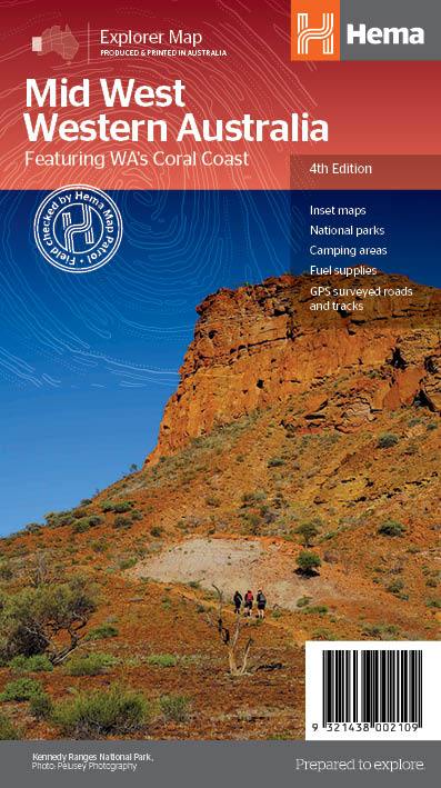
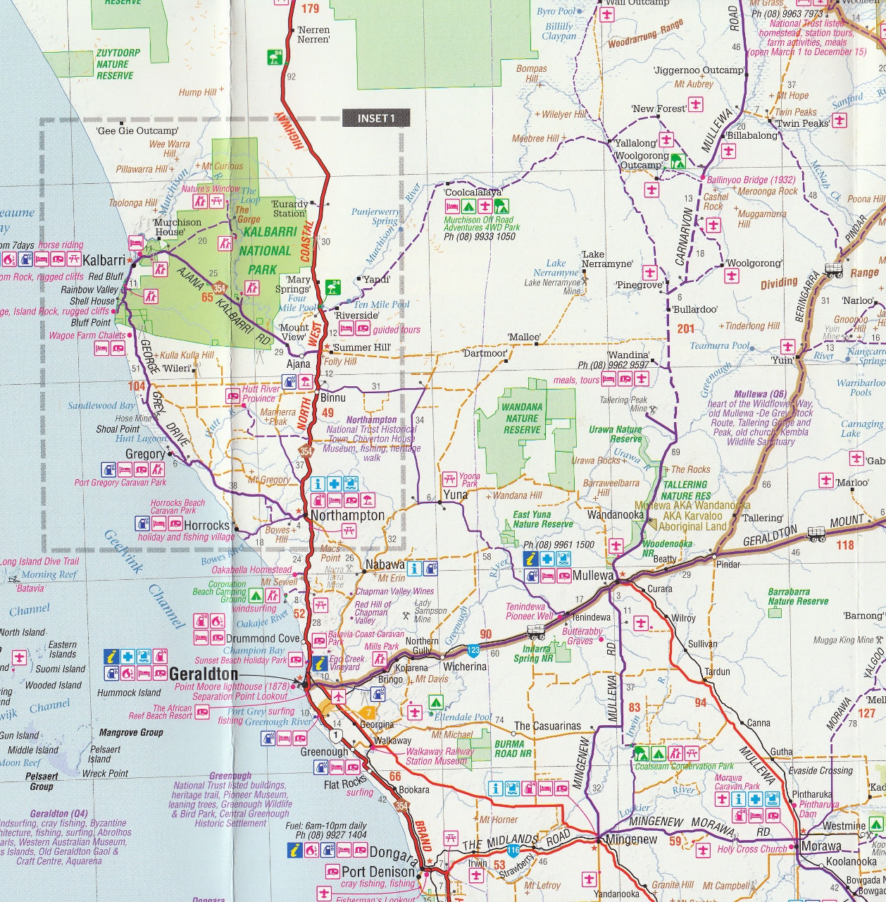
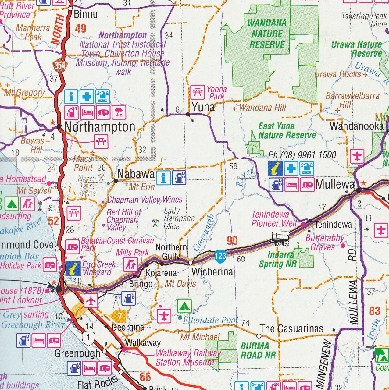
Mid West Western Australia Hema Map
$13.95 $14.95
Afterpay is only available for orders between $50.00 and $1000.00 More info
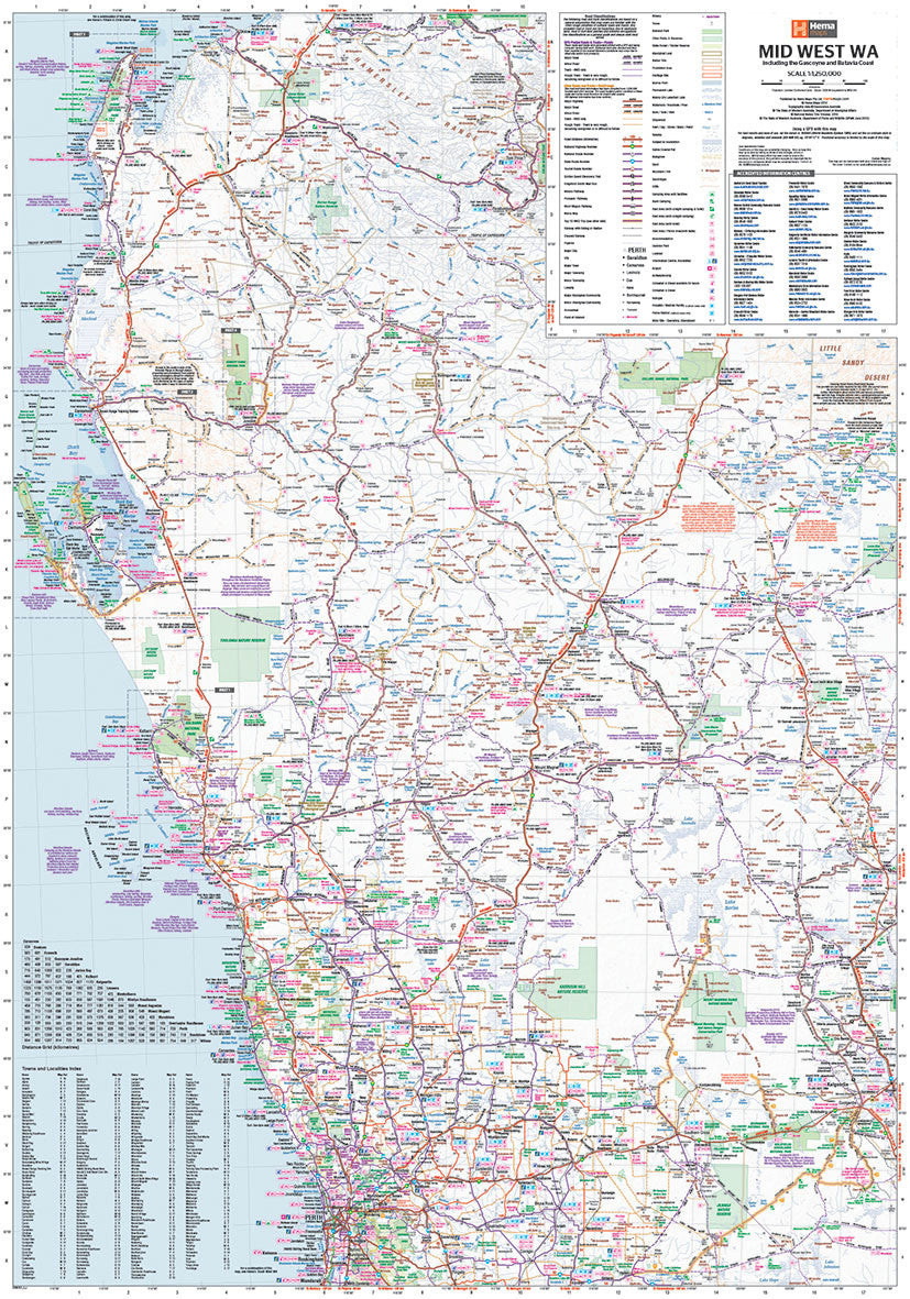
The Mid West Western Australia map is one of Hema's regional series so it is double-sided and features international symbols showing facilities, a huge level of detail about roads and tracks and the distances involved, but this new map goes quite a bit further.
The map covers from Perth to Kalgoorlie, up to NW Cape and west to Collier Range National Park, north of Meekatharra.
The level of road detail and information on this map really allows any traveller or tourist to explore the diversity of experiences in this area.
There are also 8 different road and track classifications clearly shown on the map and it also features the "famous" designated Tourist Routes such as the Golden Quest Discover Trail, Kingsford Smith Mail Run, Miners Pathway, Pioneers Pathway and Wool Wagon Pathway.
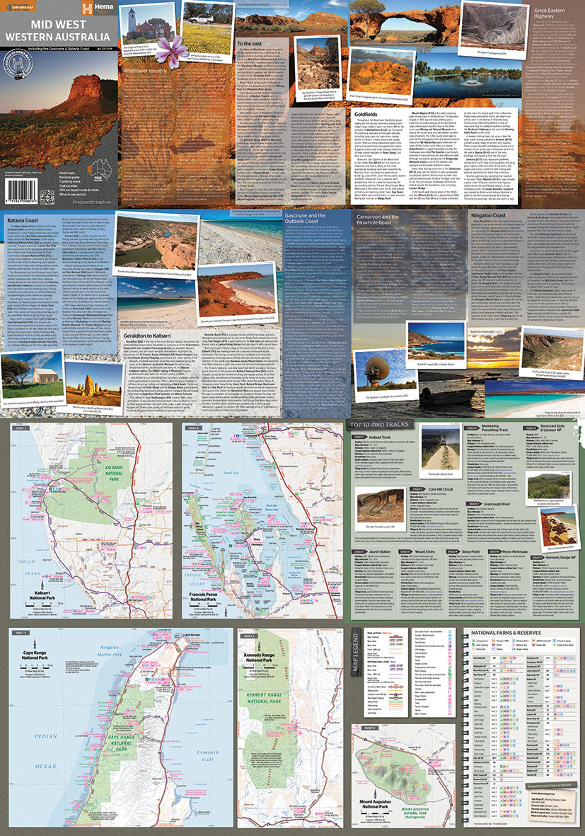
- Top 10 4WD Tracks
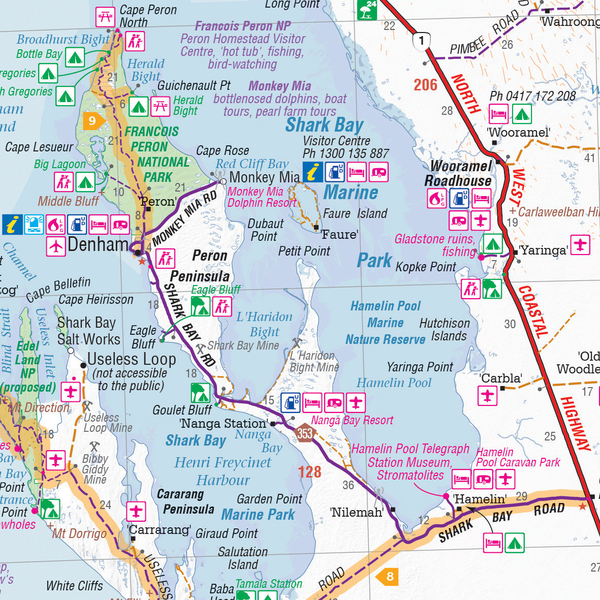
- Inset maps
- National parks
- Camping areas
- Fuel supplies
- GPS surveyed roads and tracks
- What to see and do
This map is also available as a laminated map encapsulated in high-quality plastic.
Scale 1:1,250,000
Size 700 mm (w) x 1000 mm (h)
Customer Reviews
Based on 11 reviews
Write a review
Related Items


© 2024 Mapworld. Website designed by Genie Media
X