- Australia ▾
- Topographic
▾
- Australia 50k Geoscience maps
- Australia 100k Geoscience maps
- Australia 250k Geoscience maps
- Australia 1.1m Geoscience maps
- New Zealand 50k maps
- New Zealand 250k maps
- New South Wales 25k maps
- New South Wales 50k maps
- New South Wales 100k maps
- Queensland 10k maps
- Queensland 25k maps
- Queensland 50k maps
- Queensland 100k maps
- Compasses
- Software
- GPS Systems
- Orienteering
- International ▾
- Wall Maps
▾
- World
- Australia & New Zealand
- Countries, Continents & Regions
- Historical
- Vintage National Geographic
- Australian Capital Territory
- New South Wales
- Northern Territory
- Queensland
- South Australia
- Tasmania
- Victoria
- Western Australia
- Celestial
- Children's
- Mining & Resources
- Wine Maps
- Healthcare
- Postcode Maps
- Electoral Maps
- Nautical ▾
- Flags
▾
- Australian Flag Sets & Banners
- Flag Bunting
- Handwavers
- Australian National Flags
- Aboriginal Flags
- Torres Strait Islander Flags
- International Flags
- Flagpoles & Accessories
- Australian Capital Territory Flags
- New South Wales Flags
- Northern Territory Flags
- Queensland Flags
- South Australia Flags
- Tasmania Flags
- Victoria Flags
- Western Australia Flags
- Gifts ▾
- Globes ▾
Dear valued customer. Please note that our checkout is not supported by old browsers. Please use a recent browser to access all checkout capabilities


New Guinea - Maluku ITMB Map
$24.95
Afterpay is only available for orders between $50.00 and $1000.00 More info
![]()
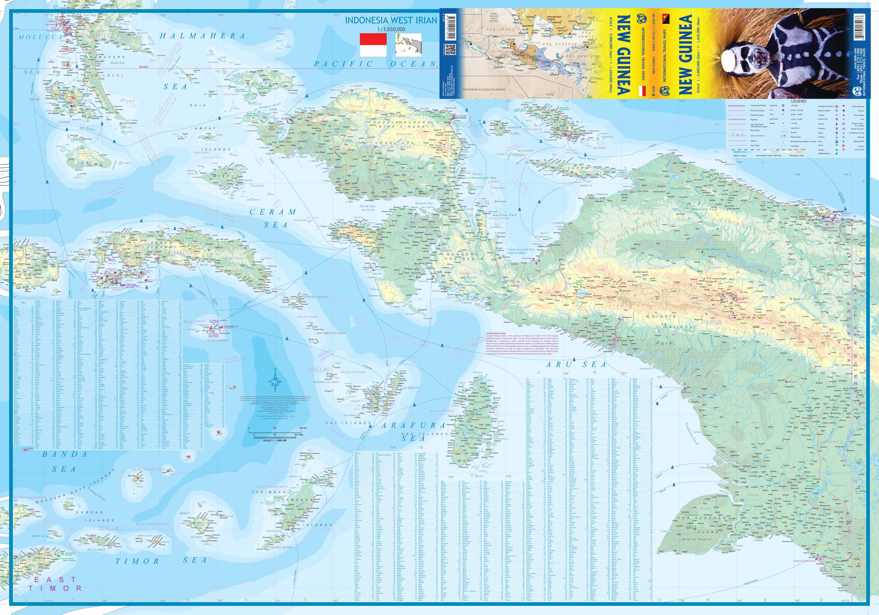
This is the replacement map for our former Papua New Guinea map. It has a similar cover picture, but for this edition, we have added the rest of the island, the Indonesian province of West Irian, to the other side of the paper, creating a complete island map (much as we did with Borneo and Dominican Republic/Haiti).
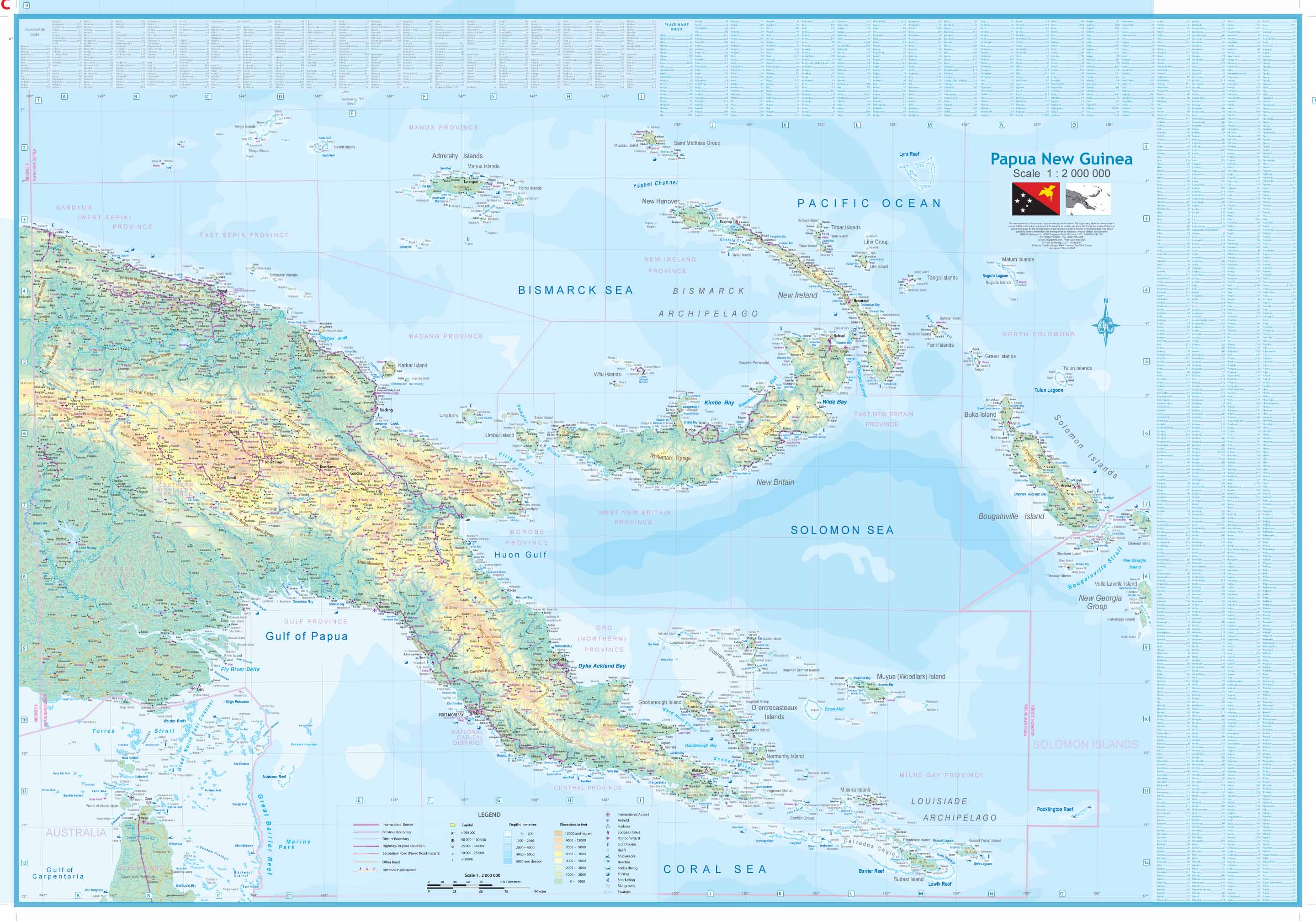
This map also includes some of the islands west of New Guinea, including the newly independent country of East Timor (not in great detail, but it’s there). Naturally, the Papua side has been updated cartographically and is MUCH more developed than the western side, but to me, the real significance of this title is that one of the largest islands in the world is now completely mapped for the first time ever.
This is the first new map of West Irian province for years and adds interesting Indonesian islands from the Ceram Sea area, such as Anbom and Hatta to ITM’s detailed coverage of Indonesia. Printed on paper, double-sided.
We can laminate this map, which will allow you to draw on it in whiteboard marker or apply map dots to locations of interest without permanently marking the map. The lamination also makes the map very durable and protects against tears and stains.
To laminate this map we have taken the folded map and flattened it out before encapsulating it in high-quality 80-micron laminate, so please be aware that there will still be slight fold lines visible.
Scale 1:2,000,000 (East) / 1:1,650,000 (West)
Size 685 mm x 990 mm
Customer Reviews
Based on 1 review
Write a review
Related Items


© 2024 Mapworld. Website designed by Genie Media
X