- Australia ▾
- Topographic
▾
- Australia 50k Geoscience maps
- Australia 100k Geoscience maps
- Australia 250k Geoscience maps
- Australia 1.1m Geoscience maps
- New Zealand 50k maps
- New Zealand 250k maps
- New South Wales 25k maps
- New South Wales 50k maps
- New South Wales 100k maps
- Queensland 10k maps
- Queensland 25k maps
- Queensland 50k maps
- Queensland 100k maps
- Compasses
- Software
- GPS Systems
- Orienteering
- International ▾
- Wall Maps
▾
- World
- Australia & New Zealand
- Countries, Continents & Regions
- Historical
- Vintage National Geographic
- Australian Capital Territory
- New South Wales
- Northern Territory
- Queensland
- South Australia
- Tasmania
- Victoria
- Western Australia
- Celestial
- Children's
- Mining & Resources
- Wine Maps
- Healthcare
- Postcode Maps
- Electoral Maps
- Nautical ▾
- Flags
▾
- Australian Flag Sets & Banners
- Flag Bunting
- Handwavers
- Australian National Flags
- Aboriginal Flags
- Torres Strait Islander Flags
- International Flags
- Flagpoles & Accessories
- Australian Capital Territory Flags
- New South Wales Flags
- Northern Territory Flags
- Queensland Flags
- South Australia Flags
- Tasmania Flags
- Victoria Flags
- Western Australia Flags
- Gifts ▾
- Globes ▾
Dear valued customer. Please note that our checkout is not supported by old browsers. Please use a recent browser to access all checkout capabilities


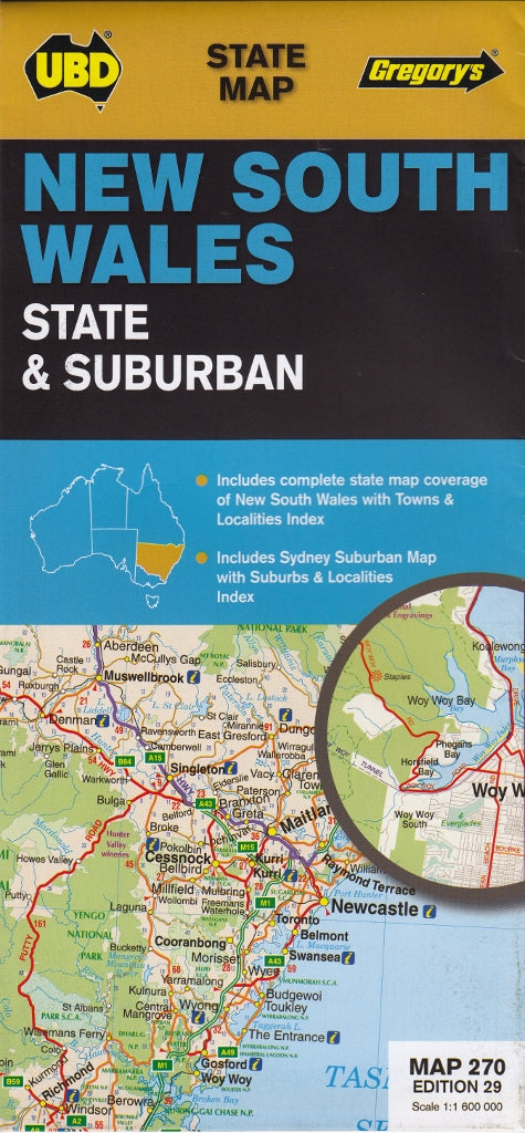
New South Wales State & Suburban UBD Map 270
$13.95
Afterpay is only available for orders between $50.00 and $1000.00 More info

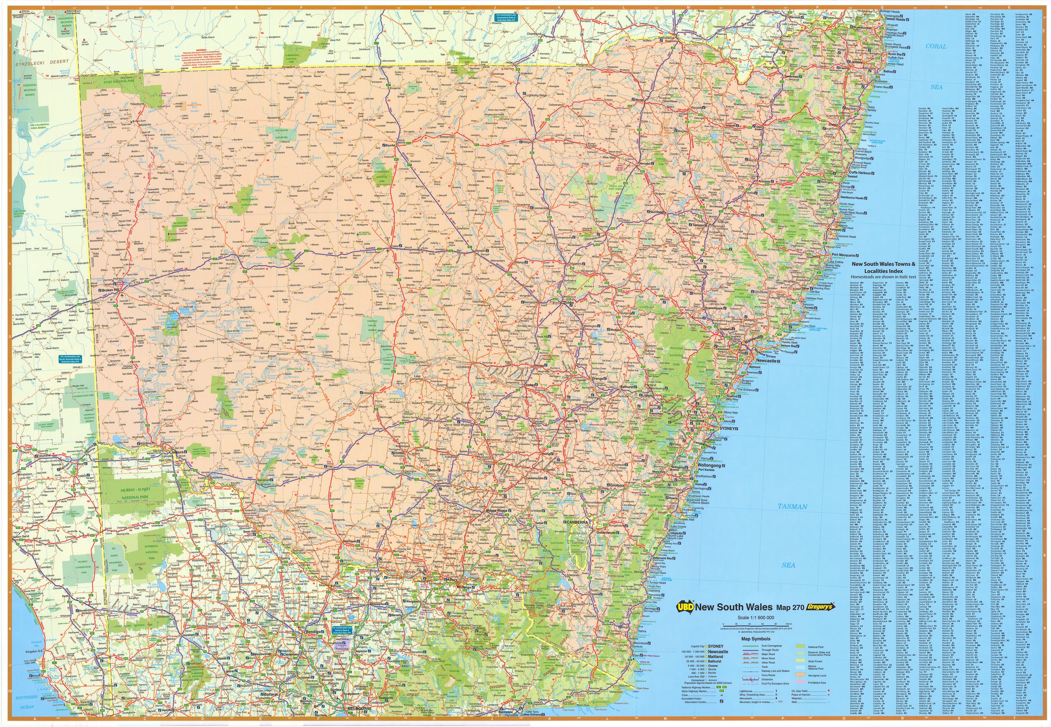
This double-sided map of NSW and Greater Sydney by UBD is fantastic for planning on, the State mapping includes a comprehensive listing of major and minor regional towns and is fully indexed. Dual carriageways, national highways, national parks and nature reserves are clearly indicated.
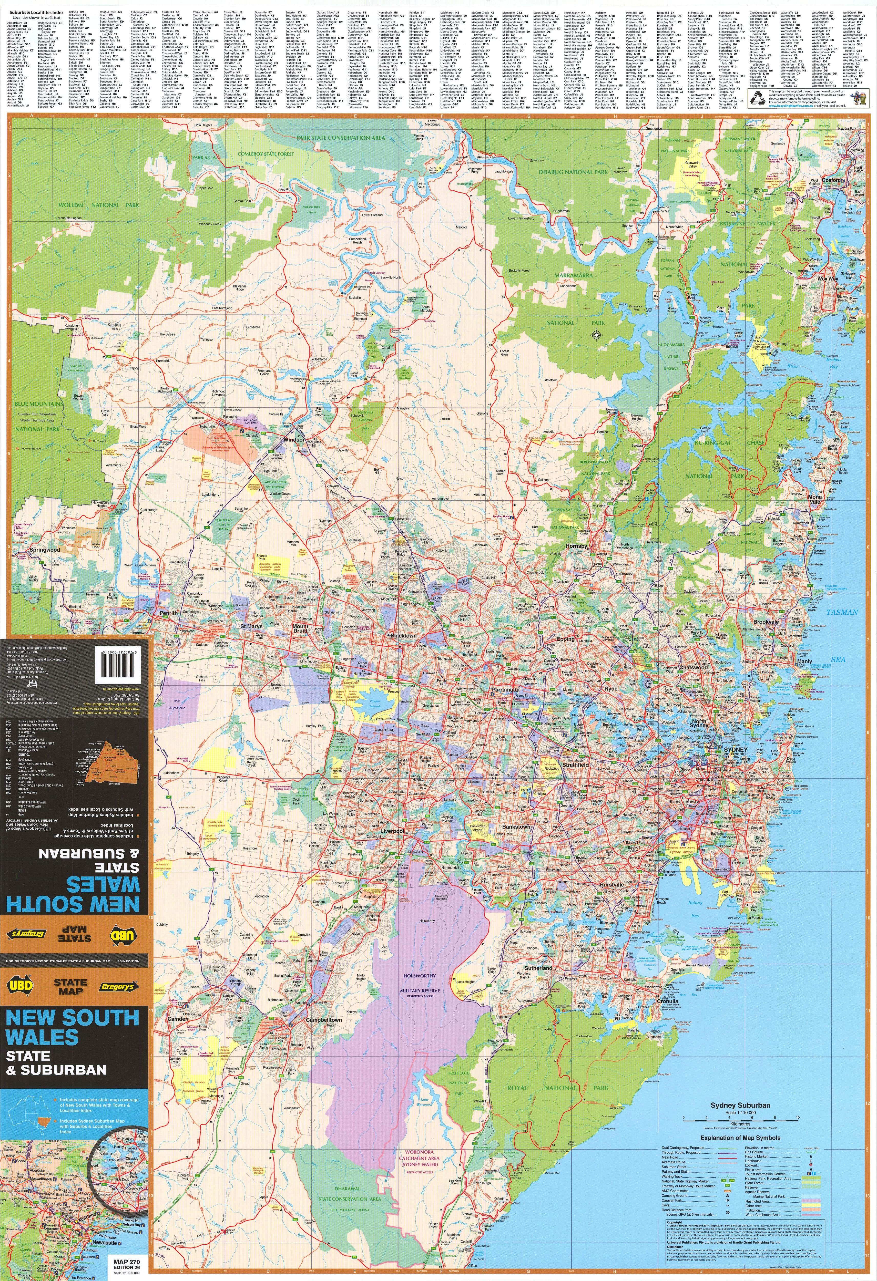
The reverse side of the map shows all of Sydney's suburbs with arterial routes and main roads clearly marked from Gosford in the north down to Clifton in the south, the map extends out west as far as Springwood. It also shows general suburban built-up areas, national parks and industrial areas. Each suburb name is marked complete with postcodes and listed in a corresponding index.
There are 2 laminated options, one is a flat laminated map from UBD at a price of $99.00 or we can laminate a previously folded map which means there will be some slight crease lines but at a price of $49.95
Scale: 1:1,600,000 / 1:110.000
Size: 700 x 1000 mm
Customer Reviews
Based on 29 reviews
Write a review
Related Items


© 2024 Mapworld. Website designed by Genie Media
X