- Australia ▾
- Topographic
▾
- Australia AUSTopo 250k (2025)
- Australia 50k Geoscience maps
- Australia 100k Geoscience maps
- Australia 250k Geoscience maps
- Australia 1:1m Geoscience maps
- New Zealand 50k maps
- New Zealand 250k maps
- New South Wales 25k maps
- New South Wales 50k maps
- New South Wales 100k maps
- Queensland 10k maps
- Queensland 25k maps
- Queensland 50k maps
- Queensland 100k maps
- Compasses
- Software
- GPS Systems
- Orienteering
- International ▾
- Wall Maps
▾
- World
- Australia & New Zealand
- Countries, Continents & Regions
- Historical
- Vintage National Geographic
- Australian Capital Territory
- New South Wales
- Northern Territory
- Queensland
- South Australia
- Tasmania
- Victoria
- Western Australia
- Celestial
- Children's
- Mining & Resources
- Wine Maps
- Healthcare
- Postcode Maps
- Electoral Maps
- Nautical ▾
- Flags
▾
- Australian Flag Sets & Banners
- Flag Bunting
- Handwavers
- Australian National Flags
- Aboriginal Flags
- Torres Strait Islander Flags
- International Flags
- Flagpoles & Accessories
- Australian Capital Territory Flags
- New South Wales Flags
- Northern Territory Flags
- Queensland Flags
- South Australia Flags
- Tasmania Flags
- Victoria Flags
- Western Australia Flags
- Gifts ▾
- Globes ▾
Dear valued customer. Please note that our checkout is not supported by old browsers. Please use a recent browser to access all checkout capabilities


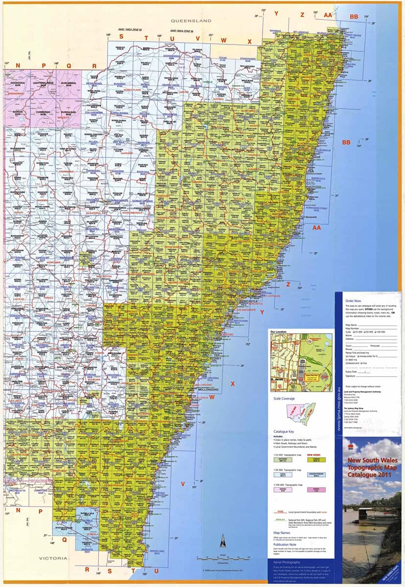
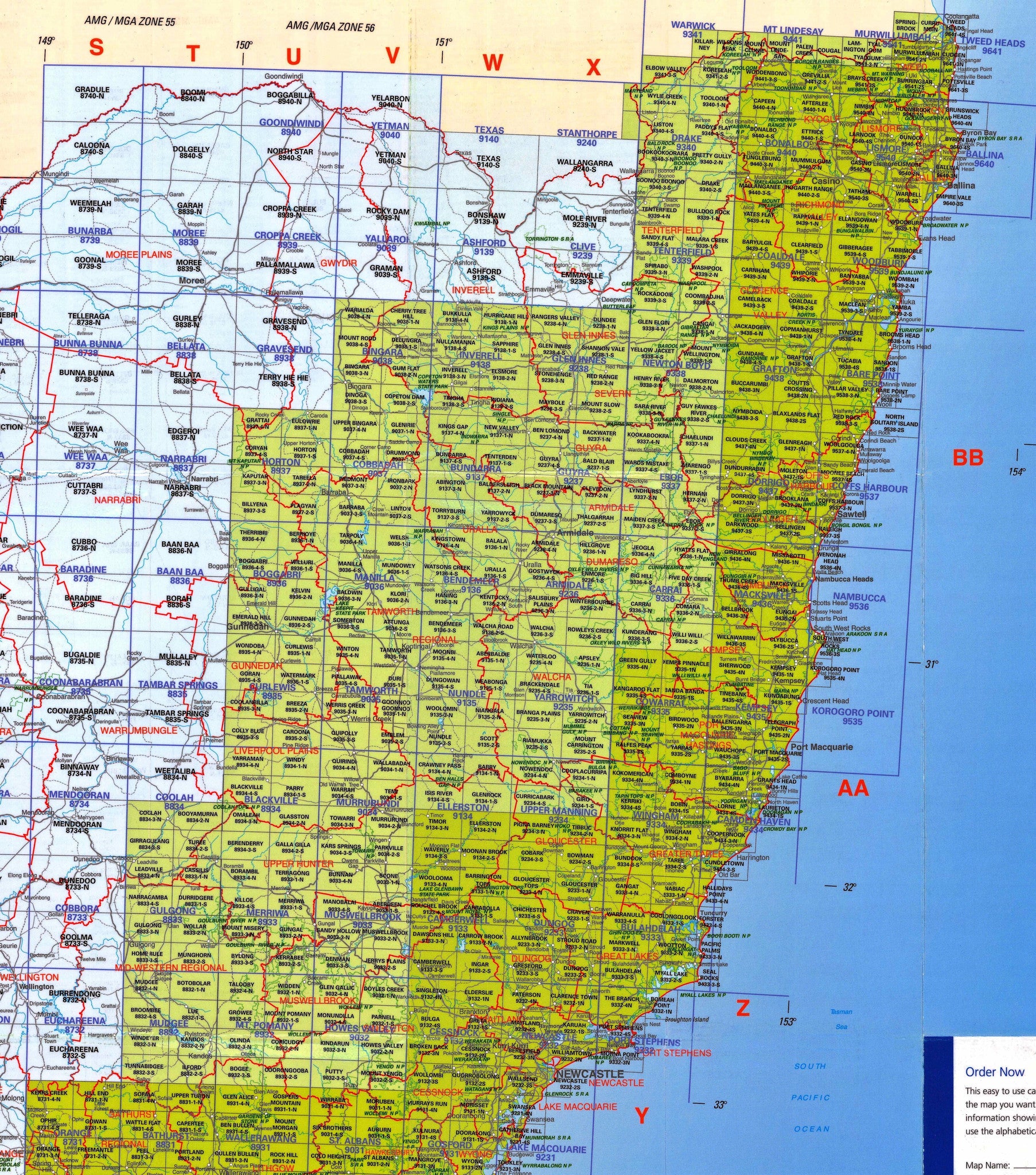
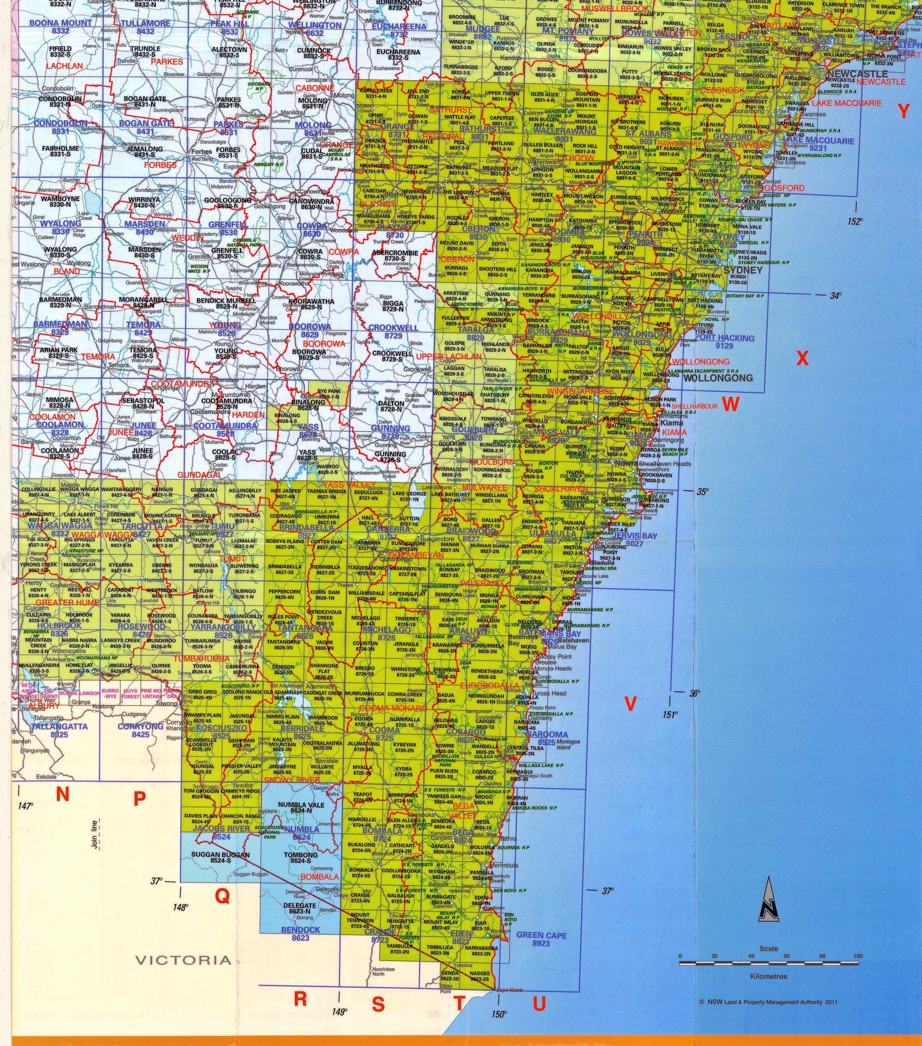
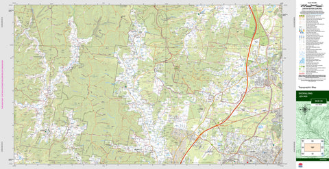
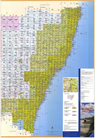
NSW 25k LPI Topographic Maps
$19.95
Afterpay is only available for orders between $50.00 and $1000.00 More info
How to Order NSW 1:25,000 LPI Topographic Maps
Explore New South Wales in precise detail with the NSW 1:25k topographic map series. These maps are ideal for bushwalkers, field researchers, surveyors, and anyone needing highly detailed elevation, terrain, and landscape information.
Ordering is simple—just follow the steps below to find and purchase the maps you need.
Step 1: Choose Your Map from the Dropdown Menu
At the top of this product page, you'll find a dropdown menu featuring our Top 100 best-selling NSW 1:25,000 Topographic Maps.
-
✅ Simply select the map you want from the dropdown list
-
🛒 Then click Add to Cart
If the map you need is not in the top 100, don’t worry—you can still order it!
Step 2: Ordering a Map Not Listed
If your desired map is not listed in the dropdown menu:
-
Select “OTHER” from the dropdown
-
Click Add to Cart
-
A pop-out cart window will appear
-
In the Order Notes section of the cart, type the full name of the map you want
📌 Important:
If you are ordering more than one map under “OTHER”, please adjust the quantity in your cart to match the number of map names you've entered in the Order Notes.
Optional: Browse the Full Collection
If you'd prefer to browse the complete catalogue, you can also:
-
📚 Click the links below (on the product page) for an alphabetical breakdown of the NSW 1:25k series
-
🧾 Each alphabetical section has its own dropdown list where you can select and add individual maps directly
- Aberbaldie - Bukalong
- Bukkulla - Craven
- Crawney Pass - Gum Flat
- Gundagai - Lake George
- Lankeys Creek - New Valley
- Newbridge - Springwood
- St Albans - Wee Jasper
- Welcome - Yowrie
To see a complete index, please click: NSW 1:25k Topo Index
Why Choose the NSW 1:25k Topographic Maps?
-
🌄 Ultra-detailed terrain information with contour intervals, watercourses, vegetation, and infrastructure
-
🥾 Ideal for hiking, camping, land navigation, and environmental surveys
-
📍 Created by NSW Spatial Services (LPI) and trusted by professionals
-
🗺️ Available individually—only pay for the areas you need
Have questions or need help choosing the right map? Contact us — we’re here to help you navigate the collection with ease.
Start planning your journey today with the most detailed mapping available for New South Wales.
Frequently Asked Questions
What area does the NSW 25k LPI Topographic Maps cover?
This topographic map covers the area named in the product title. It shows elevation contours, terrain features, waterways, roads, tracks, and key landmarks at the scale shown in the product title scale.
What scale is this topographic map?
This map is at the scale shown in the product title. Australian topographic maps are commonly produced at 1:25,000, 1:50,000, and 1:100,000 scales — the scale determines the level of detail and the area shown.
Is this map suitable for bushwalking and hiking?
Yes, topographic maps are the standard navigation tool for bushwalking, hiking, and off-track travel. They show contour lines, walking tracks, water sources, and terrain hazards.
Is this the most current edition available?
Mapworld stocks the most current editions available. Australian topographic maps are produced by Geoscience Australia or state mapping agencies and updated periodically.
Does Mapworld ship the NSW 25k LPI Topographic Maps across Australia?
Yes, Mapworld ships Australia-wide. Standard shipping is a flat $7 rate, with free standard shipping on orders over $75. Express options are available at checkout. Most orders placed before 2pm AEST on weekdays are dispatched same day.
Related Items


© 2026 Mapworld. Website designed by Genie Media
X