- Australia ▾
- Topographic
▾
- Australia 50k Geoscience maps
- Australia 100k Geoscience maps
- Australia 250k Geoscience maps
- Australia 1.1m Geoscience maps
- New Zealand 50k maps
- New Zealand 250k maps
- New South Wales 25k maps
- New South Wales 50k maps
- New South Wales 100k maps
- Queensland 10k maps
- Queensland 25k maps
- Queensland 50k maps
- Queensland 100k maps
- Compasses
- Software
- GPS Systems
- Orienteering
- International ▾
- Wall Maps
▾
- World
- Australia & New Zealand
- Countries, Continents & Regions
- Historical
- Vintage National Geographic
- Australian Capital Territory
- New South Wales
- Northern Territory
- Queensland
- South Australia
- Tasmania
- Victoria
- Western Australia
- Celestial
- Children's
- Mining & Resources
- Wine Maps
- Healthcare
- Postcode Maps
- Electoral Maps
- Nautical ▾
- Flags
▾
- Australian Flag Sets & Banners
- Flag Bunting
- Handwavers
- Australian National Flags
- Aboriginal Flags
- Torres Strait Islander Flags
- International Flags
- Flagpoles & Accessories
- Australian Capital Territory Flags
- New South Wales Flags
- Northern Territory Flags
- Queensland Flags
- South Australia Flags
- Tasmania Flags
- Victoria Flags
- Western Australia Flags
- Gifts ▾
- Globes ▾
Dear valued customer. Please note that our checkout is not supported by old browsers. Please use a recent browser to access all checkout capabilities


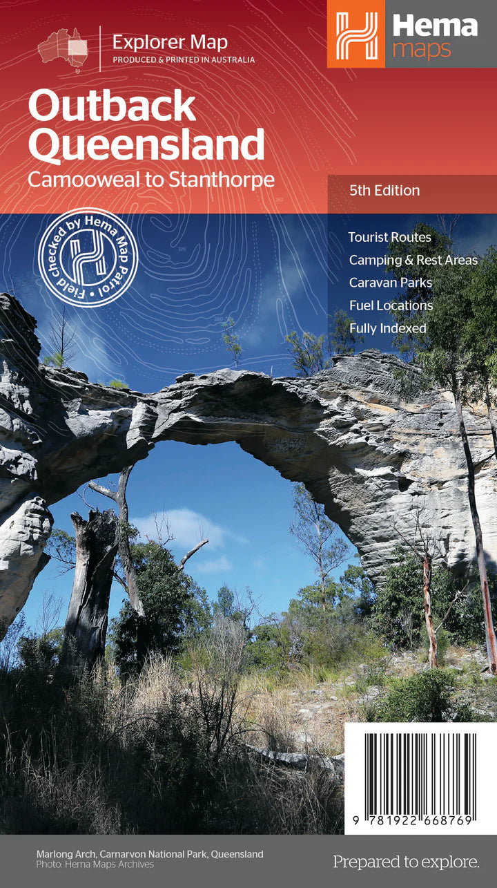
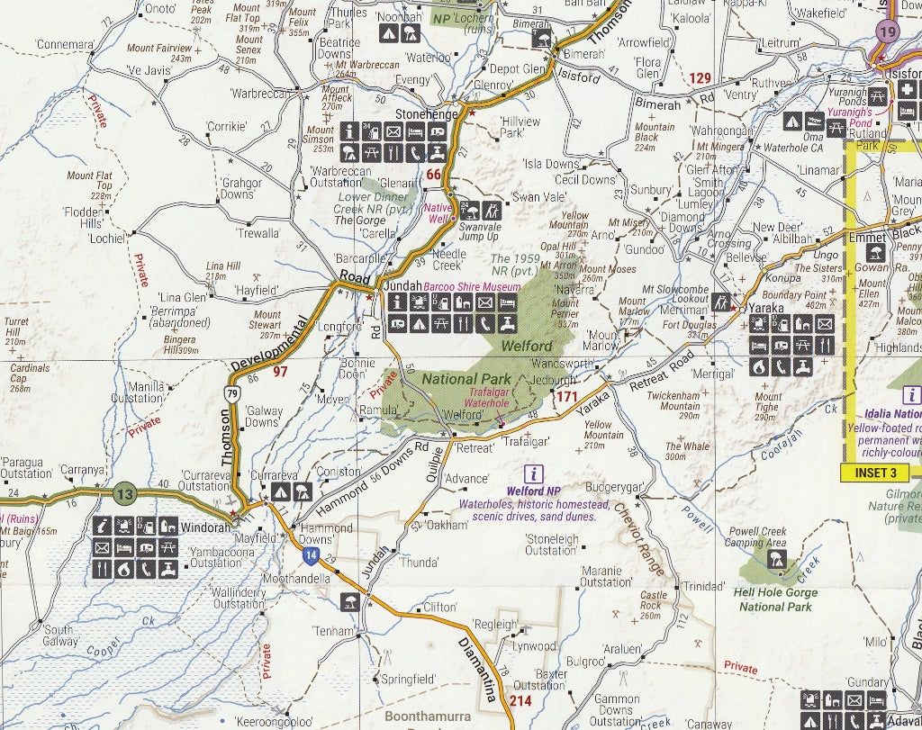
Outback Queensland Hema Map 5th Edition
$13.95 $14.95
Afterpay is only available for orders between $50.00 and $1000.00 More info
![]()
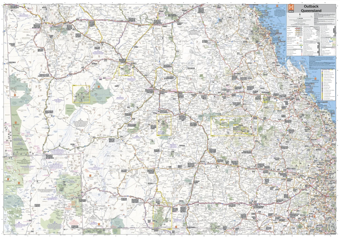
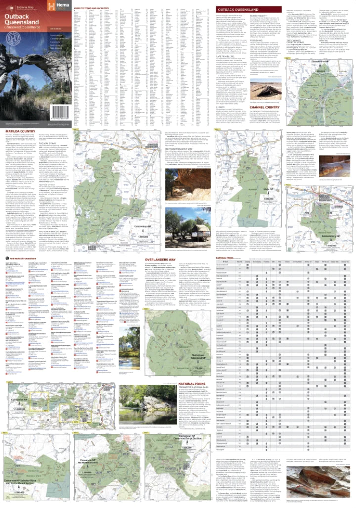
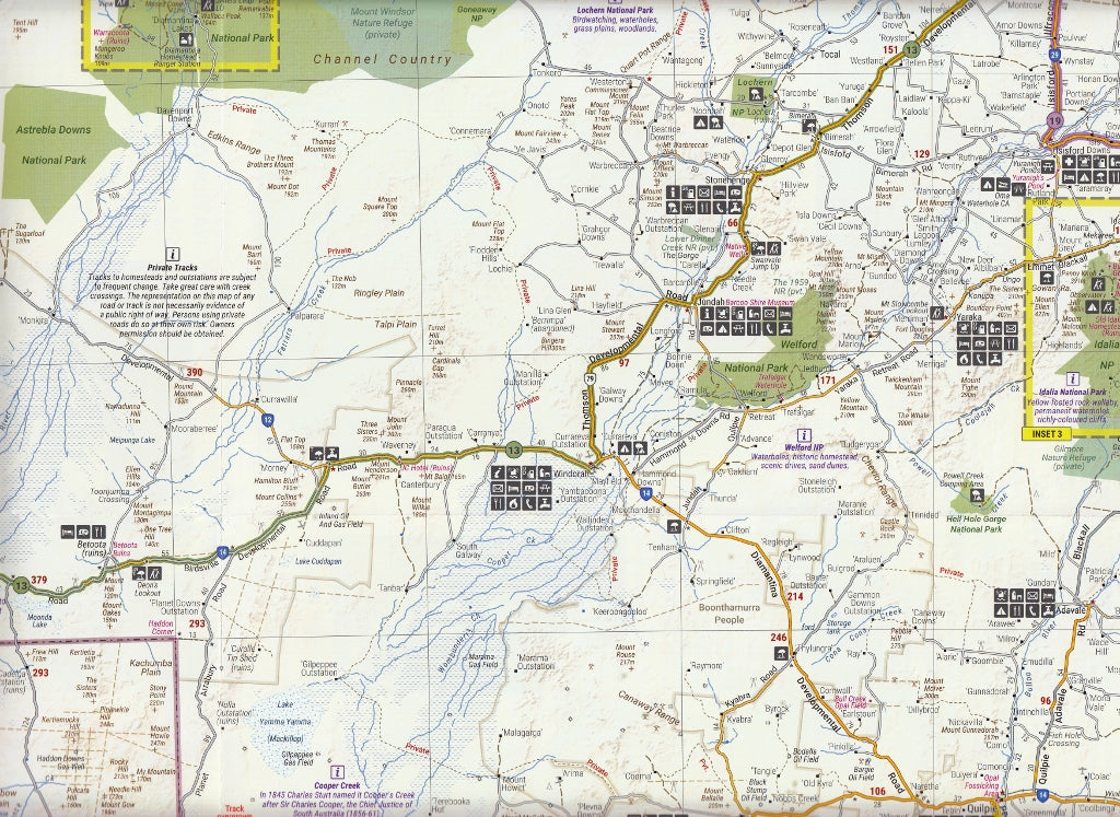
This detailed regional map of outback Queensland contains a Gulf region (1:2,500,000) inset map. On the opposite side is in-depth travel and background information on relevant regions, including Channel Country, Matilda Country and Dinosaur Fossil Country. Also included is relevant contact information, outback events throughout the year and a list of national parks.
This map covers the borders of New South Wales and the Northern Territory all the way across to the Queensland Coast and up as far as Bowen.
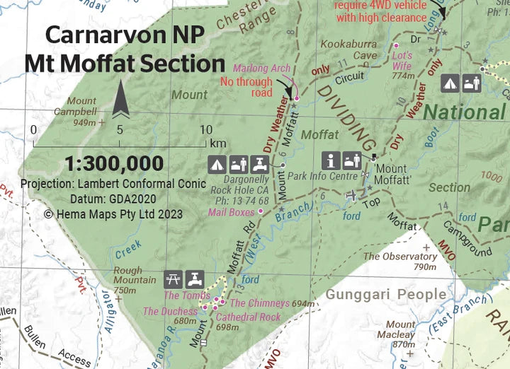
The reverse includes blow up regional maps of Diamantina NP, Bladensburg NP, Idalia NP, Currawinya NP, and Carnarvon Gorge.
This map features:
- Camping areas
- National parks
- Points of interest
- Touring routes
- Outback fuel
- GPS grid
Scale: 1:1,500,000
Size: 700 x 1000mm
Customer Reviews
Based on 25 reviews
Write a review
Related Items

© 2024 Mapworld. Website designed by Genie Media
X