- Australia ▾
- Topographic
▾
- Australia 50k Geoscience maps
- Australia 100k Geoscience maps
- Australia 250k Geoscience maps
- Australia 1.1m Geoscience maps
- New Zealand 50k maps
- New Zealand 250k maps
- New South Wales 25k maps
- New South Wales 50k maps
- New South Wales 100k maps
- Queensland 10k maps
- Queensland 25k maps
- Queensland 50k maps
- Queensland 100k maps
- Compasses
- Software
- GPS Systems
- Orienteering
- International ▾
- Wall Maps
▾
- World
- Australia & New Zealand
- Countries, Continents & Regions
- Historical
- Vintage National Geographic
- Australian Capital Territory
- New South Wales
- Northern Territory
- Queensland
- South Australia
- Tasmania
- Victoria
- Western Australia
- Celestial
- Children's
- Mining & Resources
- Wine Maps
- Healthcare
- Postcode Maps
- Electoral Maps
- Nautical ▾
- Flags
▾
- Australian Flag Sets & Banners
- Flag Bunting
- Handwavers
- Australian National Flags
- Aboriginal Flags
- Torres Strait Islander Flags
- International Flags
- Flagpoles & Accessories
- Australian Capital Territory Flags
- New South Wales Flags
- Northern Territory Flags
- Queensland Flags
- South Australia Flags
- Tasmania Flags
- Victoria Flags
- Western Australia Flags
- Gifts ▾
- Globes ▾
Dear valued customer. Please note that our checkout is not supported by old browsers. Please use a recent browser to access all checkout capabilities


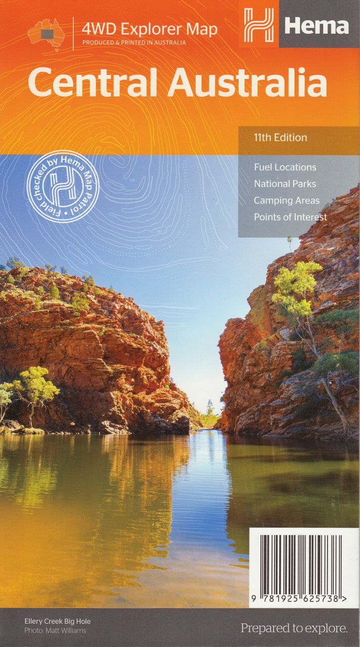
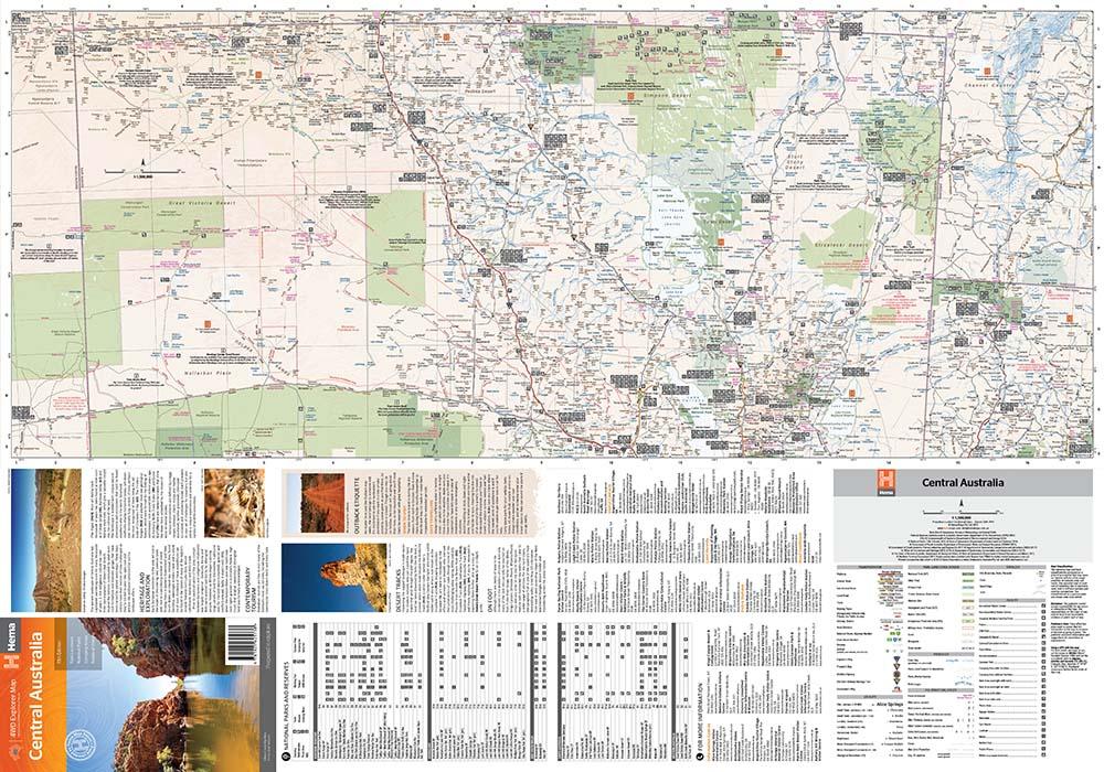
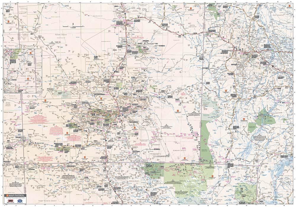
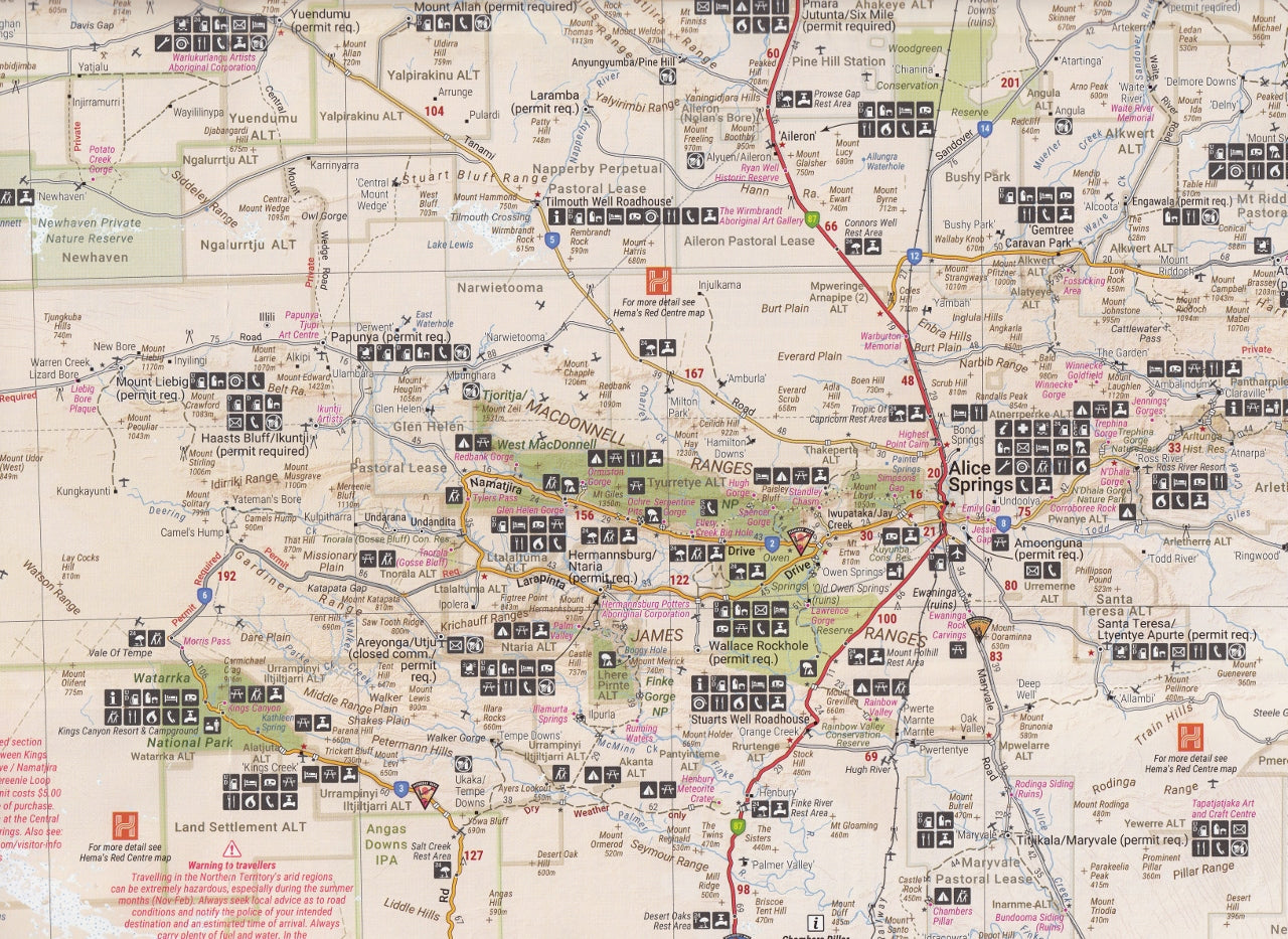
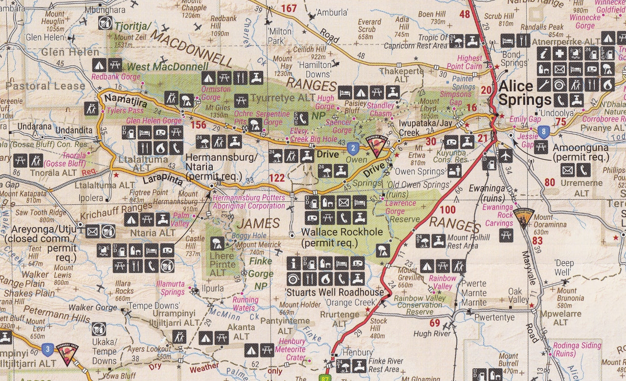
Central Australia Hema Map 11th Edition NEW
$13.95 $14.95
Afterpay is only available for orders between $50.00 and $1000.00 More info
The Central Australia map by Hema,is a two sided map.The main side covers from Oodnadatta in the south to Tennant Creek in the north. It runs from Warakurna Roadhouse in the West to Kynuna in the East.
The reverse side shows the area south of the main map from Woomera in the south to Northern Territory / South Australia border.
Includes
- Fuel Locations
- National Paks
- Camping Areas
- Point of Interest
This map is also available as a laminated map encapsulated in high-quality plastic.
Opened Size: 1000 x 700 mm
Scale: 1:1,500,000
Customer Reviews
Based on 10 reviews
Write a review
Related Items


© 2024 Mapworld. Website designed by Genie Media
X